West Pioneer Mountains
Stine Mountain
Download KML
Distance
6.75 miles one way
Type
Day hike
Difficulty
Hard
- Starting Elevation: 6100 ft.
- Ending Elevation: 9488 ft.
- Elevation Gain: 3388 ft.
 View all 9 photos
- Experience Date: Sep 13, 2019
- Hike Time: 7-8 hrs.
- Drive Time: 2 hrs. 15 min.
- Road Condition: No mountain roads. Accessible by any vehicle.
- Parking: Park in small pullout alongside the Pioneer Mountains Scenic Byway.
- Fees: None.
- Campsite Availability: Plenty of campgrounds along the Pioneer Mountains Scenic Byway. Limited camping on the trail except near the top where it flattens out.
- Private Property: None posted.
- Trail Traffic: None.
- Trail Condition: Well-definted, although rocky, trail most of the way with a short and simple off-trail segment near the top.
- Fire Restrictions: None.
- Stream Crossings: None.
- Water Sources: Stine Creek right near the start.
- Snow: None.
- Winter Access: Trailhead may be accessible although much of the Pioneer Scenic Byway is not maintained during the winter months.
- Weather: Mostly cloudy. Windy. 70's.
- Bugs: None.
- Wildlife Sighted: None.
- Side Quests: None.

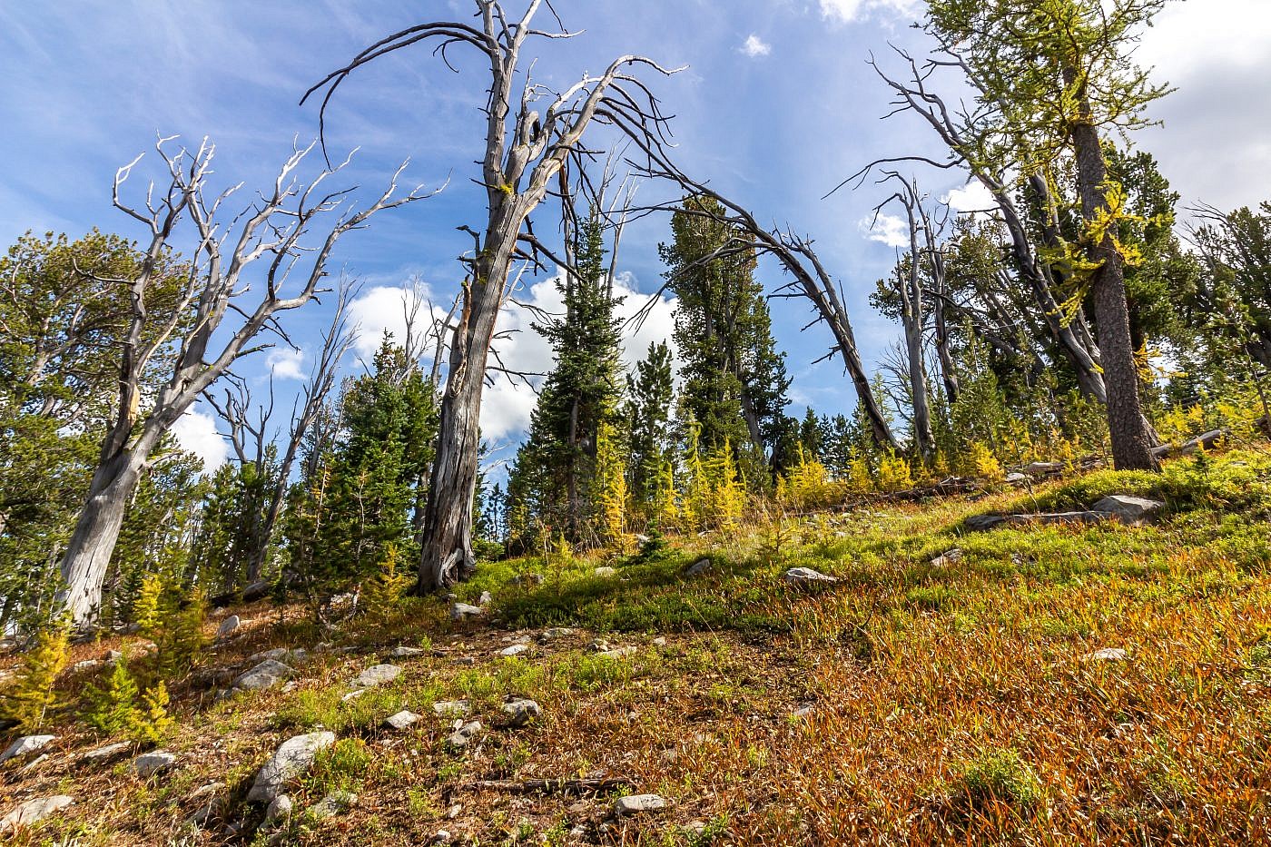
Stine Mountain (9,488′) is the highpoint of the West Pioneer Mountains, an unofficial sub-range of the Pioneer Mountains in southwest Montana. It’s a straightforward hike, mostly through the woods, that follows the northern section of the Pioneer Mountains National Scenic Trail most of the way with just a short and simple off-trail section near the top. What’s odd about this one is that most of the elevation gain is actually at the start of the hike rather than the end. The trail is extremely rocky, probably the rockiest trail I’ve ever encountered, so it’s important to have good footwear and biking is not advisable.
Stine Mountain
Background
As the summer of 2019 progressed I had become mostly focused on bagging range highpoints but I still had a list of secondary “bonus peaks” that I wished to do if the circumstances allowed. Some of these peaks are ones that I had seen along the road or read about but others are secondary highpoints or highpoints of sub-ranges. Stine Mountain (9,490′) is the highpoint of the West Pioneer Mountains, an unofficial sub-range of the Pioneer Mountains, and falls into this “bonus peak” category.
My second week of full-time peakbagging had started out with a summit of Mount Haggin, a massive and iconic peak of the Anaconda Range. I felt great afterwards, both mentally and physically, and decided I wanted to slay another mountain the next day; peakbagging season was wrapping up quick and there was little time to waste. I had already done most of the nearby highpoints and ended up settling on Stine Mountain which was only about an hours drive. I wasn’t seeking out any grand vistas, dramatic landscapes, or thrilling ridgewalks with this one, I just wanted to get in, bag it, and get out.
Stine Mountain is not nearly as aesthetically pleasing or grand as its jagged neighbors in the East Pioneers, the other sub-range of the Pioneers, but it’s still one heck of a climb. The elevation profile of this one is sort of inverted because most of the elevation gain is actually at the start of the hike rather than the end. In fact, the hike gets flatter the farther you go. Additionally, the peak is just a short distance off the Pioneer National Recreation Trail so there’s little off-trail travel and you could easily incorporate it into a longer loop. Please see my write-up on Torrey Mountain for more information on the Pioneer Mountains and their highpoints.
The Adventure Begins…
I spent the previous night at the Beaverdam Campground a few miles off of I-15 south of Butte and just an hour drive from the trailhead. The only reference I had for this mountain was The Boughner Blog which was put together by another fellow peakbagger seeking out the same goal of bagging all the range highpoints in Montana but who has a decent head start on me. According to his report the trailhead is just a small pullout at the northern terminus of the Pioneer National Scenic Trail along the Pioneer Mountains Scenic Byway which I was a little familiar with. I was able to find this mysterious pullout (on the east side of the road) relatively easily but it’s not well marked at all so make sure to keep a close eye out for it and have your map handy.
On The Trail
Once at the pullout I didn’t waste much time getting on the trail. As mentioned before I was taking a more get-in-and-get-out style of approach to this one so I wanted to get the job done as quickly as possible. I had reluctantly decided to leave my bike behind because I’d read that most of the elevation gain was at the start but after only a bit of hiking I had second thoughts and went back for it. By studying the map I had convinced myself that, even if I had to walk it up the steep sections, it would pay off to be able to bike the flattish looking section that made up the second part of the trail. Boy was I wrong.
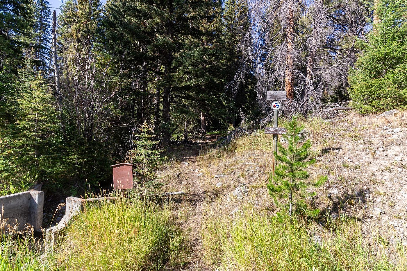
The trailhead is the northern terminus of the Pioneer National Scenic Trail.
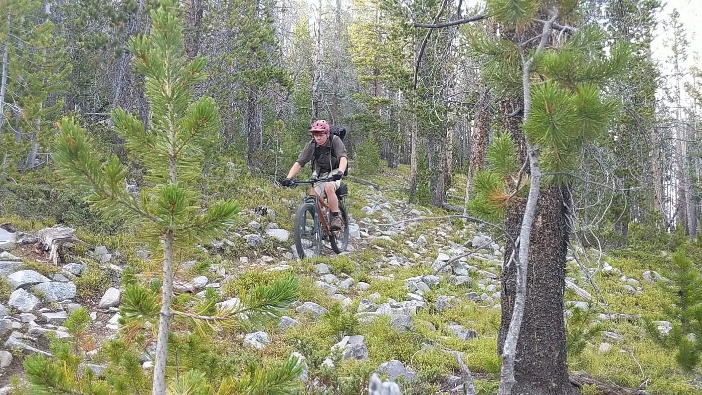
The very first section of trail is flat and bike appropriate which what gave me false hope. I quickly discovered, though, that the steep sections at the start were so incredibly steep that there was no hope of actually biking any of it. On top of that, this has got to be one of the rockiest trails I’ve been on. It’s so rocky that even the less steep sections were rendered unbikable which is saying something since technical riding is my forte. I just kept thinking to myself that if I could get passed the steep stuff my efforts would pay off on the flat section but it seemed that the higher up I got the rockier the trail became.

A photo showing just how rocky the trail is. Even for a technical rider like me with a 27.5+ mountain bike the terrain is virtually impossible to bike on.
Finally after pushing my bike up steep, rocky terrain for several miles the trail began to plateau and the flat section I’d been anticipating was starting to begin. The trail remained unbearably rocky, however, and although I was able to bike some chunks of the trail it was extremely slow-going and I still found myself walking the bike for a good portion of it. About 1.5 miles before the summit I came to the conclusion that any efforts to continue on the bike would be futile so, quite frustrated, I ditched the bike and began chugging along on foot.
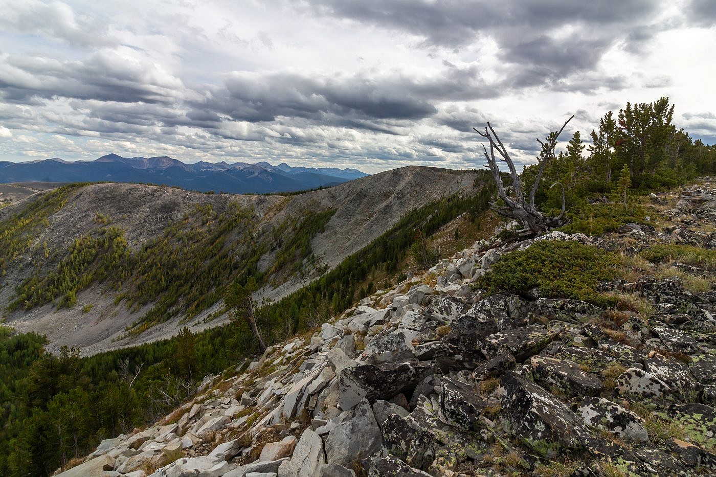
Right around this point I got my first ever view of Stine Mountain sitting on the opposite side of a large cirque. As far as I know it can’t be seen from anywhere in the valleys that surround the range so I really had no idea what it looked like. As you’d expect it doesn’t look very “peaky” and is barely distinguishable from the other points in the range but it does sit just barely above the treeline. There is a sort of false summit right next to it that you could easily mistake for the highpoint so make sure you’ve identified the correct summit; you don’t want to travel all that way just to return and realize you’ve missed it! About 3/4 of a mile before the summit you ditch the trail and continue along the rim of the cirque until you’re there.
First view of Stine Mountain (center). The blip to the right of it could easily be mistaken for it. From here continue along the rim of the cirque, ditching the trail about 3/4 mile before the summit, until you’re there.
The sun briefly showed its face right after ditching the trail.
The final “cirque-walk” to the summit (center right).
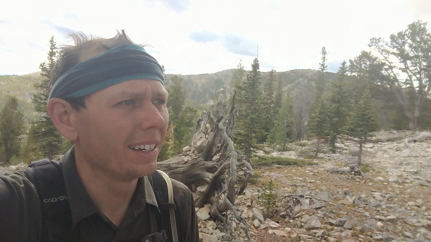
Stine Mountain
Stine Mountain, despite being one of the most gentle summits I’d been on all summer, was definitely the windiest. I went from being sweaty and hot from that relentless bike ride to just straight up cold. It was fun, though, to see some of the peaks I’d been on this summer including West Goat Peak and Mount Haggin of the Anacondas, and Torrey Mountain of the East Pioneers.
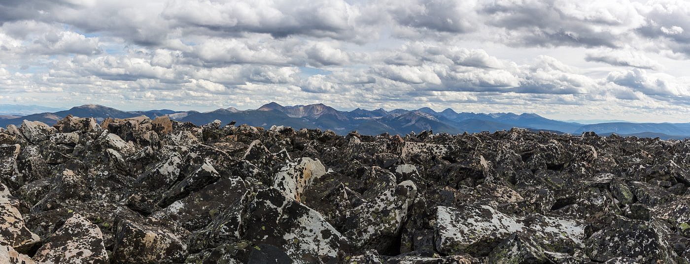
Looking towards the East Pioneers from the summit.
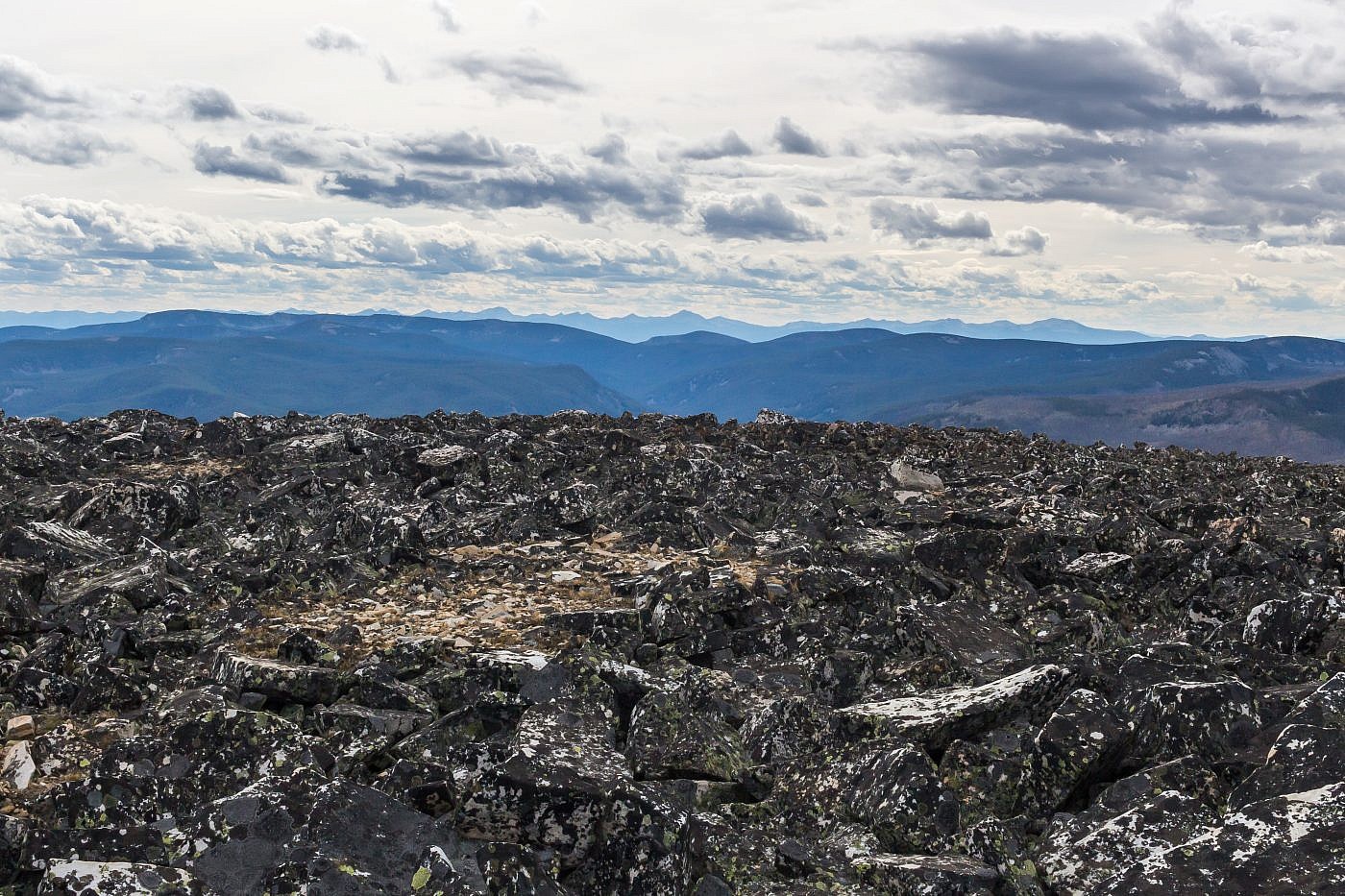
Looking west from the summit towards the Big Hole Valley. Beaverhead Mountains in the distance.

Looking back along the rim of the cirque. Anaconda Range in the distance. West Goat on the far left and Mount Haggin somewhere on the far right.
The Return
After I had my fun on the summit I began the long trek back and was looking forward to bombing the rocky hills on my bike. Shortly after recovering my bike, though, I noticed it wasn’t riding quite right. I took a quick pit stop and discovered my rear tire had lost a significant amount of pressure. Just great, I thought, after all that effort dragging that stupid bike up here I now had to deal with this. Hoping to avoid some half-assed tube swap and not wanting to hike the rest of the way I decided to pump it with air hoping that the leak was slow enough that I could get down the mountain. Thankfully, the air held decently well and the ride down was worth the struggle that I had endured earlier. The rocks made it super sketchy and I was probably going way faster than I should have but I find it hard to resist the rush sometimes and in the end I made it back safe and sound.
Finishing off the adventure.
