East Pioneer Mountains
Torrey Mountain
Download KML
Distance
5.5 miles one way
Type
Day hike
Difficulty
Hard
- Starting Elevation: 7150 ft.
- Ending Elevation: 11147 ft.
- Elevation Gain: 3997 ft.
 View all 8 photos
- Experience Date: Jul 28, 2019
- Hike Time: 8-10 hrs.
- Drive Time: 2.5 hrs.
- Road Condition: Well-maintained dirt road. Suitable for almost any vehicle.
- Parking: Plenty of parking.
- Fees: None.
- Campsite Availability: Dinner Station Campground at trailhead. Camping at Deerhead Lake.
- Private Property: None.
- Trail Traffic: Very light.
- Trail Condition: Well-maintained trail to Deerhead Lake. All off-trail after the lake.
- Fire Restrictions: None.
- Stream Crossings: None.
- Water Sources: Only water source is Deerhead Lake.
- Snow: Several patches near top.
- Winter Access: Unknown.
- Weather: Sunny and warm. 70's.
- Bugs: None.
- Wildlife Sighted: None,
- Side Quests: Tweedy Mountain for experts only!

Torrey Mountain (11,147′) is the 2nd highest point in the Pioneer Mountains just northwest of Dillon, MT. It is surpassed only by its slightly larger brother to the north, Tweedy Mountain, which stands a mere 7′ taller. Torrey is definitely a force to be reckoned with. Although the route is fairly obvious the majority of the hike is off-trail and involves scaling numerous talus fields that seem to go on forever. Shade is definitely lacking on this one so take whatever measures are need to stay cool. The access road is well-maintained and the trailhead is located near the Dinner Station Campground which makes for a great base camp to do some additional exploring in the area.
Torrey Mountain.
Background
If you’re itching to get somewhere new the Pioneer Mountains are a great option. The range is separated by the Pioneer Mountains Scenic Byway into two unofficial sub-ranges; the East Pioneers and West Pioneers. The West Pioneers are mostly just rolling foothills while the East Pioneers are your more typical gnarly mountain range filled with sharp peaks and beautiful alpine lakes. I highly recommend a trip down the scenic byway. There’re all kinds of trailheads, a hot springs, a ski hill, incredible views, and the access point for the truly “ghosty” ghost town of Coolidge. See this link for more details.
Torrey Mountain of the East Pioneer Mountains is a monster. At 11,147′ it’s the ninth tallest mountain in Montana if you exclude the Beartooths. (To me, it makes sense to neglect the Beartooths when comparing mountains since they’re so much taller than everything else in Montana.) It isn’t, however, the range highpoint. This title is claimed by Torrey’s brother, Tweedy Mountain, which stands a mere 7′ higher than Torrey. Because they’re so similar in height I think it makes sense to summit both if you’re going for the highpoint of the range. Although Torrey and Tweedy are less than 2 miles apart as the crow flies, it’s highly unlikely you’d be able to summit both in the same day. The terrain between the two has some class 5 sections so unless you’re a climbing expert you’ll need to start at different trailheads to bag the pair.
Torrey Mountain holds a special place in my heart. I had unknowingly photographed it back in 2015 and for several years I assumed it was a picture of the Tobacco Roots. It always bothered me not knowing exactly where I had taken the photo and when I took a trip the the Dillon area in late 2018 I was able to track down the exact spot where the photo had been taken; it wasn’t the Tobacco Roots but the East Pioneers! Feeling satisfied that I had finally found the spot where I’d taken that picture years earlier I decided I’d better add Torrey to my list.
The route up Torrey is straightfoward but far from easy. 75% is off-trail with some bushwhacking and there’re several sections of seemingly endless talus fields to traverse. There’s also very little shade along the route so you can plan to be exposed to the sun for a good chunk of the hike.
If you’re looking for something a little more low-key but still a formidable challenge I recommend the highpoint of the West Pioneers, Stine Mountain. It can be accessed from the northern terminus of the Pioneer National Scenic Trail along the byway and provides great views of the whole mountain range.
My mystery photo of the East Pioneer Mountains taken in 2015. Torrey Mountain (11,147′) in the center and Tweedy Mountain (11,154′) on the far right.
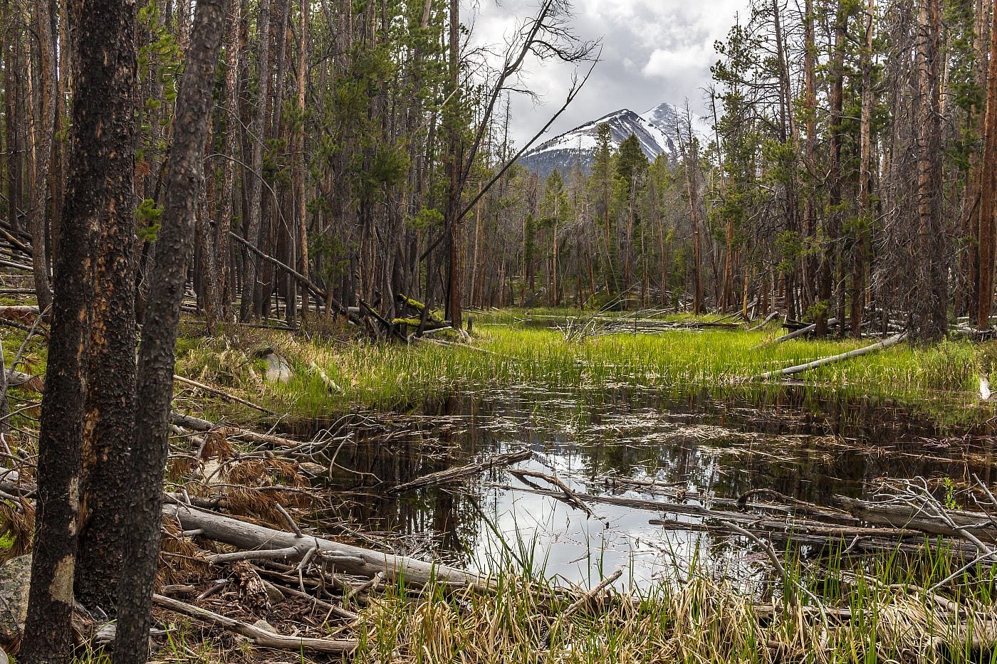
A shot of Torrey Mountain in the springtime.
Stine Mountain (9,490′), the highpoint of the West Pioneers, can be accessed via northern terminus of the Pioneer National Scenic Trail.
The Adventure Begins…
I spent Saturday night at the Dinner Station Campground, located right at the trailhead, so I could get as early a start as possible the next day. I had gotten a little spooked after getting caught in a thunderstorm near the top of South Baldy Mountain in the Tobacco Roots several weeks earlier and wanted to do everything I could to mitigate my chances of getting caught in another one, especially since there’s almost no cover whatsoever along the route up Torrey. I had spent a night at the campground earlier that year so was already a little familiar with the trail and had a general idea of what I was up against. Both times I stayed at this campground it was virtually abandoned despite being a very well-established campground in a prime location. The drive to the trailhead is straightforward and the road is suitable for almost any vehicle.
On the Trail
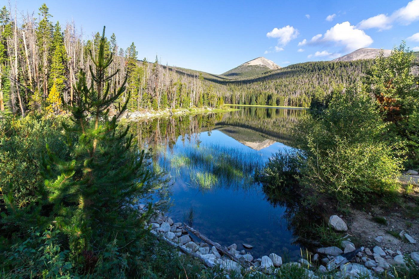
The first mile of the trail will take you up to Deerhead Lake. It’s a steady uphill and is a nice warm up for what’s to come. There’s some camping at the lake if you want to do some light backpacking or use the lake as a base camp. At the lake I recommend taking a minute to assess the terrain and plan you’re route. The route I took involves bushwhacking around the southern edge of the lake to the west end and then heading southwest up to the crest of a forested ridge, which you will spend the remainder of the hike on. Some routes suggest heading up the ridge to the north of the lake which sounds comparable to the other ridge. Either way, the southern ridge route was totally fine so it’s the one I suggest.

Deerhead Lake. Bushwhack around it’s southern shores until you get to the opposite end. Then bushwhack up the ridge to the south of the lake and ride it all the way to the top. The peak you see at the end of the lake is not Torrey although it is a point you’ll be shooting for once on the ridge.
I learned a valuable lesson on this hike, bring lots of water! I knew this was going to be a nasty one and that I’d be spending a lot of time in the sun so I’d planned to top off my bladder and fill an extra water bottle at the lake. Idiotically I forgot to and being caught up in all the excitement didn’t realize this until I got to the crest of the ridge above the lake. At this point I decided I’d gone to far and would have to just proceed onward and carefully ration my water for the rest of the hike. This was not a good situation to be in. The last thing you want is to run out of water way up on the top of a mountain on a hot summer day. It put me under extra stress for the entire hike and I can say I will never make this mistake again.
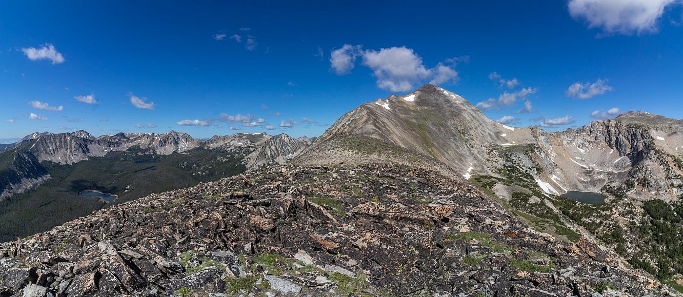
Once on the ridge the path to the top is obvious. Just keep following the ridge until you’re there. Tree cover disappears quickly so plan for a sunny journey. After you ascend to the knob visible from the lake the real fun starts. From a distance the terrain looks fine, almost grassy. But once you leave the trees you’ll be traversing seemingly endless talus fields. Luckily the terrain is mostly flat and the talus is, for the most part, stable so you won’t be sliding around everywhere but hiking along this rough terrain in the hot sun with limited water really started to wear on me.
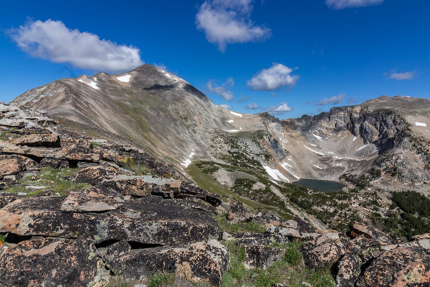
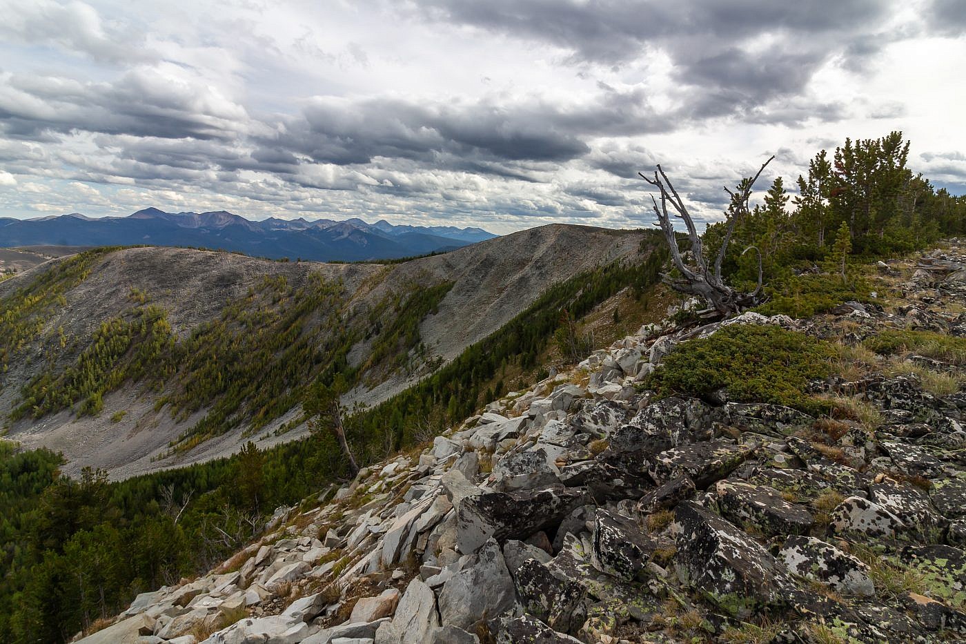
The final ridgewalk up Torrey. It’s incredibly scenic but the talus fields are relentless. Boot Lake, to the left of the ridge, can be accessed via another trailhead at the Dinner Station Campground. The small, unnamed lake to the right of the ridge could probably be most easily accessed by just descending the ridge towards it from this point.
After the flat ridge section the steepness begins to increase sharply. The little blips along the ridge near the top turn out to be bigger than they look from a distance so I chose to sidehill around them and up to the saddle just below Torrey’s summit to avoid unnecessary ups and downs.
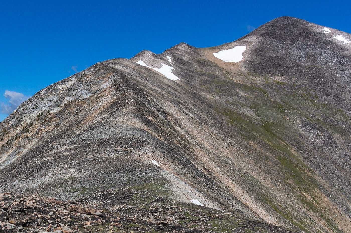
I chose to sidehill around the increasingly large humps near the top to the saddle just below Torrey’s summit.
Torrey Mountain
After a short but steep scramble from the saddle you’ll be at the summit. As you’d expect the views are incredible and you pretty much feel on top of the world. I was so exhausted at this point that I made myself a little nest in the circle of rocks at the summit and took a refreshing nap in the afternoon sun. At one point I saw a plane flying overhead and wondered if anyone noticed me on the summit.
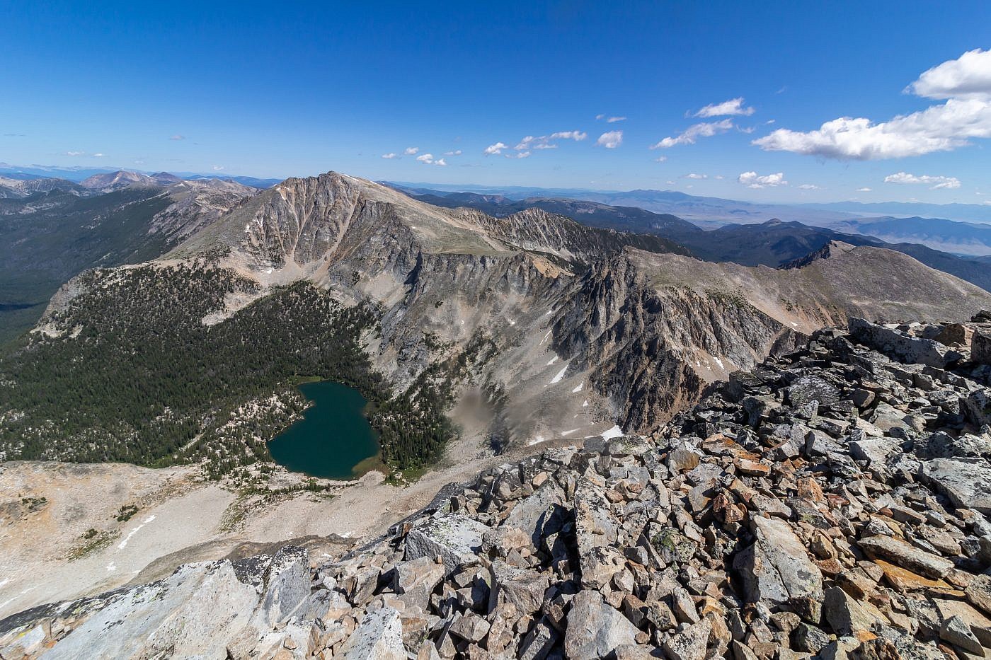
Looking north from the summit of Torrey. The actual highpoint of the range, Tweedy Mountain (11,154′) is situated just behind Torrey Lake. From this angle you can easily see how difficult it would be to get to one peak from the other. Torrey Lake can be accessed via a 10 mile hike starting from the other side of the range and you can supposedly ascend either mountain from a base camp at the lake.
The Return
For me, the return was excruciating. I was nervous about running out of water and was already feeling a bit dehydrated from having to ration it so sparingly. I was grateful it lasted as long as it did but I eventually ran out in the forested section on the ridge above Deerhead Lake. As soon as I got to the lake I busted out the filter and guzzled down as much water as I could before finishing off the last mile. Thankfully I made it back to the trailhead in one piece and on my way home had to stop at the Dillon Dairy Queen for some sustenance. When I got there, though, I was still feeling the effects of exhaustion plus dehydration and took a nap in the parking lot. I felt better after but was ashamed at myself for making such a rookie mistake. Never underestimate the power of these mountains. All it takes once simple mistake to put yourself in serious danger, especially when hiking alone. The good thing is that you can learn from your mistakes and staying hydrated has now become my top priority when peakbagging.
