Boulder Mountains
Haystack Mountain
Download KML
Distance
3.4 miles one way
Type
Day hike
Difficulty
Moderate
- Starting Elevation: 6500 ft.
- Ending Elevation: 8819 ft.
- Elevation Gain: 2319 ft.
 View all 10 photos
- Experience Date: Aug 4, 2019
- Hike Time: 3-4 hrs.
- Drive Time: 1.5 hrs.
- Road Condition: Poor condition. High-clearance vehicle recommended. Unable to make it to official trailhead in Outback.
- Parking: Plenty of parking at trailhead or alongside road if necessary.
- Fees: None.
- Campsite Availability: Could camp at or near trailhead. No camping options along trail except for a flat, protected area on the summit.
- Private Property: None posted.
- Trail Traffic: None.
- Trail Condition: Very well-maintained trail all the way to the top.
- Fire Restrictions: None.
- Stream Crossings: None.
- Water Sources: None.
- Snow: None.
- Winter Access: Probably can do this one in the winter with extra effort.
- Weather: Partly Cloudy. Pleasant. 70's.
- Bugs: None.
- Wildlife Sighted: None.
- Side Quests: None.

Haystack Mountain (8,819′) is the highpoint of the Boulders Mountains, a large but gentle mountain range just north of Butte, MT. It’s a simple hike that climbs steadily up the well-established Haystack Mountain National Recreation Trail all the way to the top. The road to the trailhead is a bit rugged but if you don’t mind adding up to another mile or so to the hike you can park alongside the road and walk the rest of the way in. What makes the Boulders unique are the numerous granite boulders scattered throughout the range and there’s no shortage of them along this trail. The trail is also suitable for bikes but only for experts.
Haystack Mountain.
Background
Just north of Butte, MT lies a vast mountain range known as the Boulder Mountains. Visually, the Boulder’s aren’t anything special. There aren’t any sharp peaks towering overhead and the few lakes that do exist in the range are man-made. But if you take they time to visit the Boulders you’ll immediately realize that they got their name from the numerous granite boulders scattered throughout the range. These boulders formed due to the spheroidal weathering of cracked granite masses which make up part of the Boulder Batholith. The Boulder Batholith formed millions of years ago from magma that cooled beneath the earth’s surface and it’s the resulting granite that became the host rock for many of the ores that were mined in Butte.
There’s plenty of recreating to be done in the Boulders, mostly in the form of off-roading, but for the hikers out there, Haystack Mountain (8,819′), the highpoint of the range, is a great place to start. It’s a fairly simple hike that follows the Haystack Mountain National Recreation Trail all the way to the summit. For once there’s a range highpoint that actually has an official trail!
The Adventure Begins…
For the first time all year I would have several companions joining me-my usual hiking partner Arlo, my coworker Raimie, and his dog Vega. As much as I enjoy solo hiking it was nice to have some company along for a change and Raimie, having a background in geology, was able to provide some interesting commentary along the way.
Getting to the trailhead is simple if you actually know where to go. Online information is scarce for this one but I assumed that because we’d be hiking a National Recreation Trail that Google would be able to get us there. I should’ve known better not to trust Google, though, as it ended up taking us straight onto someones private property. Luckily the owners were outside and were able to point us in the right direction. Even after that, because of the lack of signage, we had to make a couple u-turns before finally stumbling upon the correct road.
I’ll provide detailed directions to the trailhead to avoid confusion: From I-15 take exit 138 and immediately head north on East Elk Park Road (frontage road). Follow this road for about 5 miles until just before it curves under the interstate and take a right on Haystack Road (dirt road). After about 0.7 miles you’ll encounter a gate with some parking. Higher clearance vehicles can drive another mile or so to the official trailhead. My Outback only made it only a little ways beyond the gate which added a little extra distance to the hike.
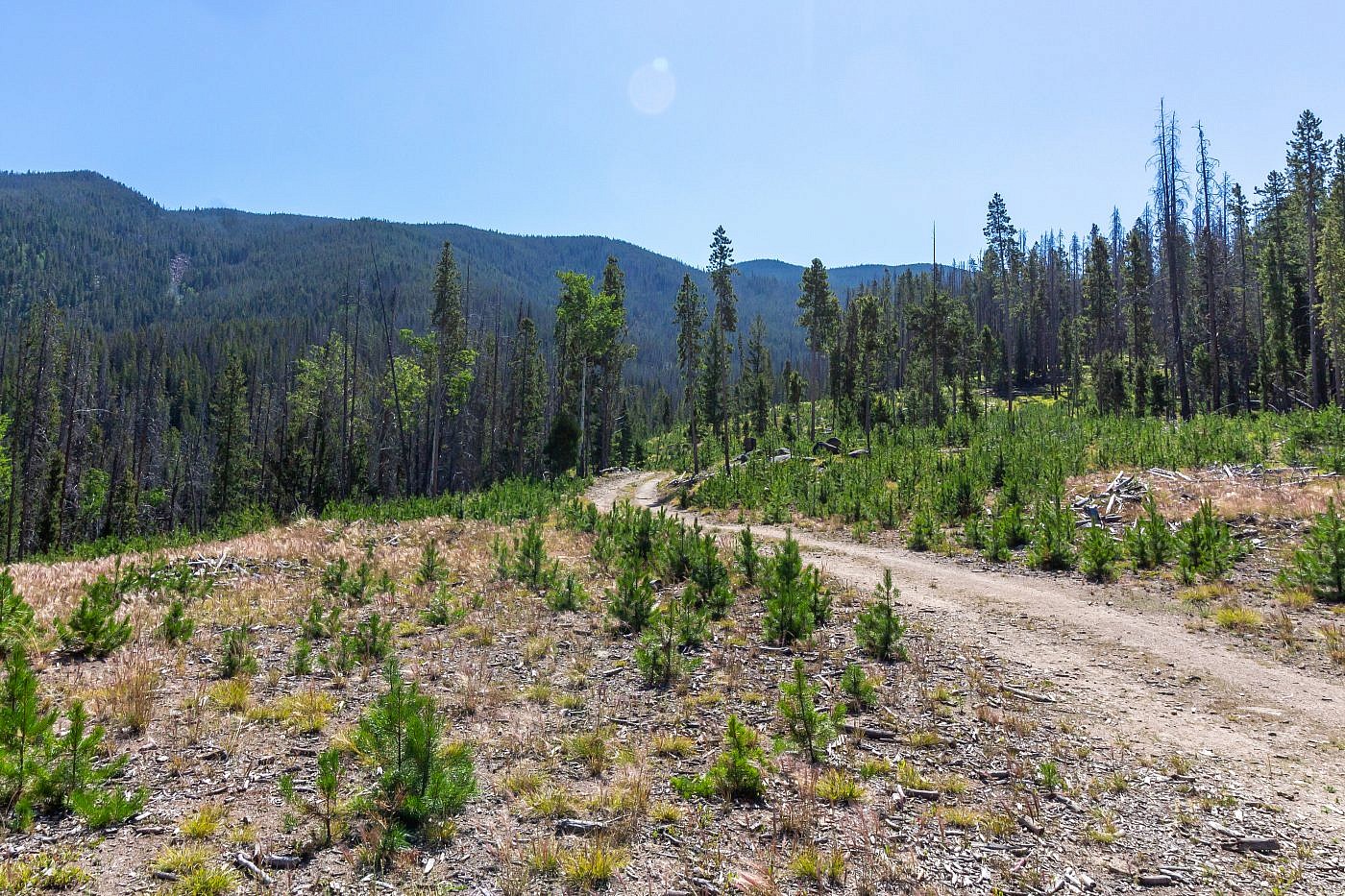
Our parking spot. From here we hiked another 1/2 mile or so to the official trailhead.
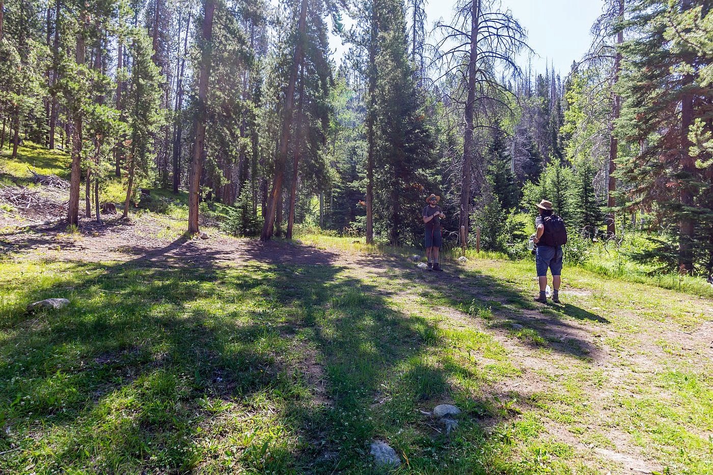
The official trailhead. I couldn’t believe how deserted the trail was being only a 20 min. drive from Butte. A trail like this would be overflowing if it were that close to Bozeman.
On the Trail
There’s not too much to say about the trail itself. It’s a very well-maintained, well-designed trail with a steady uphill grade the entire way and is almost completely shaded so sun exposure isn’t too much of an issue except at the top. It’d be a great trail to bike although I’d only recommend it for experts. Along the way you’ll pass by many granite boulder fields that were mentioned in the “Background” section.
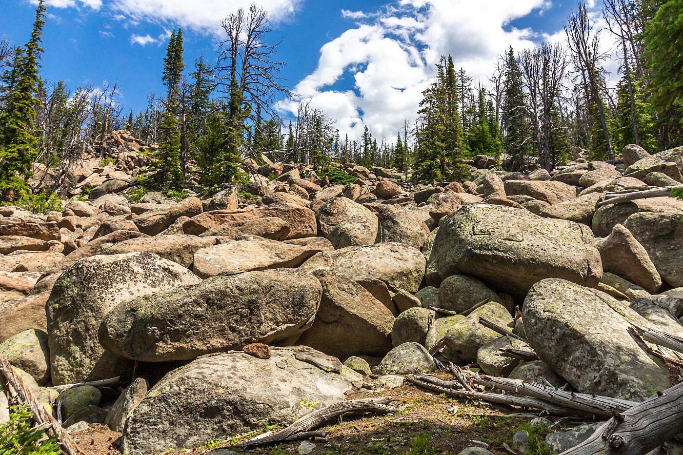
One of the many boulder fields you’ll encounter while on the trail.
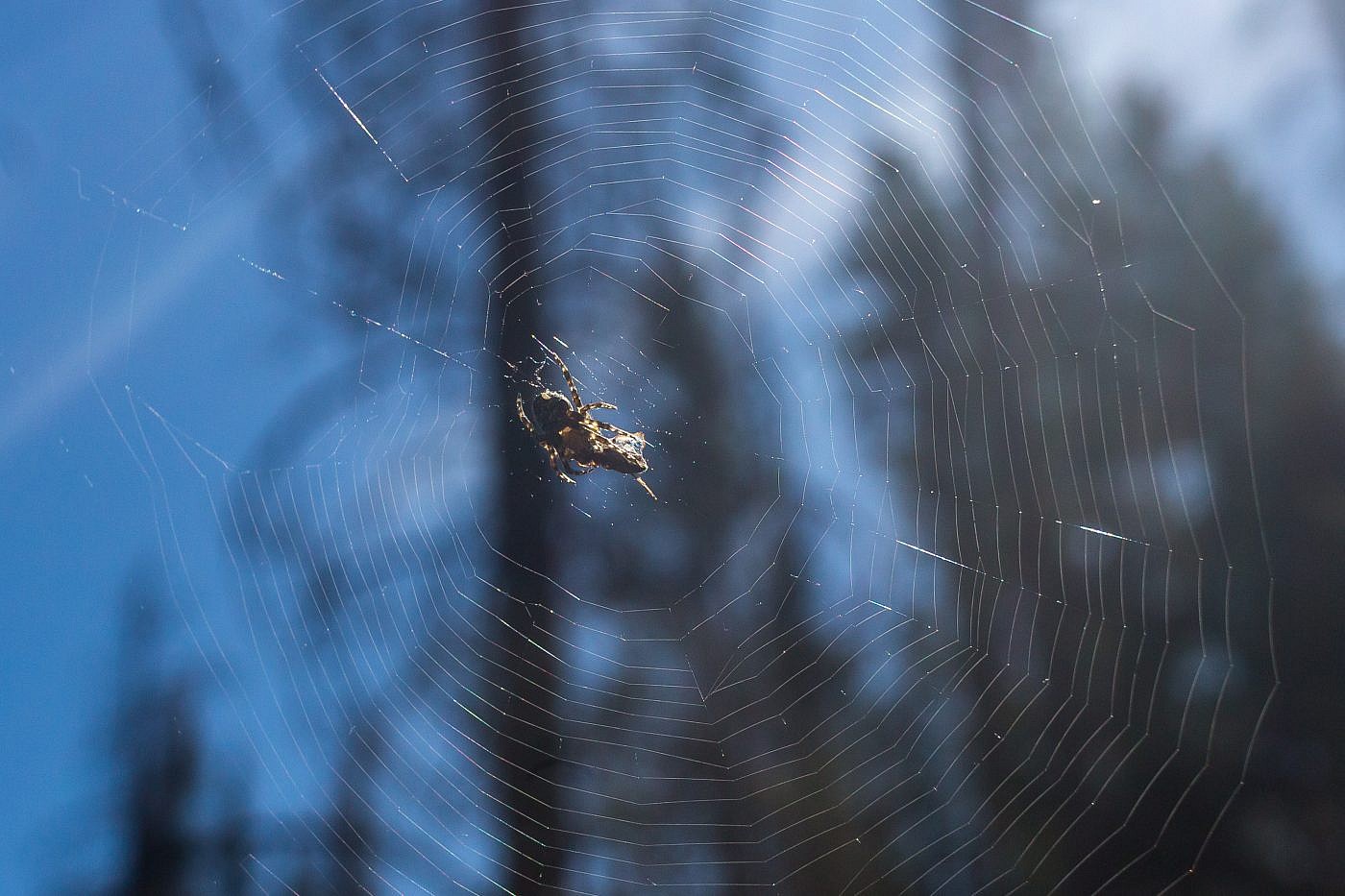
A spider and its prey.
The Summit
The summit of Haystack is mostly just a heaping pile of weathered granite boulders. We took some time to scramble around the boulders and attempted to figure out which one actually represented the highest point of the summit (see picture below). The summit use to be home to a fire lookout which has long since been removed. Little evidence of the lookout remains but you can check this link for some history on the lookout. There’s a nice flat area below the boulders where you can supposedly find the bench mark although I couldn’t find it. The spot is probably flat enough to camp on and the surrounding boulders provide nice protection from the wind.
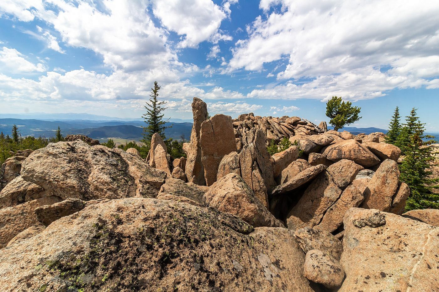
The summit of Haystack Mountain is mostly just heaping pile of granite boulders. The true summit is either the narrow boulder sticking up in the center left or the wider boulder behind it to the right. A fire lookout use to exist on the summit but little evidence of it remains.
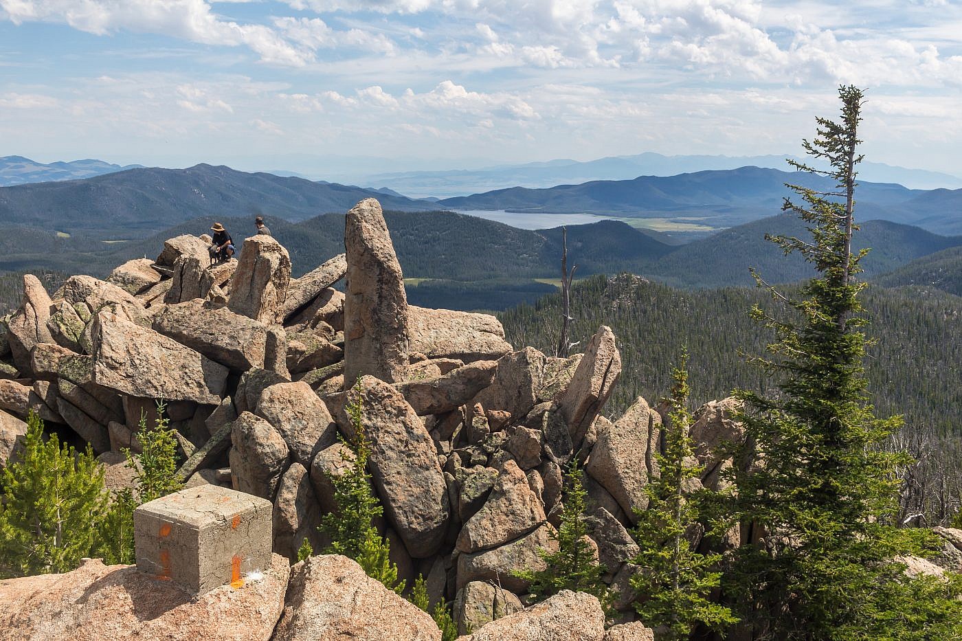
Looking southeast from the summit. Whitetail Reservoir in the distance.
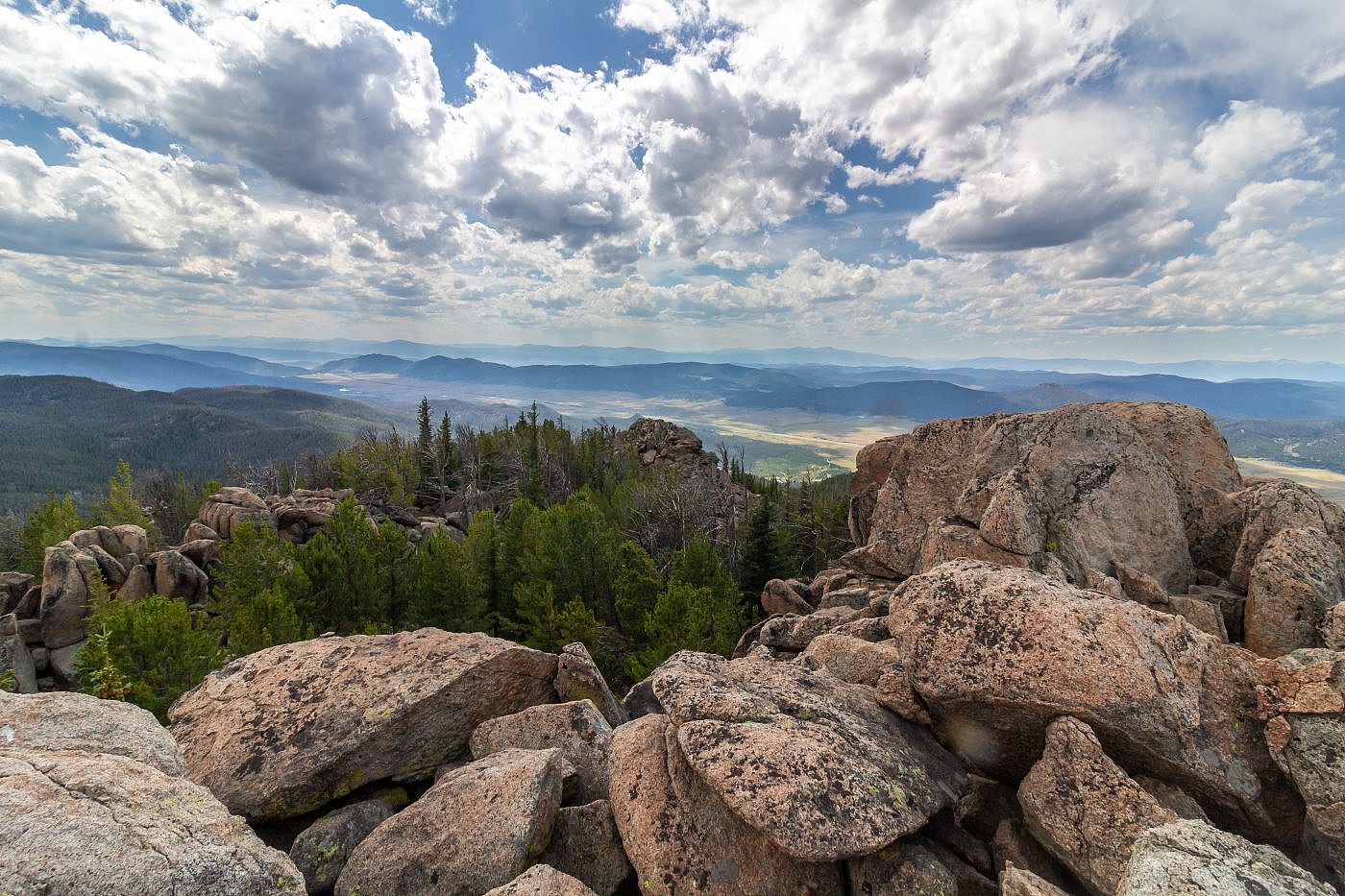
Looking southwest from the summit towards Butte.
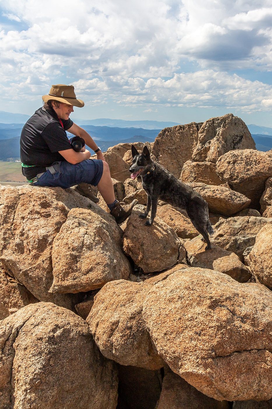
Raimie and his dog Vega on the summit.
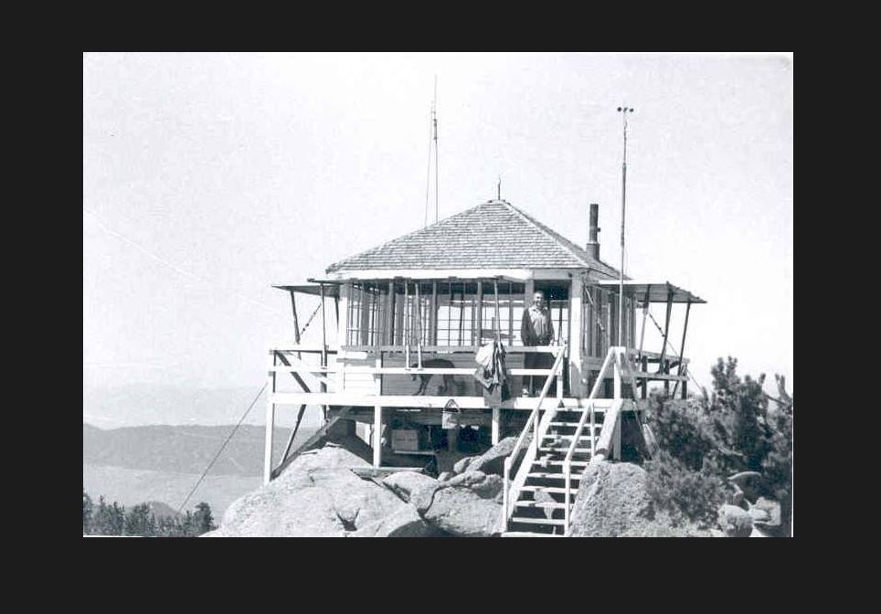
A picture of the old fire lookout. Source: http://www.nrtdatabase.org/trailDetail.php?recordID=406#five
