Elkhorn Mountains
Elkhorn Peak to Crow Peak Loop
Download KML
Distance
9.5 miles round trip
Type
Day hike
Difficulty
Moderate
- Starting Elevation: 6500 ft.
- Ending Elevation: 9414 ft.
- Elevation Gain: 2914 ft.
 View all 12 photos
- Experience Date: Sep 15, 2019
- Hike Time: 6-8 hrs.
- Drive Time: 1 hr. 30 min.
- Road Condition: Well-maintained dirt road. 2 WD accessible. High-clearance not necessary.
- Parking: Plenty of parking.
- Fees: None.
- Campsite Availability: Some areas to camp along trail before it gets steep.
- Private Property: Private property in the town of Elkhorn so be careful where you park.
- Trail Traffic: Light.
- Trail Condition: Dirt road plus off-trail travel with some spur trails here and there.
- Fire Restrictions: None.
- Stream Crossings: None.
- Water Sources: Small creek in the drainage below Crow Peak.
- Snow: None.
- Winter Access: Trailhead can be accessed in winter. `
- Weather: Partly Cloudy. Pleasant. 70's.
- Bugs: None.
- Wildlife Sighted: None.
- Side Quests: Elkhorn ghost town. Any of the lakes east of the peaks.

Crow Peak (9,414′) is the highpoint of the Elkhorn Mountains, a lesser-known gem of the Bozeman area. It’s only a three mile hike to its summit from the ghost town of Elkhorn but you can easily bag Crow’s neighbor, Elkhorn Peak (9,381′), along the way and turn this into a delightful loop hike. Starting from the ghost town you follow an old mining trail for several miles and then a series of spur trails up to the summit of Elkhorn Peak. Then make the incredibly scenic traverse over to Crow Peak and descend the drainage to the northwest back to the trailhead. Much of this hike is off-trail but the terrain is easily navigable. Side quests include an old mining camp on the way up Elkhorn Peak, any of the lakes at the bases of the peaks, or even the ghost town of Elkhorn.
Shot of Elkhorn Peak (left) and Crow Peak (right).
Background
For me, the Elkhorn Mountains south of Helena, MT, are somewhat of a hidden gem of the Bozeman area. You won’t find any sharp, menacing peaks in this range but what the range lacks in scenery it makes up for in other areas. The whole range is like a giant playground and there’s something for everyone here. There’s hiking, there’s biking, there’s off-roading, there’s ghost-towning, there’re even a handful of lakes for backpacking and plenty of streams for fishing. Maybe the best thing about this range is the roads that pervade it making it accessible from almost any angle and allowing you to create your own unique hikes; this is my personal favorite thing to do. I highly recommend picking up a copy of this map if you venture into the range.
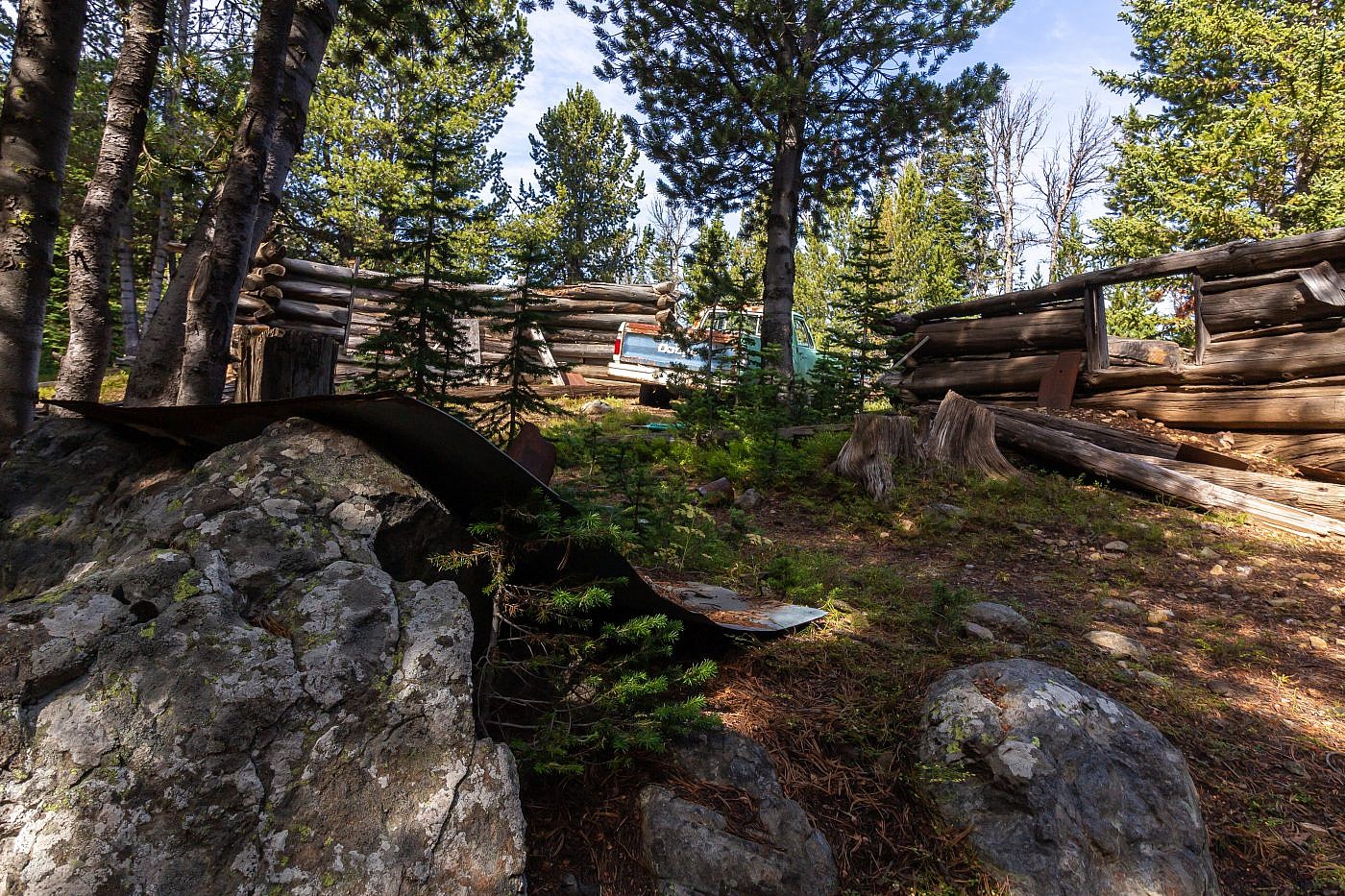
My first taste of the range was many years ago when I visited the ghost town of Elkhorn with my brother. Technically it’s not a full on ghost town since it still has about 10 residents but there are many old structures leftover from the mining days which have been preserved making it a worthwhile stop. I wouldn’t return to the mountains again until late 2018 when I made a winter attempt at the 2nd highest point of the range Elkhorn Peak (9,381′). This attempt proved unsuccessful but it left me craving more and I immediately began to formulate plans for a loop hike around Elkhorn Peak and its nearby brother Crow Peak (9,414′), the highpoint of the range.
Elkhorn ghost town.
The Elkhorn Peak to Crow Peak loop is all around a fun hike. Starting from the town of Elkhorn you can loop either direction around the two peaks but for some reason it feels more natural to go clockwise such that you summit Crow Peak last. The hike starts on an old road but much of it is off-trail with some spur trails mixed in and the terrain is easily navigable with a few scrambles here and there. The views are gorgeous, especially the traverse between the two peaks, and since this is a loop hike you won’t have to retrace your footsteps at any point which is an extra bonus.
The Adventure Begins…
For my second week of full-time peakbagging I had summited both Mount Haggin and Stine Mountain, canoed the Gates of the Mountains with my friend Arlo and his dad, and was ready to top it all off with the Elkhorn to Crow Peak loop. I knew I might only have another week or two of good peak-bagging before snow prevented travel in the high country so every available day was precious to me.
I had spent the night in Helena and was therefore quite close to the trailhead located right in the ghost town of Elkhorn. The drive was only about an hour mostly because of the long dirt road between Highway 69 and Elkhorn. Because people actually live in the town the road is well-maintained and passable by just about any vehicle. I parked in a small open space right where the road abruptly kinks right and heads into the mountains.
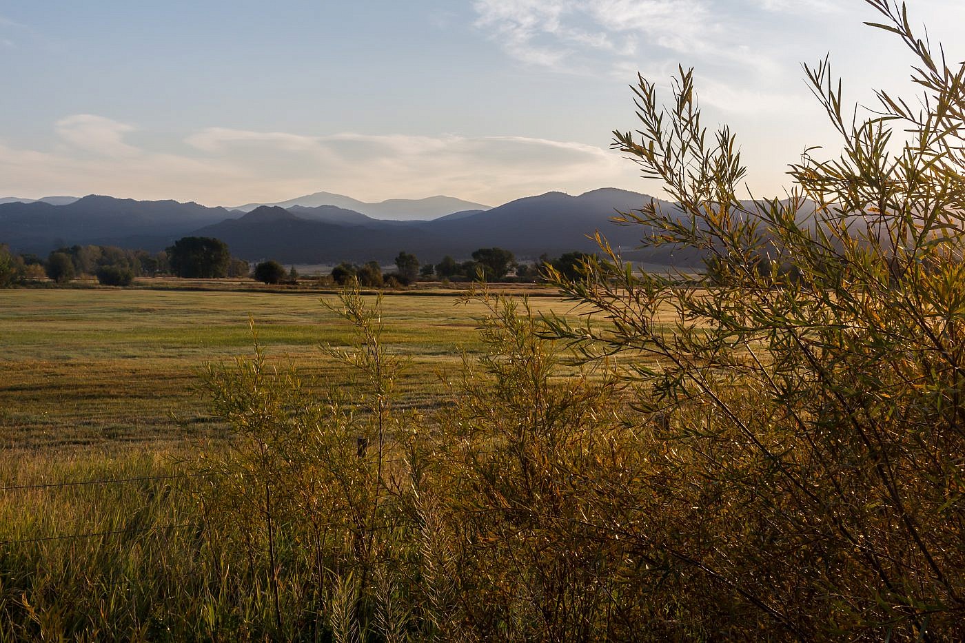
Early morning shot of Elkhorn Peak (left) and Crow Peak (right) from near Boulder, MT.
On the Trail
The first section of trail follows FS Road #258 for several miles. It’s simple and quite enjoyable with some old mining buildings along the way for added appeal. Make sure you stick to the road as closely as possible-there are some random intersections here and there where the path is unclear but generally if you hang to the left you should be all good. I recommend studying a map beforehand or using some sort of gps tracker app.
A random shot from along the road.
Several miles in I had my first encounter with a human on a trail in weeks. He was an older guy, maybe 50, driving towards me in an ATV. I anticipated that he’d just drive by, give a head nod, and continue on his way but he actually stopped to talk. Man, was this guy excited; I could literally feel the positive energy radiating from his body. Apparently he’d just summited Crow Peak from a base camp he’d established at an old mining camp further ahead and was just tremendously proud of his accomplishment, as someone of his age should be! It was exciting to finally encounter someone on the trails who had a similar mentality and passion towards the mountains. After parting ways I decided to head for the old mining camp to have a look around and take a lunch break. To get to the mining camp you will want to stay left where the road splits and continue along the main road whereas to go straight to the peak you would take a right.
The old mining camp. I think it’s a worthwhile stop and doesn’t add too much extra length to the hike although you will have to bushwhack a bit to get back on the correct path.
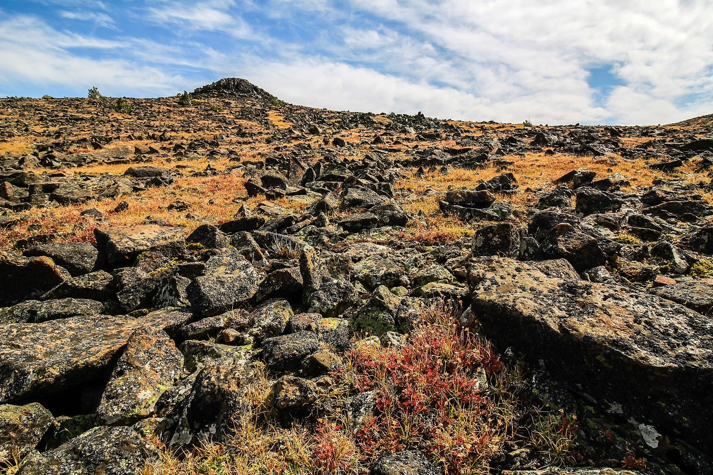
After my quick lunch break at the mining camp I decided to bushwhack south up some steep slopes towards Windy Point which sits just below Elkhorn Peak. I quickly stumbled upon a spur trail which conveniently spit me out of the trees right at Windy Point. I’m guessing this is the trail you’d normally take if you didn’t go to the mining camp. From here you can follow this spur trail, which fades in and out, straight to the summit of Elkhorn Peak. It’s worth it to mention a large chunk of exposed quartz on the south side of Windy Point. I wasn’t aware of this on my way up so I didn’t get a close look but I recommend taking a slight detour to go check it out.
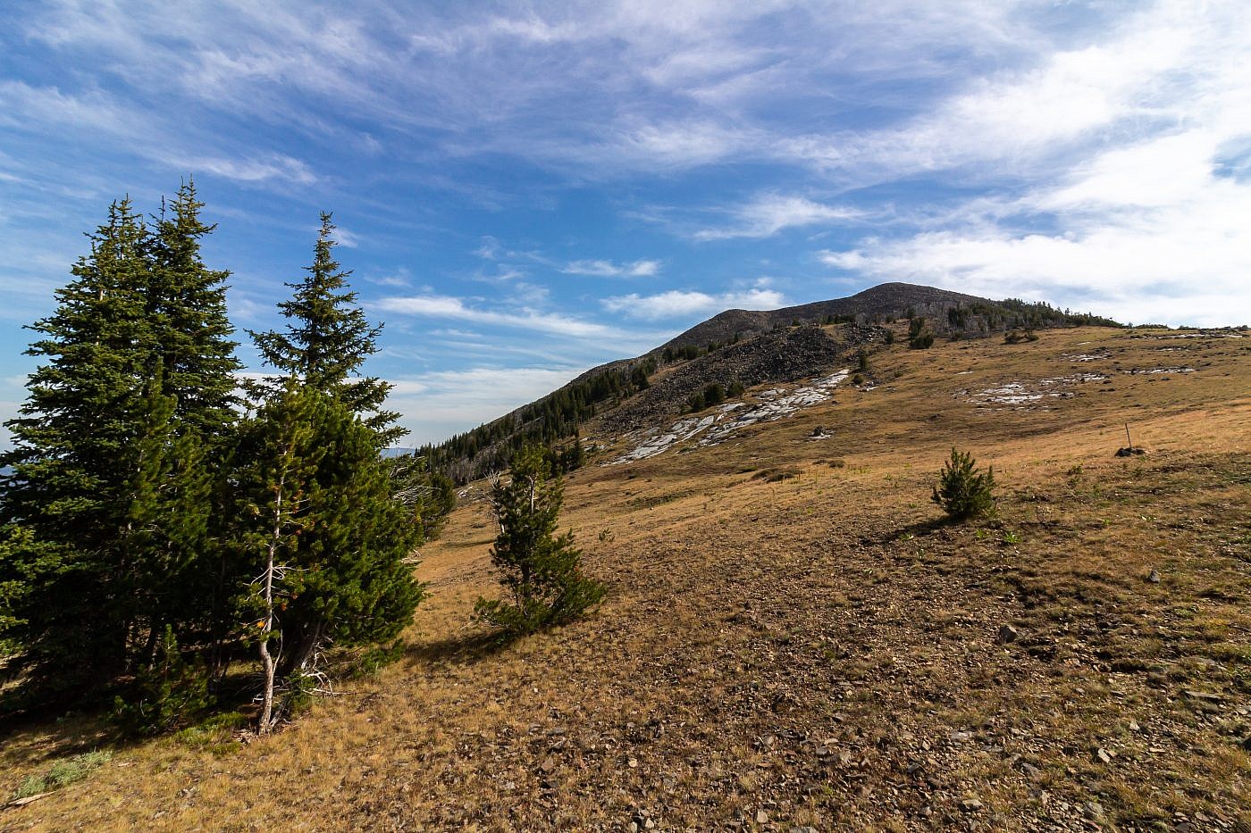
First view of Elkhorn Peak after emerging from the woods. From here you can follow a faint spur trail all the way to the summit.
On my way up Elkhorn Peak I encountered yet another group of older hikers. Much like the other guy I’d met they’d driven a good chunk of the way up the road in a Jeep in order to shorten the hike. There was a clear leader of the group who had a similar passion for peakbagging. He claimed that a friend of his said that the exposed granite in the Elkhorns is some of the oldest in the world. I haven’t been able to verify this claim but I’m sure there’s some truth to it. He’s also the one who made me aware of the exposed quartz near Windy Point. This was turning out to be a great day for meeting people!
Elkhorn Peak and the Crow Peak Traverse
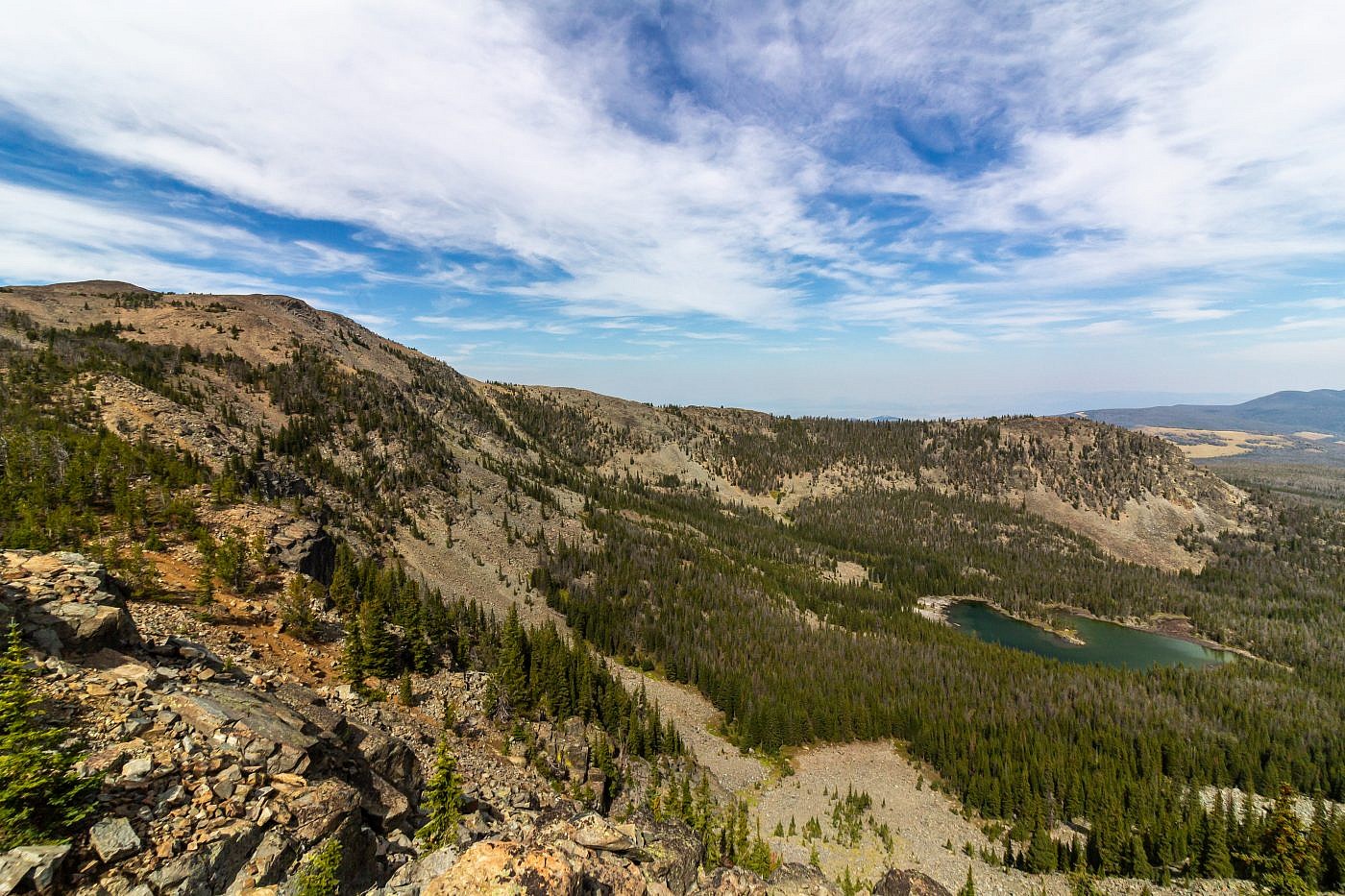
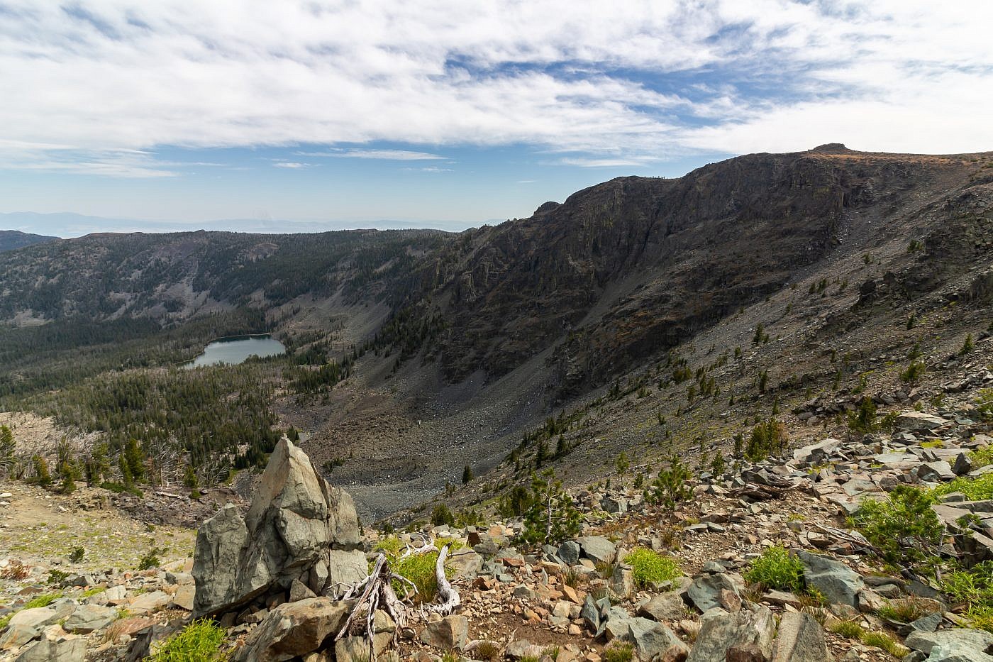
I didn’t spend too much time at the top of Elkhorn Peak. As you’d expect the views are great and you can clearly see the path over to Crow Peak. From here you will descend the southeast slopes of Elkhorn back into the trees for a bit, follow the connecting ridge, and then make the final ascent up Crow. It’s incredibly scenic and is definitely the highlight of the hike. Along the way you’ll pass by Hidden Lake and Glenwood Lake which sit below Elkhorn Peak and Crow Peak respectively. Both, I think, would make great backpacking destinations although I’d probably approach them from the east. Just before the the final ascent of Crow I took a slight detour to a rock outcropping above Glenwood Lake. This provided great views of the lake and of the traverse between the two peaks.
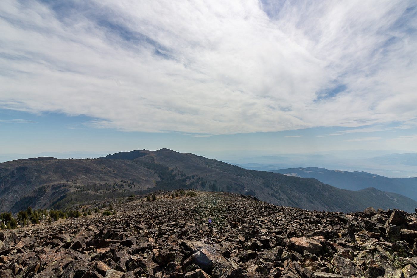
View of Crow Peak from the summit of Elkhorn Peak. The traverse between the two peaks is definitely the highlight of the hike and the route should be fairly obvious.
Hidden Lake. Elkhorn Peak on the left.
Glenwood Lake. I took a slight detour to visit the rock outcropping on the far right.
Approaching the rock outcropping.
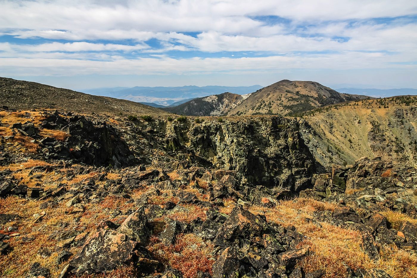
View of the traverse from the rock outcropping. Elk Peak on the right and Windy Point just below on the left. From this angle you can see the quart chunk to the right of Windy Point.
Crow Peak
With just a little more effort I was finally at the summit of Crow Peak. It was super windy but I was able to take cover behind the summit cairn to gaze upon the wondrous sights. It wasn’t long before I saw even more hikers. This time is was a pair of seriously hardcore peakbaggers from Helena, probably in their 50’s. These guys were the real deal having bagged all kinds of peaks from across the country. They’re the only people I’ve met on trail who truly shared the same peakbagging interest as me. We sat on the summit and chatted for a good hour or so about our experiences in the mountains and I even joined them on the way back down.
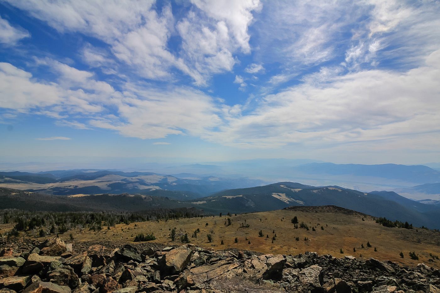
Looking southwest from the summit of Crow Peak.
The Return
The return is relatively straightforward but does get a cliffy at the start. You first want to descend the northwest slopes of Crow into a drainage known as Greyback Gulch. This is definitely the steepest part of the hike but it’s short and sweet. Once in the drainage just follow the small, possibly dry, creek. Eventually you’ll run into a spur trail and then to the road you came in on which will take you back to the parking lot.
Shot of Elkhorn Peak (left) and Crow Peak (right) on my way home. Here you can clearly see the quartz chunk on Elkhorn Peak.
