East Pioneer Mountains
Tweedy Mountain Loop
Download KML
Distance
11.25 miles round trip
Type
Day hike
Difficulty
Hard
- Starting Elevation: 7400 ft.
- Ending Elevation: 11154 ft.
- Elevation Gain: 3754 ft.
 View all 34 photos
- Experience Date: Jul 10, 2020
- Hike Time: 7-10 hrs.
- Drive Time: 3 hrs.
- Road Condition: Decent dirt road with some rocky sections near the end. 2 WD accessible. High clearance recommended for last section. High clearance required to get to official Gorge Lakes Trailhead.
- Parking: Plenty of parking along road and at official Gorge Lakes Trailhead.
- Fees: None.
- Campsite Availability: Camping at trailhead or along road. Plenty of flat area around official Gorge Lakes Trailhead. Camping at South Gorge Lakes. Well-established sites at North Gorge Lake and Barb Lake.
- Private Property: None posted.
- Trail Traffic: Light.
- Trail Condition: Dirt road followed by a well-established trail. Then off-trail with some class 2 boulder scrambling at end. Barb Lake route is mostly off-trail and requires some SERIOUS bushwhacking.
- Fire Restrictions: None.
- Stream Crossings: Minor stream crossing near South Gorge Lake.
- Water Sources: Route parallels Gorge Creek near the start. Plenty of small streams along the way. South Gorge Lake. Barb Lake.
- Snow: Some small to large snow patches here and there. Must navigate around large snow field near top.
- Winter Access: None.
- Weather: Mostly sunny. 70's. Pleasant. Cool on summit.
- Bugs: Few mosquitoes.
- Wildlife Sighted: Saw a grouse.
- Side Quests: North Gorge Lake. Barb Lake. Torrey Lake. Torrey Mountain if you're an experienced climber.

Tweedy Mountain is the highpoint of the East Pioneer Mountains and 8th highest point in Montana if you exclude the Beartooth Mountains. There are several routes to the summit but the simplest and most popular starts from the Gorge Lakes trailhead on the east side of the range. The route follows the main trail for several miles before heading off-trail up to South Gorge Lake and finishes with a fun, albeit steep, scramble up Torrey’s northern flank. It is possible to skip South Gorge Lake and head straight to the summit but this will not shave off much time and you’ll miss out on the beauty of the lake. Alternatively, it is possible to bushwhack to Barb Lake from the same trailhead. The final ascent from Barb Lake is much simpler than the previous route but the bushwhacking can be miserable at times. These two routes could be combined to form a nice loop around the peak. Torrey could also be climbed from a base camp at North Gorge Lake or Torrey Lake on the west side of the range. The last mile to the trailhead requires high-clearance but up to that point it should be accessible by most vehicles although the road is a bit long and bumpy.
Tweedy Mountain.
Background
By the time July rolled around I was thirsting for a real mountain summit. Not some piddly mountain that I could do in the off-season but something that was formidable and would require some actual work to conquer-I wanted to suffer. I thought back to February and remember thinking at the time only five more months until peakbagging season, then four months, then three, and so on. It was hard to believe the moment had finally come-snow was no longer an obstacle and I could pick any peak I wanted! Of course I wanted to conquer a range highpoint, that is my main goal after all, but where do I start? Many of the highpoints that remain on my list are smaller-scale and more appropriate for the off-season. On the other hand, many of the formidable highpoints that remain on my list are either in heavy grizzly country or so challenging that I’d want a hiking partner. After taking this into account there’re not actually too many peaks left that satisfy my criteria.
One peak that I had my sights on was Tweedy Mountain, the highpoint of the East Pioneers. I had done Tweedy’s neighbor and second highest point in the range, Torrey Mountain, and the highpoint of the West Pioneers, Stine Mountain, last year and really wanted to complete the highpoints of the range. The main thing that had initially deterred me from Tweedy was the questionable state of the road to the trailhead. Basically every report I checked seemed to suggest that the road was complete crap and I feared my little Outback just wasn’t cut out for the job. But lately I’d been really pushing the limits of my Outback and decided I wasn’t going to let the road stop me even if it meant parking a ways out and backpacking or biking the rest of the way in.
From what I can tell there are three main routes to the summit of Tweedy. The first and most common starts from the Gorge Lakes trailhead on the east side of the range. From there it’s about a three mile hike on a well-established trail followed by a short off-trail section to South Gorge Lake and finishes off-trail with a super fun boulder scramble to the summit. The second route, the Barb Lake route, also starts from the the Gorge Lakes trailhead but is completely off-trail. This route requires some SERIOUS bushwhacking at times but the final ascent from Barb Lake is much simpler than the ascent from South Gorge Lake. The third and final route starts form the west side of the range just off the Pioneer Mountains Scenic Byway near the Mono Creek Campground. This route will take you 10 miles up David Creek to Torrey Lake. From the lake you can supposedly ascend either Tweedy or Torrey Mountain. This final route is very long so I’d recommend incorporating the climbs as part of a backpacking trip to Torrey Lake. My overall route recommendation is the easier in-and-out route via South Gorge Lake but to get the most out of your trip I would do the loop hike going clockwise to Barb Lake, up to the summit, down to South Gorge Lake, and back out. This will get the nasty bushwhacking out of the way first and the rest is smooth sailing. The route outlined in this report is the reverse loop.
For more general information on the Pioneer Mountains please see my write-ups on Torrey Mountain and Stine Mountain.
The Adventure Begins…
I set out on a Thursday night with the plan to camp as close to the trailhead as possible with my greatest fear being the state of the road. I was also just slightly worried about snow situation since the route I’d be taking would involve ascending a north-facing slope and knew there was a large snow patch near the top that might cause some trouble.
As I approached Dillon I got the classic view of Tweedy and Torrey to the west. I examined Tweedy to get a read on the snow but it was impossible to see the slope I’d be ascending from this angle. Based on the amount of snow I could see I determined it probably wouldn’t be an issue and decided to 100% commit and not worry about it until the time came.
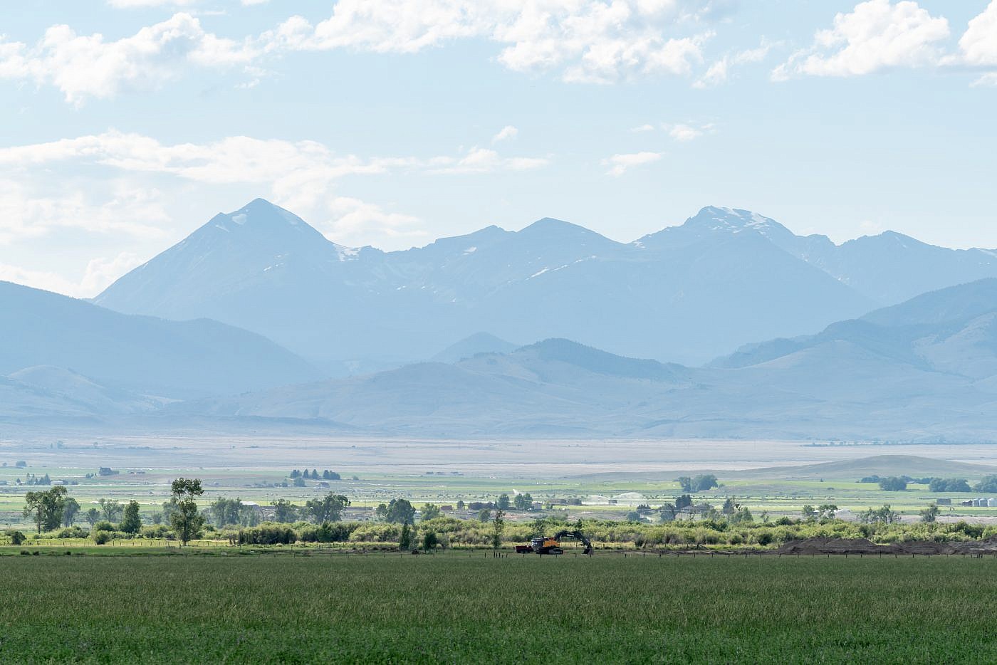
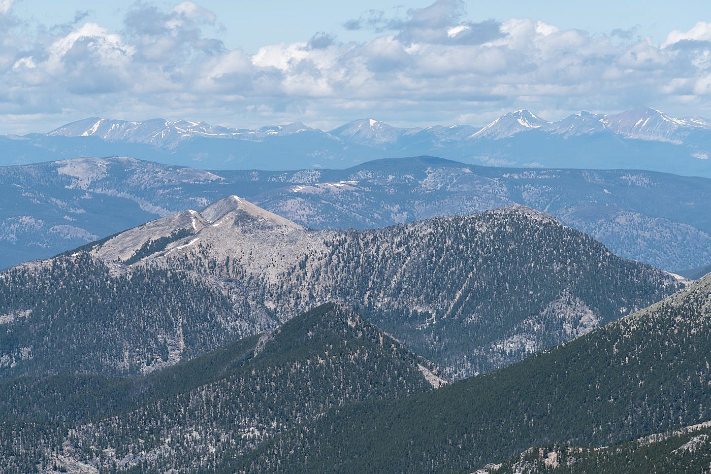
The classic view of Tweedy Mountain (left) and Torrey Mountain (right) as seen from the Dillon area. Here I examined the snow situation on Tweedy but couldn’t get the information I was after since you can’t see the face in question from this angle. The east face, which can be seen, looked almost snow-free which boosted my confidence. The Barb Lake bushwhack route involves ascending this face.
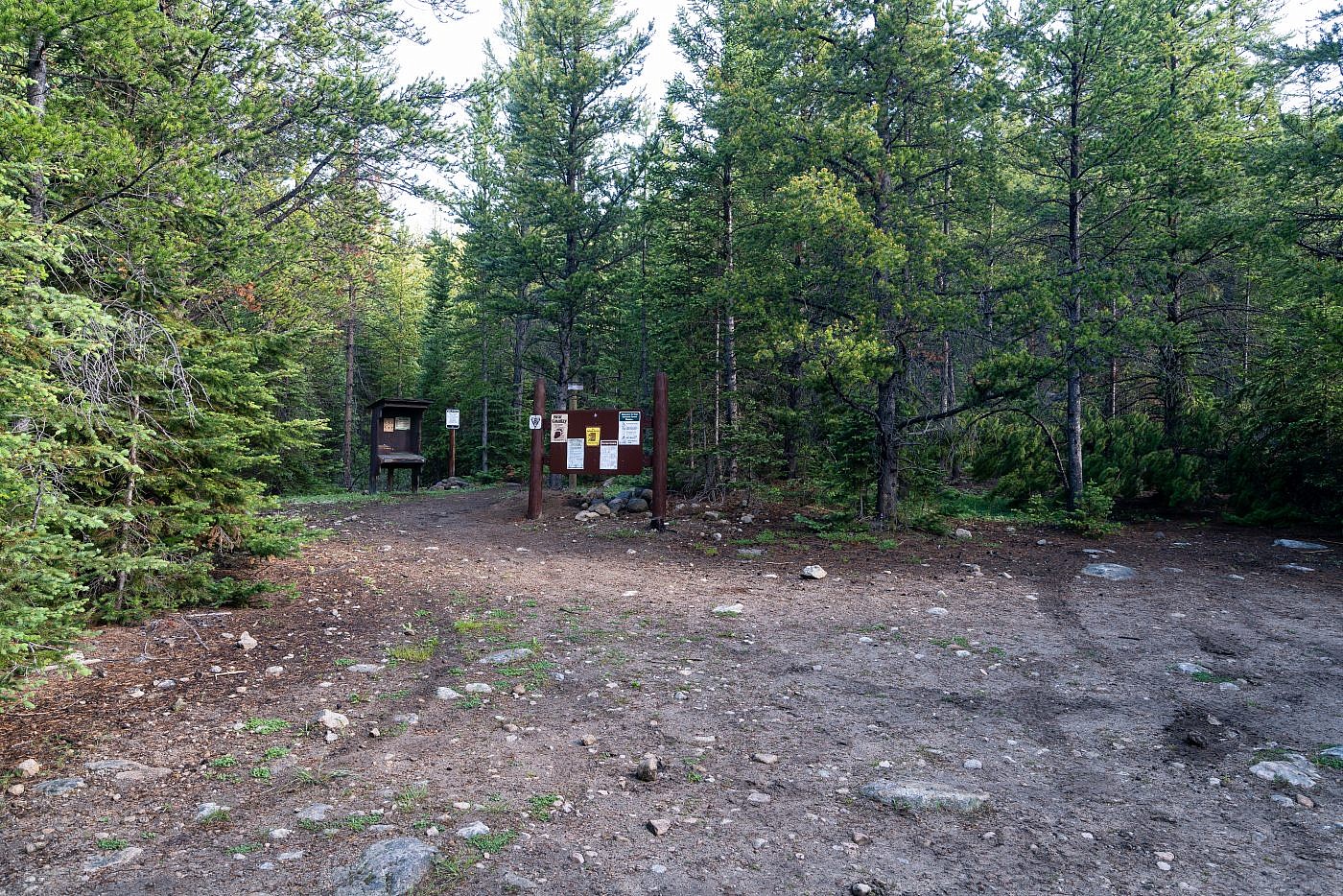
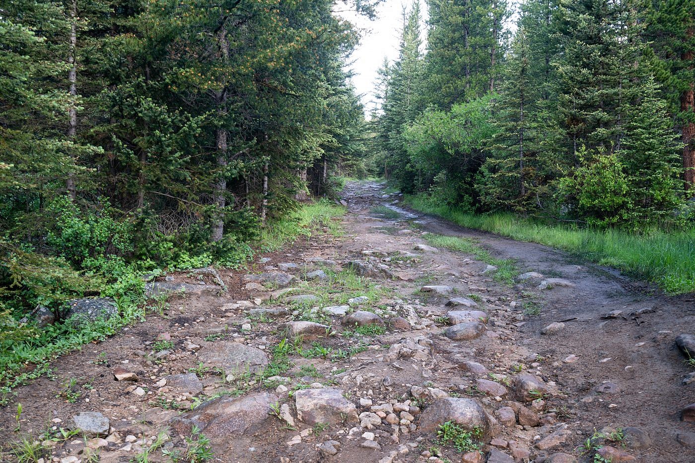
As I approached the trailhead I was surprised at the condition of the road. This road was not nearly as bad as I had anticipated. It wasn’t even close to as bad as some of the roads I’d driven earlier in the year and it was only the last several miles that had some nasty spots hear and there. It is rocky in areas but the surface is mostly compacted dirt so you as long as you can navigate around the rocks the driving is actually quite smooth, albeit slow at times. The last mile to the trailhead, however, follows an “unimproved” road and is a different story. It’s actually not terrible but there’s one section with large rock steps which does absolutely require high-clearance. There are some parking spots right before the rock steps but I didn’t even try this section of road and established my camp in a small clearing (basically an alternate parking lot for lower clearance vehicles) where the road becomes “unimproved”. Overall it took about an hour of driving from the interstate. Here are the detailed directions:
From I-15 take the Apex/Birch Creek exit (exit 74) about 10 miles north of Dillon, MT. Follow Birch Creek Road for 8.5 miles. Stay right at the Y and follow for another 1.1 miles to another Y. Take a right at the Y and follow Willow Creek Rd. (FS Road #8200) up and then down a small hill. The road deteriorates the farther along you get. After 6.5 miles there’s another Y and a sign for the Gorge Lakes trailhead to the left. Here the road becomes “unimproved” and is impassable without a high-clearance vehicle. With a high-clearance vehicle you can continue another 1.1 miles to the official trailhead. There’s parking along the road right at the final Y or further up the “unimproved” road before it requires high-clearance.
This is about the worst the road gets before the start of the unimproved road. It’s mainly compacted dirt with rocks poking out so as long as you can avoid the rocks it’s really not too bad.
This is the short “rock step” section that makes the “unimproved” road inaccessible without high-clearance.
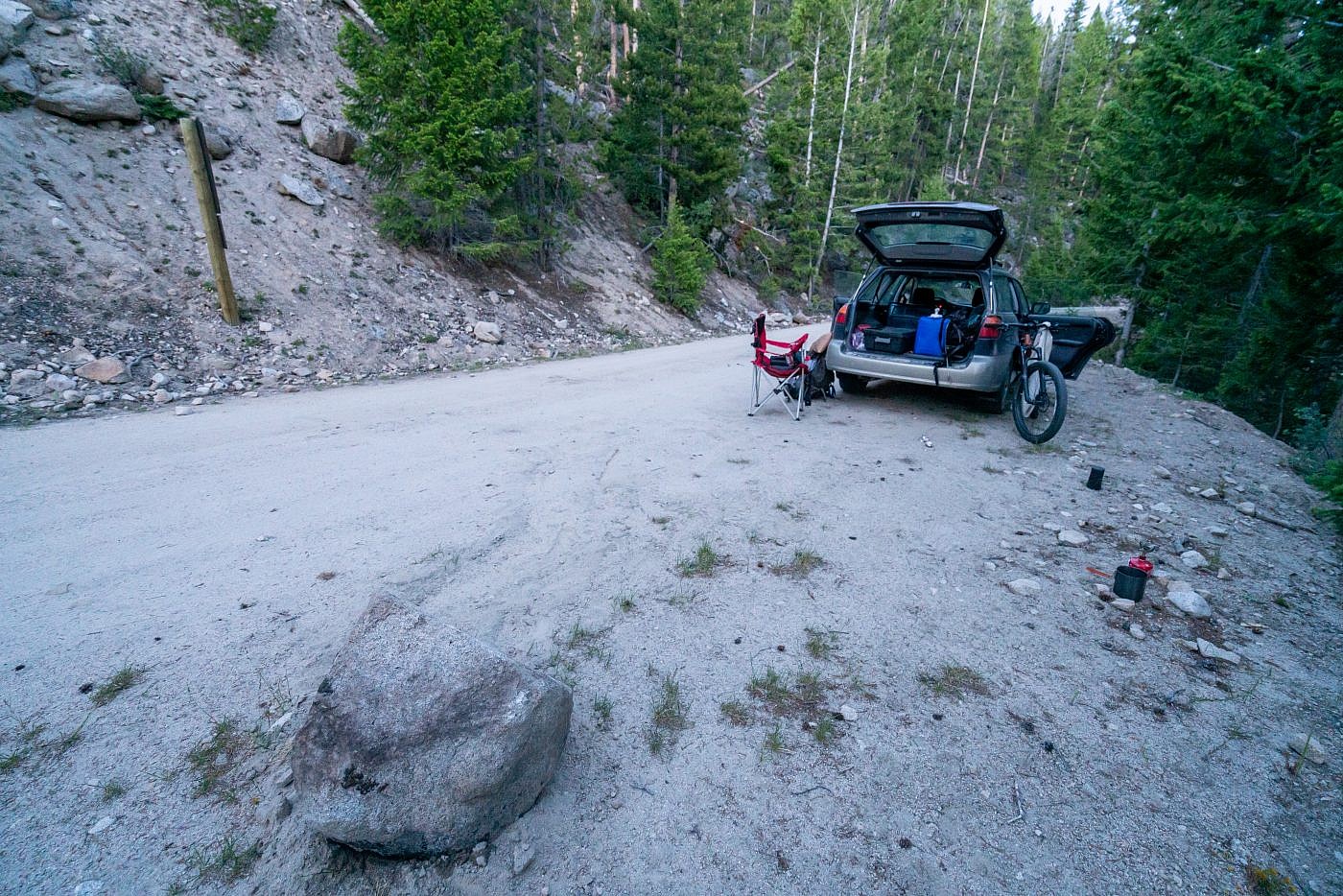
My campsite near the start of the unimproved road.
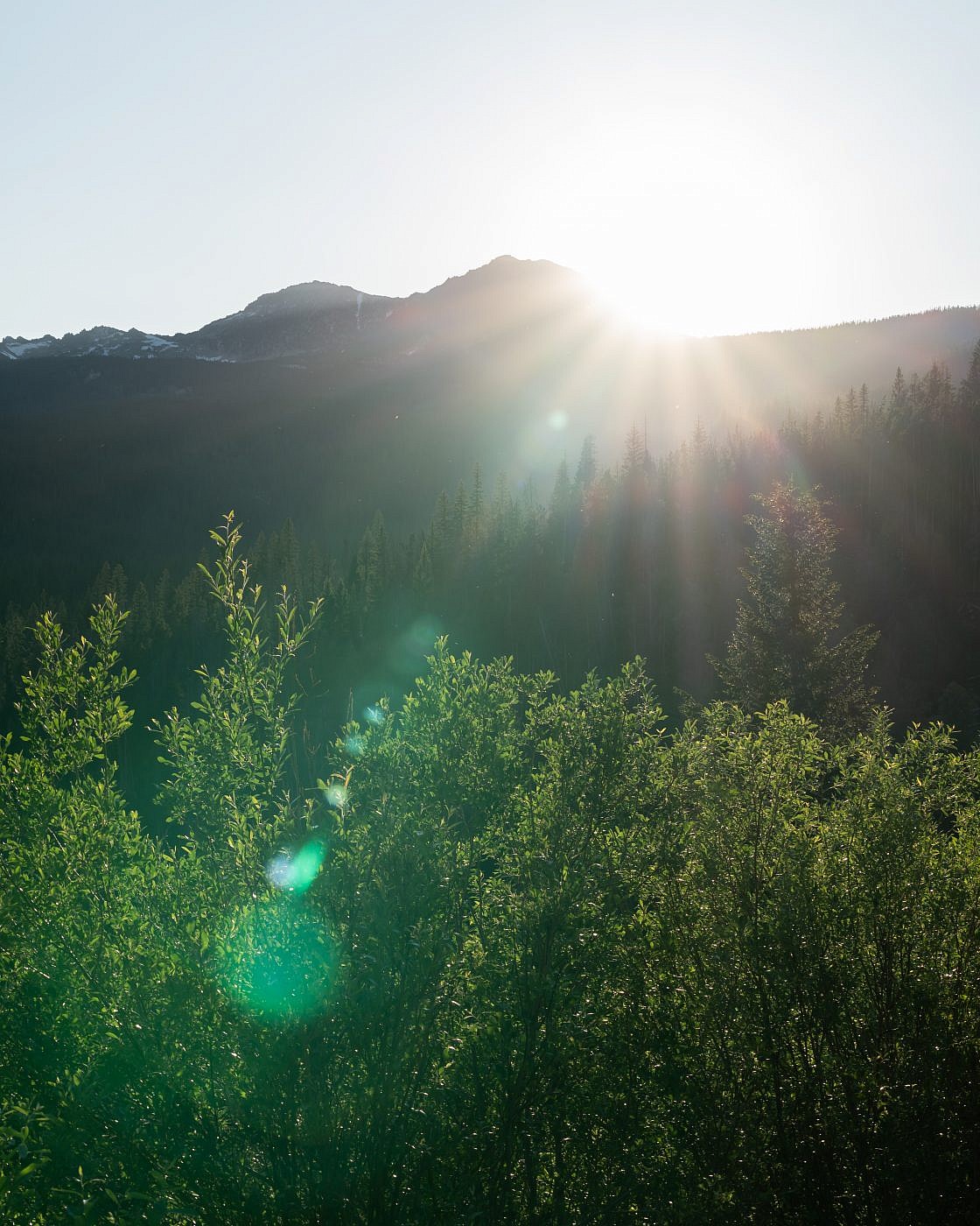
Sunset over the Pioneers from near my campsite..
On the Trail
I woke up to the sound of rain pelting the top of my car and rolling thunder in the distance. An early morning squall was in the forecast so I wasn’t too alarmed but it did end up delaying me a bit. Once I was sure the coast was clear I prepped my gear and took off down the unimproved road towards the Gorge Lakes trailhead.
Clouds still remained over the mountains as I began my journey but it wasn’t long before the sun came out and baked them away.
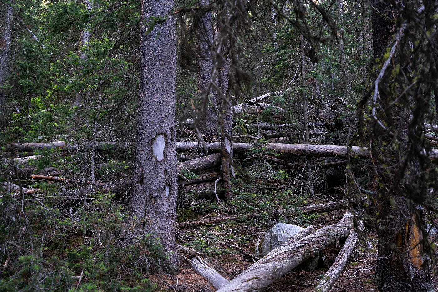
Just before the trailhead you’ll notice a large grassy clearing to the left with a pile of wood in the center. I don’t know if this is the best place to the leave the road for the Barb Lakes route but this is where I emerged on the way out. From here you’ll have to bushwhack through the woods a little ways to Gorge Creek and find a way to cross it. There’s a small log bridge that I was able to use. From there you must bushwhack up a very steep and densely forested slope with all kinds of deadfall and other obstacles along the way. Once at the top of the hill sidehill south along the slopes until you’re in the DuBois Creek drainage. From here head west staying to the north of the creek and look for a series of rock markers that have been placed indicating the simplest path. If you can find the markers and are able to keep track of them it’s relatively simple off-trail hike to Barb Lake. Once at Barb Lake simply shoot for the top! *More information on this section and my experience with it in the “Return” section of this report.
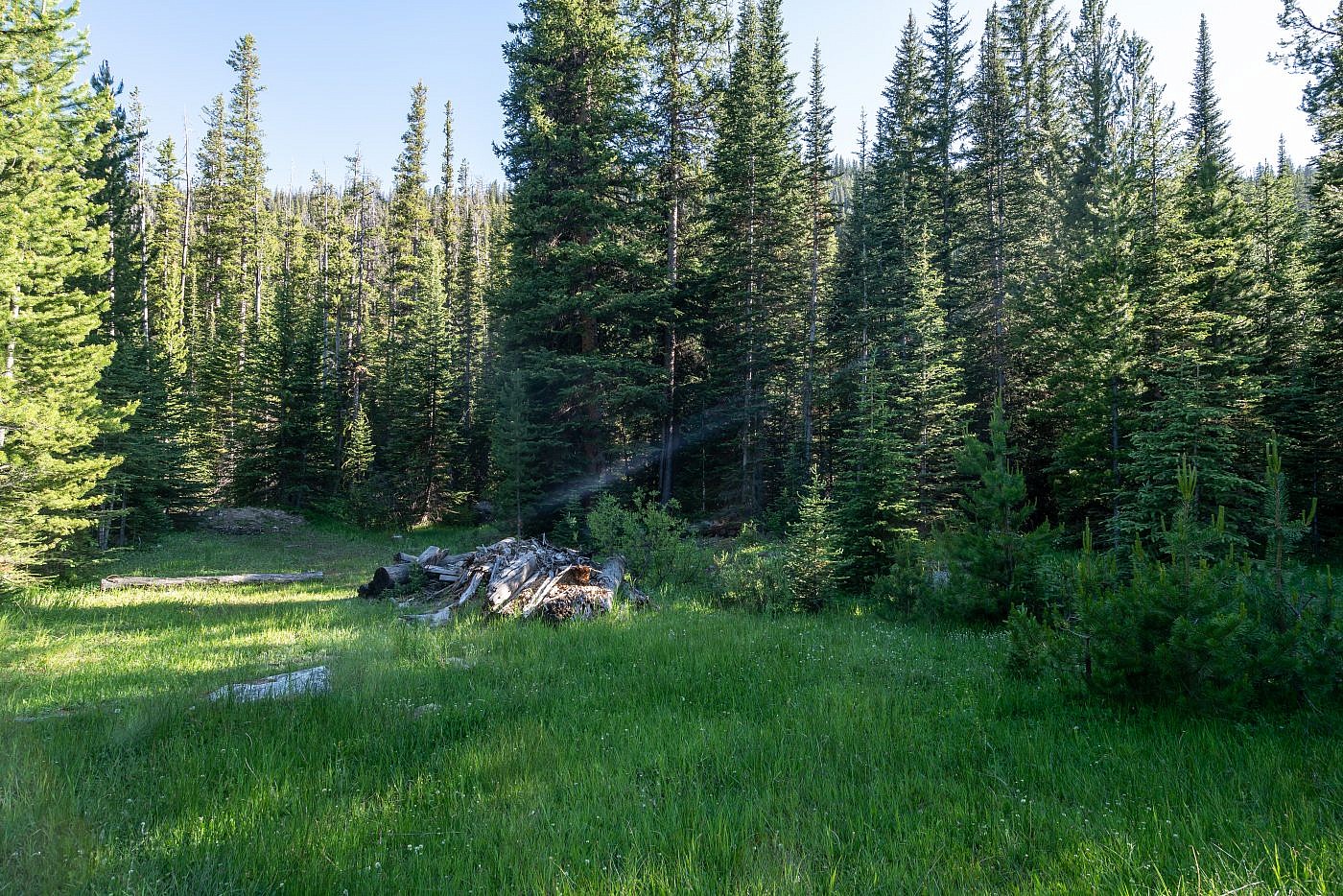
The clearing just before the official Barb Lakes trailhead. From here cross Gorge Creek, bushwhack up the steep hill in front of you, sidehill around to the DuBois Creek draiange. Then head west, following a series of rock markers all the way to Barb Lake. From there it’s simple climb to the top.
The Old Trail
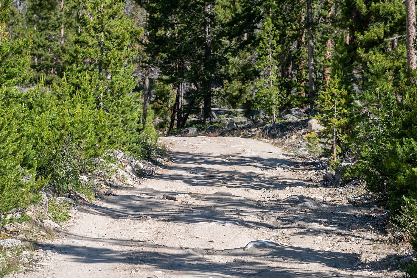
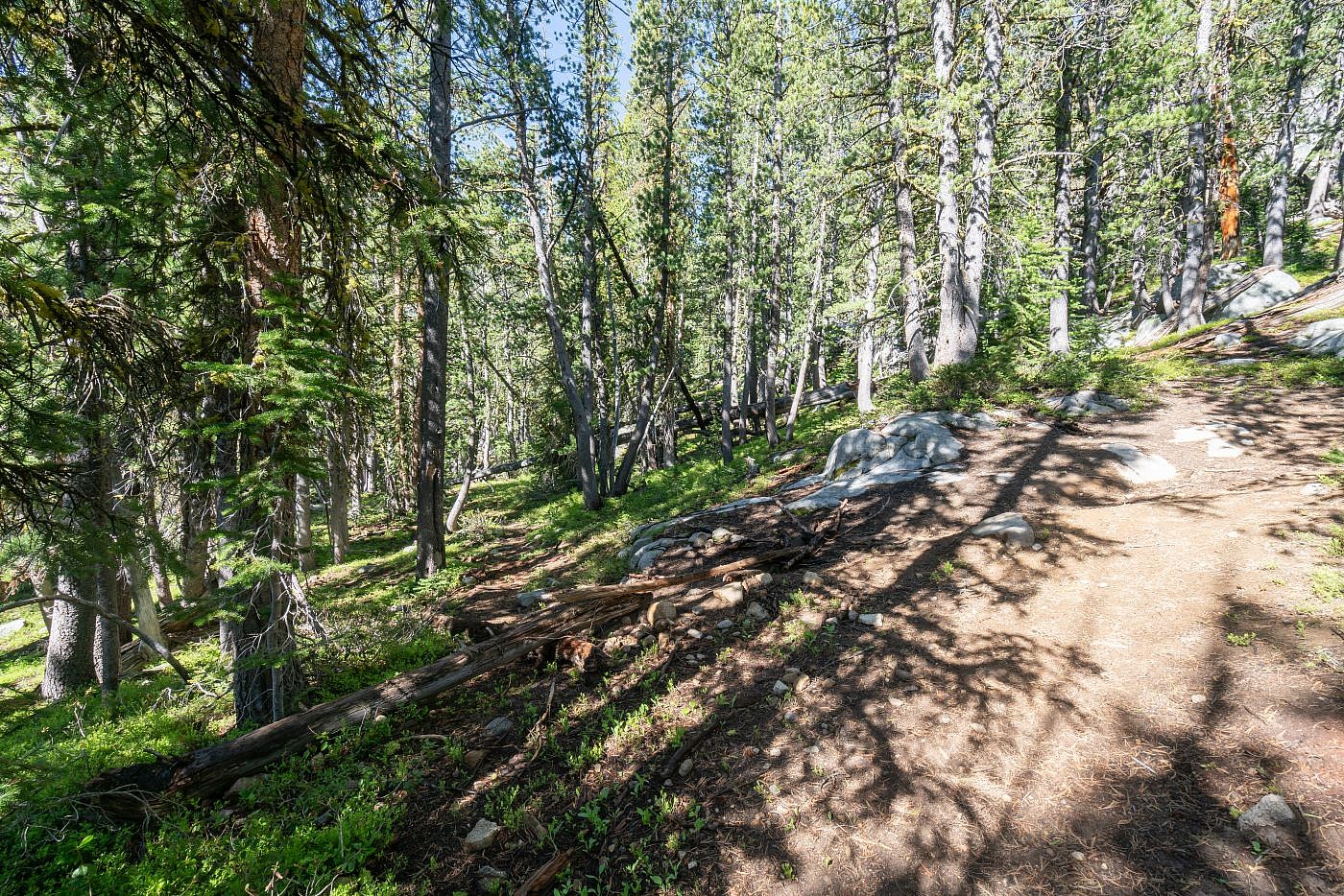
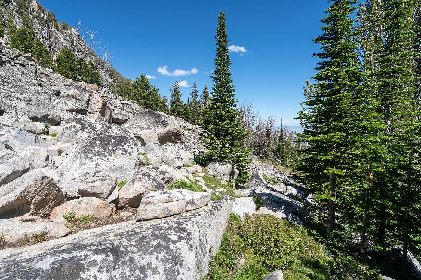
After about 1.1 miles of hiking I arrived at the official Gorge Lakes trailhead. The first section of official trail is forested with limited views but is an all-around pleasant hike with just a steady uphill grade. According to the reports after about 3 miles you’re supposed to encounter a junction with the old trail branching off and heading southwest towards South Gorge Lake. As I approached the 3 mile mark I was on high alert searching for this junction and just as I was about to turn around thinking I missed it it presented itself to me. The junction is right after a small bridge where the main trail dips slightly south. The Summitpost reports claims it’s marked by cairns and a “learning tree” but I didn’t see either of these. If you were to continue on the main trail you’d end up at North Gorge Lake just a short distance further which would make for a great backpacking destination or base camp for Torrey.
From the start of the old trail you descend just a tad bit of elevation into a clearing. In Cedron Jones’ route in “Peakbagging Montana” he recommends following the old trail for 200 yds. to a “wet meadow”, head across Buckhorn Creek, then follow the natural ramp on Tweedy’s north face up to the summit, skipping South Gorge Lake entirely. I believe this clearing is not the “wet meadow” he describes but I lost the trail here and just started heading southwest along the base of a cliff face towards South Gorge Lake which I wanted to check out before the final climb. I believe if I’d looked harder I could’ve stuck to the trail and followed it all way to the lake as described in the SummitPost page but the route I took was mostly open and simple to navigate. Just before getting to the lake I did re-merge with the trail but it quickly disappeared again. I think from the clearing you can pretty much just pick a direction and go but I think it’s well worth your time to check out the lake.
The junction with the “old trail” branching off to the left about 3 miles in. Follow the old trail down hill a short ways to a small clearing (I believe I mistook this for the “wet meadow” referenced in Cedron Jones’ “Peakbagging Montana”). At the clearing I lost the old trail but continued southwest along the base of some cliffs and was able to bushwhack the rest of the way to South Gorge Lake with relative ease.
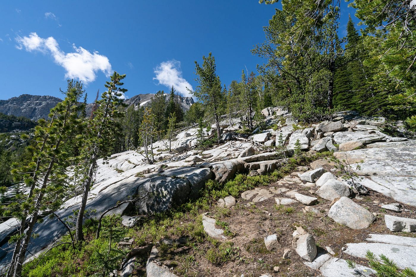
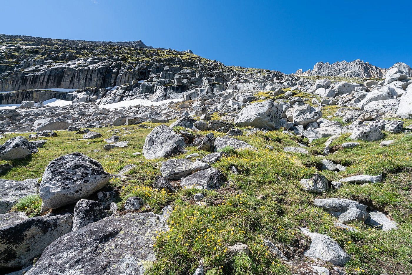
Working my way along a rocky section towards South Gorge Lake. The route is clear and simple with minimal bushwhacking.
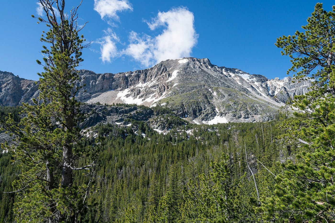
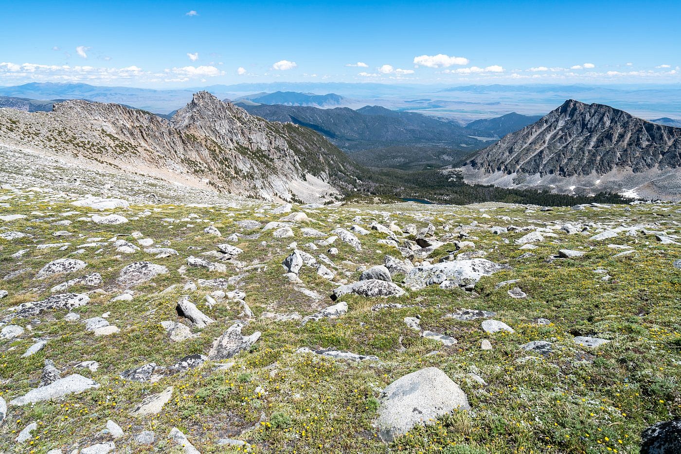
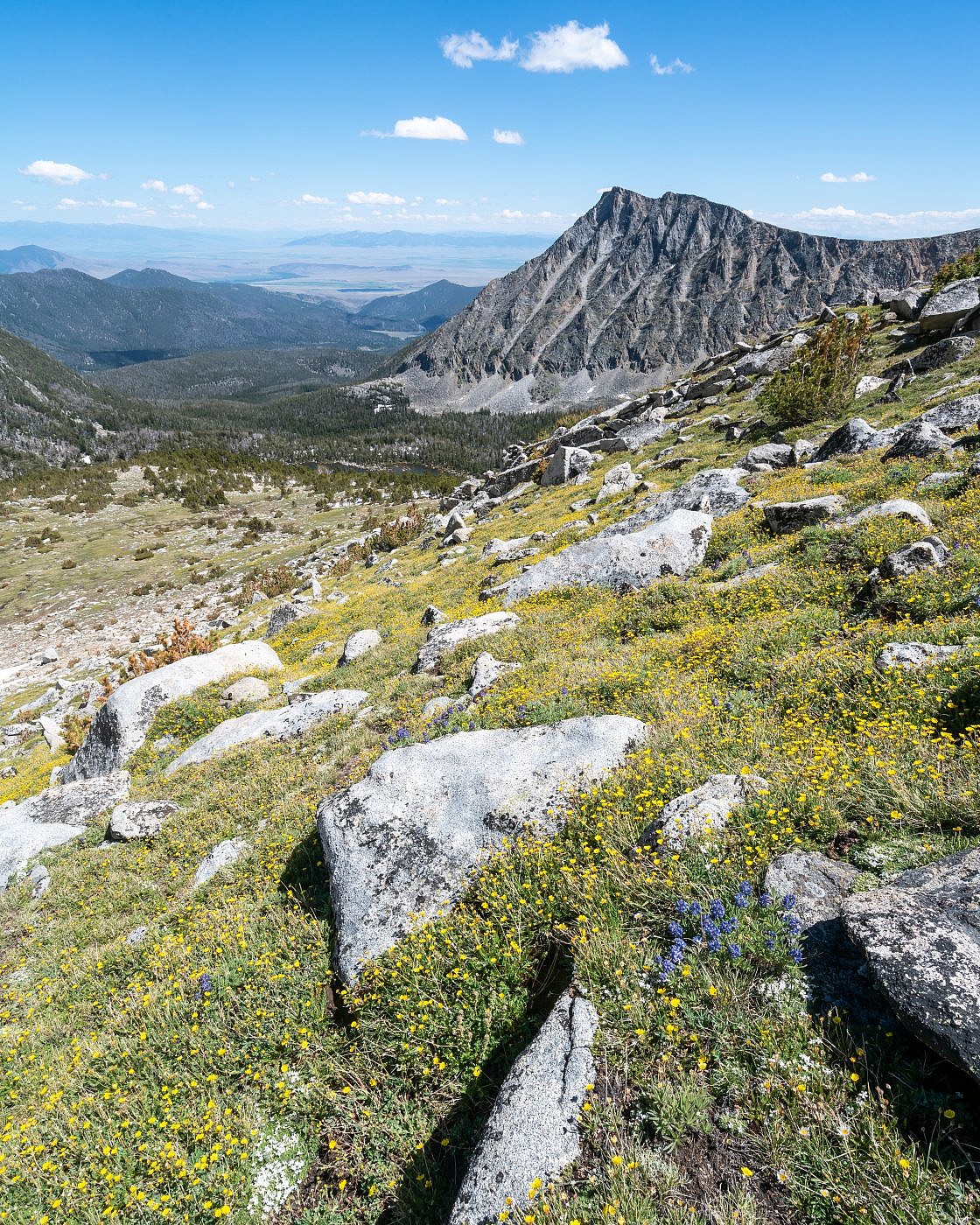
The first clear view of Tweedy Mountain just before South Gorge Lake. Here you can see the “natural ramp” on Tweedy’s north-facing slope which is the simplest route to the summit from this angle. Cedron Jones’ route aims for the cliffy hump at the base of the ramp on the left and then onward to the summit avoiding South Gorge Lake entirely. I recommend making the short trek over to South Gorge Lake and heading up the ramp from the right side.
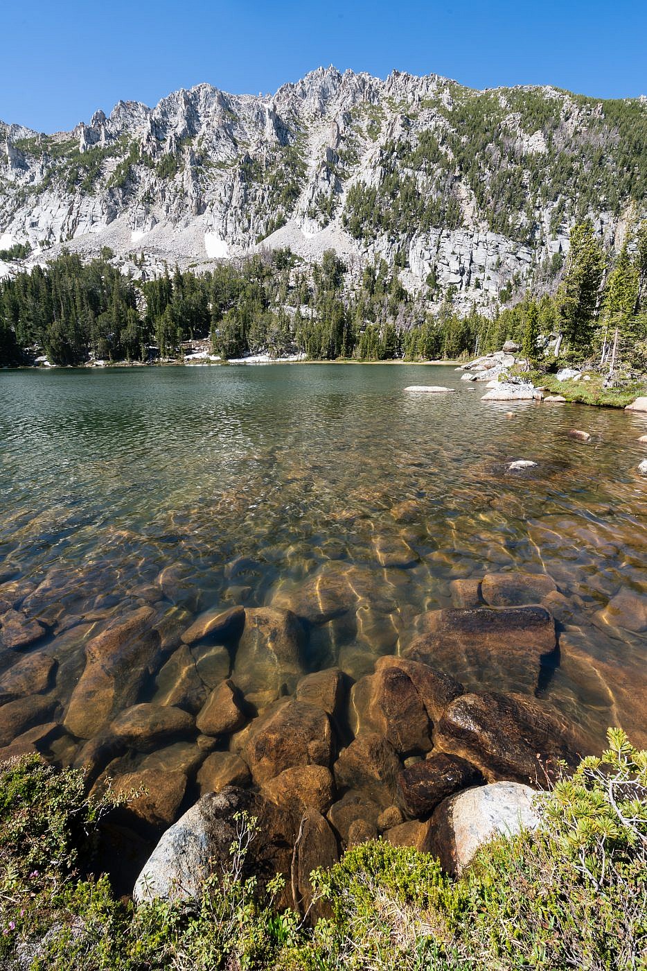
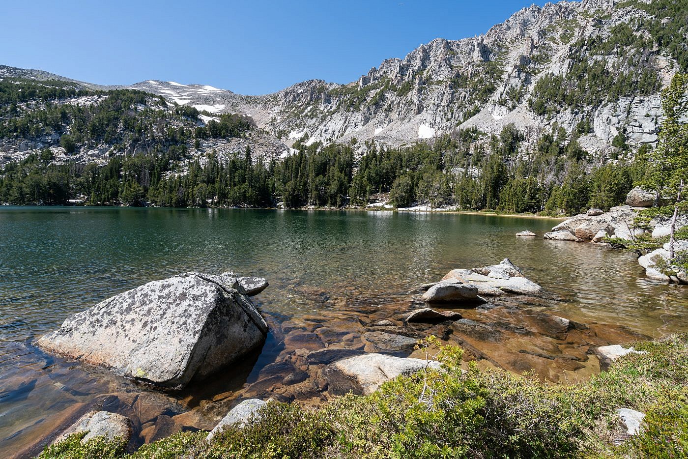
South Gorge Lake
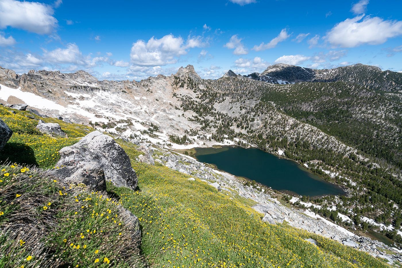
South Gorge Lake is simply beautiful and I think it’s be a shame to travel all this way and not check it out considering it doesn’t really add any difficulty to the hike. At the lake I took a short break to have a snack, replenish my supply of water, and get mentally prepared for the 2000′ climb I was about to endure over the next mile. From this angle the route up is fairly obvious. I bushwhacked to the south end of the lake to the base of the natural ramp and just started climbing diagonally towards the east side of the ramp making one large switchback with a bunch of smaller switchbacks in between.
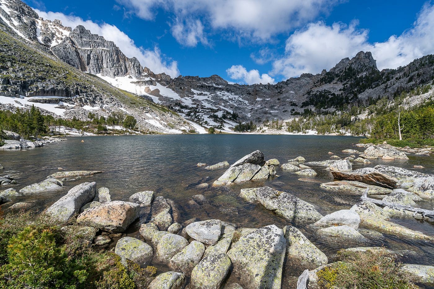
South Gorge Lake is “Gorge”-ous. I began the final ascent by bushwhacking to the base of the natural ramp in the center of the image and then climbed diagonally towards the east side of the ramp.
Tweedy Mountain Ascent
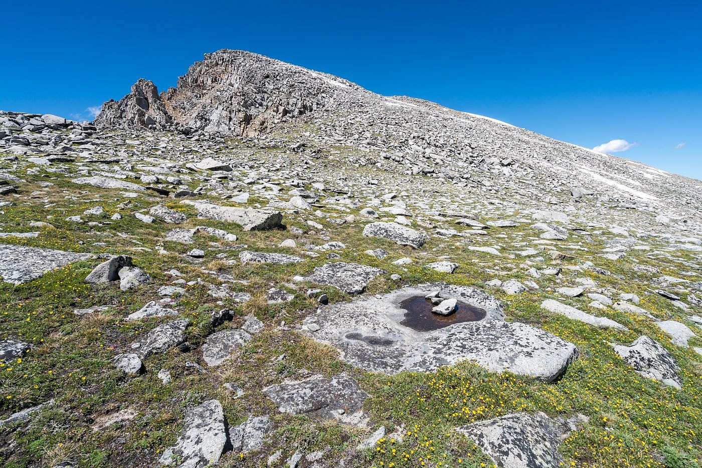
The final ascent of Tweedy is one of more beautiful, enjoyable, and fun ascents I’ve made. It gets steep quick but the endless carpet of wildflowers helped distract me from the steepness. The first 1,000′ or so is like this-steep, grassy terrain with a few rock scrambles here and there. Once through the grassy section the terrain transitions into a straight-up boulder field. The field looked daunting to me at first but it turned out to be super fun. The boulders are large but more importantly they’re stable so you can confidently scramble around them without too much fear of losing your balance. I did need to stop and assess the terrain frequently to make sure I was on course but it was all-around a good time. I even encountered a pair of ladies in the boulder field who’d started their ascent from a base camp at North Gorge Lake.
Looking up the natural ramp from the base of South Gorge Lake.
Looking down the natural ramp towards South Gorge Lake. The first section of the climb is mostly on a carpet of these yellow wildflowers.
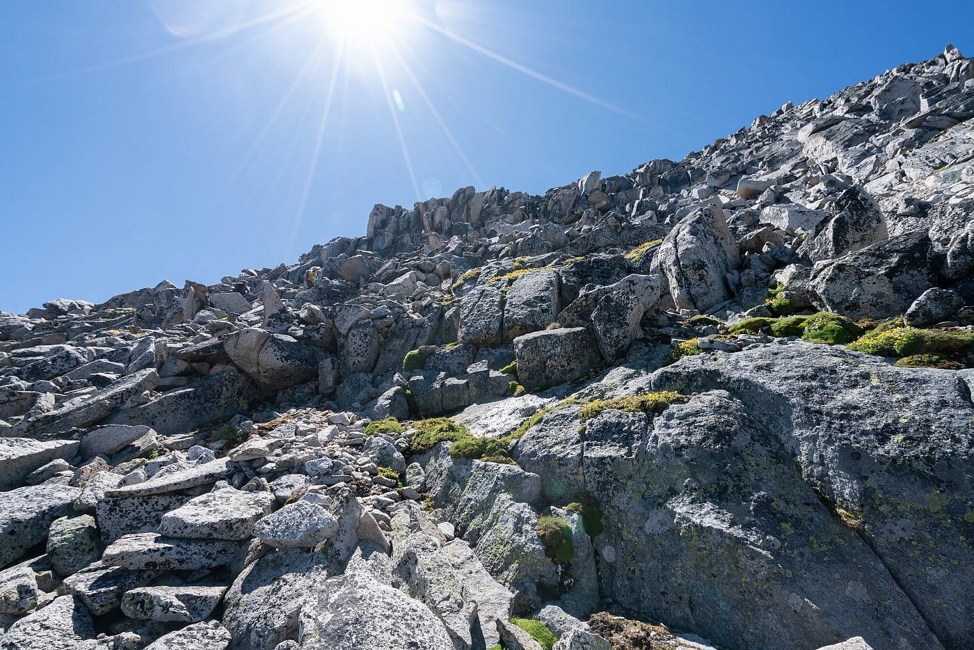
After about 1,000′ of vertical the terrain transitions into a straight-up boulder field. The boulders are large and stable which makes the ascent quite fun.
The last obstacle that worried me was the large snow patch near the top of the mountain. After making my way through the boulder field I was conveniently dumped off right at the base of the snow patch which I now saw would not be a challenge whatsoever. I ended up side-hilling to the left side of the patch and ascended the talus field up to the top it, then went diagonally to the right through a gap in the snow up to Tweedy’s east ridge. From there it was a simple walk to the summit!
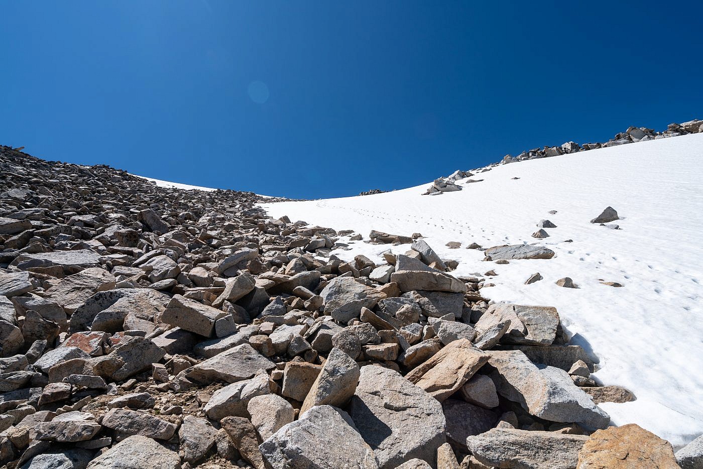
After emerging from the boulder field on the east side of the natural ramp I went below the large snow patch, up the left side of if, then diagonally back towards the summit through a gap in the snow above it. Those are not my footprints.
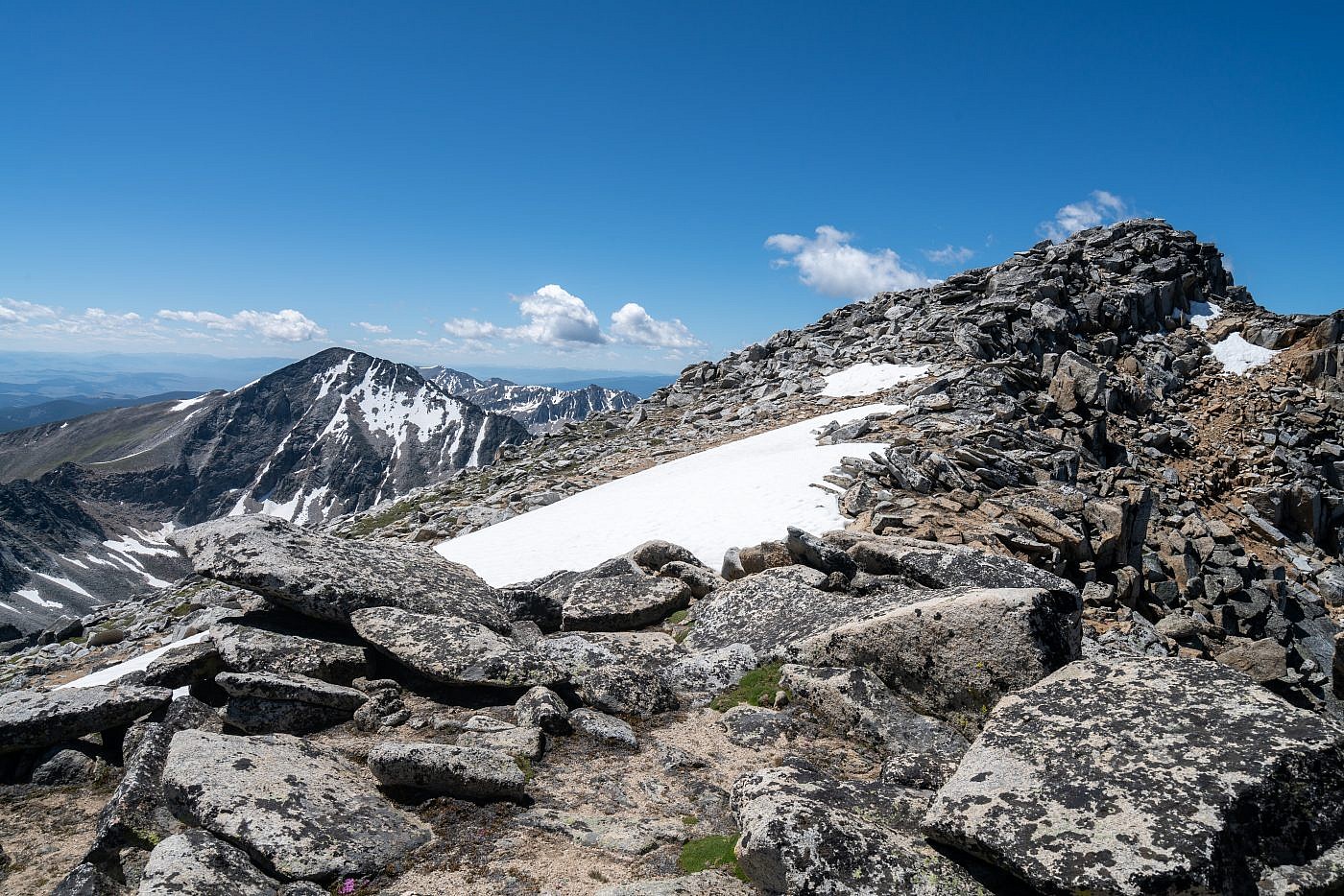
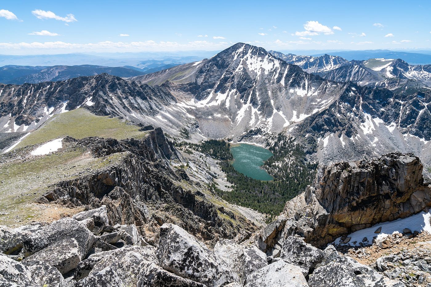
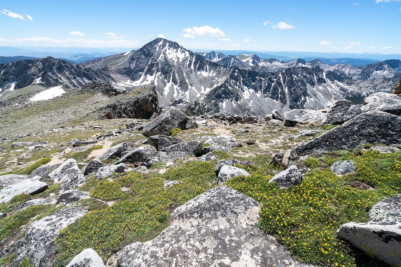
The final ridgewalk to the summit. Tweedy’s neighbor and 2nd highest point, Torrey Mountain, on the left.
Tweedy Mountain
Once at the summit I let out my usual scream of triumph, signed my name in the summit register, and started taking pictures like a madman. I couldn’t even begin to process the beauty of my first true mountain summit of the year and was thrilled to be on top of the 8th tallest mountain in Montana excluding the Beartooths.
The two hiker ladies made it to the summit shortly after me and we all sat around at the top snacking and chatting. It turns out they were from Washington and on a road trip in an attempt to escape the Covid madness. They’d backpacked to North Gorge Lake with their families and it was their turn to summit Tweedy while their husbands looked after the kiddos. Their next stop was somewhere in Gallatin Canyon to do some climbing but they said they’d be stopping in Bozeman first. They weren’t too thrilled when I warned them that Gallatin County was the hotspot for Covid in Montana and it sounded like they were going to try to avoid Bozeman altogether.
After the two ladies took off I remained at the top still just in awe, taking photos, and identifying familiar and unfamiliar landmarks. The only question I had now was do I return safely the way I came or do I step up the adventure and take the Barb Lake route back down. Of course I had made up my mind earlier that I wanted to suffer and decided the Barb Lake route was the most suitable.
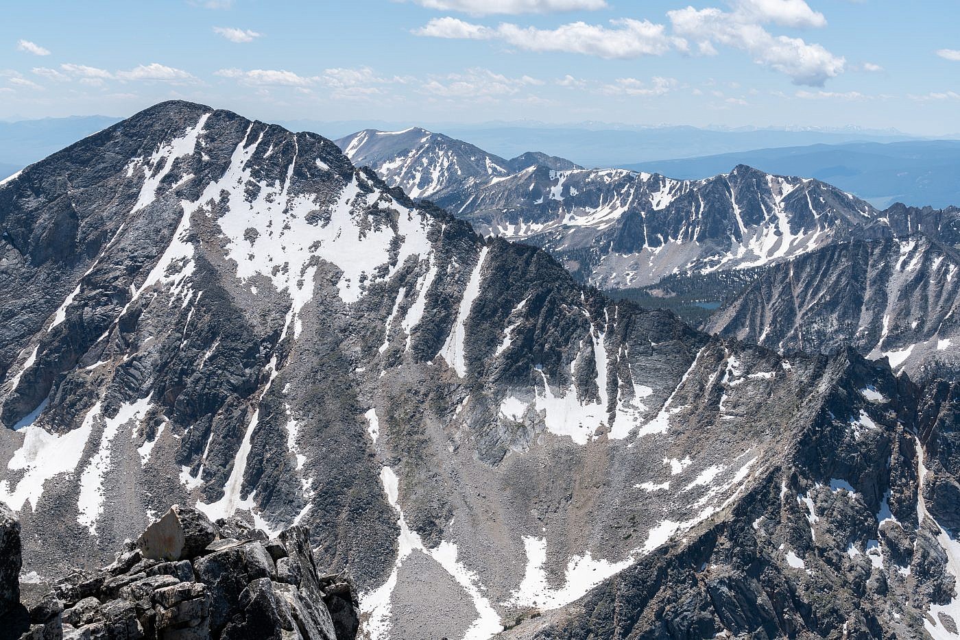
Looking south from the summit towards Tweedy Mountain.
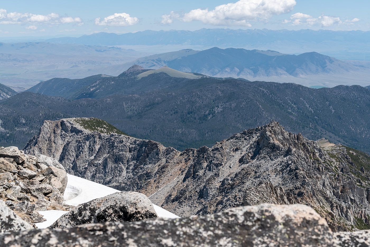
Looking east from the summit. Barb Mountain (looks impossible) in the foreground, Tobacco Roots in the background, and the McCartney Mountain Range in the foreground.
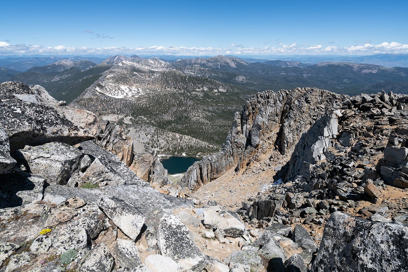
Looking north from the summit. South Gorge Lake in the foreground.
Zoom shot looking north of the summit at the Anaconda Range.
Descent to Barb Lake
The trek down to Barb Lake was, as expected, much easier than the ascent from South Gorge Lake but just as scenic. It’s worthwhile to meander a little extra distance south of Tweedy to the edge of a cliff overlooking Torrey Lake and Torrey Mountain. Both Torrey and Tweedy can be climbed from a base camp at the lake.
Descending to Barb Lake (barely visible on the right) is as easy as it looks. Barb Peak on the left.
It’s worthwhile to wander over to the cliffs south of Tweedy for a nice view of Torrey Lake and Torrey Mountain. Both Torrey and Tweedy can be climbed from a base camp at this lake.
Looking back up Tweedy’s slopes on the way to Barb Lake.
Looking down the slopes towards Barb Lake.
Another shot of Torrey.
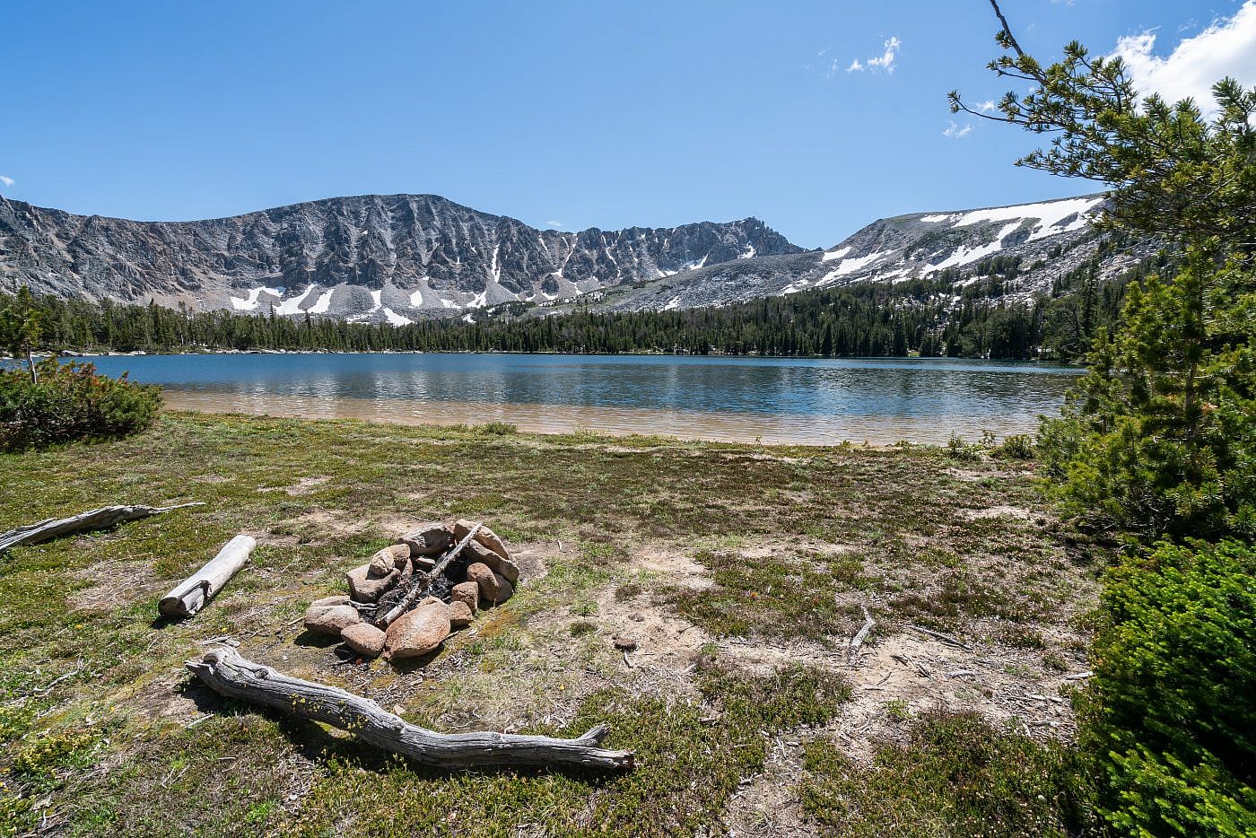
Barb Lake
Barb Lake is awesome. I wouldn’t say it’s quite as breathtaking as South Gorge Lake but it’s more camper appropriate and much of the shoreline is a sandy beach. It boggled my mind to discover several well-established campsites at the lake. I’m not sure what madness would drive someone to bushwhack up to the lake from the Gorge Lake Trailhead to camp. This peakbagger.com entry seems to suggest that there’s an old trail that follows DuBois Creek to a road further down the drainage. This may be a simpler way to backpack to the lake but I have no way of confirming its existence.
Barb Lake with Barb Mountain in the background. I do not think it’s possible to get to the top.
The sandy beaches of Barb Lake.
View of the path up to Tweedy from Barb Lake.
Bushwhacking Back to the Trailhead
The only thing I had to go off for the path back to the trailhead was a couple gps tracks that I had pictures of on my phone. I started by heading east along the drainage staying well north of DuBois creek and almost hugging the talus slopes that make up the northern boundary of the drainage. It wasn’t long before I stumbled upon several rock markers which seemed to be chained together as if someone had intentionally placed them there. These markers continued and it became evident that they were placed there intentionally and made this section of the return much simpler than expected. It still wasn’t easy following the markers and several times I lost track of the route but it was still a relief to know I was staying on course.
I started out heading east out of Barb Lake and staying close to the talus slope that defines the north boundary of the drainage. If you’re lucky you’ll stumble upon a series of rock markers which will lead you through this section with relative ease.
After a mile or so I lost track of the markers and again had to rely on the gps track on my phone. I could see the track lead around the ridge to the north and up to a flat spot just southeast of the ridge. I was able to bushwhack up to this flat spot but the terrain was becoming more exhausting and harder to navigate with more and more obstacles getting in the way. I did encounter a few random rock markers and blazes but they really didn’t help too much.
Working my way up to the flat spot southeast of the ridge. There were some random rock markers and blazes but they didn’t help much.
The next challenge was to sidehill north along the slopes. The terrain continued to degrade and I was starting to get frustrated at this point. I was on the right track, according to my gps reference, but it was slow going, the sidehilling was exhaustive, and there was more and more undergrowth and deadfall to avoid. There was also no indication whatsoever of an established route although, again, I did see the random blaze here and there and even encountered a tree with some yellow tape tied to it. What good this was without any other markers is beyond me.
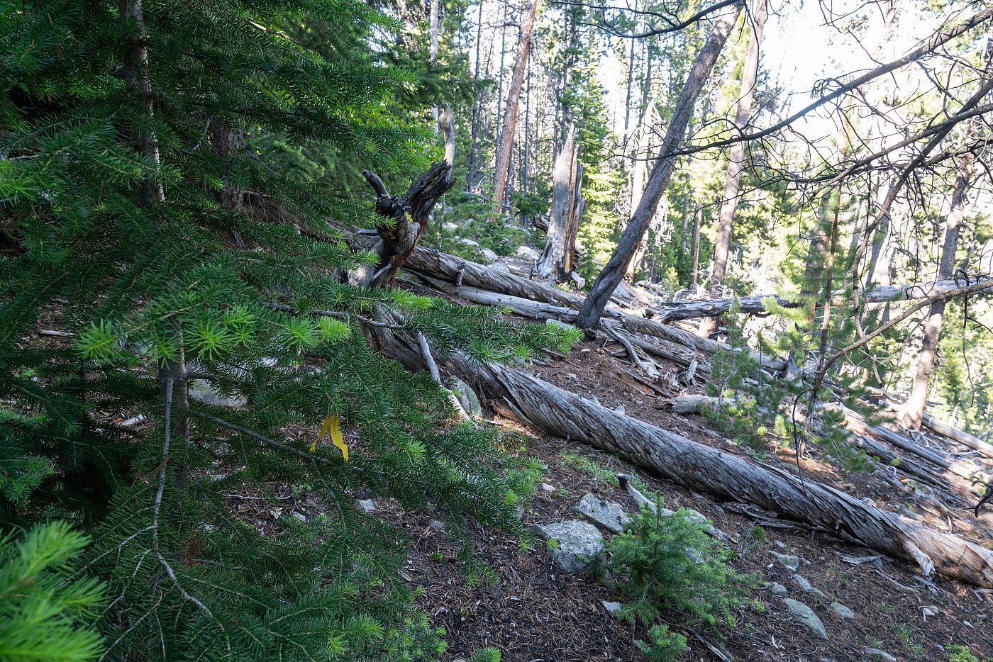
The sidehilling section is just a mess of deadfall and undergrowth with virtually no indication of an established route. I did encounter some yellow tape on this tree. What good this was I cannot say.
After a good hour of the sidehilling madness I finally made it to the top of the last hill. Here, according to the reports, was supposedly the most difficult section of bushwhacking-descending the hill back to the trailhead. This was not a lie, it really was the most challenging section. It’s incredibly steep, it’s a tangle of deadfall, trees, and undergrowth, and there’s no clear path through it whatsoever. So without much of a plan I just plunged right in, suffering the entire way. There were spider webs getting in my face and the spiders on those webs crawling on my hat, I was getting scratched up, and my toes were so far jammed into the ends of my boots that I thought they might never recover. This was not what I wanted to endure at the end of a long hike, maybe at the start, but not at the end.
Looking back at the final bushwhacking section from the bottom of the hill. This section was hell and it would be much more tolerable at the start of the hike versus the end.
Finally I made it through the bushwhacking hell hole but there was still one last challenge to face-getting across Gorge Creek. From what I’d read there was a log bridge somewhere along the creek and after a bit of searching I found it. It was pretty sketchy and falling in would’ve been disastrous but by that point I was ready to accept death and just went for it. Success! I made it across and back to safety. I emerged back onto the road at the spot described earlier and from there onward it was a simple mile hike back to the my campsite.
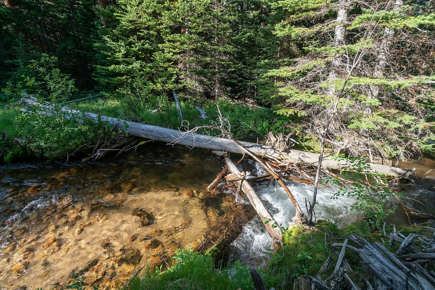
The piddly little log bridge crossing Gorge Creek. It’s not as stable as it looks and falling into the fast moving creek would’ve been disastrous but I went for it anyway and took the final step back to safety.
