Cour d'Alene Mountains
Cherry Peak
Download KML
Distance
4.25 miles one way
Type
Day hike
Difficulty
Moderate
- Starting Elevation: 6600 ft.
- Ending Elevation: 7351 ft.
- Elevation Gain: 751 ft.
 View all 18 photos
- Experience Date: Jun 26, 2020
- Hike Time: 4 hrs.
- Drive Time: 5.5 hrs.
- Road Condition: Long but well-maintained dirt road. 2 WD accessible. High-clearance not necessary.
- Parking: Plenty of parking.
- Fees: None.
- Campsite Availability: Camping at Tuffy's Lake. Possible camping at flat spots along Eddy Ridge.
- Private Property: None posted.
- Trail Traffic: None.
- Trail Condition: Well-maintained trail for 3 miles followed by some spotty trails and then completely off-trail with minimal bushwhacking and talus scrambling.
- Fire Restrictions: None.
- Stream Crossings: None.
- Water Sources: None.
- Snow: Some small to large snow patches here and there.
- Winter Access: None.
- Weather: Mostly sunny. 80's.
- Bugs: Some gnat-like insects were biting at the summit. Few mosquitoes and some flies.
- Wildlife Sighted: Grouse. Possible mountain lion scat.
- Side Quests: Eddy Mountain Lookout. Penrose Peak. Tuffy's Lake.

Cherry Peak (7,351′) is the highpoint of the Cour d’Alene Mountains, the northernmost portion of the Bitterroot Range. It’s a delightful and incredibly scenic hike that follows the Eddy Ridge Trail most of the way followed by a short off-trail section near the end with some minor scrambles here and there. The hike starts at 6,600′ so your car will do most of the climbing for you although there is some hidden elevation gain along the way due to the many small ups and downs along the ridge. There’s little tree cover on this hike so if it’s sunny be prepared for a hot day and take whatever precautions are necessary to stay cool. Although long, the road to the trailhead is in great shape and most vehicles should be able to get to the trailhead with ease. Side quests include the Tuffy’s Lake Lookout, just a simple side hike off the main trail, Tuffy’s Lake, a possible backpacking destination, or Penrose Peak, the 2nd highest point in the range and more challenging side quest.
Cherry Peak.
Background
The Bitterroot Range is a vast sub-range of the Rockies which straddles the Montana-Idaho border. The range can be further broken down into several more sub-ranges including the Cour d’Alene Mountains, Saint Joe Mountains, Bitterroot Mountains, Beaverhead Mountains, and Centennial Mountains. The Cour d’Alene Mountains comprise the northernmost portion of the Bitterroot Range and are roughly defined by the Clark Fork River to the north and east, I-90 to the south, Highway 95 to the west and Lake Pend Oreille to the northwest.
One the most interesting geologic events that occurred in the area is the story of Glacial Lake Missoula. During the last ice age the Purcell Lobe of the Cordilleran Ice Sheet blocked the Clark Fork River near the northwest corner of the Cour d’Alene Mountains forming a 2000 foot ice dam. This dam caused the river to overflow, flooding many of the nearby valleys and eventually forming Glacial Lake Missoula which was comparable in size to the great lakes. Eventually this dam gave way causing a massive rush of water through the Clark Fork Valley draining the lake and causing catastrophic flooding to the west of the dam.
My first taste Cour d’Alene Mountains came in mid-June of 2020 when I summited Baldy Mountain, the highpont of the “Thompson-Baldy Area” of the Cabinet Mountains. From the summit I got an excellent view of the Cour d’Alene’s and was able to identify the highpoint, Cherry Peak, just a short distance to the southwest. A couple weeks later I decided to make a shot at it on my way to Kalispell to visit some friends. Information on this one is surprisingly scarce but I found this report on peakbagger to be the most helpful. The route starts near the Eddy Mountain Lookout and follows the Eddy Ridge Trail south towards the peak with a short off-trail section near the end.
Looking west from the summit of Baldy towards the Cour d’Alene Mountains. Cherry Peak is the highpoint (center left).
The Adventure Begins…
This adventure began almost exactly the same as my first visit to the area just two weeks earlier when I did Baldy. I had wanted to camp close to the trailhead near Thompson Falls, MT but it was getting late and being unfamiliar with the camping options in the area I again ended up settling at the almost deserted Cascade Campground along the Clark Fork River about 1.5 hrs. from the trailhead.
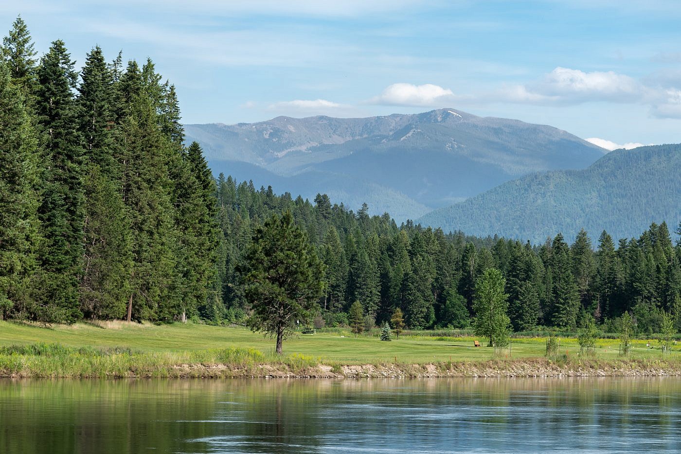
As I passed through Thompson Falls the next day I was almost immediately presented with a grand view of Cherry Peak to the southeast which forms a beautiful backdrop to the Clark Fork River. Although Cherry rises nearly 5,000′ above the valley floor the trailhead starts most of the way up at 6600 ft. You know what that means? Everyone’s favorite thing-endless mountain roads.
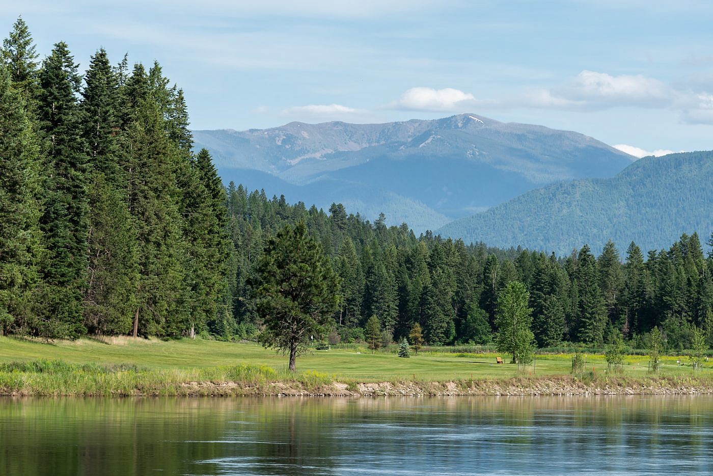
Cherry Peak forms a beautiful backdrop to the Clark Fork River near Thompson Falls.
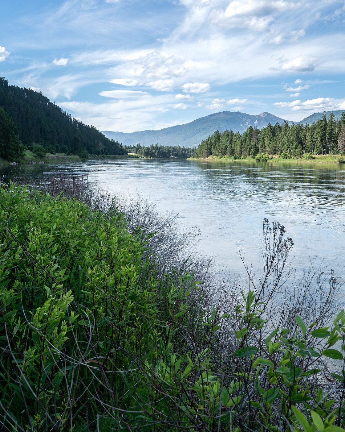
Looking north along the Clark Fork River from near Thompson Falls. A road leads to Cougar Peak Lookout in the center right of the image. The higher point to the right of that poking above the treeline is Graves Peak. I believe a trail leads from the lookout to Graves. This looks like a lovely adventure for the future!
It is about an hours drive up Eddy’s Ridge to the trailhead but it’s one of the better mountain roads I’ve been on and I made it easily in my Outback. Here are the detailed directions:
From Highway 200 exit onto Highway 471 on the west side of town and head south. Exit Highway 471 at Cherry Creek Road (paved) near the “Historic Point” sign and follow for 5.4 miles. After the 5.4 miles take a right onto Eddy Peak Road which is where the dirt roads begin. After about 1.5 miles continue straight at the Y and follow for another mile or so to another Y and take a left onto FS 7600. From there just continue up the seemingly endless series of switchbacks to the trailhead.
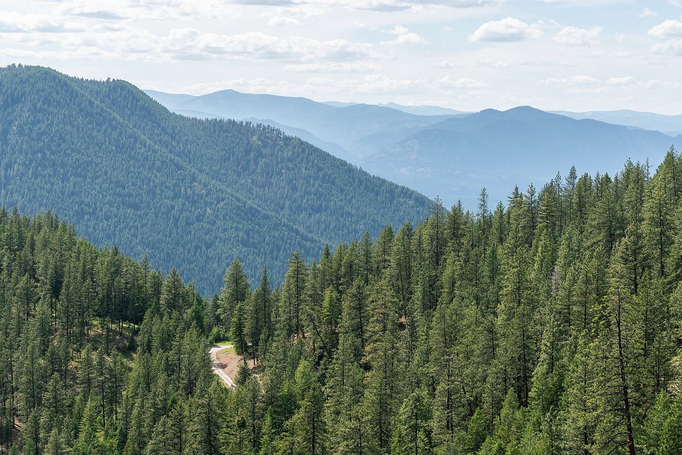
Looking west from the road.
The trailhead is well-marked with a large parking lot but was completely deserted. The road does continue onward for almost another mile to the Eddy Mountain Lookout but it’s gated year-round. Although I wasn’t able to get there I recommend checking out the lookout if you can spare the time-I’m sure the views of the Clark Fork River Valley are just incredible from that vantage point. More information on the lookout can be found here and here.
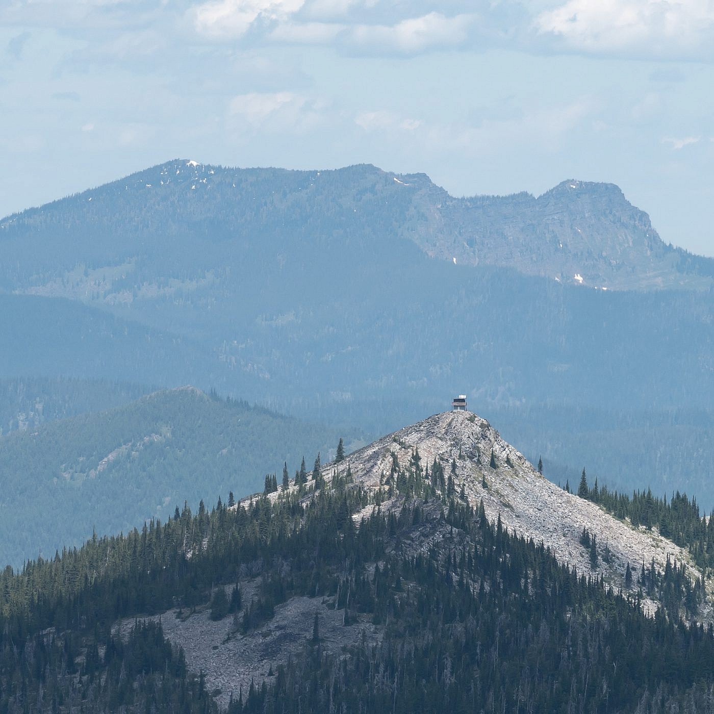
Eddy Mountain Lookout.
On the Trail
The trail starts out heading south along the ridge through a sparse pine forest. The forest doesn’t provide much shade so finding a way to keep cool is essential for this one. For me this means packing extra water and wearing my ultra-geeky sun hat complete with neck cape. It’s not long before you get your first view of Cherry Peak to the south and the terrain you’ll be crossing to get there.
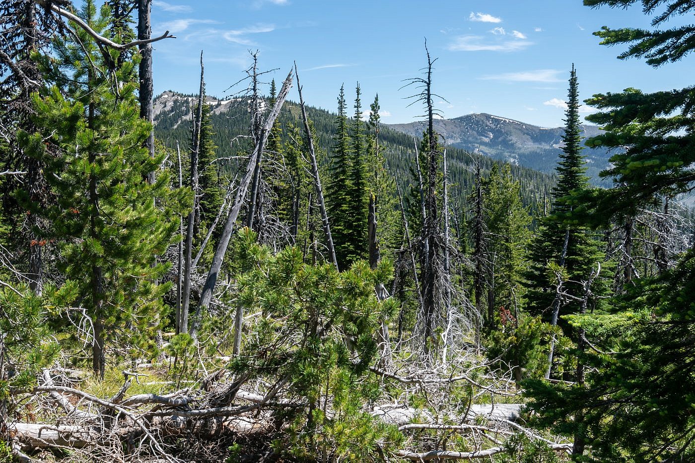
Looking south along Eddy Ridge towards Cherry Peak (right) near the start of the hike. The trees don’t provide much cover so make sure you prepare for the sun.
While I did my research for this hike one of the few reports I came across claimed they encountered thousands of mountain lion tracks. While I’m sure this was an exaggeration I did go in to this one on higher alert than usual. Normally I don’t even think about mountain lions while hiking in the woods. You just don’t hear about people being attacked by them and while I recognize them as a threat they just don’t worry me too much. On this hike, however, especially near the start, I found myself frequently scanning the woods, almost expecting to see one stalking me in the shadows. This fear grew even stronger when I came across scat which I believe to be from a mountain lion. I came across several more piles as I made my way along the ridge but I kept my cool and just made sure to make noise and stay vigilant.
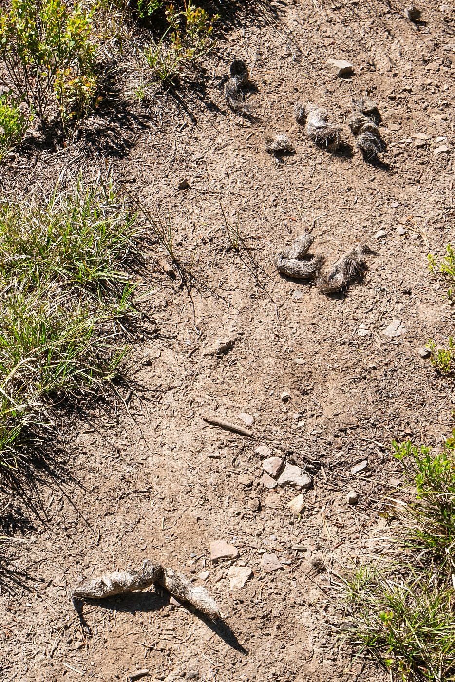
Probable mountain lion scat.
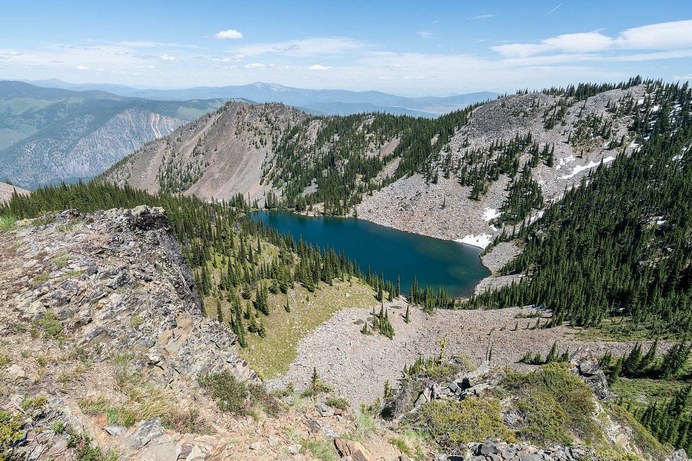
Around half way in I encountered an unexpected fork in the trail. I took a minute to skim my maps trying to decide which way to go and decided on the right fork since the one detailed trip report I could find said the trail stuck to the west side of the ridge. I had been hoping to get a view of Tuffy’s Lake which was on the opposite side of the ridge so I decided I might check out the left fork on the way back to see if I could get my view.
The fork in the trail. The main trail follows the right fork but you can follow the left fork to a viewpoint above Tuffy’s Lake or even descend to the lake which looks like an excellent backpacking spot.
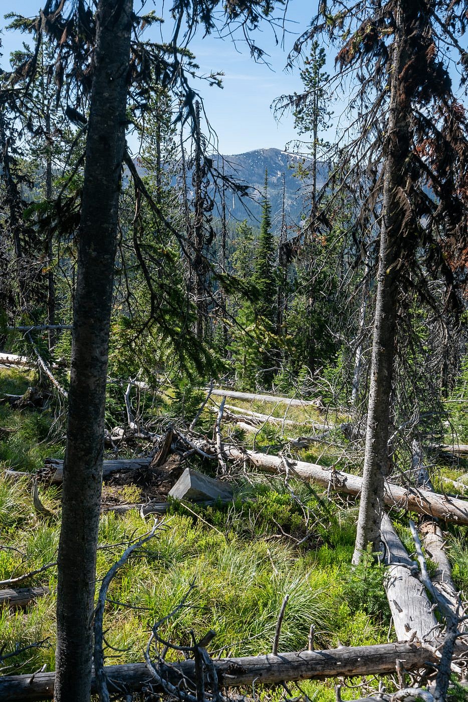
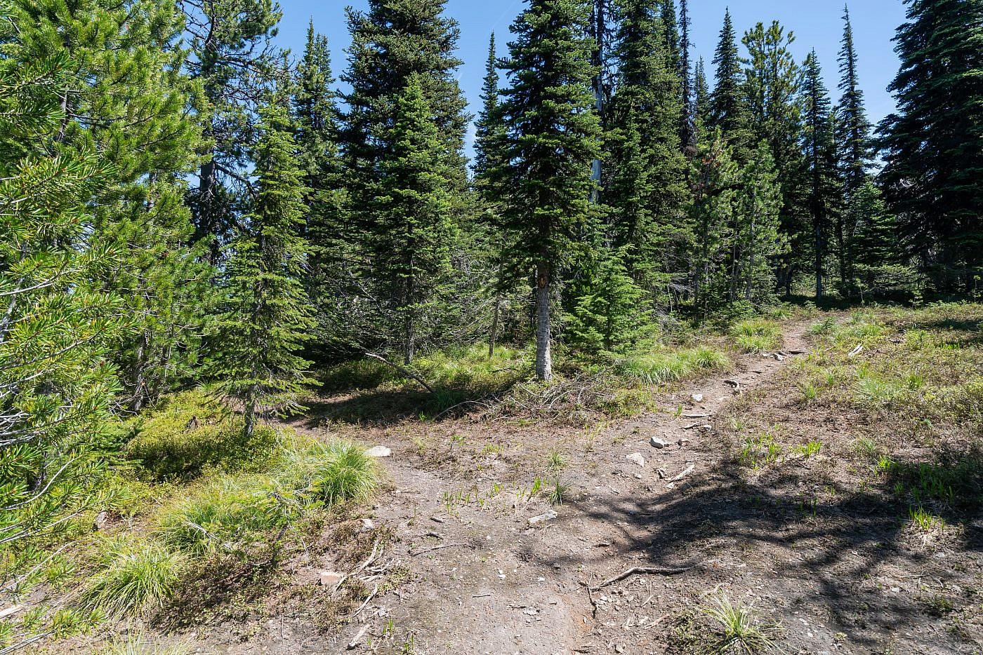
A little ways beyond the fork the trail starts to get a bit spotty. In fact, about 3 miles in the trail completely disappears and you must continue off-trail for the remainder of the hike. It’s really not too bad though. The forest is so thin that you can easily find your way through the trees and a short distance later you leave the trees anyway and continue in the open along the ridge.
There’s a little bit of bushwhacking through the last section of trees before ascending above the treeline.
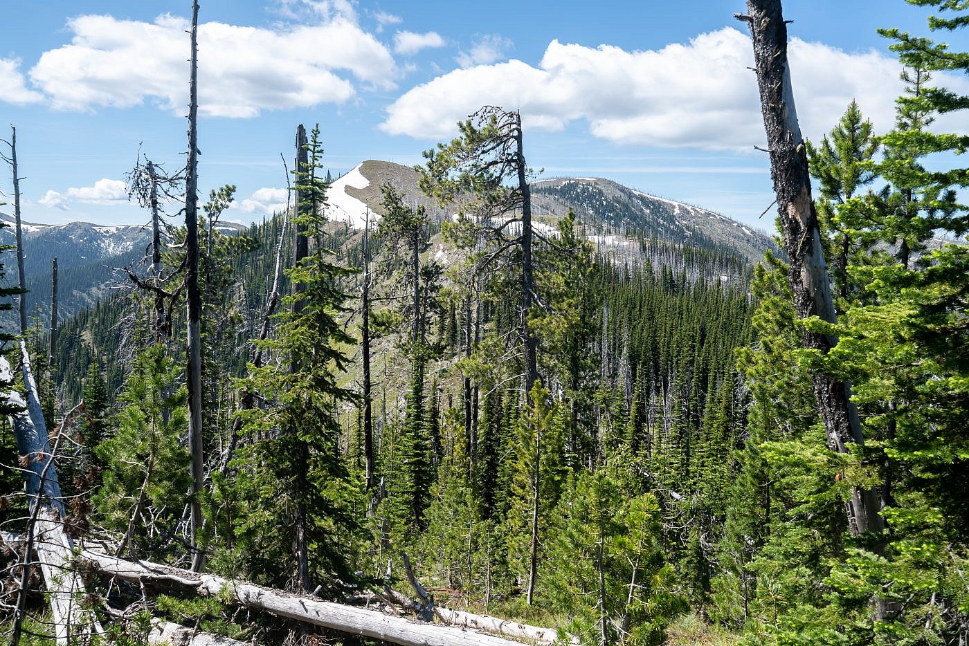
Once I was through the trees the route to the summit was obvious. Just follow the ridge until you’re there! The only dilemma I faced was do I stick to the top of the ridge for the better views and face a few ups and downs or sidehill along it to save energy. I ended up mostly staying on the west side of the ridge and then finally ascending it closer to the summit but I think it’s better just to stick to the top of the ridge.
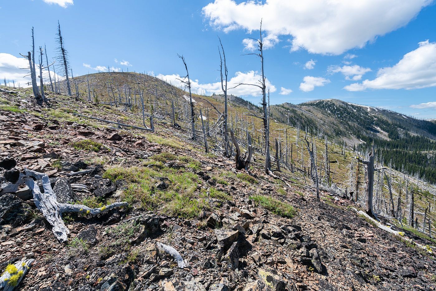
The off-trail section along the ridge is very scenic and pleasant trek. There are a few short talus scrambles but the terrain is easily navigable. I recommend sticking to the top of the ridge and enduring a few extra ups and downs for the extra scenery.
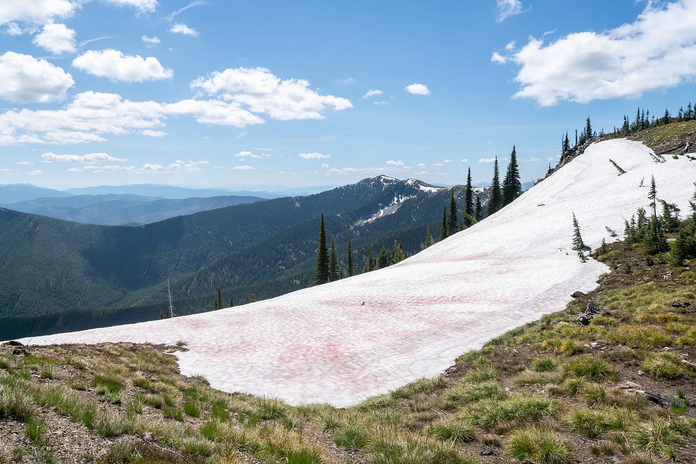
There were just a few patches of snow along the way. This one was covered in watermelon snow, a kind of green algae. Penrose Peak in the background.
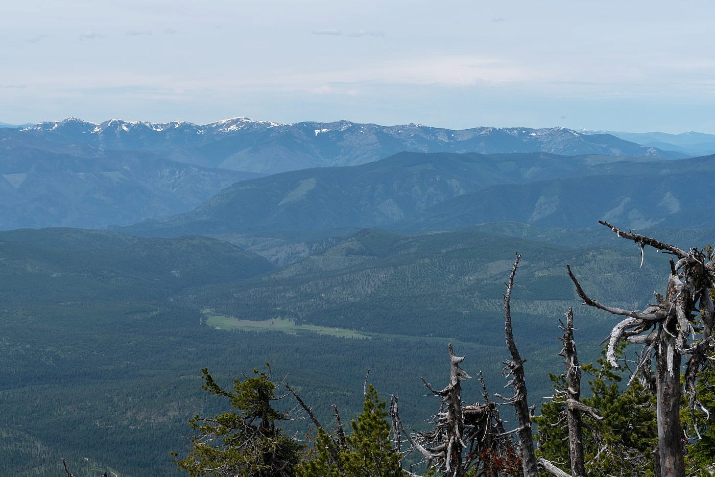
Looking northeast towards Baldy Mountain, the highpoint of the “Thompson-Baldy Area” of the Cabinet Mountains. I hiked this one two weeks earlier.
Cherry Peak
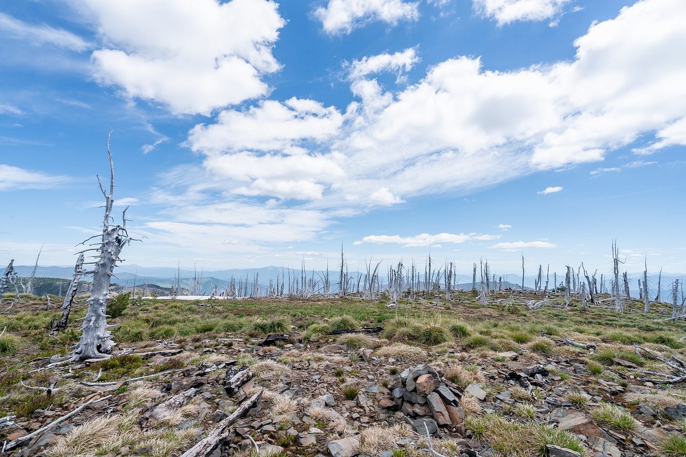
The summit of Cherry Peak is very flat and mostly bare with some some ghastly looking trees scattered about. Many of the trees on the west side of the summit are burnt suggesting a forest fire roasted the summit sometime in the recent past. There’s a summit register buried in the cairn which was placed back in 2009. It looks like, according to the logbook, only 2-3 people climb this thing each year which was very surprising to me. I know this isn’t the most popular trail in the world but I thought there’d be at least a few more people seeking it out.
Just southeast of the summit is the second highest point in the range, Penrose Peak (7,232′). This looks like an incredibly scenic side quest which would probably turn this into a full dayhike. From my assessment it appears as if you can simply just follow the ridge south for just over 2 miles to its summit. There would be some extra ups and downs meaning additional elevation gain but I think it’d be well worth it if you have the time.
Cherry Peak summit. Be sure to log your name in the summit register buried in the cairn!
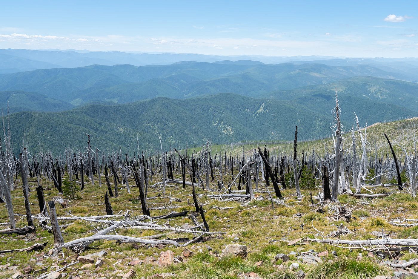
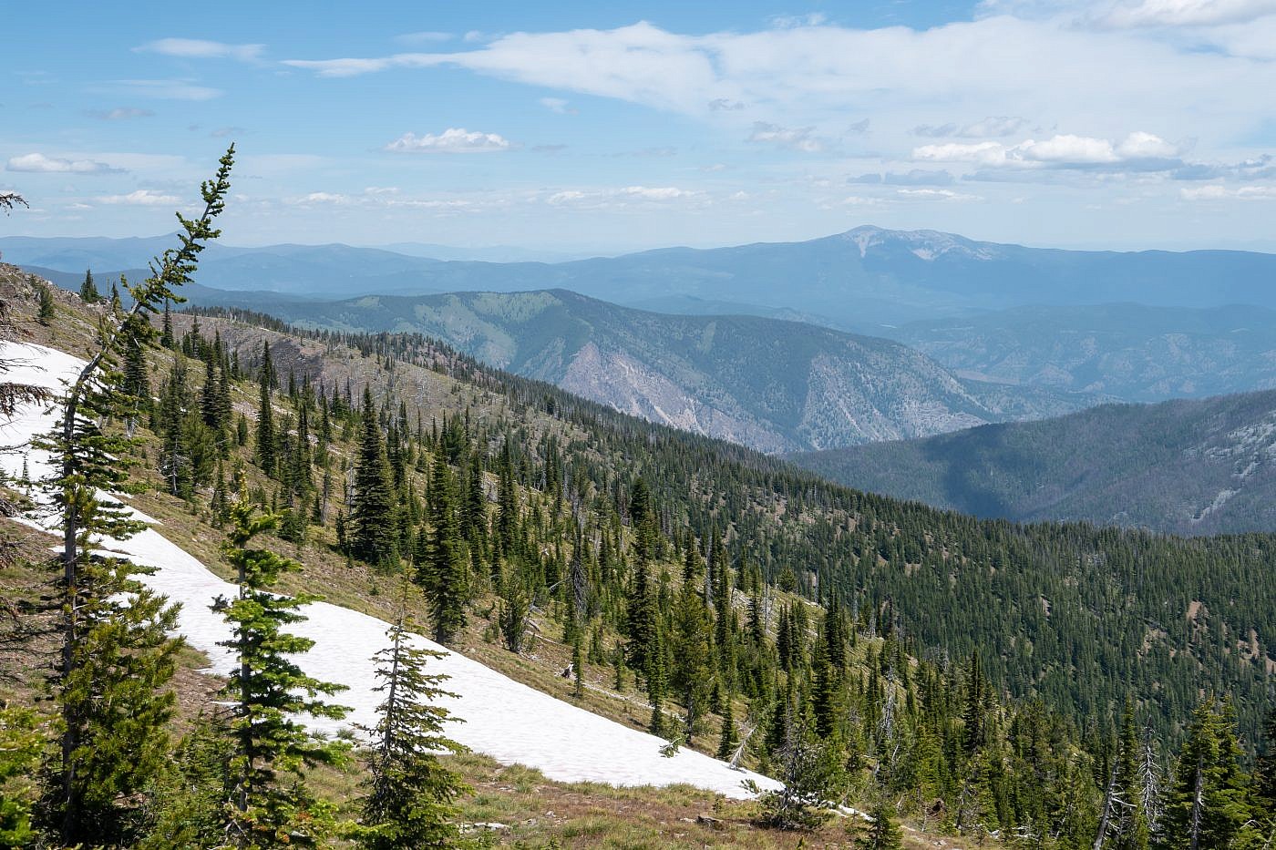
Looking west from the summit over the Cour d’Alene Mountains. The vastness of the Bitterroot Range is mind-boggling.
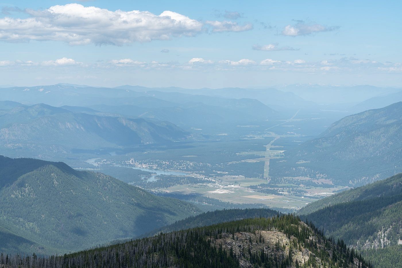
Looking northwest from the summit towards Thompson Falls and the Clark Fork River Valley. Cabinet Mountains way off in the distance.
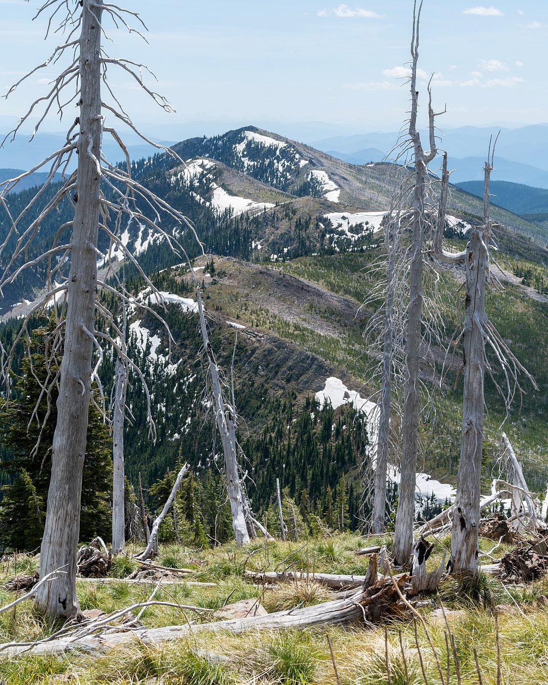
Penrose Peak would be a moderately difficult side quest. It looks like you can simply follow the ridge south to the summit.
The Return
For the return I stuck mostly to the crest of the ridge so I could soak up all the views. I recommend doing this as sidehilling along uneven terrain can get exhaustive. When I got back to the junction I decided to investigate the left fork to see if it lead to a viewpoint of Tuffy’s Lake. It looked like the trail actually continued down to the lake so I ditched it and bushwhacked my way up to a local highpoint and sure enough there was a perfect view of the lake. It looks like a great backpacking destination and I think there’s a good chance that that’s where the trail actually leads.
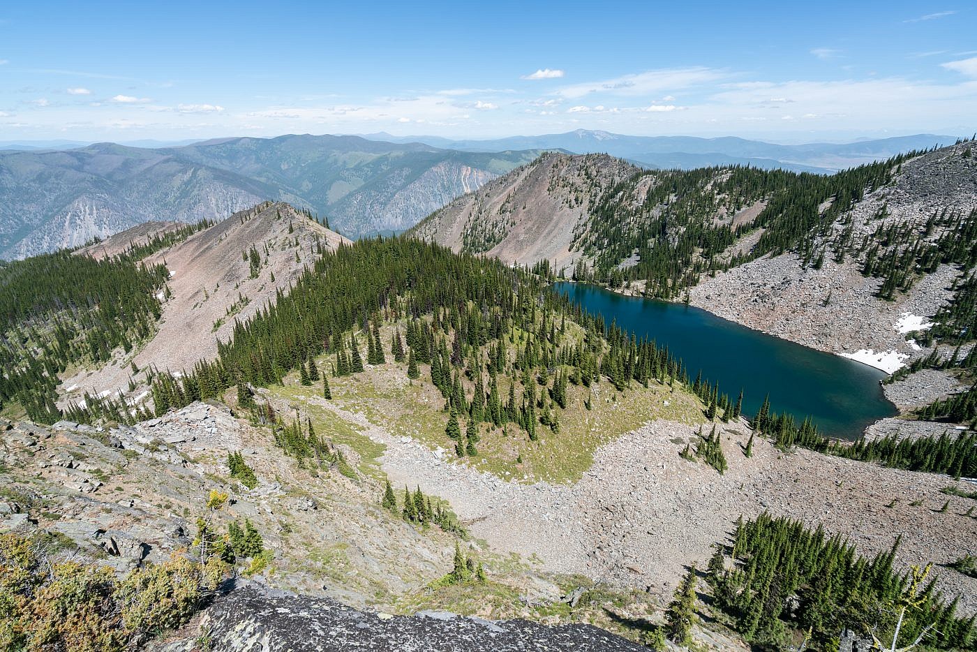
Tuffy’s Lake lookout. I bushwhacked up to this point from the junction but I’m fairly confident the left fork will take you down to the lake which looks like a great backpacking destination. Baldy Mountain way off in the distance.
