Ruby Range
Ruby Peak
Download KML
Distance
5 miles one way
Type
Day hike
Difficulty
Hard
- Starting Elevation: 5600 ft.
- Ending Elevation: 9391 ft.
- Elevation Gain: 3791 ft.
 View all 6 photos
- Experience Date: Aug 3, 2019
- Hike Time: 5-6 hrs.
- Drive Time: 1 hr. 45 min.
- Road Condition: Well-maintained dirt road. 2 WD accessible. High-clearance not necessary.
- Parking: No official parking lot but plenty of parking along road.
- Fees: None.
- Campsite Availability: Dispersed camping along first section of trail.
- Private Property: None posted.
- Trail Traffic: Very light.
- Trail Condition: Old ATV track for 2.5 miles followed by 2.5 miles of off-trail travel.
- Fire Restrictions: None.
- Stream Crossings: None.
- Water Sources: None. This hike is dry as a bone.
- Snow: None.
- Winter Access: Unknown.
- Weather: Sunny. Warm. 70's.
- Bugs: None.
- Wildlife Sighted: None.
- Side Quests: Laurin Peak (unofficial name for 2nd highest point in the range).

Ruby Peak (9,391′) is the highpoint of the Ruby Mountains just west of Alder, MT. Although the Rubies aren’t known for their dramatic peaks or pristine lakes you’ll find them to be virtually free of people which makes them an excellent place to escape from society. The hike up Ruby Peak is a surprisingly pleasant considering that you’re covering almost 4,000′ of vertical over just 5 miles. There’s one small section of steep bushwhacking but aside from that the terrain is cakewalk-none of that talus nonsense you tend to encounter on the higher peaks. Even the trailhead is easy to get to being just short and simple drive from Alder, MT. Laurin Peak, the 2nd highest point in the range, is Ruby’s neighbor so you could easily incorporate it into your adventure if you’re hungry for more.
Ruby Peak.
Background
I’ll be honest with you, the Rubies are nothing special. They’re about as generic as a mountain range can be-large enough to be more than just rolling hills yet too small to compete with the magnificence of ranges like the Tobacco Roots or Crazies. Most are unaware of its existence and even if they were there’s not much to attract one to this range. It’s not really on the way to anywhere or along an interstate so its not surprising that it gets such little attention. But for me any mountain range with a “highpoint” is a mountain range worth visiting and this is why I made a trip to the Rubies in early August of 2019. Additionally, this place is almost completely devoid of people so you’re guaranteed a solitary experience in the mountains.
By this point in the summer my main goal had become to specifically focus on bagging mountain range highpoints. There’s something about conquering the highpoint of a range that really makes the experience feel like it has more of a purpose and there’s a more well-defined goal involved; the way I see it, if you’re going to visit a new area, bagging the highpoint is the best way to get a taste of a range.
The highpoint of the the Rubies stands at 9,391′, just a hair shorter than the all-too-familiar Sacajawea Peak of the Bridgers. It’s much more of a challenge though, as you can’t simply drive half the way up and the trail is much less established. Technically the peak doesn’t have an official name but some sites call it “Ruby Peak” which I shall adapt.
There’s almost no online information on the route up this mountain, there’s not even a page for it on summitpost.com and there’s only one trip report on peakbagger.com which should tell you something about how unheard of this mountain is. I therefore consulted Cedron Jones’ “Peakbagging Montana” for information on the simplest route up the mountain.
Ruby Range as seen from the small town of Alder, MT. Ruby Peak on the left and Laurin Peak (unofficial) on the right.
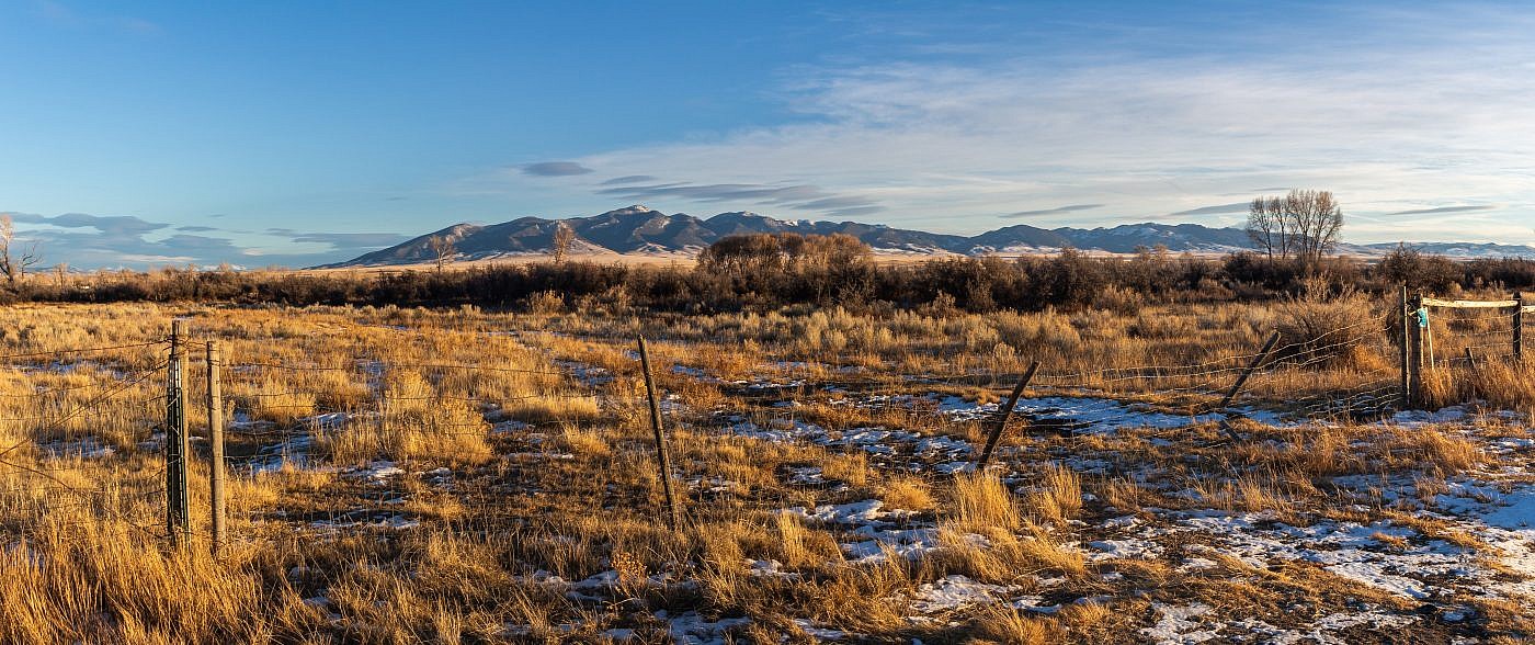
Looking east towards the Rubies from Highway 41.
The Adventure Begins
This adventure began the same way many of my adventures began in the summer of 2019. After finishing work on Friday I raced home, packed up my stuff, and headed to one of my favorite campgrounds: Toll Mountain Campground just south of Homestake Pass.
If I remember correctly, I didn’t have any official plans to summit Ruby Peak that weekend, just a list of peaks to choose from. Although the summer had been a mild one so far I found the weather to be significantly more disagreeable than other summers. Every weekend seemed to be more about dodging thunderstorms than climbing mountains but on this particular weekend the Rubies were clear and therefore became my target.
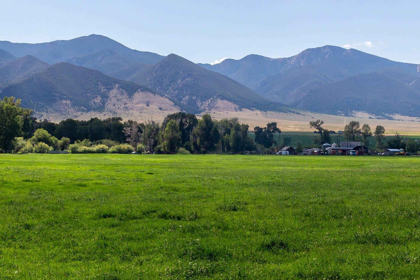
Traveling south from Whitehall along Highway 41 is one of my favorite drives. The Tobacco Roots, to the east, are astonishing from this angle and you’re in prime Lewis and Clark territory. It’s in this region that Lewis and Clark, while traveling up the Jefferson River, became increasingly nervous about finding the headwaters of the Missouri. This was unfamiliar territory and it wasn’t until Sacjawea identified the nearby Beaverhead Rock that they were assured they were on track. Shortly after, they encountered the Shoshones (Sacajawea’s tribe) who provided them with horses and assisted with their difficult journey across the Rockies.
Getting to the trailhead is simple but because there’s no official trailhead I will provide detailed directions. From Highway 287 exit west at 1st Street (Virginia Ave.) in the small town of Alder, MT. This is also the exit for Ruby Dam. After a very short distance head south at the T onto Upper Ruby Road (Highway 357). After about 1/4 mile take a right (west) onto Judy Lane (which turns into Spring Canyon Road) and follow it for about 2 miles. Just after Ewe Ln and right before Spring Canyon Road turns abruptly south exit right onto a dirt road which heads towards the mountains. Shortly after there’s a gate which will take you onto BLM land. From the gate drive another mile or so to a flat grassy area and park.
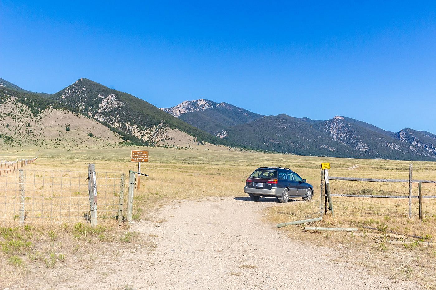
This is the BLM gate. From here travel another mile or so to a flattish area where you can park.
On the Trail
It was unclear to me at first where to go once I got to the “parking lot”. There’re no signs and I couldn’t seem to find a trail anywhere, just wide open grasslands. Upon closer inspection, however, I noticed a very faint ATV track leading towards the mouth of a canyon which I determined to be Porier Canyon, the simplest route to the summit.
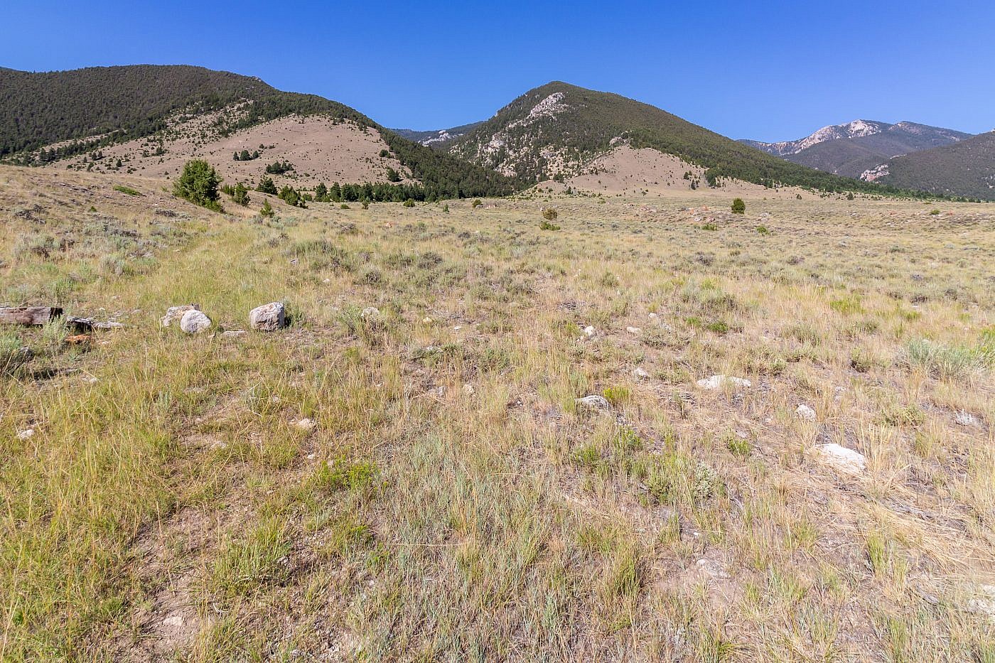
The faint ATV track leading to Porier Canyon (center left). Cedron Jones recommends a loop where you head up Laurin Canyon (right) instead, loop over Laurin Peak (right) and Ruby Peak (hidden) and descend through Porier Canyon back to the lot.
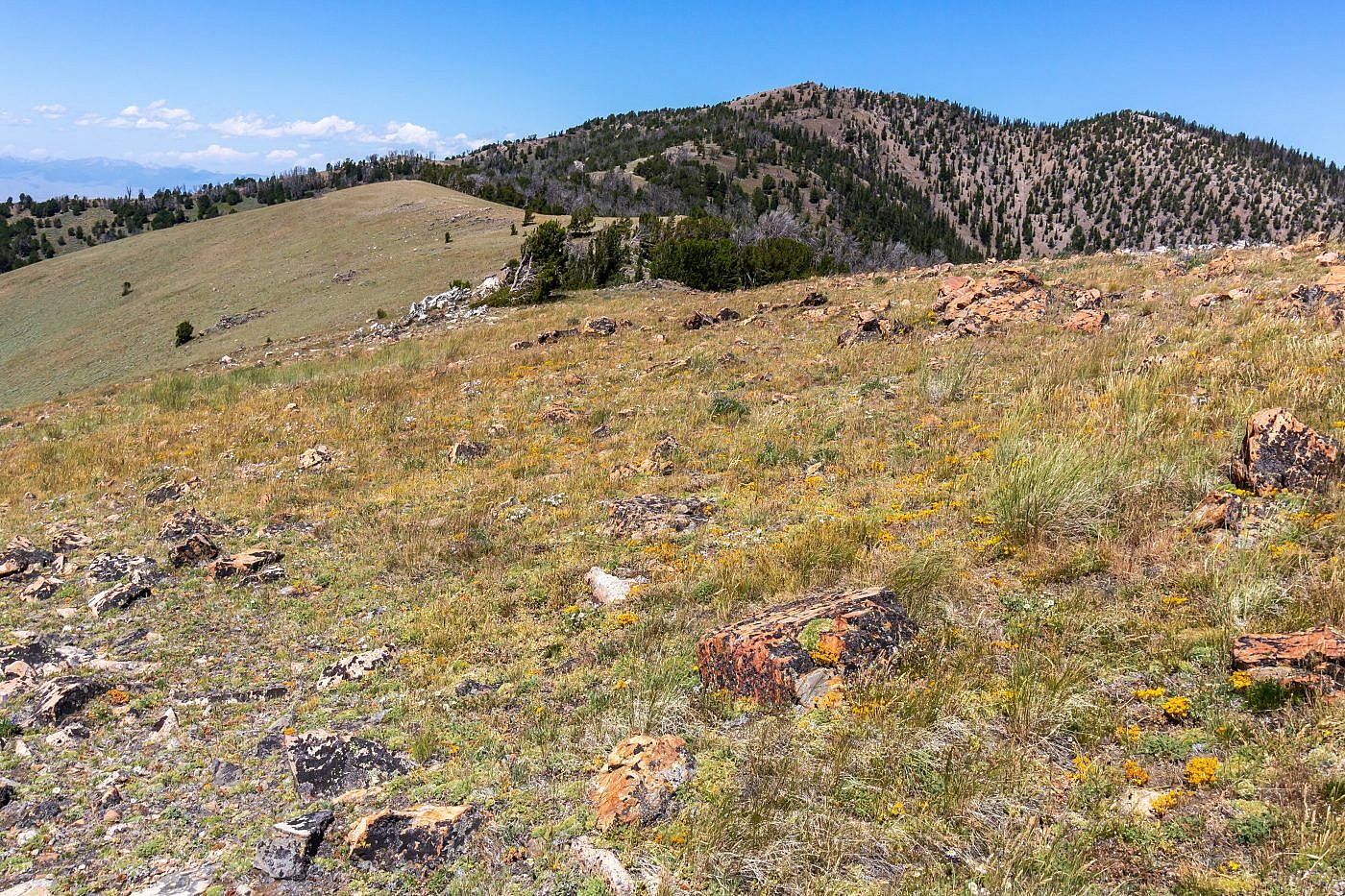
After a brief stroll through the grasslands you’ll enter Porier canyon. From here it’s a pleasant, shaded hike through the canyon along the ATV track. After about 2.5 miles things start to get a bit tricky. At the point where the ATV track turns sharply to the west you want to continue south and head up the ridge in front of you. This is the steepest and most challenging section and if you’re routefinding goes awry you might encounter some nasty bushwhacking. There is a spur trail that parallels a gully to the left for a little ways so you want to stick to this trail as far as it leads. The gully, as you’d expect, is full of brush, deadfall, and other nasty things that will get in your way so stay to the right of the gully. Eventually, if you persevere, you’ll make it to the top of the slope and find yourself on a grassy ridge where you’ll get your first views of Ruby Peak. From here just simply follow the ridge to the top!
First views of Ruby. Follow the grassy ridge all the way to the top.
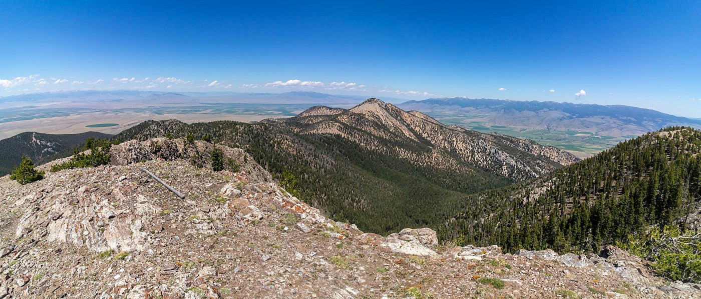
Looking north from the summit of Ruby Peak. Laurin Peak is the obvious highpoint to the north. Cedron Jones’ loop route involves hiking up Laurin Canyon (front), a nastier hike apparently, then up to Laurin Peak or the connecting ridge, over to Ruby and then back to the lot via Porier Canyon.
The Return
The descent went about as smooth as the ascent. While descending the ridge to Porier Canyon I stayed as close to the gully as I could without actually entering it hoping to find the spur trail mentioned in Cedron Jones’ book. Although I eventually found it it wasn’t until I was fairly close to the bottom anyway. I don’t think there’s an “easy” way to get up/down this ridge, you’ll just have to buck up and do some bushwhacking.
