Big Belt Mountains
Mount Edith
Download KML
Distance
3 miles one way
Type
Day hike
Difficulty
Moderate
- Starting Elevation: 7650 ft.
- Ending Elevation: 9507 ft.
- Elevation Gain: 1857 ft.
 View all 10 photos
- Experience Date: Jul 29, 2018
- Hike Time: 3-4 hrs.
- Drive Time: 1 hr. 45 min.
- Road Condition: Long dirt road. 2 WD accessible. Moderate clearance vehicle recommended for last 1/2 mile. Made it to trailhead in Subaru Legacy.
- Parking: Large lot with plenty of available parking.
- Fees: None
- Campsite Availability: Plenty of camping at lot. None along trail. Camping at Edith Lake if willing to make the trek.
- Private Property: None encountered.
- Trail Traffic: Very light.
- Trail Condition: Well maintained trail up to saddle. Simple off-trail travel from saddle to summit.
- Fire Restrictions: None
- Stream Crossings: None
- Water Sources: None
- Snow: None
- Winter Access: Unknown
- Weather: Partly cloudy. 80's. Hazy from forest fire smoke.
- Bugs: Few
- Wildlife Sighted: None
- Side Quests: Mount Baldy. Edith Lake.

Mount Edith is the highpoint of the Big Belt Mountains which flank the eastern shores of Canyon Ferry Lake southeast of Helena, MT. The Big Belts aren’t nearly as rugged as some of their neighbors but they’re vast and if you’re looking to do some crowd-free recreating there Mount Edith is a great place to start. Edith doesn’t stand out like many mountain range highpoints, in fact it’s barely visible from the west. To get a good close-up view you have to travel all the way to the east side of the range near White Sulphur Springs but if you know where to look you can actually get a nice view of it in the distance from right here in Bozeman. Getting to the trailhead involves some long and windy dirt roads but the trail itself is in great shape. There’s a short off-trail section near the end but the terrain is easily navigable. Side quests include Mount Baldy, Edith’s neighbor and 2nd highest point in the range, and Edith Lake which would be a great backpacking destination.
Mount Edith as seen from the Shields River Valley.
Background
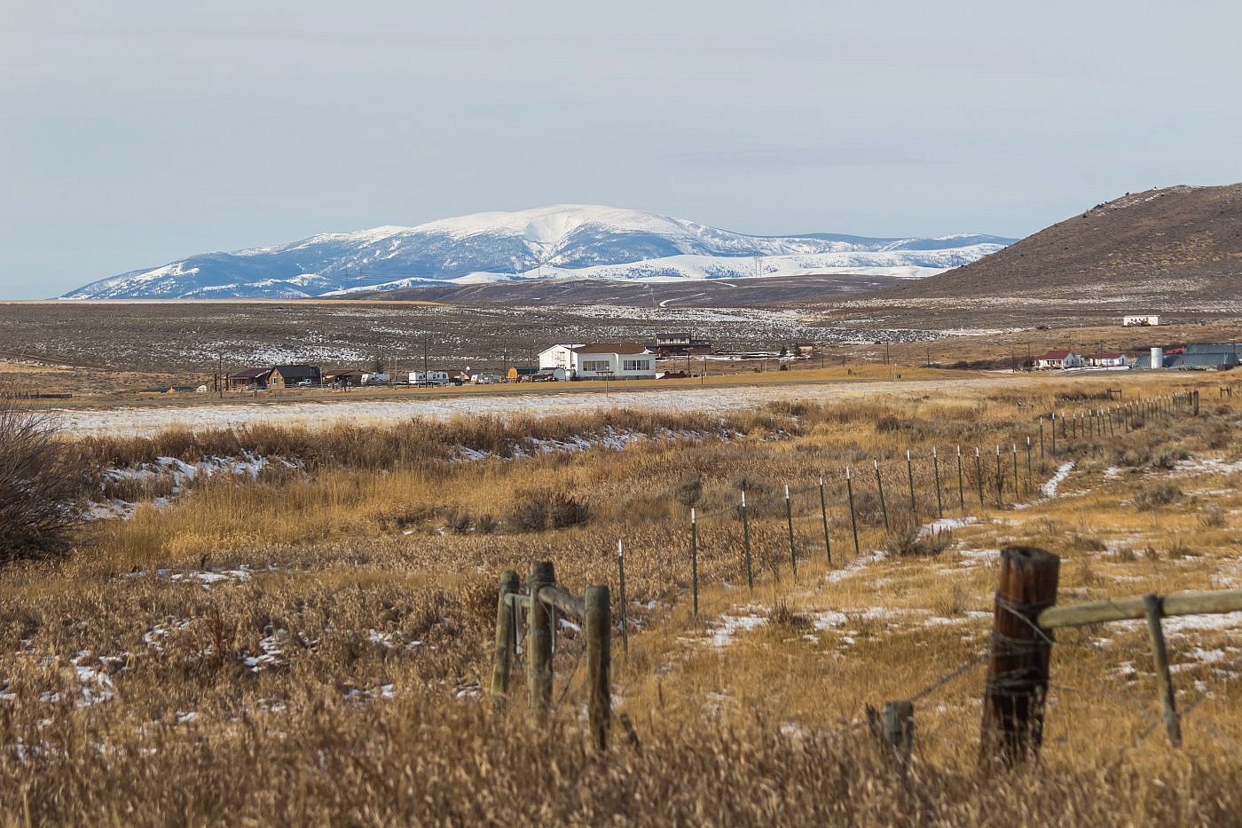
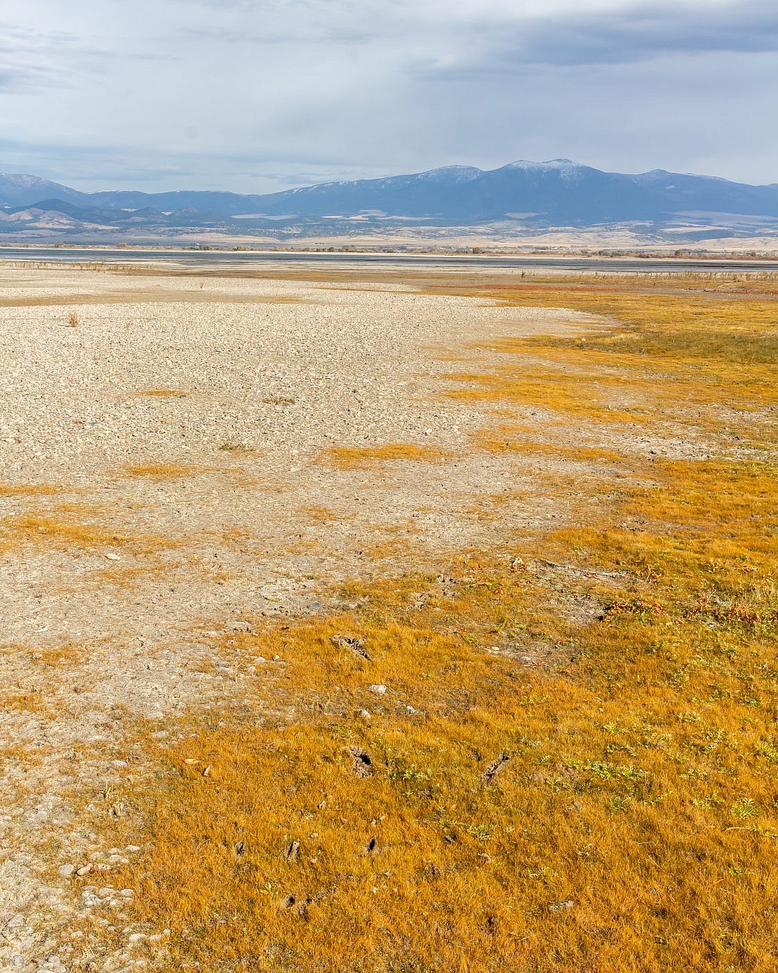
Sandwiched between the Elkhorn Mountains to the west and the Big Belt Mountains to the east, Highway 287 provides an essential connection between Helena and I-90. While passing through this valley you will practically be retracing the footsteps of the Lewis and Clark expedition over 200 years ago and therefore gazing upon the wondrous mountains that appear exactly as Lewis and Clark would have seen them. Although theses mountain ranges aren’t nearly as rugged as many of the other ranges in the state any onlooker will notice a prominent, round-topped mountain almost due east of the small town of Townsend, MT.
My hiking partner Arlo had seen this mountain many times on his travels between Bozeman and his hometown Kalispell and finally decided it was worth investigating. I had seen the mountain many times too so when he proposed the idea of climbing it I immediately agreed to take on the challenge. At the time I didn’t even know what mountain range it was it but this excited me even more as I was growing more and more interested in exploring the lesser-known areas farther outside Bozeman. Additionally, I was still recovering from a knee injury and wasn’t quite ready to take on anything too challenging making this the perfect candidate.
So here’s the interesting part. We set out to climb this mystery mountain that we thought was Mount Edith, the highpoint of the range, but it wasn’t until we were almost to the trailhead that we realized the mountain we thought was Edith was actually Mount Baldy, the 2nd highest point in the range. It turns out that Mount Edith is barely distinguishable from the other round-topped mountains of the southern Big Belts and from Highway 287 it doesn’t even look like a mountain let alone the highpoint of the range which explains our confusion. In fact, you have to drive all the way to the east side of the range, near White Sulphur Springs, to get a good idea of the shape of the mountain and even then it doesn’t look like much. Surprisingly, you can get a decent view from right here in Bozeman where, although far in the distance, you can see it side by side with Mount Baldy.
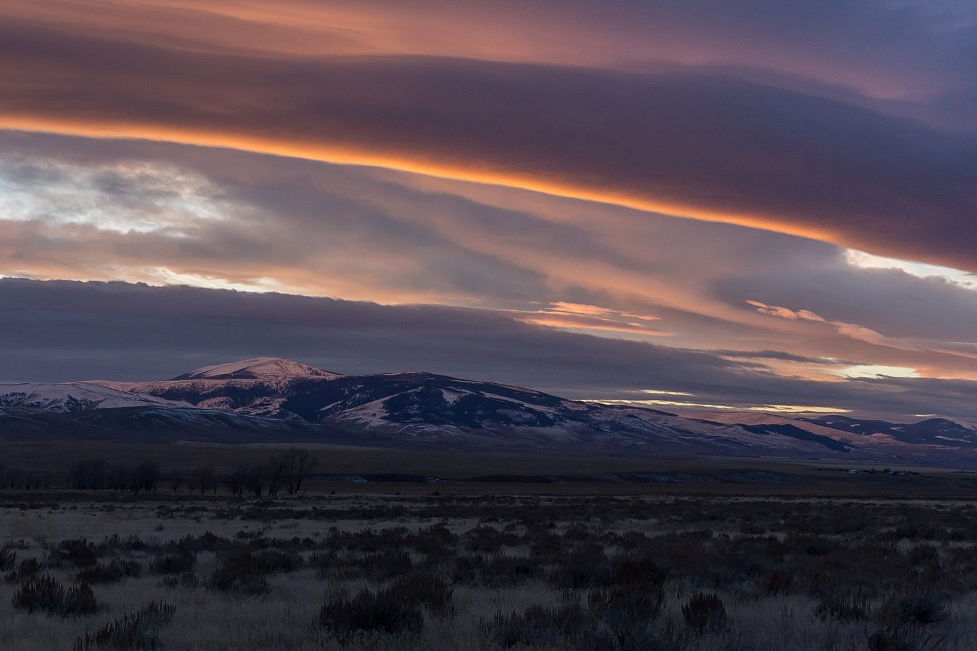
Mount Edith at sunset as seen from the east side of the Big Belts near White Sulphur Springs.
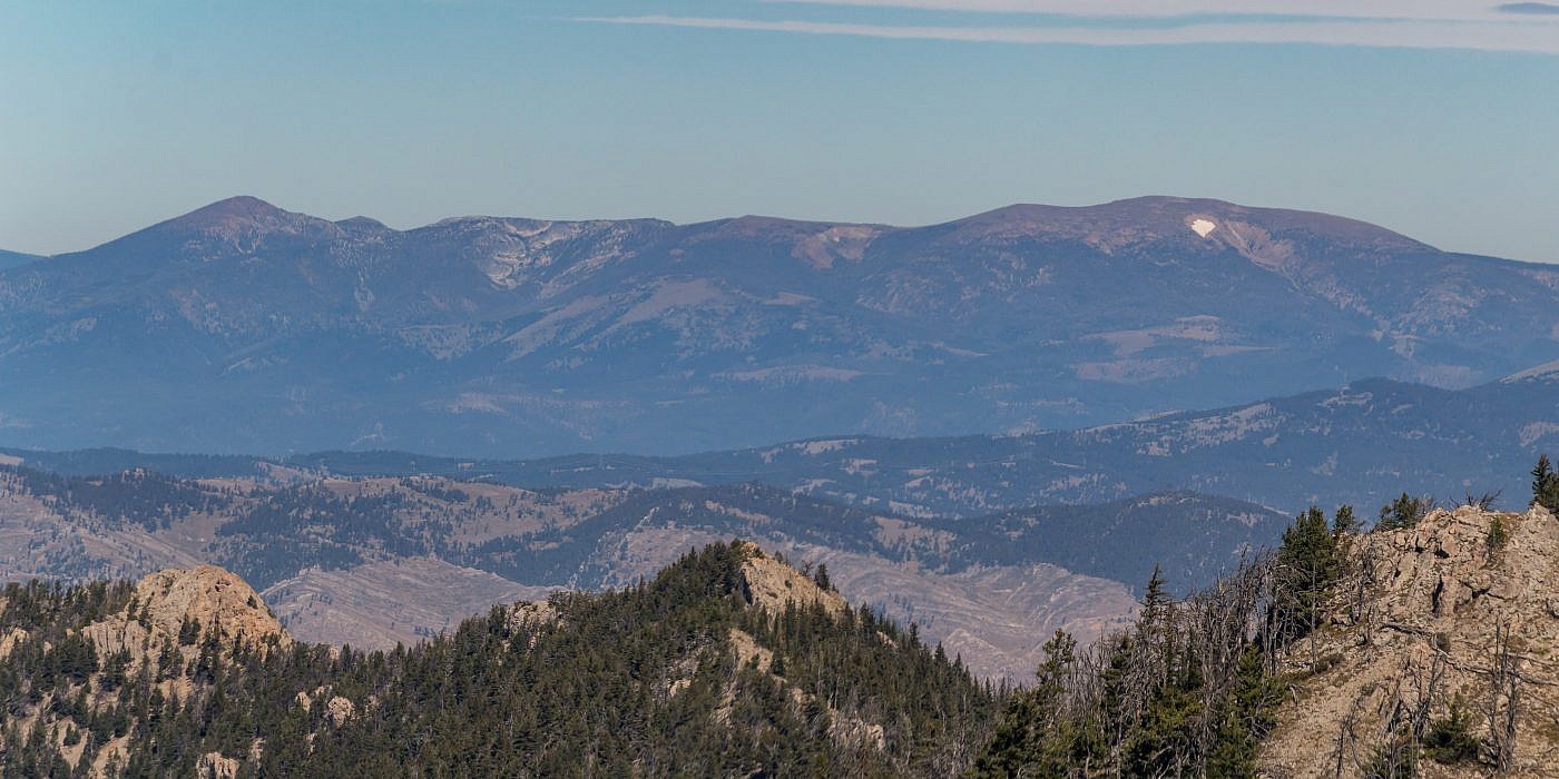
Mount Edith (right) and Mount Baldy (left) as seen from the northern Bridgers. As you can see, Mount Baldy looks much more “mountainy” compared with Edith which looks like more of a little blip on the ridge. In theory, you should be able to get to Baldy from the same trailhead.
Looking east at Mount Baldy from the shores of Canyon Ferry Lake.
The Adventure Begins…
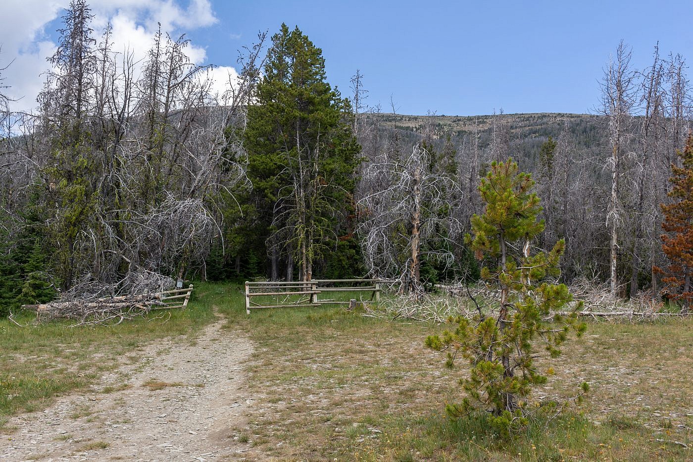
Arlo had done all the research on this one so I was relying on him entirely for directions to the trailhead. But as we started meandering along the windy dirt roads it became clear that getting to the trailhead would probably be more of a challenge than climbing the mountain itself! We drove for what seemed like forever, turning around several times until somehow we came upon the trailhead. The last half mile is a little hairy but with some care you should be able to make it without a high-clearance vehicle. We made it all the way in Arlo’s 1989 Subaru Legacy to give you an idea. I will describe the directions in detail to eliminate any confusion. From Highway 12 head north on Cabin Gulch Road (FS Road #423). After a short distance continue right onto East Fork Cabin Gulch Road (still FS road #423) and follow as it winds through the foothills. After 9 total miles from the highway take a right onto the more primitive road and follow for another 2ish miles to the trailhead.
The parking lot and trailhead. The trail switchbacks up Edith’s southern flank as seen in the picture.
On the Trail
Once at the trailhead it becomes a very straightforward hike with no surprises. You start by climbing a series of switchbacks up Edith’s southern flank to a saddle where the trail continues forward descending the saddle to Edith Lake. Here you ditch the trail and head east up the ridge to a false-summit and then onward to the actual summit. It’s not too steep and the terrain is easily navigable. That’s really all there is to it. If you’d like to add some more adventure to the mix you could head west at the saddle and follow the ridge directly to Mount Baldy-the mountain we originally mistook for Edith. You could also descend from the saddle to Edith Lake which would make for a great backpacking destination.
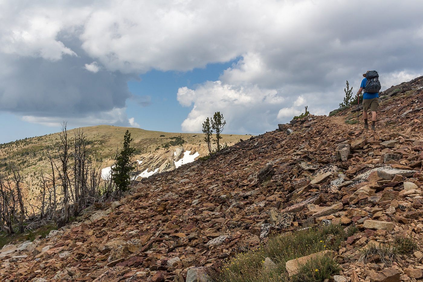
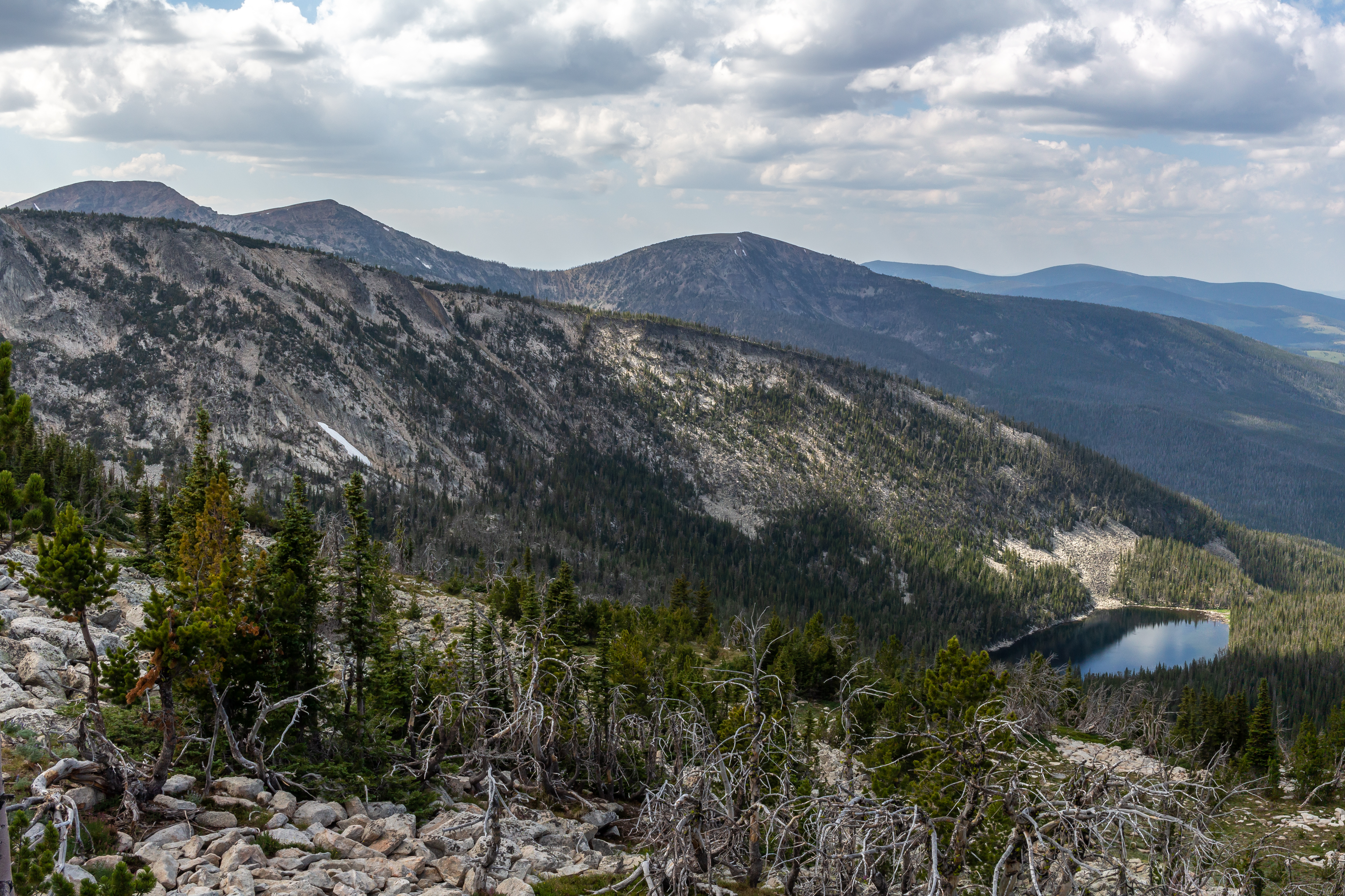
Working our way towards the saddle just above the treeline.
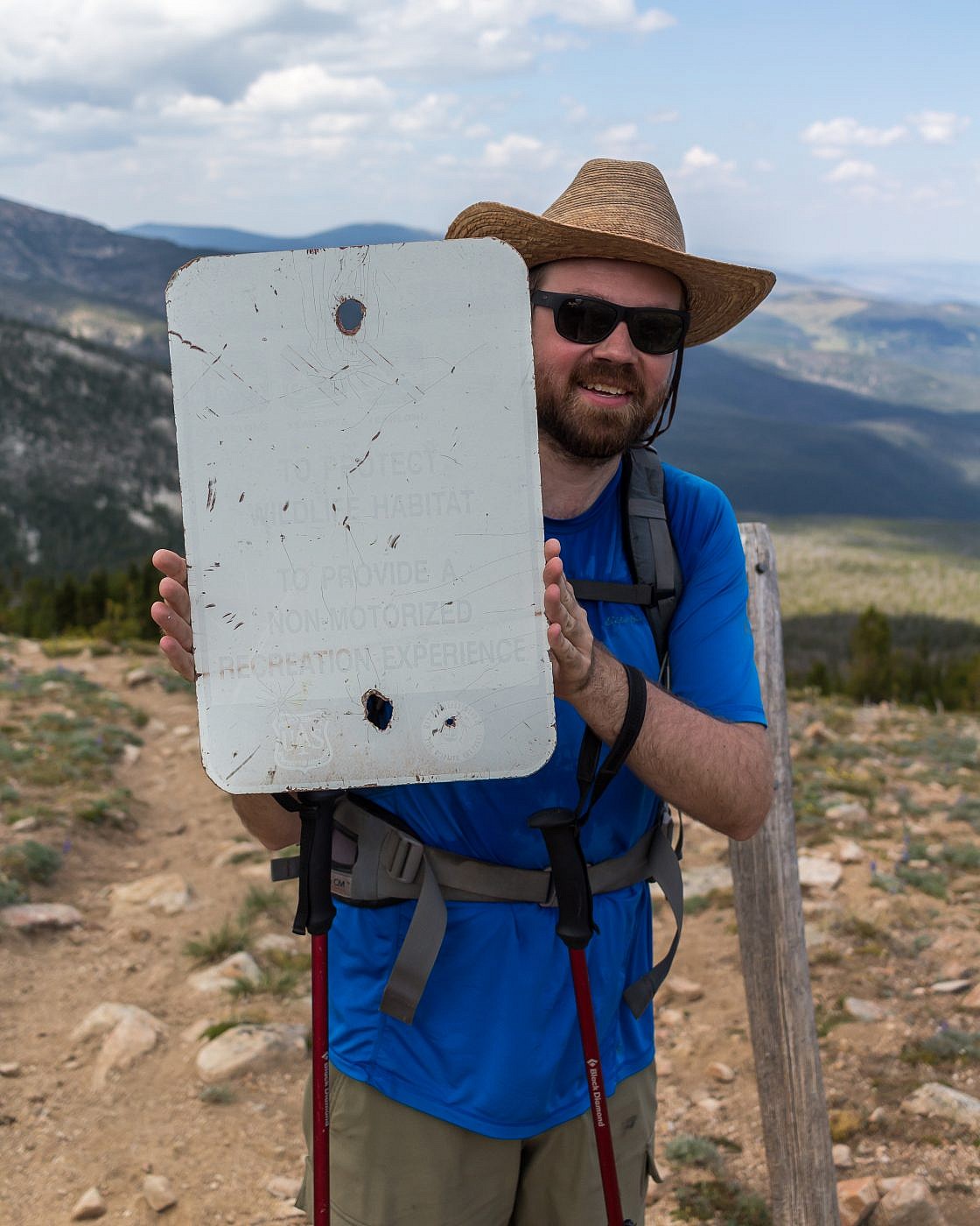
A broken down sign at the saddle. Here you ditch the trail, which descends to Edith Lake, and climb the moderately steep ridge to the east all the way to the summit.
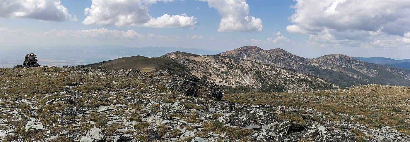
The view west from the false summit. Mount Baldy (center right) is the 2nd highest point in the range which I’m assuming you can get to by following the ridge west, rather than east, at the saddle. This would be significantly longer than Edith with more elevation gain since the ridgewalk will have additional ups and downs.
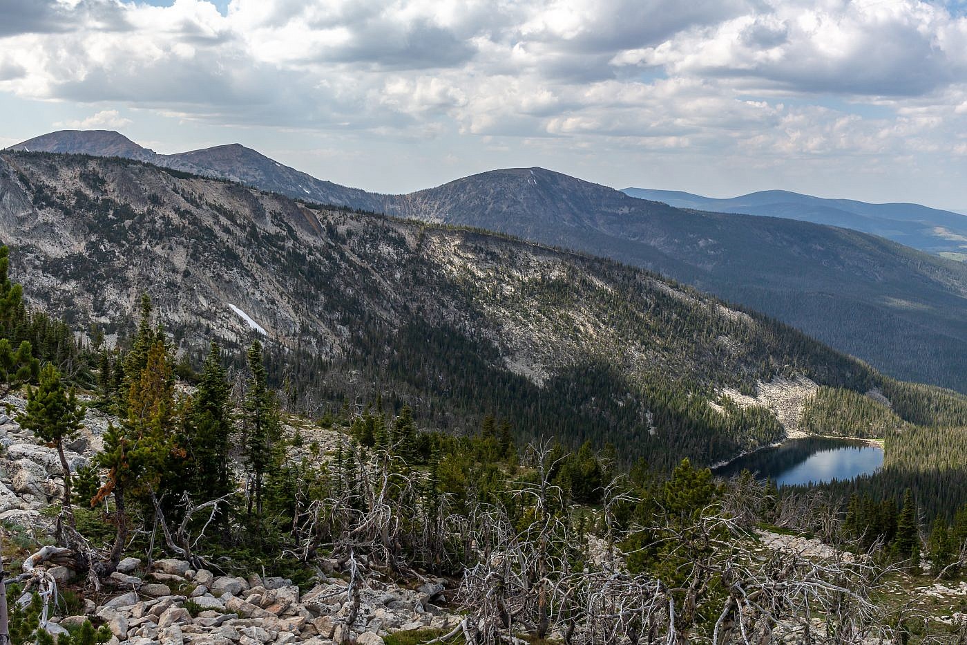
To get to Edith Lake simply follow the trail north from the saddle.
Looking east from the summit of Edith. Castle Mountains on the right and Little Belt Mountains on the left in the distance.
