Flint Creek Range
Mount Powell to Deer Lodge Mountain Loop
Download KML
Distance
14 miles round trip
Type
Day hike
Difficulty
Hard
- Starting Elevation: 6300 ft.
- Ending Elevation: 10168 ft.
- Elevation Gain: 3868 ft.
 View all 9 photos
- Experience Date: Jun 29, 2019
- Hike Time: 8-11 hrs. depending on if you loop around Deer Lodge Mountain.
- Drive Time: 2.5 hrs.
- Road Condition: Windy dirty road. Nasty in spots. High clearance vehicle recommended. Made it just barely in my Subaru Outback.
- Parking: Plenty of parking.
- Fees: None.
- Campsite Availability: Campsites can be found along the creek before you leave the trail.
- Private Property: None encountered.
- Trail Traffic: None.
- Trail Condition: First several miles are on an old, but well-established ORV track. Once you leave the ORV track at the bridge it's all off-trail travel.
- Fire Restrictions: None.
- Stream Crossings: Some depending on time of year.
- Water Sources: Dempsey Creek.
- Snow: Patches of snow near the top but did not have to traverse any.
- Winter Access: Unknown.
- Weather: Partly Cloudy. Pleasant. 70's.
- Bugs: None.
- Wildlife Sighted: None.
- Side Quests: Deer Lodge Mountain. Dempsey Basin.

Mount Powell is the highpoint of the Flint Creek Range, a relatively unknown range just west of Deer Lodge, MT along I-90. This one has a nice combination of everything you’d look for in a good adventure. It’s incredibly scenic, there’s a healthy mixture of on-trail and off-trail travel, and there’s even a nice side quest that you can easily incorporate into the day if you’re feeling extra adventurous. The road to the trailhead gets rough in spots so a high-clearance vehicle is recommended although not entirely needed. The trailhead also provides access to Dempsey Basin, a collection of beautiful sub-alpine lakes, which flanks Powell to the southwest. Deer Lodge Mountain is a great side quest which will take you along the edge of giant cirque known as “The Crater”.
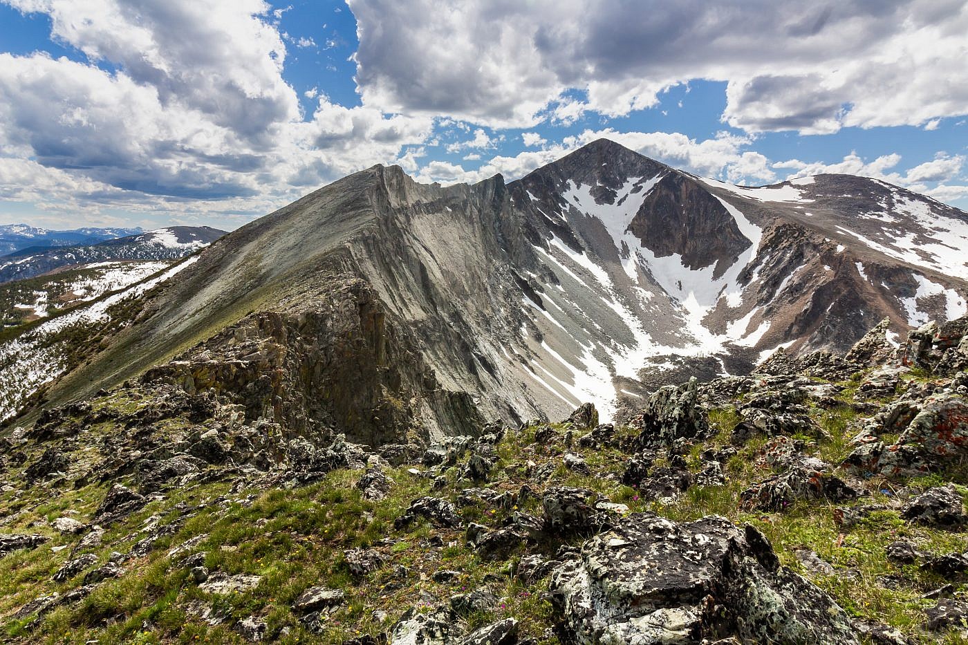
Mount Powell and “The Crater”.
Background
Early summer is always a tricky time for peakbagging. You never really know how much snow is still present in the backcountry so it can be hard to judge whether a peak is doable or not. Sometimes you have to just take a chance and hope for the best but there’s nothing worse than almost getting to the top and being forced to turn around because of some precarious snow field.
I was really starting to get the itch towards the end of June so one day I decided it was time to seek out my first peak of the season. Mount Powell, the highpoint of the Flint Creek Range, had been on my list since the previous winter when I first noticed it on a trip to Phillipsburg, MT. While exploring around the Anaconda Mountains in mid-June I noted how little snow there seemed to be on the peak. When the next week came around I decided it was time to take a shot at it. I knew the drainage’s had to be melted out and figured that since the entire route is on south-facing slopes the chances of encountering unexpected snow were minimal.
I’d also read that it’s worthwhile to also bag nearby Deer Lodge Mountain which can be accessed by following the ridge that heads due east from the summit of Powell. The route follows the rim of a giant cirque known as “The Crater” which, according to my research, was quite breathtaking. My ability to bag Deer Lodge Mountain would depend on how I felt after getting to the top of Powell but I knew I’d give it my best shot.
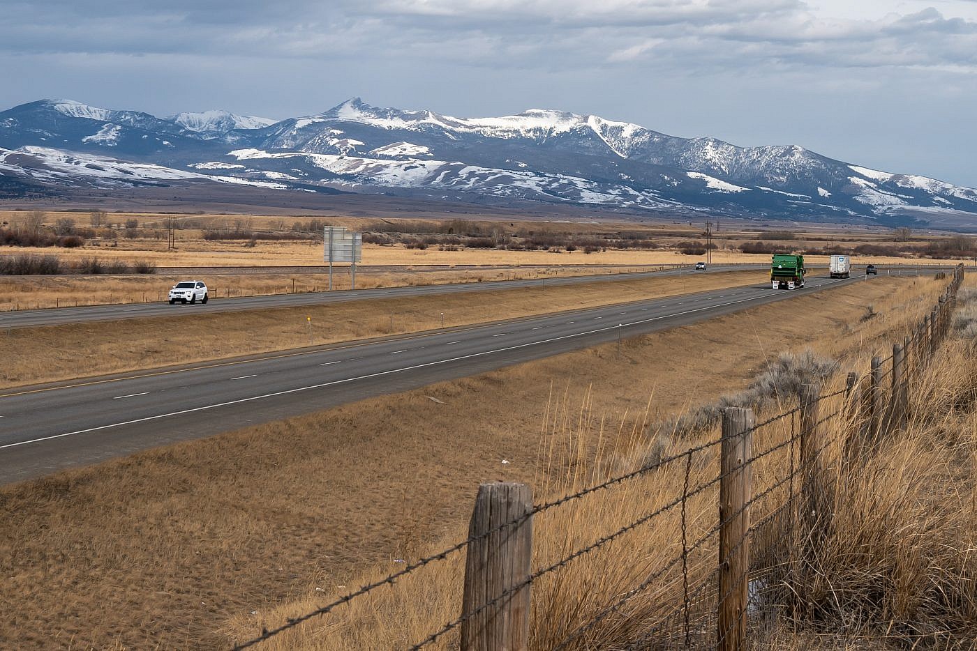
While most people wouldn’t have any idea where Mount Powell (center left) is located, anyone who’s driven between Bozeman and Missoula along I-90 has undoubtedly laid eyes on the peak. It towers overhead Deer Lodge Valley through which I-90 winds. If you’re heading north along I-90 you’re treated to great views of Powell, Deer Lodge Mountain (center right) and the rest of the Flint Creek Range.
The Adventure Begins…
In order to get a head start on the day I camped at the Toll Mountain Campground, just south of Homestake Pass, the night before. I love this campground because it is centralized in a cluster of mountain ranges in the Butte area and therefore makes for a great base camp. Depending on the time of year it can be crowded but if you know where to look you can usually find somewhere to camp even if it’s not in the official campground.
Getting to the trailhead is not straightforward. I used the directions outlined on the Summit Post page which I will describe in detail. Take exit 195 off of I-90 at Racetrack, MT. Head west on Racetrack Road for a short distance until you hit a T. From the T take a right onto Yellowstone Trail. After about 0.7 miles take a left (west) onto Quinlan Road. Head west for about 3.5 miles through a dogleg and take a sharp right on Dempsey Lake Road. After about a mile take a left at the Y and then a quick right up a small hill onto FS Road #8507. Follows this road for about 7.5 miles to the trailhead.
The reports seem to suggest that it’s a simple drive, accessible by any 2 WD vehicle. While you shouldn’t need 4 WD I do highly recommend a high-clearance vehicle. Once you turn onto FS Road #8507 the road becomes nasty, with deep ruts that you need to straddle. There’s even a point where the official road has been completely washed out. Luckily a secondary road has been routed around this obstruction but it’s far from “well-maintained”. I’ve only bottomed out my Outback several times and one of the times was on this section. After the washed-out section it gets progressively better until you finally reach the trailhead.
On the Trail
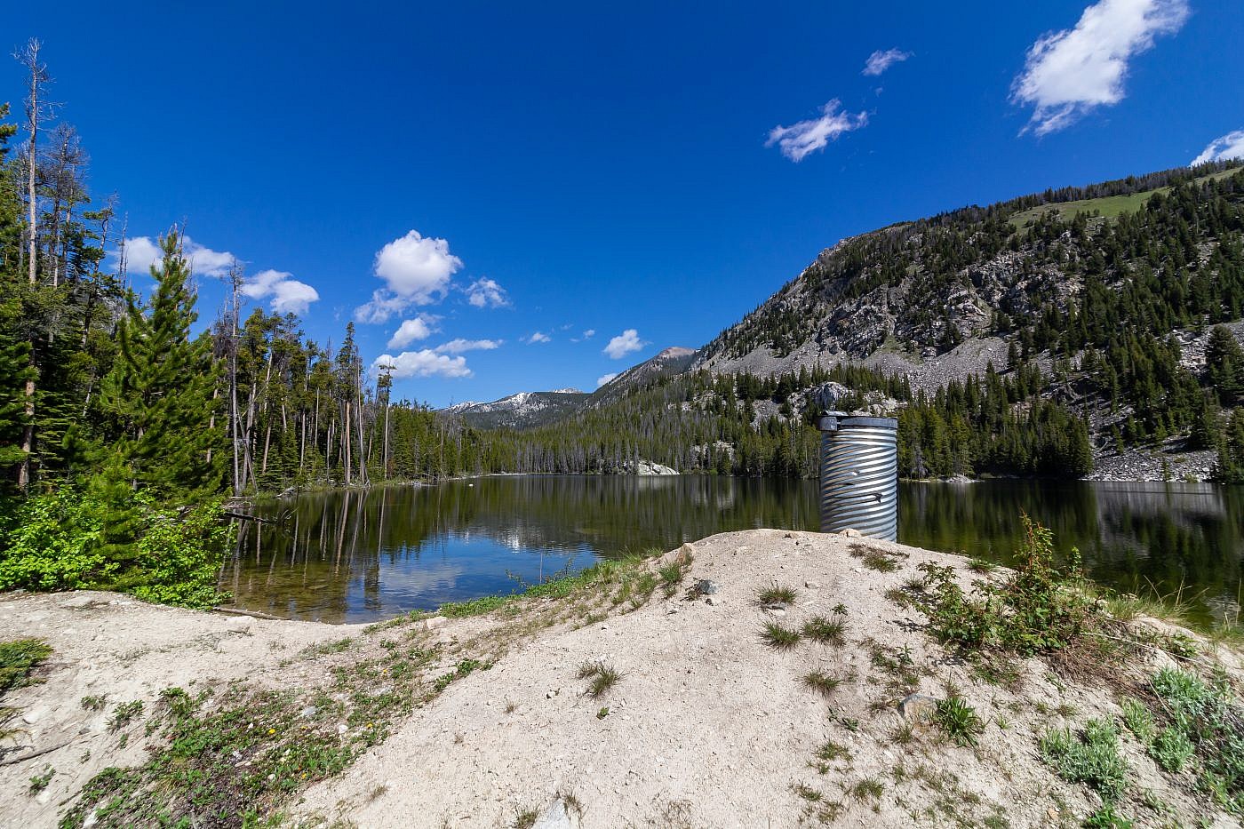
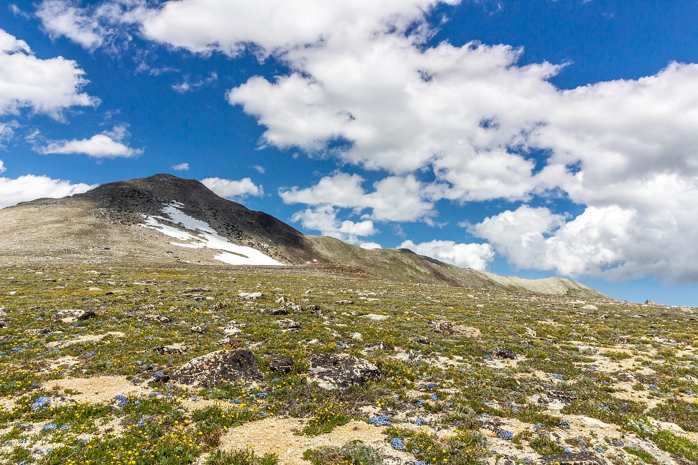
I chose to bike the first 3.5 mile section which is on an old ORV road. It’s definitely a bumpy one and I had to walk my bike several times but I knew it’d be worth it to shave off some time on the way back down. The road parallels the Dumpsey Creek drainage and you’re never very far from the creek which serves as a great water source. It’s worth it to take a slight detour to Bohn Lake about 2 miles in. It’s nothing special but it’ll give you a nice visual of the ridge you’ll ultimately be ascending to get to Powell.
Bohn Lake. The point above the treeline in the center of the image is the top of the ridge you’ll be ascending to get to Powell.
After approximately 3.5 miles of steady uphill you will encounter a bridge which crosses Dumpsey Creek. This is where you leave the road. Do not cross the bridge but head right (north) and continue to follow the creek a short distance before heading towards the left side of the drainage in front of you. I implore you to stay out of the center of the drainage entirely. I misinterpreted the Summit Post trail report and ended up having to endure some nasty bushwhacking before emerging onto a fairly clear, albeit steep, slope which you simply take to the top of the ridge. My suggestion is to stay far to the left of the drainage which will allow you to avoid any of the nasty bushwhacking.
If you were continue along the ORV route you would end up in Dempsey Basin which harbors a collection of beautiful sub-alpine lakes. It looks like a backpackers paradise and I hope to return sometime in the near future to explore the lakes.
Ascending the ridge. Looking up the drainage towards Dempsey Basin.
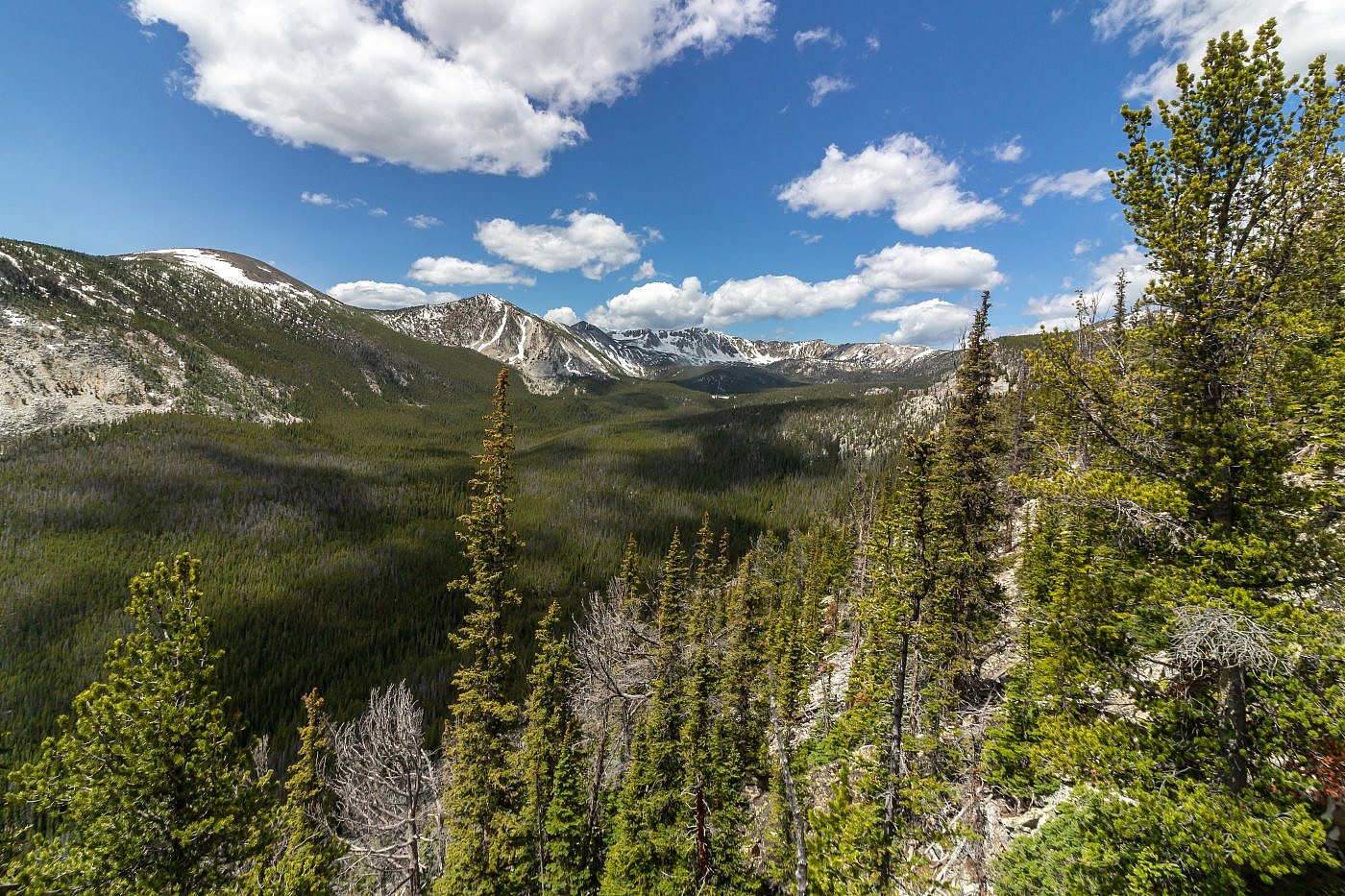
After some strenuous climbing you will emerge on a flat meadow at about 8,600′. Here you will get your first view of Powell which is straight ahead and Deer Lodge Mountain which is far to the right. At this point the hard part is done and you can enjoy a simple stroll along the beautiful, wildflower-covered meadow with incredible 360 degree views of the Flints.
The meadows leading to the final ascent of Powell. Deer Lodge Mountain is just barely peaking above the meadow on the far right. Note that the distance between Powell and Deer Lodge is deceptively far so if you go for it be prepared.
Dempsey Basin.
After traversing the meadow you begin the final ascent up Powell. As you’d expect, it’s steep, but the ground is relatively stable (unlike many of the nasty scree/talus climbs I’ve had to endure) so it shouldn’t take too much more effort before you’re at the top.
Deer Lodge Mountain
Powell alone makes for a long day but if you’re thirsty for more you might as well bag Deer Lodge Mountain. I was thirsty for more and was still feeling pretty good so I decided to go for it. At the time I didn’t realize how much more effort it was going to take but even if I did I’m sure I still would’ve went for it, I guess that’s the masochist in me.
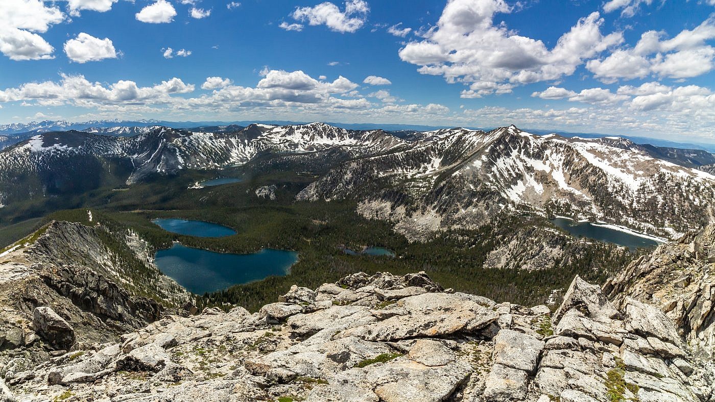
The route to Deer Lodge is obvious. Just follow the ridge leading east from the summit of Powell. It’s an extremely gorgeous side quest and it’ll lead you around the rim of “The Crater” which is seriously breathtaking. Keep in mind this will add another 3 or so total miles to the journey and although there’s no serious chunks of elevation gain the ridgewalk is full of ups and downs which do add up over the course of the hike. At the summit of Deer Lodge you’re treating to excellent views of the valley below. The view of Powell from this perspective makes it look way gnarlier especially juxtaposed with The Crater.
Peering over the edge of The Crater. The ridge following the rim of the Crater will lead you straight to the summit of Deer Lodge Mountain which is far in the distance.
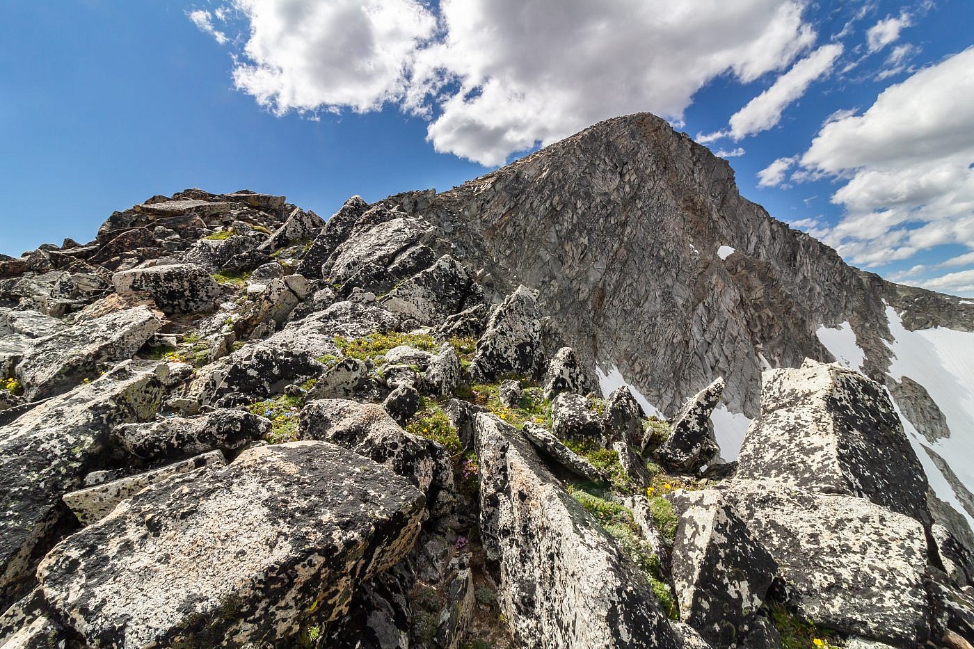
Looking up the eastern ridge of Mount Powell.
Almost to Deer Lodge Mountain. This angle provides excellent views of the Crater and Mount Powell.
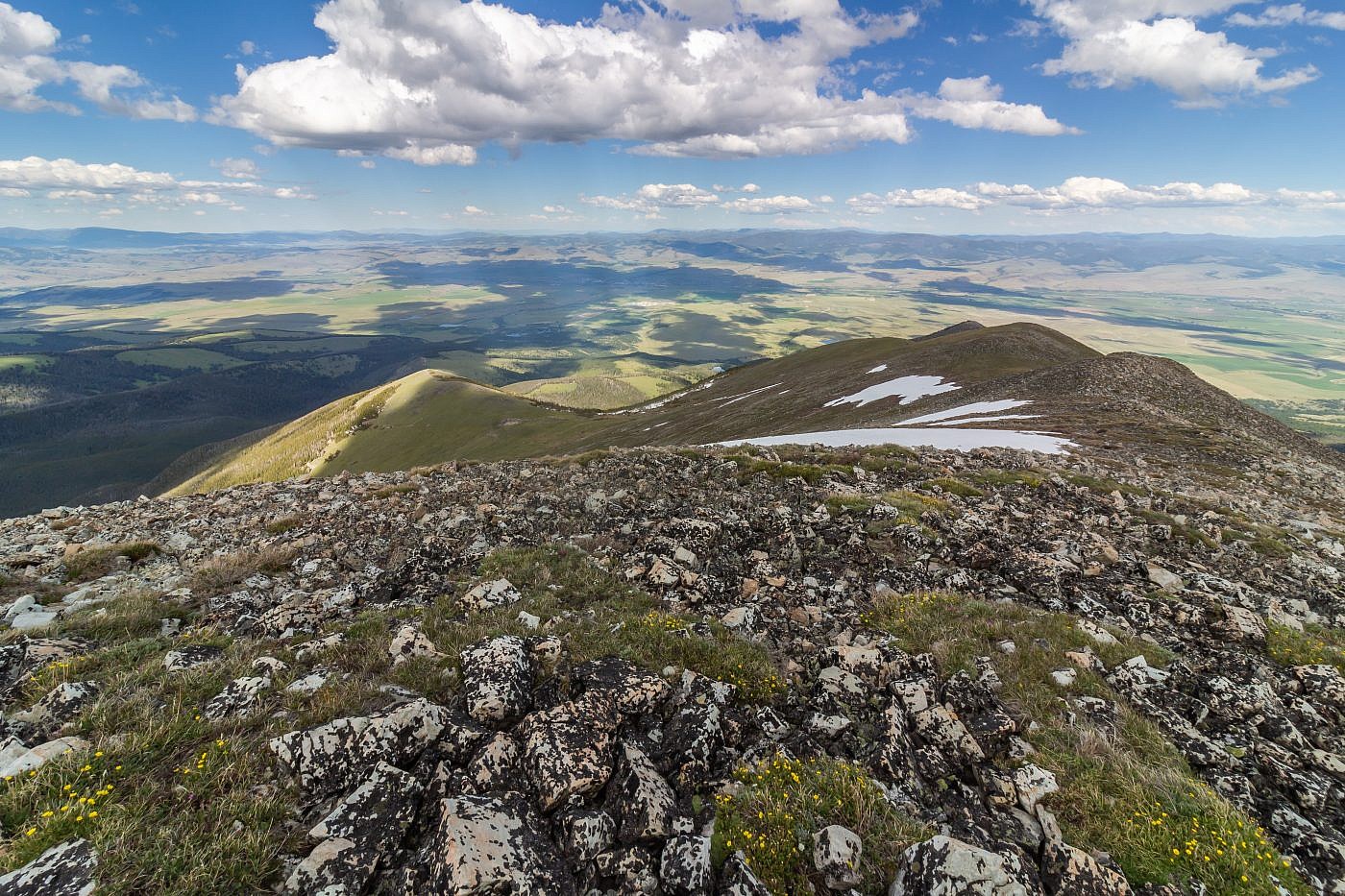
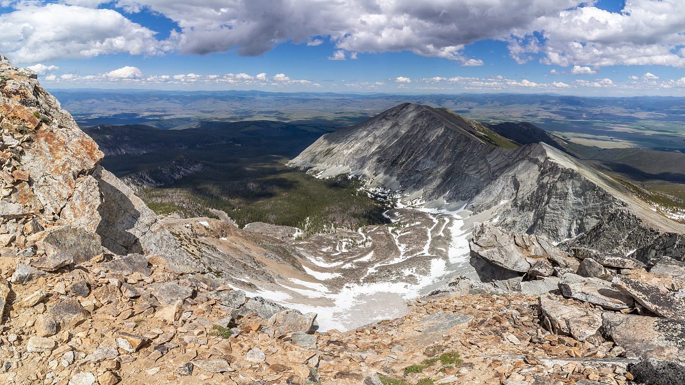
Looking east from the summit of Deer Lodge Mountain.
The Return
I’m not entirely sure about the easiest route back. You essentially want to shoot for the meadow back near the base of Powell. I’m unsure if it’s better to retrace your footsteps along the ridge and descend Powell’s slopes back to the meadow or just sidehill along the ridge until your back at the meadow. I adapted a combination of these, first following the ridge and then sidehilling around. I did this to avoid any unnecessary elevation gain but found the slopes to be challenging to traverse because of the scree/talus which made the footing unstable. I was also getting pretty tired by this point and found the sidehilling to be generally awkward and exhausting. It may be easier just to stick to flatter terrain and endure some extra elevation gain rather the the awkward sidehilling but that’s more of a personal preference.
