Garnet Range
Old Baldy Mountain
Download KML
Distance
1.1 miles one way
Type
Day hike
Difficulty
Easiest
- Starting Elevation: 6900 ft.
- Ending Elevation: 7511 ft.
- Elevation Gain: 611 ft.
 View all 13 photos
- Experience Date: Jun 4, 2020
- Hike Time: 1 hr.
- Drive Time: 4.5 hrs.
- Road Condition: Reasonably maintained, although very long dirt road. 2 WD accessible. High-clearance not necessary. Trees blocking the road near "trailhead".
- Parking: Plenty of parking along the road.
- Fees: None.
- Campsite Availability: Plenty of camping along road.
- Private Property: None posted.
- Trail Traffic: None.
- Trail Condition: No trail. First part on a road followed by a short off-trail scramble.
- Fire Restrictions: None.
- Stream Crossings: None.
- Water Sources: None.
- Snow: Small patches near the top.
- Winter Access: Doubtful.
- Weather: Partly Cloudy. 60's.
- Bugs: None.
- Wildlife Sighted: None.
- Side Quests: None.

Old Baldy Mountain (7,511′) is the highpoint of the Garnet Range north of Deer Lodge, MT. Old Baldy is one of those highpoints you do just to bag it mainly because getting to the “trailhead” requires up to 2.5 hrs. of cumbersome driving on mountain roads. Luckily the road is in decent shape but in the end it takes significantly longer just to get to the trailhead than to actually hike the thing. From the trailhead it’s a simple mile hike to the summit with just a short off-trail section at the end up the mountain’s northern slopes. I speculate that it can be accessed from the north but have no information on the road condition from that angle. It also may be possible to park where the road leaves Brock Creek and follow the creek up the drainage toward the summit from the south but some of this land is on private property.
Old Baldy Mountain.
Background
My first taste of the Garnet Range, just north of Drummond, MT along I-90, was in late 2019 when I accidentally stumbled upon the ghost town of Garnet located deep within the mountains. I had been driving along Highway 200, which parallels the Blackfoot River, searching for tamaracks to photograph when I somehow found myself on the road to Garnet and decided I might as well check it out. Garnet was established after large gold deposits were found in the area and became a thriving mining town from the late 1800’s through the early 1900’s. As the gold dwindled, however, Garnet lost much of its residents and by the 1940’s it was mostly abandoned. Today Garnet is one of most well-preserved ghost towns in Montana and is operated by the BLM. Since the structures have been well-maintained over the years it’s definitely not as “ghosty” feeling as many of the other Montana ghost towns but it’s certainly worth the stop if you’re in the area.
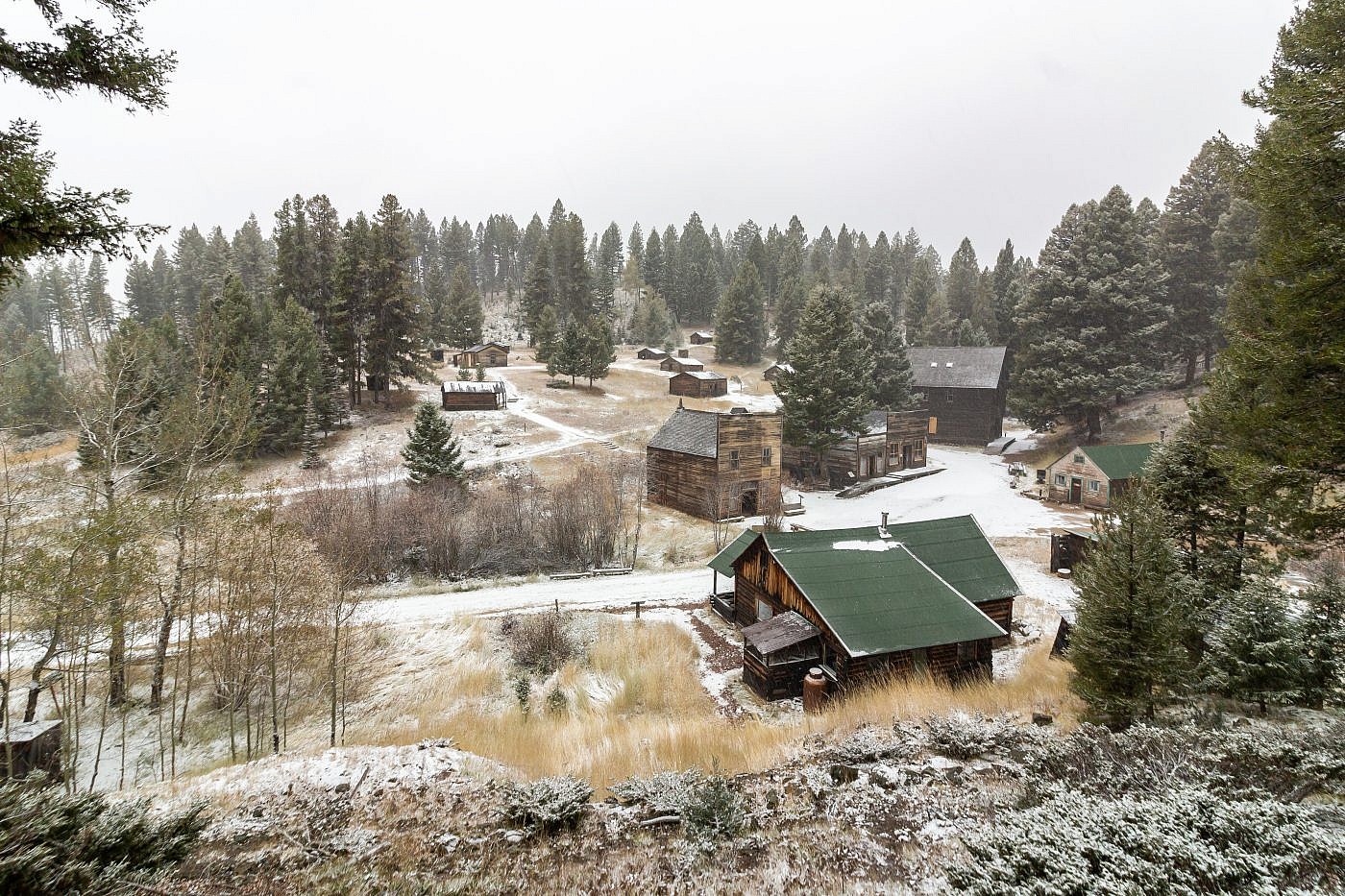
Garnet ghost town.
Aside from the ghost town the Garnets’s aren’t exactly a hot spot for recreating. I’m unaware of any extensive trail system in the range and they’re just not that scenic to begin with. But conquering the highpoint, Old Baldy Mountain (7,511′), was must-do for me so in early June 2020 I decided to take a stab at it, mainly because everything else was still snowed in. Old Baldy is one of the easiest highpoints to bag since you can drive very close to the summit and from there it’s a simple mile hike to the top.
The Adventure Begins
As I approached the Garnets from the south along I-90 I skimmed the range hoping I could get a glimpse of Old Baldy Mountain. I’d made this drive many times so I assumed I’d laid eyes on it at some point but I really wanted to verify that it was visible from the interstate. Unfortunately, none of the peaks in the Garnets really stand out so I was unable to determine if it could be seen.
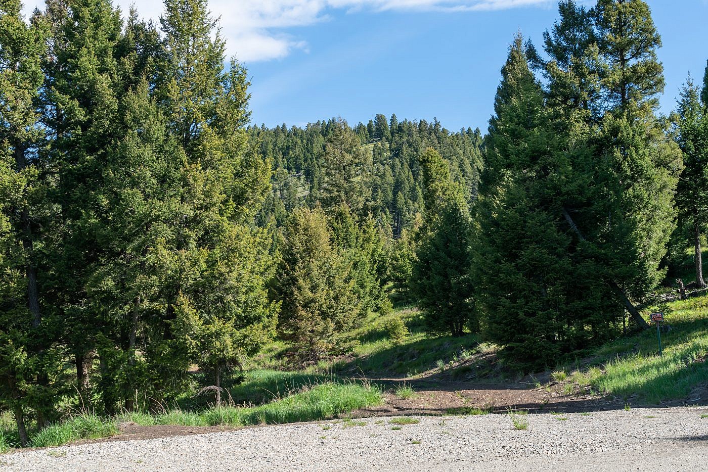
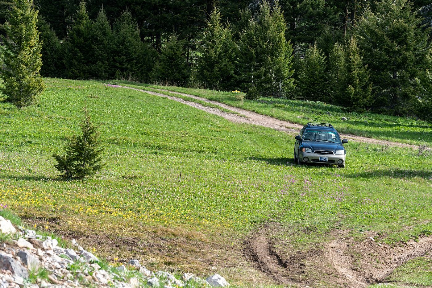
Getting to the “trailhead” for Old Baldy actually takes significantly longer than the hike itself. Not only is it a two hour drive along the interstate but this is followed by an almost 20 mile drive on a mountain road which ended up taking me an additional 2.5 hrs. The road is in decent shape which alleviates some of the pain but the drive seriously drags on forever. My Outback handled it fine and I’m sure a more appropriate mountain vehicle could do it in less time but either way you’re looking at a very tedious drive. I followed these instructions which I can verify are correct. Here’s my interpretation: From I-90 take exit 170 and follow Brock Creek Road north. After about 5.2 miles you’ll encounter a Y. Continue left at the Y for another 3.5 miles until where the road curves abruptly and begins to switchback up into the mountains. Continue on the main road (Brock Creek Road 2872) for another 3.9 miles and then take a left at the Y (East Brock Creek Road). Follow this road for another 4 miles. At some point the road transitions to Windy Rock Jeep Trail 2882 which takes you just east of Windy Rock. After the 4 miles there’s a T with Hoodoo Fire Road 2865 coming in from the north. From here just continue straight through the T for as far as you can go. I made it about another mile before I encountered trees blocking the road and then found an open area along the road to park.
It may be possible to park where the road leaves Brock Creek, follow the creek up the drainage, and ascend Old Baldy from the south. This would shave off over an hour of driving time which I would gladly trade for more hiking time but much of the land is on private property so it’s hard to say if this is possible. It also looks like you could access the mountain from the Avon Valley to the north but I’m unfamiliar with the condition of the roads from that angle.
A possible alternate route. This is the point where the road leaves Brock Creek. Another road continues straight along the drainage which may provide access to the mountain from the south although some of the land is on private property.
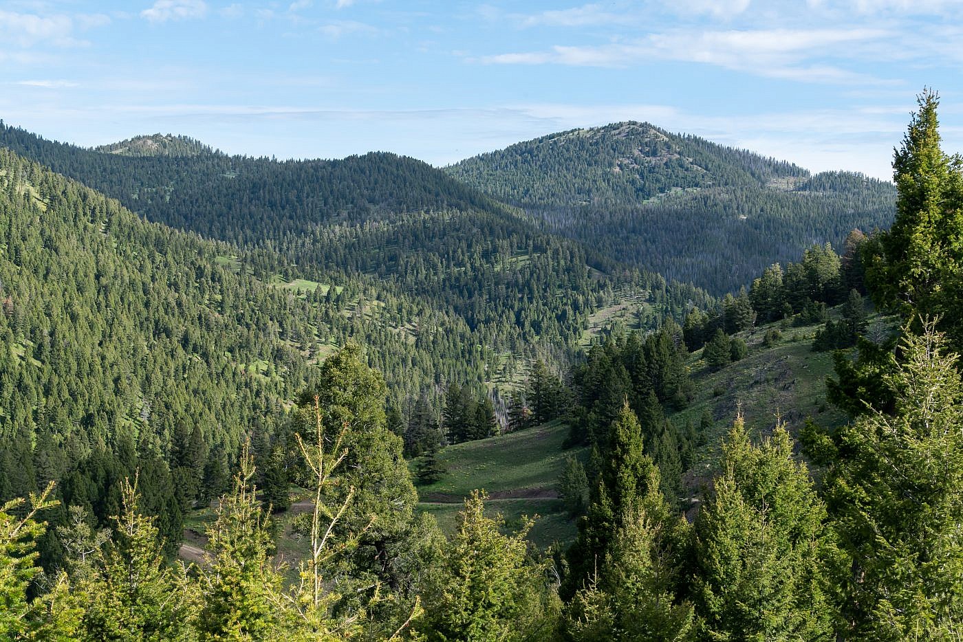
Old Baldy Mountain with the Brock Creek drainage in the foreground.

Trees blocking the road. I parked here which is about a mile from the summit.
On the Trail
From the parking spot continue along the road. After about 1/3 of a mile the forest opens up and you’ll get your first view of Old Baldy. Here the road continues left although my maps show the road continuing straight, through a field, and then along the east side of Old Baldy. You can see the road on the other side of the field but it looks like the BLM has removed the road in between. I continued off-trail through the field until I met back up with the road and followed it to the northern face of the mountain. Here I ditched the road entirely and continued off-trail up the north face all the way to the summit.
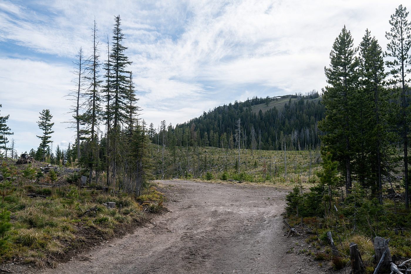
First view of Old Baldy. Here the road continues left but you’ll want to cross the open field to the right and then remerge with the road on the other side of the field.
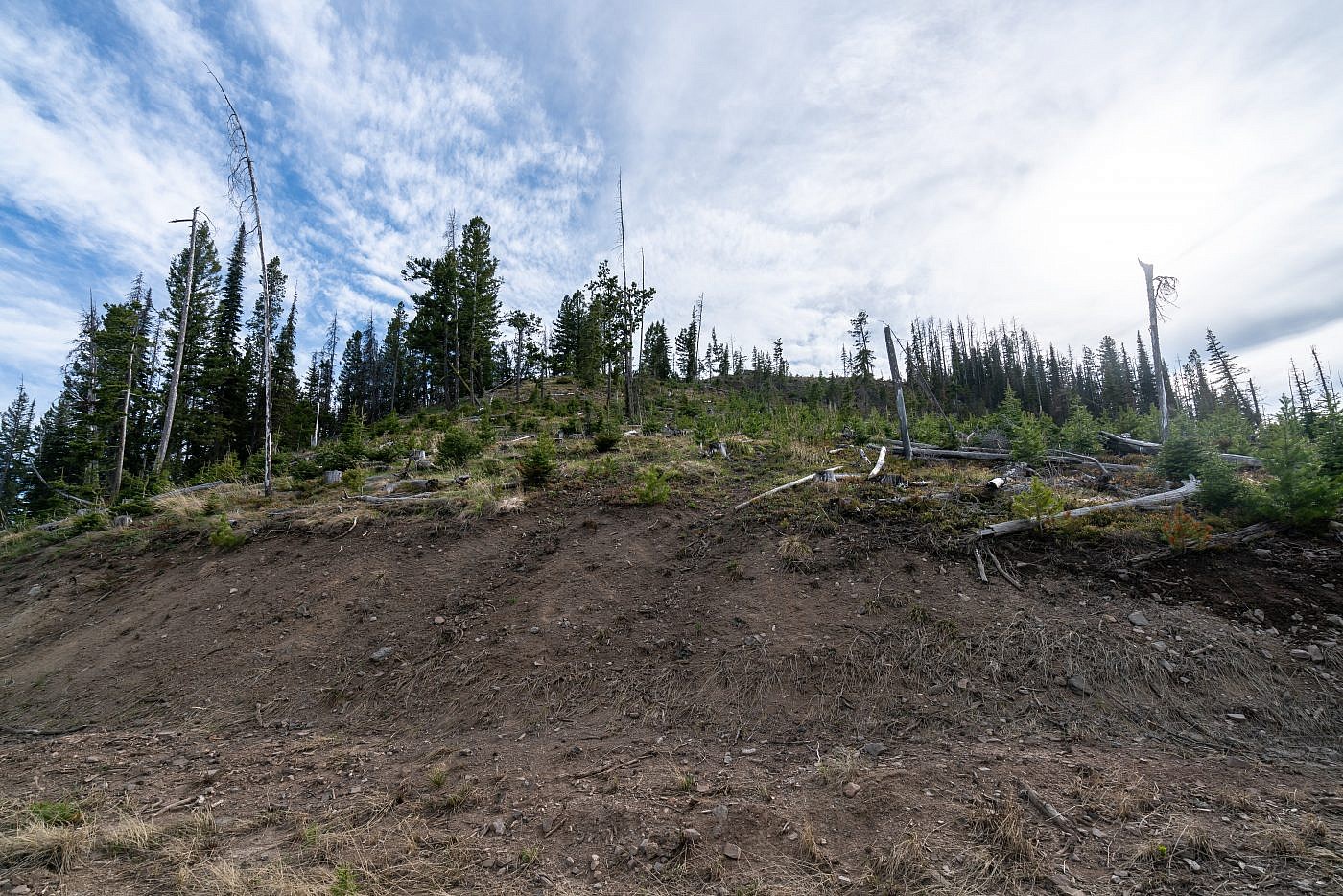
The northern slopes of Old Baldy. This is where I ditched the road and continued up the slopes all the way to the summit.
Old Baldy Mountain
As I took my final steps to the summit I was hit with a wave of intense happiness. I was about to conquer my first official range highpoint of the season and being only early June I was almost a month ahead of schedule compared to the previous year.
The first thing I noticed at the top was the summit register; a small glass container nestled safely in the summit cairn. Excitedly I opened it up, curious to see how many ascents had been made in previous years. Much to my surprise there were only 18 entries dating back to 2012 which is when the register was placed. That’s less than two per year! I’m sure there are some who didn’t register their name but it says something about how few people make it to the top of this thing. I took some time to read through all the entries and when I came to the last page I saw that my rival, Forrest Boughner, had been to the top just last September. “Boughner!”, I thought, “I’m hot on your tail!”. This Boughner character probably has no idea I exist but he has the same goal as me of summiting all of Montana’s range highpoints and I use his blog as a resource from time to time. I had even checked his blog for information on Old Baldy but didn’t find anything meaning he’s further ahead of me than I thought!
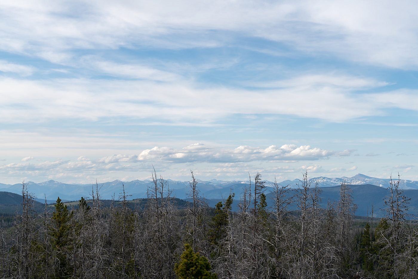
Old Baldy is at the edge of what I consider the “Bozeman area” so the views from the top, to me, offer a unique perspective of the surrounding mountains and I spent almost an hour at the top trying to identify them. After I had my fill I raced back down the mountain and found a gorgeous and peaceful camping spot just a short way down the road.
Looking north from the summit towards the Lewis and Clark Range. Red Mountain, the highpoint, is on the far right.
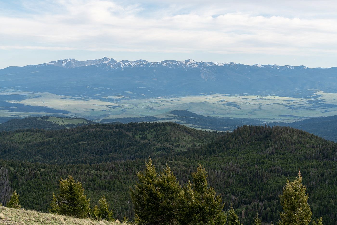
Looking south from the summit towards the Flint Creek Range. Mount Powell, the highpoint which I did last year, is the second peak from the left.
Looking west from the summit. Not entirely sure which range is in the distance but I’m guessing it’s either the John Long Mountains, Sapphires, or Bitterroots.
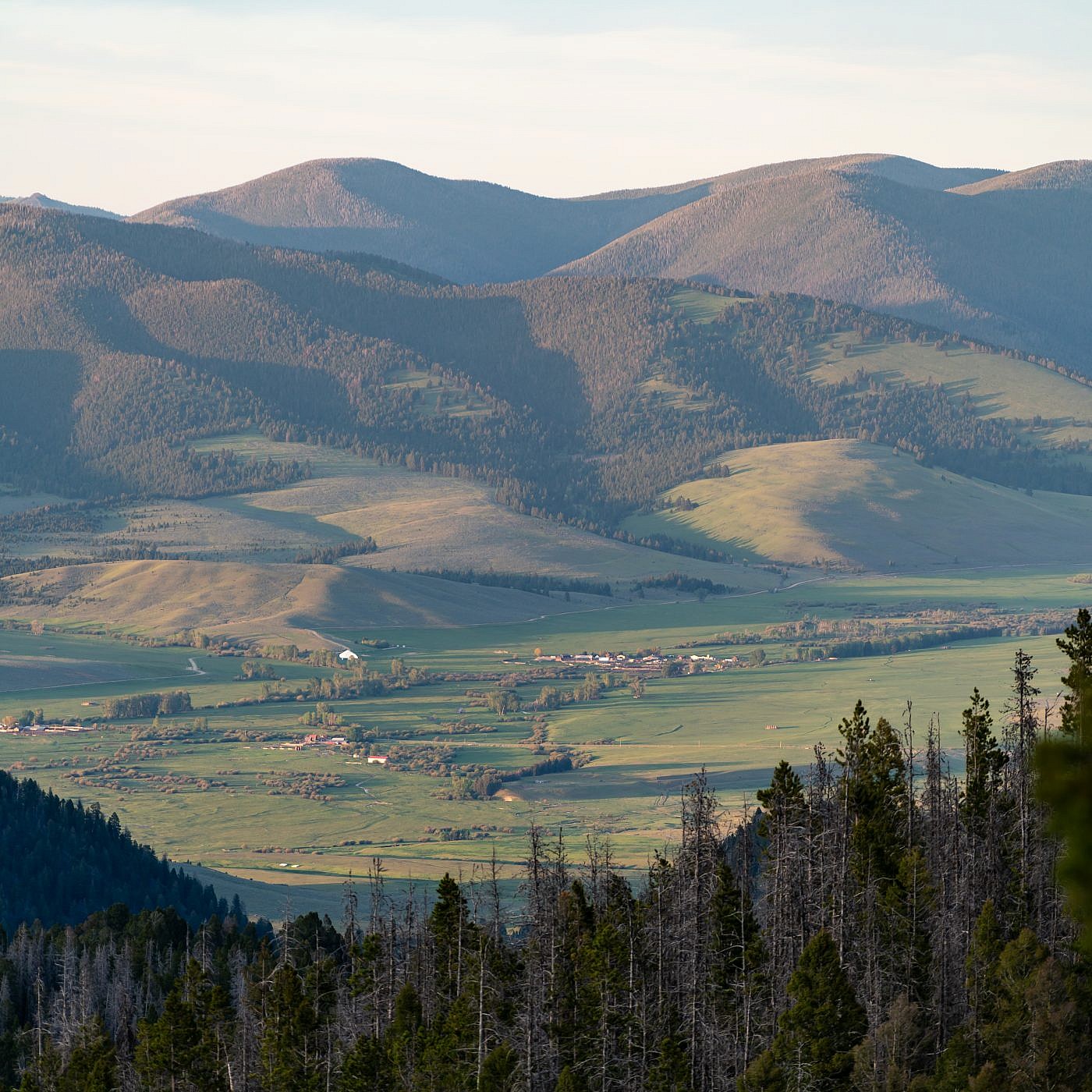
Looking northeast from the summit towards the Nevada Mountains. Avon valley in the foreground.
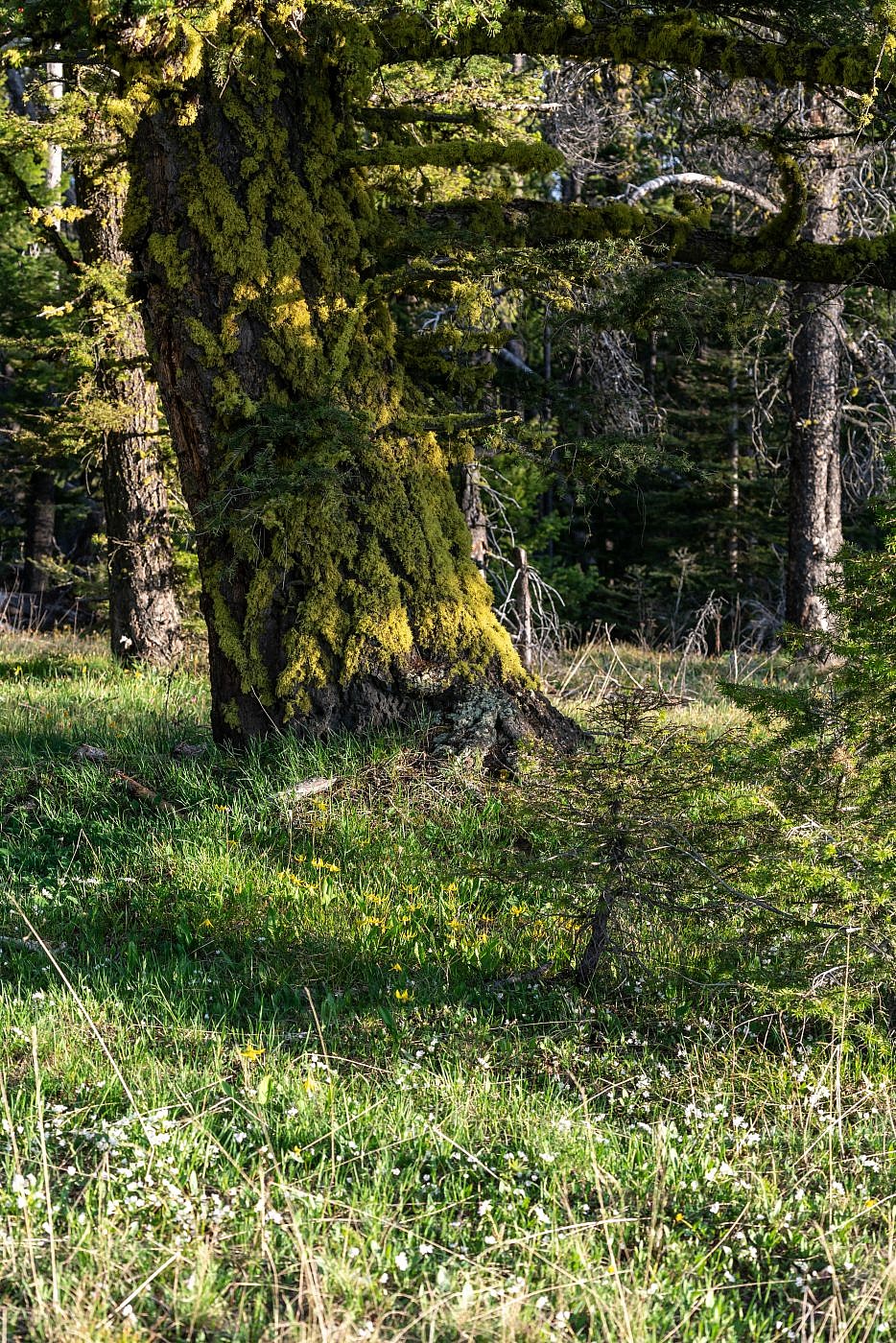
My campsite was surrounded by glacier lilies and these mossy trees which lit up beautifully just before sunset.
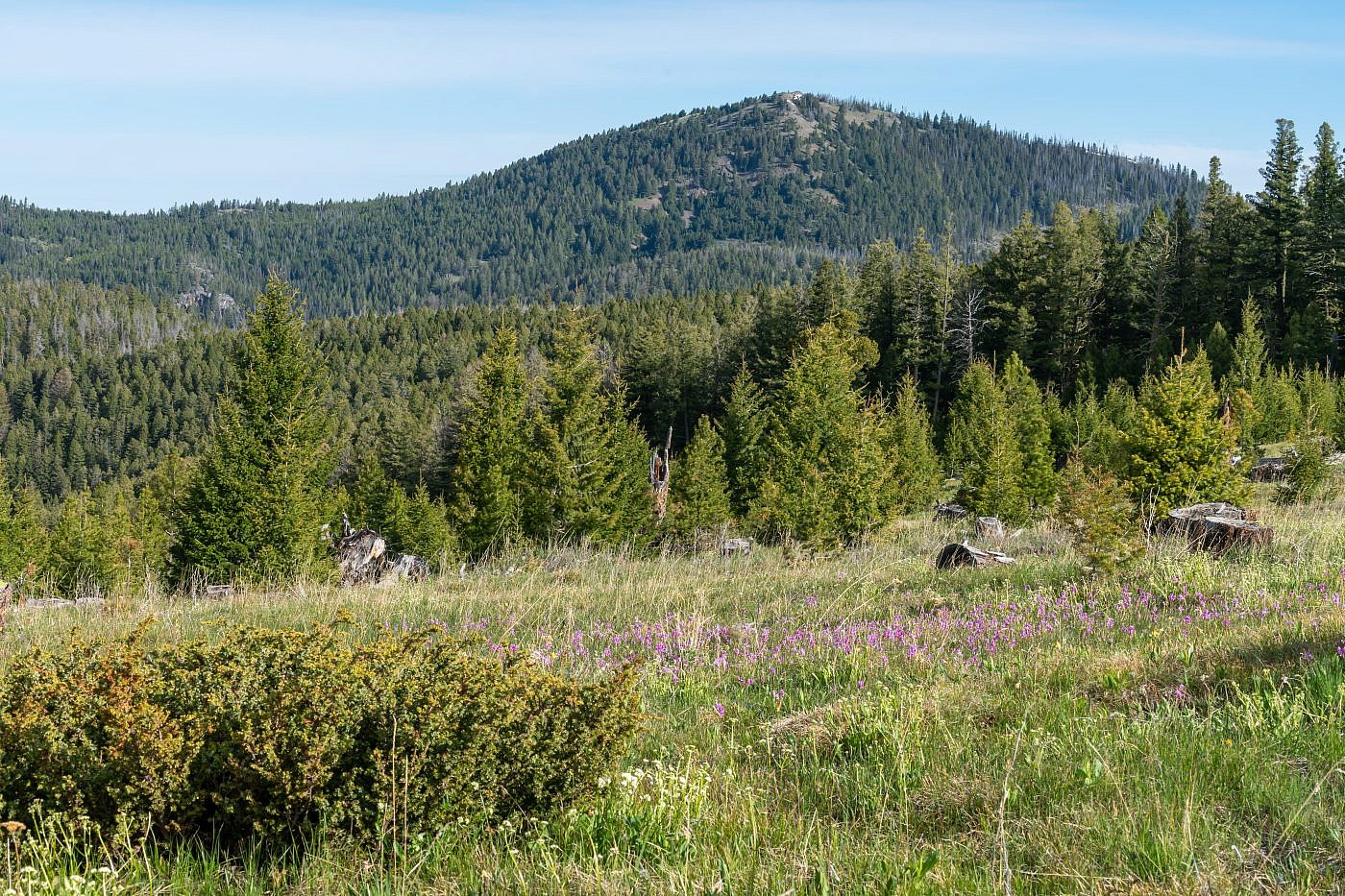
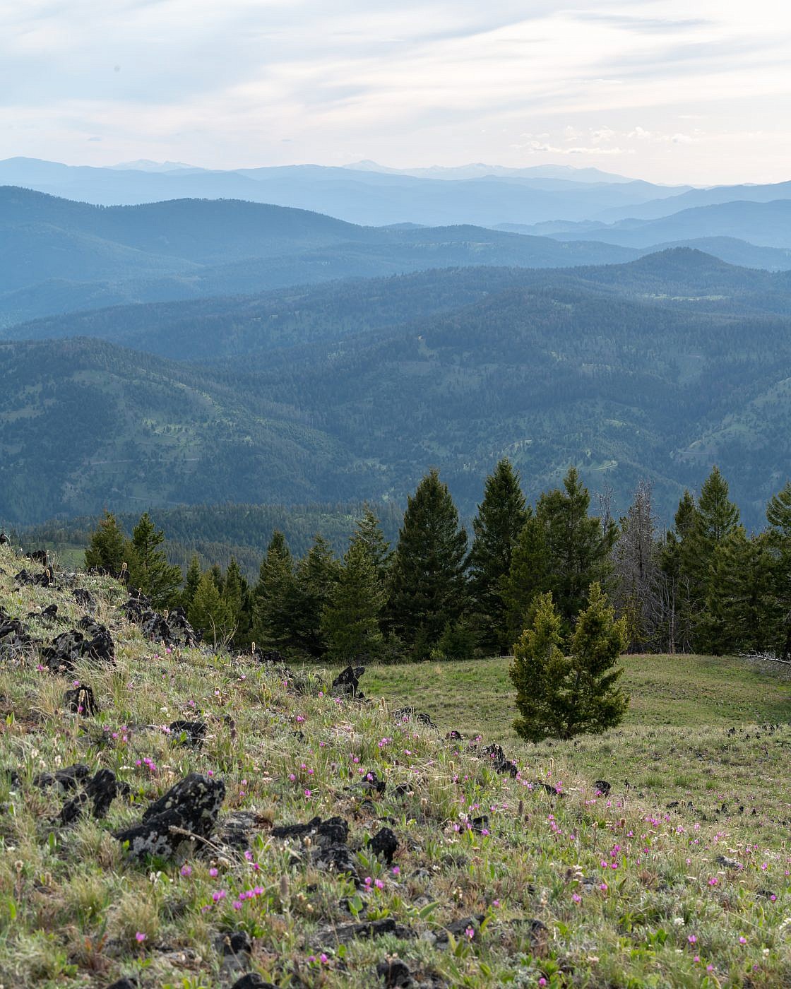
Took a pit stop in this beautiful meadow on the way out to get a shot of Old Baldy. The wildflowers were just out of this world.
Old Baldy Mountain.
