Reservation Divide
Ch-paa-qn Peak
Download KML
Distance
3 miles one way
Type
Day hike
Difficulty
Moderate
- Starting Elevation: 6200 ft.
- Ending Elevation: 7996 ft.
- Elevation Gain: 1796 ft.
 View all 13 photos
- Experience Date: Jun 5, 2020
- Hike Time: 4 hrs.
- Drive Time: 4 hrs.
- Road Condition: Well-maintained dirt road. 2 WD accessible. High-clearance not necessary.
- Parking: Small lot at trailhead.
- Fees: None.
- Campsite Availability: Possible camping near trailhead.
- Private Property: None.
- Trail Traffic: Light.
- Trail Condition: Well-maintained trail with a short off-trail talus scramble at the end. Trail was mostly covered in 2-3 feet of snow when I did it but could easily float over the top of it.
- Fire Restrictions: None.
- Stream Crossings: None.
- Water Sources: None.
- Snow: Lots of snow on trail and some smaller snow fields near the top.
- Winter Access: None.
- Weather: Partly sunny. Pleasant. 70's.
- Bugs: None.
- Wildlife Sighted: None.
- Side Quests: None.

Ch-paa-qn Peak (pronounced “cha pa kwin”) is the highpoint of a long ridge known as Reservation Divide just west of Missoula, MT. Because of its close proximity to Missoula Cha-paa-qn is somewhat of an icon of the area, being one of the tallest peaks around, and is a popular hike for locals. It’s a relatively simple, no-nonsense hike which follows the Reservation Divide trail west through the forest followed by a short, off-trail talus scramble up Ch-paa-qn’s southern flank. Getting to the trailhead requires a long and tedious drive from the interstate but the roads are in decent shape. There is a second, comparable route which comes in from the west along the Sleeping Woman Trail but there are conflicting reports on the condition of the trail.
Ch-paa-qn Peak (“shining peak”).
Background
Up until recently the mountains around Missoula, MT never really sparked my interest. Having only been to Missoula a handful of times over the years all I ever really saw of them was what could be seen from the town itself and unlike Bozeman and Butte, which are virtually surrounded by jagged, snow-cappped peaks, the mountains around Missoula appear unimpressive and frankly kind of boring. But hidden behind all those boring foothills are some of the most impressive mountains Montana has to offer, you just have to know where to look.
One of the few mountains that can be seen from Missoula that peaks above the treeline is Ch-paa-qn Peak (a Salish word meaning “shining peak” and pronounced “cha pa kwin”). Ch-paa-qn Peak (7,996′) is the highpoint of a long, unglaciated ridge located northwest of Missoula known as Reservation Divide and is a popular hike for locals. There is some controversy as to what mountain range the peak actually lies within. I’ve heard it’s technically part of the Coeur d’Alene Mountains but the consensus seems to be that it’s not really part of any other mountain range and that the Reservation Divide is in itself its own range.
Although Ch-paa-qn Peak rises a staggering 5,000′ above the valley floor, getting to its summit is surprisingly simple. There are two comparable routes to the summit and both start around 6,000′. The simplest and most popular route starts from the southeast at the trailhead for Reservation Divide Trail #98. The trail starts by climbing steadily through the forest followed by a short talus scramble up the mountain’s south facing slopes. The second route starts from the southwest and follows Sleeping Woman Trail #707. According to the Summit Post write-up, as of 2015 there are many downed trees and hiking this trail is not advisable.
The Adventure Begins…
My day began in the Garnet Range near the “trailhead” for Old Baldy Mountain (the highpoint) which I had done the previous day. I wanted to sneak in another easy-ish peak since it looked like rain the next couple days so on my way back to I-90, a painstaking 2.5 hr. drive, I had plenty of time to contemplate my next move. Being early June my options were still quite limited by the snow and I didn’t want to spend endless hours on tedious mountain roads so I eventually settled on Ch-paa-qn Peak, the highpoint of Reservation Divide just northwest of Missoula, MT. This was a peak I knew nothing about or had even laid eyes on so all I had to go off of was Cedron Jones’ information in “Peakbagging Montana” and a few quick Google searches.
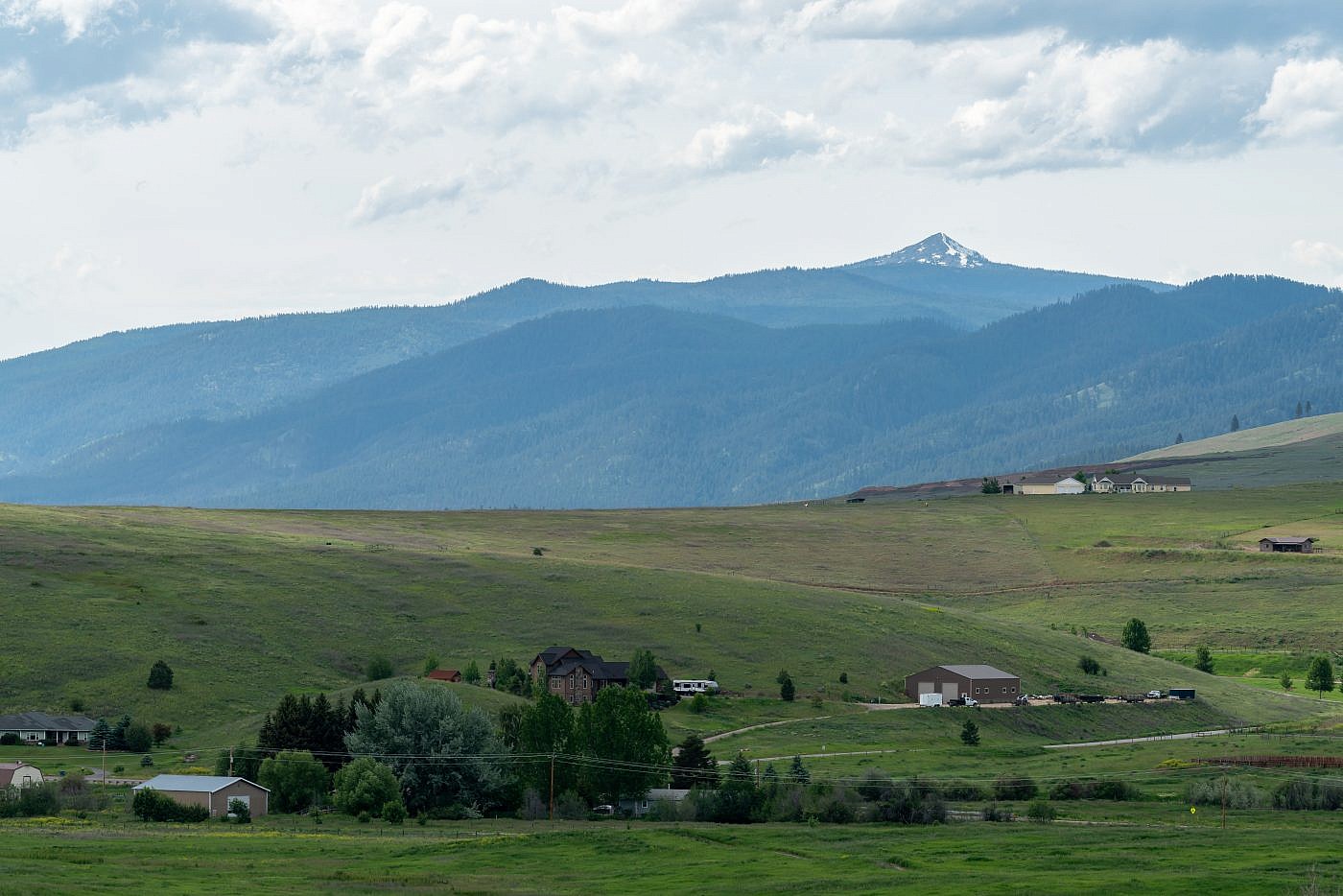
As I rolled in to Missoula I gazed excitedly towards the horizon hoping to get a glimpse of this mysterious peak and sure enough there it was. It’s clearly visible from I-90 and I wondered how I’d never noticed it before. Regardless, the summit looked almost entirely snow free so I figured the trail would be as well and made the decision to commit.
Ch-paa-qn Peak as seen from the Missoula area near I-90.
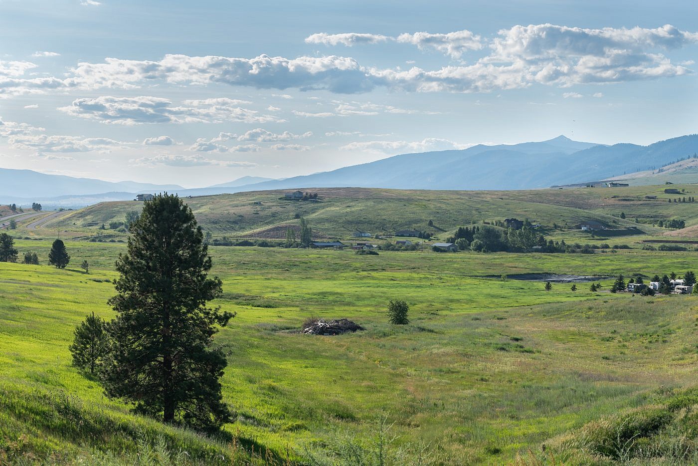
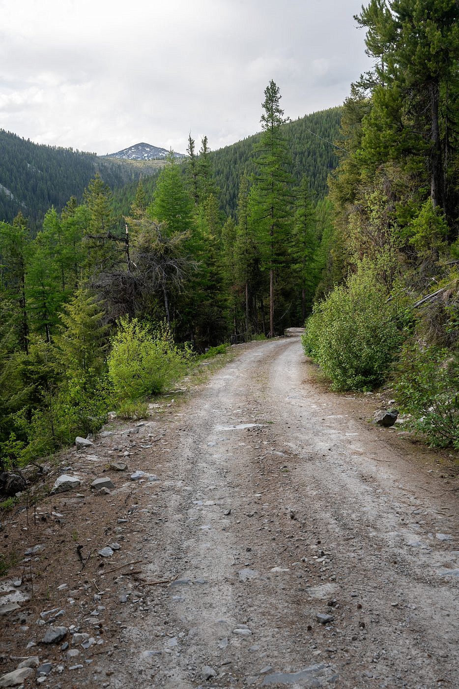
Getting to the trailhead is simple if you know where to go but does take about an hour of driving time from the interstate. From I-90 take exit 82 and follow the frontage road for a short distance until you see a Y and a sign for the historic Ninemile Ranger Station. Take a right at the Y and follow Remount Road for about 2.5 miles to an intersection at the location of the Ninemile Ranger Station. Continue through the intersection onto Edith Peak Road and follow it for another 1.5 miles until another Y. Go right at the Y (still Edith Peak Road) and continue another 8.5 miles up the mountains to the Reservation Divide trailhead on the left. The road is in descent shape and I had no trouble getting there in my Outback although there were a couple muddy sections from the spring runoff. Going left at the final Y and following FS Road #5490 will get you to the trailhead for the 2nd route.
View of Ch-paa-qn from Edith Peak Road.
On the Trail
As much as I enjoy my mountain solitude I was relieved to see a couple other cars at the trailhead. This gave me hope that the trail was indeed passable and it’s nice to know that there are other people around while traveling through bear country. The actual trail is just beyond the parking lot and labeled as “Reservation Divide Trail #98”.
As I embarked on my journey I quickly realized the trail was not going to be as simple as I thought. Not only was I encountering a descent amount of deadfall along the trail but the the amount of snow was increasing exponentially just within the first section. It wasn’t long before I caught up to a group of hikers who’d set out about 10 minutes before me and were trying to navigate through the snow surrounding the trail which was now a full-blown creek. I tailed them for a bit until encountering a father with two young kids who said they had to turn around because it got too swampy. Just great, I thought, I drove for over an hour on some tedious mountain road which I vowed not to do earlier in the day and now might be forced to turn around. This was simply not an option so I pushed onward, eventually overtaking the other group, and made it through the swampy section and back on to the now almost completely snow-covered trail.
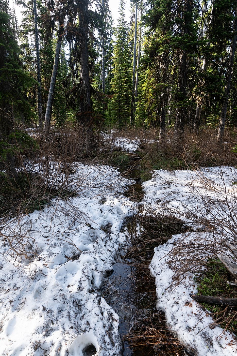
The trail turned into a full-blown creek for a short distance at the start.
For some reason the mountains were on my side this day and although the trail was now completely covered in snow it was cohesive enough that I could easily float over the top even without snowshoes. There had to have been at least 3-4 feet of snow I was walking over though and I started to become increasingly nervous about the return journey. I knew that snow tends to lose its integrity as the temperature warms throughout the day and feared that I may be post-holing the entire way back which would add some serious misery to the hike. I tried not to think about this though so I continued along the trail which was starting to become harder and harder to follow. Luckily someone else had been there recently so I was able to follow their footsteps.
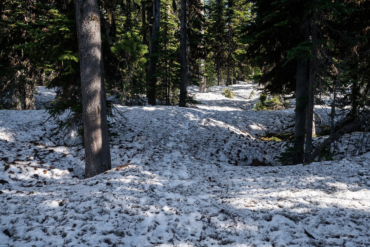
The whole area was completely covered with snow making the trail difficult to follow. Luckily the snow was cohesive enough to float over and there were even some fresh tracks in the snow that I could follow.
About 2.5 miles in I made it to the southern face of the mountain and started to consider where I should leave the trail and start the final scramble. Rumor has it there’s a climber’s trail that branches from the main trail but there was no way I’d have been able to find that with all the snow so when it became convenient I ditched the trail and started heading up. There’s a small section through the trees which was still quite snowy but once I made it above the treeline it was a relatively snow-free and simple talus scramble all the way to the top.
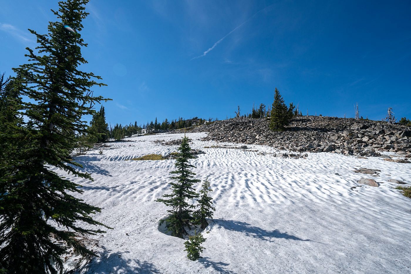
The final ascent.
Ch-paa-qn Peak
The views from the top offer a unique perspective of the Missoula area especially for a Bozemanite unfamiliar with some of the surrounding terrain. I think my favorite view was of the Missions, one of the gnarliest looking ranges in the area. If you look close you can actually see both Mission and Elizabeth Falls cascading through the mountains. I visited Mission Falls last year and it is easily one of the most impressive waterfalls I’ve ever seen. It is on the Flathead Indian Reservation so you’ll need a tribal recreation permit (easy to obtain) to recreate there.
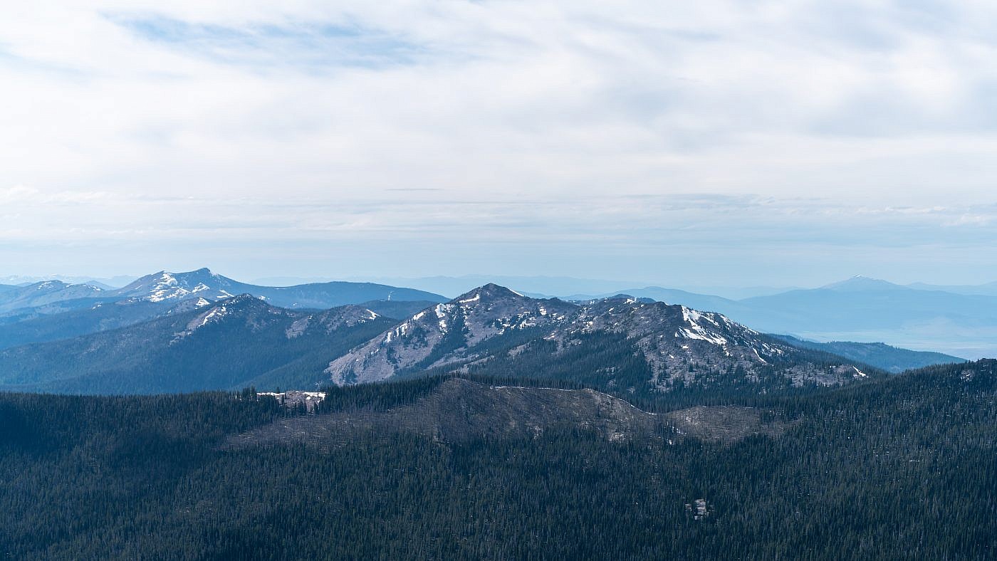
Looking northwest along the rest of Reservation Divide.
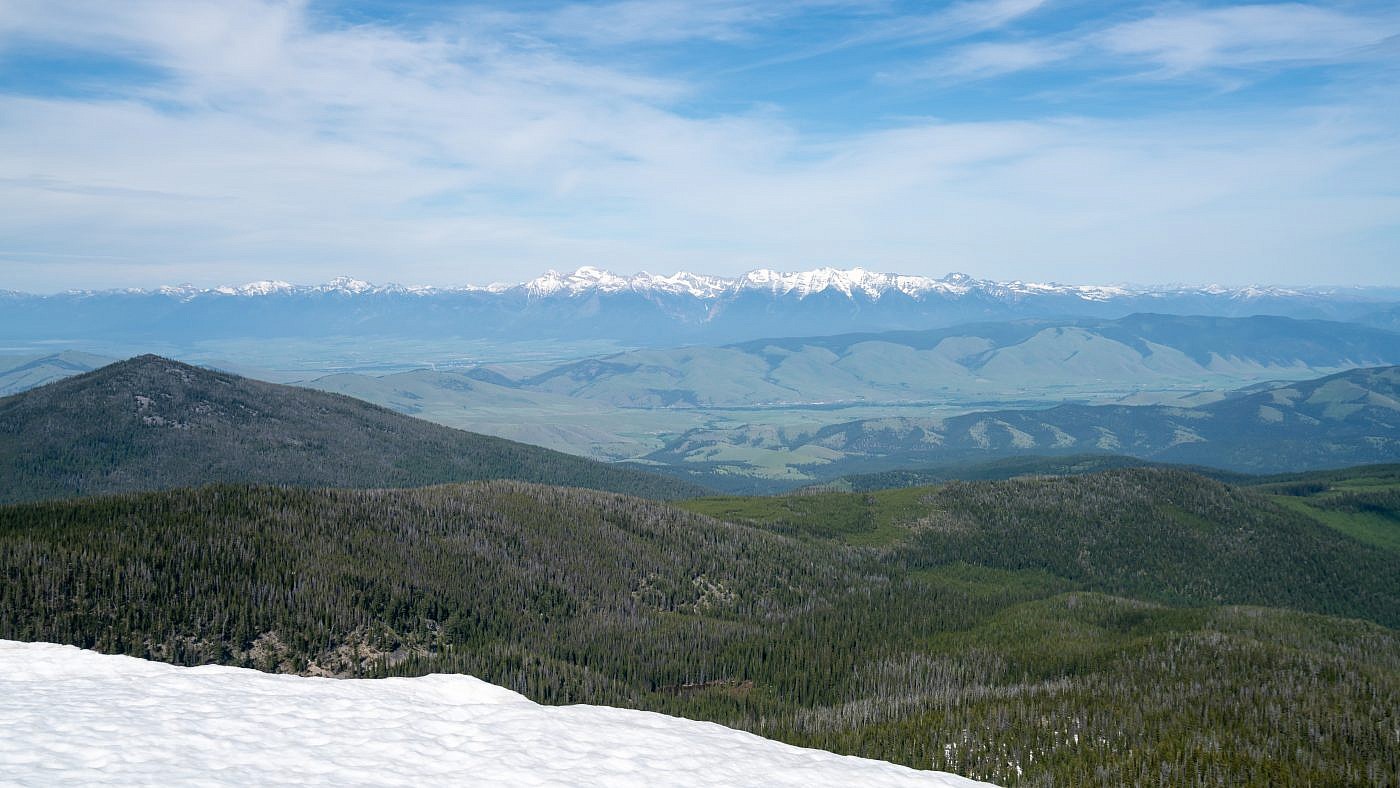
Looking east towards the Mission Mountains.
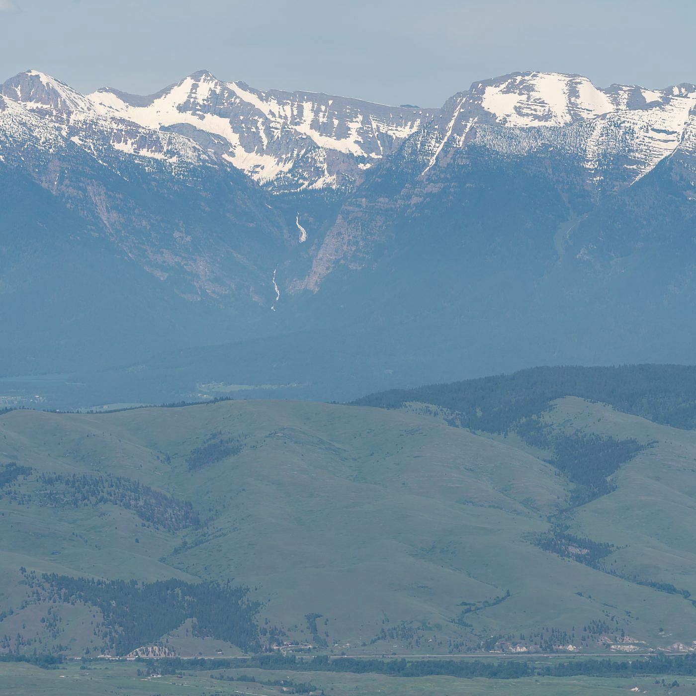
Closeup of Mission Falls (bottom) and Elizabeth Falls (top) in the Mission Mountains.
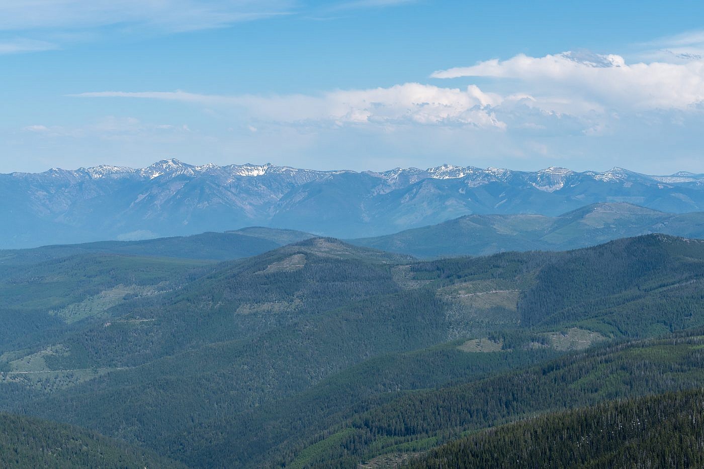
Looking east towards the Rattlesnake Mountains, a range I have yet to visit.
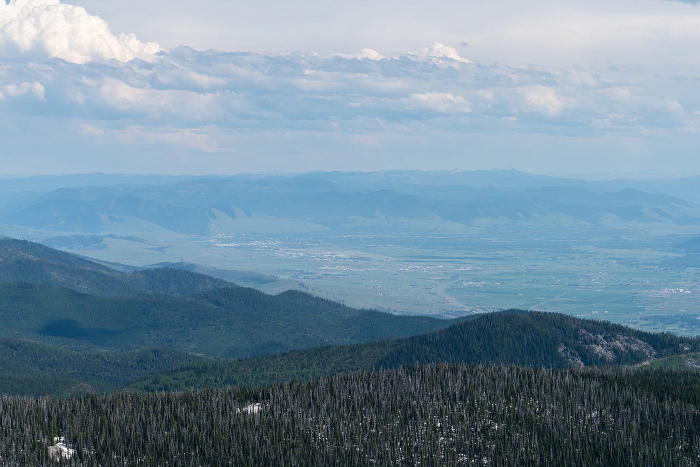
Looking southeast towards Missoula.
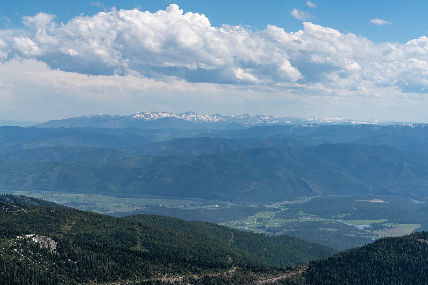
Looking south towards the Bitteroots.
The Return
The return went smoothly and I was grateful that the snow was still strong enough to support my weight. I did wonder whatever happened to the group I encountered on the way up. I’d heard them behind me around the time I left the main trail but didn’t see or hear them at all on my way back down and their car was still in the lot when I got back. My guess is that they didn’t know they were supposed to leave the main trail and just blindly kept on hiking.
Planning to stay in the area to do some more exploring over the next couple days and tired from all the hiking and driving I wanted to find a nearby campground to crash at. I ended up at the Quartz Flat Campground just 20 miles further down I-90. Although it’s right alongside the interstate there were plenty of spots open and it was surprisingly peaceful being nestled right up against the Clark Fork River.
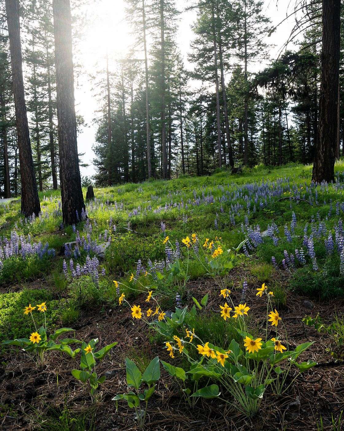
A gorgeous field of arrowleaf balsamroot and silver lupine along the road on my way out.
