Tobacco Root Mountains
Leggat Mountain
Download KML
Distance
2.75 miles one way
Type
Day hike
Difficulty
Moderate
- Starting Elevation: 8750 ft.
- Ending Elevation: 10216 ft.
- Elevation Gain: 1466 ft.
 View all 26 photos
- Experience Date: Oct 3, 2019
- Hike Time: 3-4 hrs.
- Drive Time: 2 hrs.
- Road Condition: Well-maintained dirt road. 2 WD accessible. High-clearance not necessary.
- Parking: Plenty of parking.
- Fees: None.
- Campsite Availability: Branham Lakes Campground near trailhead.
- Private Property: None posted.
- Trail Traffic: None.
- Trail Condition: Well maintained trail up to saddle followed by off-trail travel and then a steep class 3 scramble near the summit.
- Fire Restrictions: None.
- Stream Crossings: None.
- Water Sources: Branham Lakes. Gneiss Lake. Creek paralleling trail before saddle.
- Snow: Fresh layer of snow over everything. Possibly first snowfall of the year.
- Winter Access: Unknown.
- Weather: Partly cloudy. Cold. 30's-40's.
- Bugs: None.
- Wildlife Sighted: Bear tracks in the fresh snow.
- Side Quests: Many trails to explore in the Branham Lakes area. Thompson Peak is a simple side quest.

Leggat Mountain (10,216′) is an almost unheard of peak near the Branham Lakes Campground located deep within the Tobacco Root Mountains. It starts with a short climb up to a saddle, followed by a short off-trail section over to Gneiss Lake, and then a steep scramble up Leggat’s northeast ridge up to the summit. There is a very steep class 3 section just below the summit but other than that it’s a very pleasant hike. There are many other peaks in the area that could be done from a base camp at the campground. These include Thompson Peak, Lady of the Lake Peak, Mount Bradley, or any of the numerous unnamed peaks nearby. The road to the campground is long and tedious but should be accessible by most vehicles.
Leggat Mountain.
Background
The Branham Lakes area of of the Tobacco Roots is probably my favorite spot in the entire mountain range. I first discovered it when I came upon this article from Outside Bozeman while researching peakbagging options. The article describes an off-trail route up Lady of the Lake Peak (10,218′) near the Branham Lakes Campground. I hadn’t realized there was a campground buried so deep within the range and at such a high elevation so I pulled out my Beartooth Publishing map to investigate the area in more detail. Upon inspection I discovered a plethora of new hiking options and peaks within the area and decided I had to check it out. I made my first trek there in September of 2018 and was blown away. I managed to summit both Lady of the Lake Peak and nearby Thompson Peak (10,386′) on back-to-back days but felt I’d only scratched the surface of what the area had to offer.
View of the Branham Lakes Basin on my way up Lady of the Lake Peak in 2018.
By the time October 2019 rolled around peakbagging season was nearing its end. I’d managed to bag eight peaks in the month of September alone and I was, for the most part, satisfied with my accomplishments. I was saddened, however, when the first snowfall came on the first day of October and realized that I’d have to wait a whole nine months for peakbagging season to return. This prompted me to make one last deep journey into the mountains and what better spot to visit than the Branham Lakes Campground?
I didn’t really have a definite plan for this trip, I just wanted to go to the lake and immerse myself in nature. The campground was almost completely deserted when I was there in September of the previous year so I figured it’d be totally deserted in October and I’d be guaranteed some real mountain solitude. The only goal I had in mind was getting to Gneiss Lake which sits below Leggat Mountain (10,216′) just south of Thompson Peak across the Thompson Reservoir drainage. It looked like a fairly straightforward hike to the lake. The first section follows trail #6015 from Upper Branham Lake to a saddle about 1.5 miles in. I had done this part the previous year so knew what to expect. From the saddle it looked like just a simple off-trail jaunt over to the lake and, if I was feeling it, Leggat Mountain didn’t look out of the realm of possibility. I’d like add that there is some discrepancy as to which of the two mountains above Gneiss Lake is actually Leggat Mountain. My Beartooth Publishing map indicates the mountain farther west is Leggat so that’s what I’ll call it.
View south from the summit of Thompson Peak on my first trip to Branham Lakes Campground. Leggat Mountain (10,216′) in the center, Gneiss Lake just below it on the right, and Thompson Reservoir (mostly dry) on the bottom right.
The Adventure Begins…
I took off from Bozeman on a Wednesday afternoon hoping to get to the campground in time to hike up to the saddle above Branham Lakes and maybe photograph the sunset from up there. I was a little nervous about the road leading to the campground because of some fresh snow that had fallen the night before but luckily most it had melted by the time I got there and the drive went smoothly. The lakes and surrounding mountains looked gorgeous with the light sprinkling of snow and I knew there was going to be some unique photo opportunities which was perfect since I’d just replaced my Canon SL1 with a Sony A7R2 and wanted to test it out. To get to the campground simply follow Mill Creek Road east out of Sheridan, MT for 13 miles. It’s long, tedious, and windy but surprisingly smooth aside from a few rough patches here and there and should be passable by most vehicles
Lower Branham Lake with Branham Peaks in the background on the right. From what I’ve read the scramble up to Branham Peaks from the saddle is not simple and may require some technical climbing skills. A fun side quest would be to follow the ridge in front of Branham Peaks up to the highpoint on the center left and then descend to the saddle on the far left.
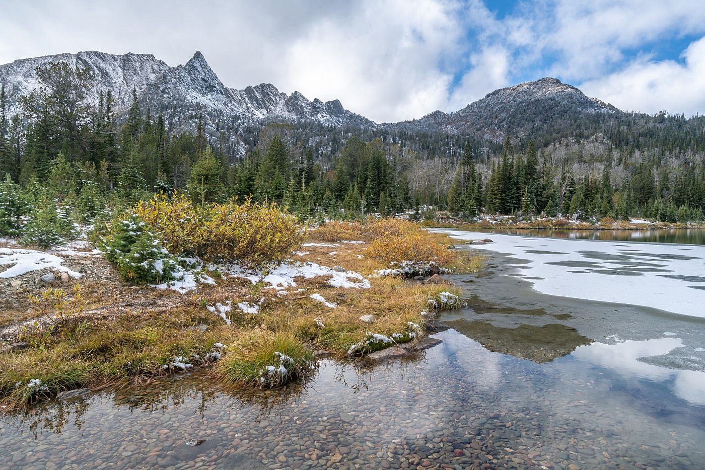
Looking west along the shores of Lower Branham Lake. Gneiss Lake is on the other side of the saddle.
On the Trail Part 1
As expected I was the only person at the campground so I was able to choose a prime camping location. Evening was approaching quick though so I hastily geared up and set out for the saddle. The trail starts out climbing steadily, then flattens for a bit as you pass through some beautiful subalpine meadows, and finishes with a steep climb up to the saddle. There was just enough snow to make the scenery pop but not impede my travel which is a situation you don’t encounter very often.
A small creek parallels the trail as you pass through beautiful subalpine meadows on the way to the saddle.
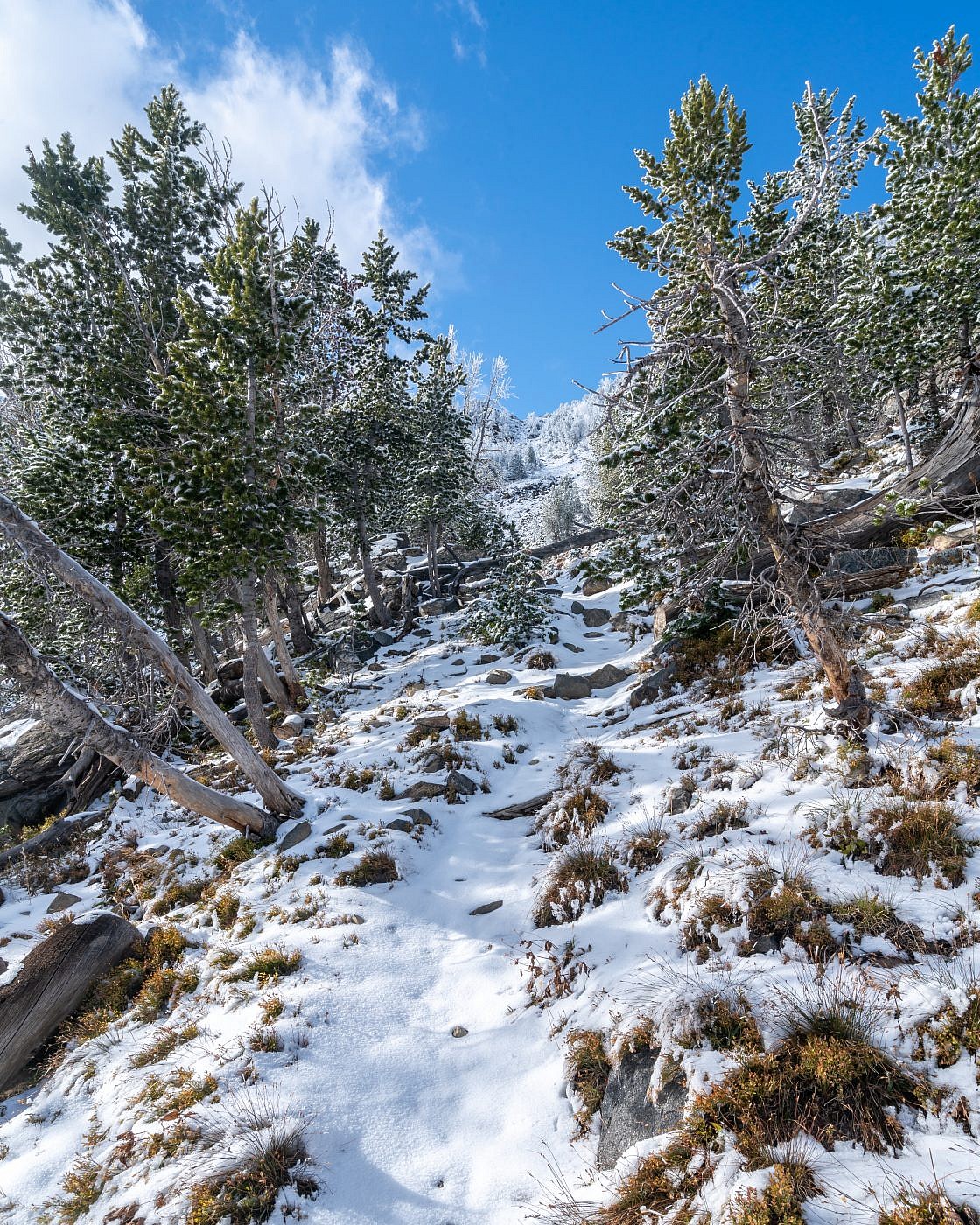
Climbing up to the saddle.
The Saddle
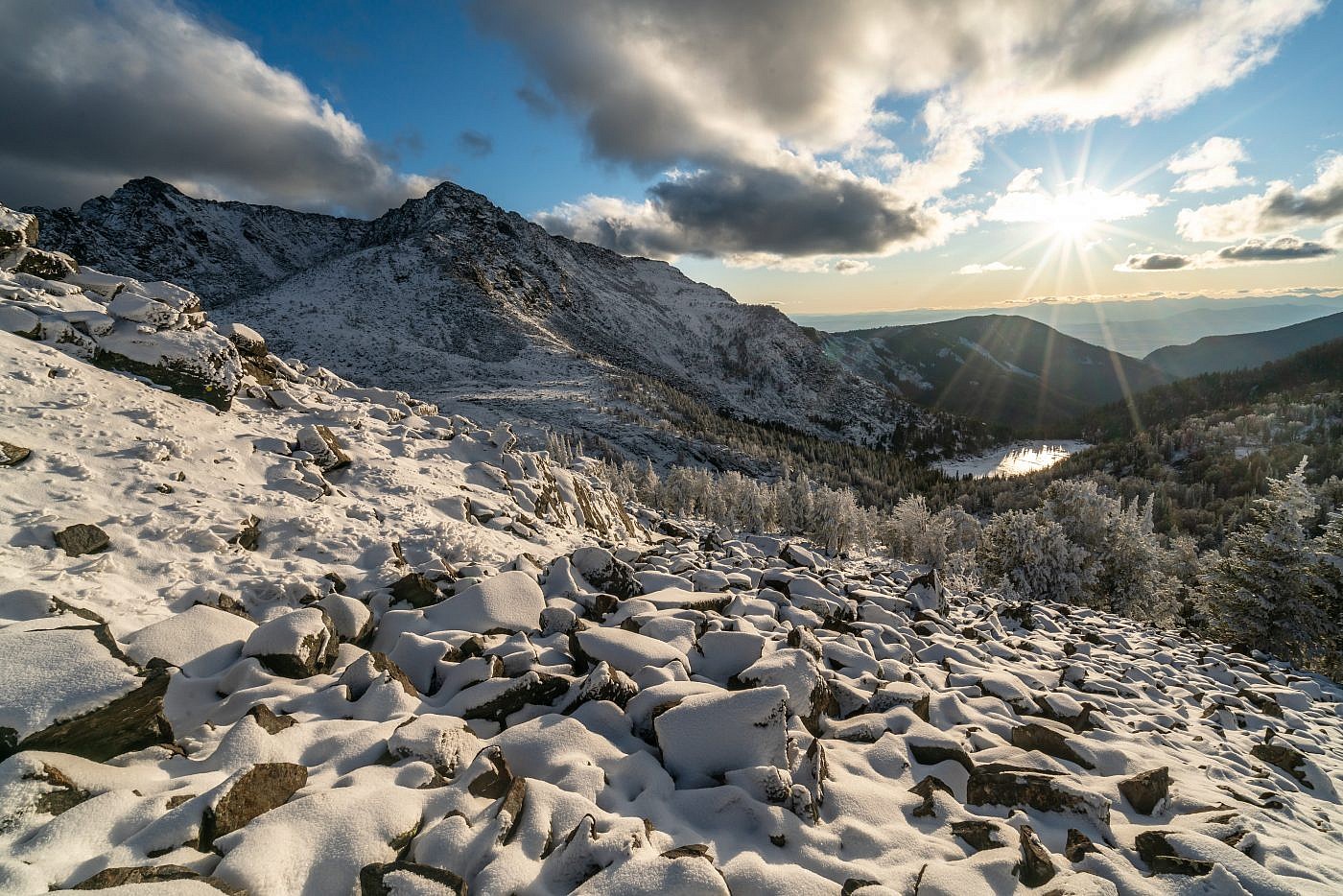
Once at the saddle I just wandered around for a bit absorbing the wonders of mother nature. The scenery was indescribably beautiful and although the snow was deeper you could still easily move around through it. I still had a descent amount of time before sunset so I decided to head south along the edge of the saddle to scope out a route to Gneiss Lake and maybe even try to get there. This route quickly gets rocky and with the added danger from the snow I made the call to turn back and try again in the morning. I spent the remainder of the evening up on the saddle taking photographs and after sunset made the dark and somewhat frightening journey back to camp where I settled in for a relaxing, although cold, night around the fire.
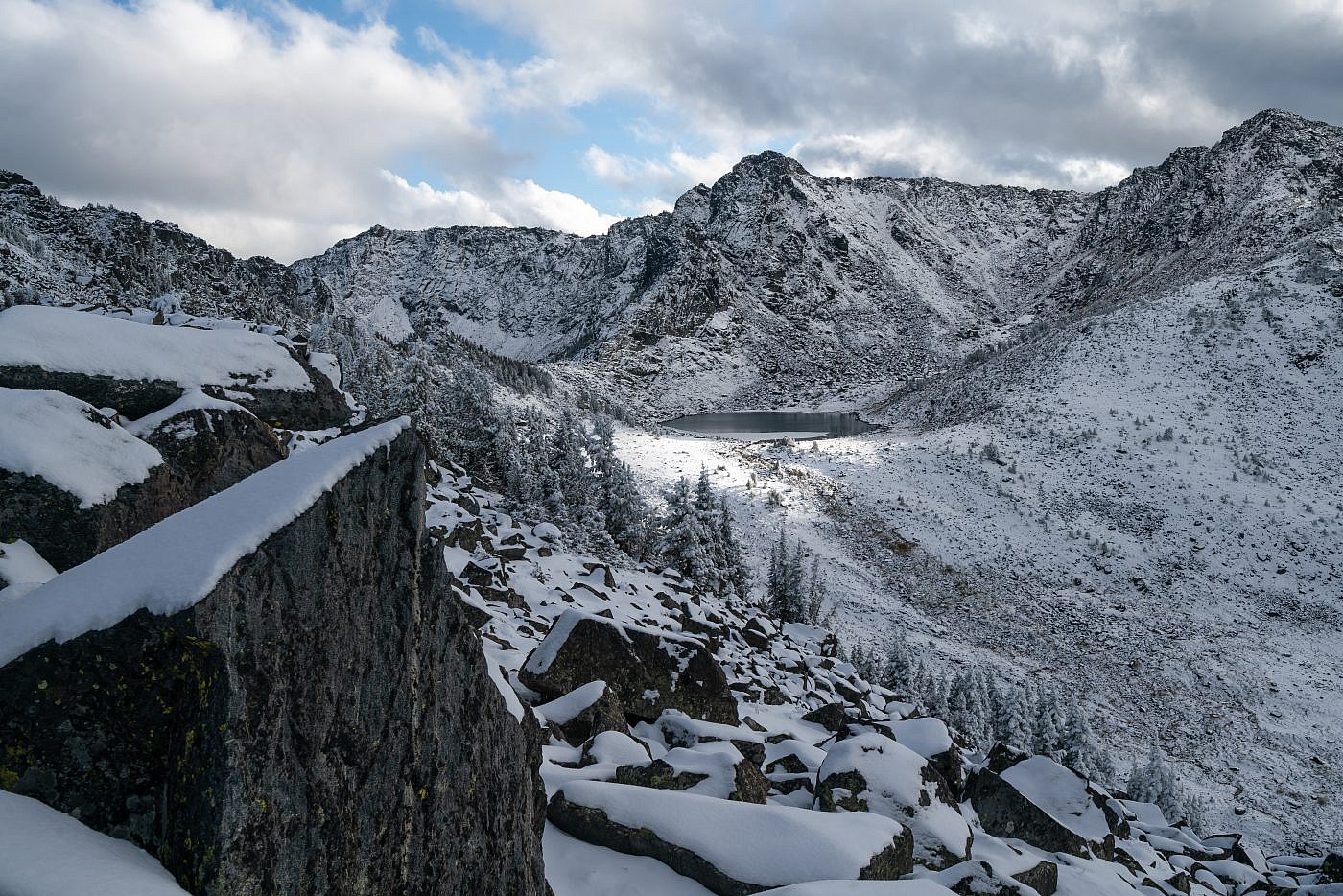
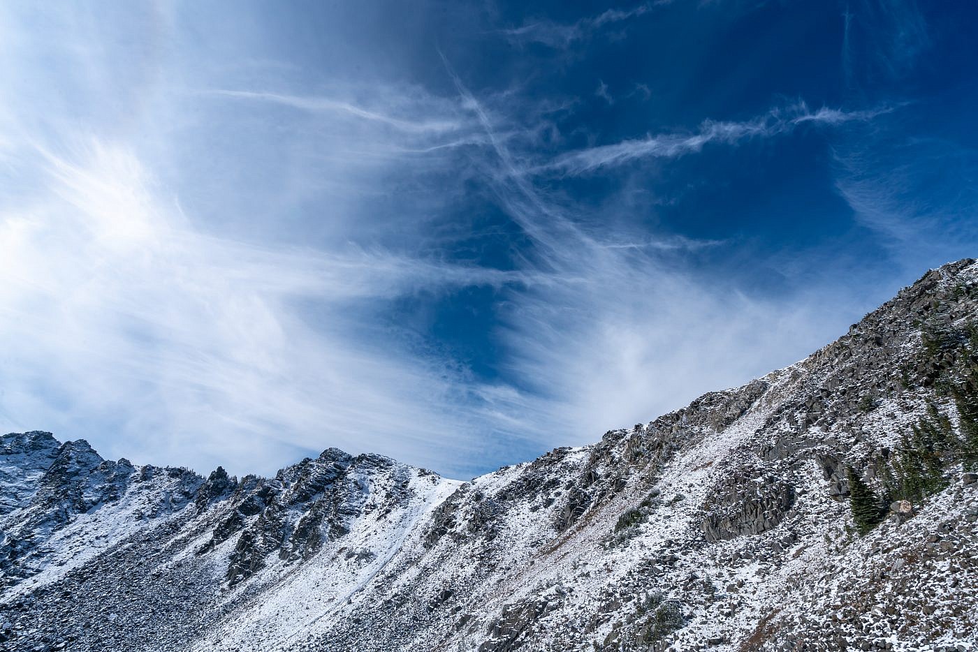
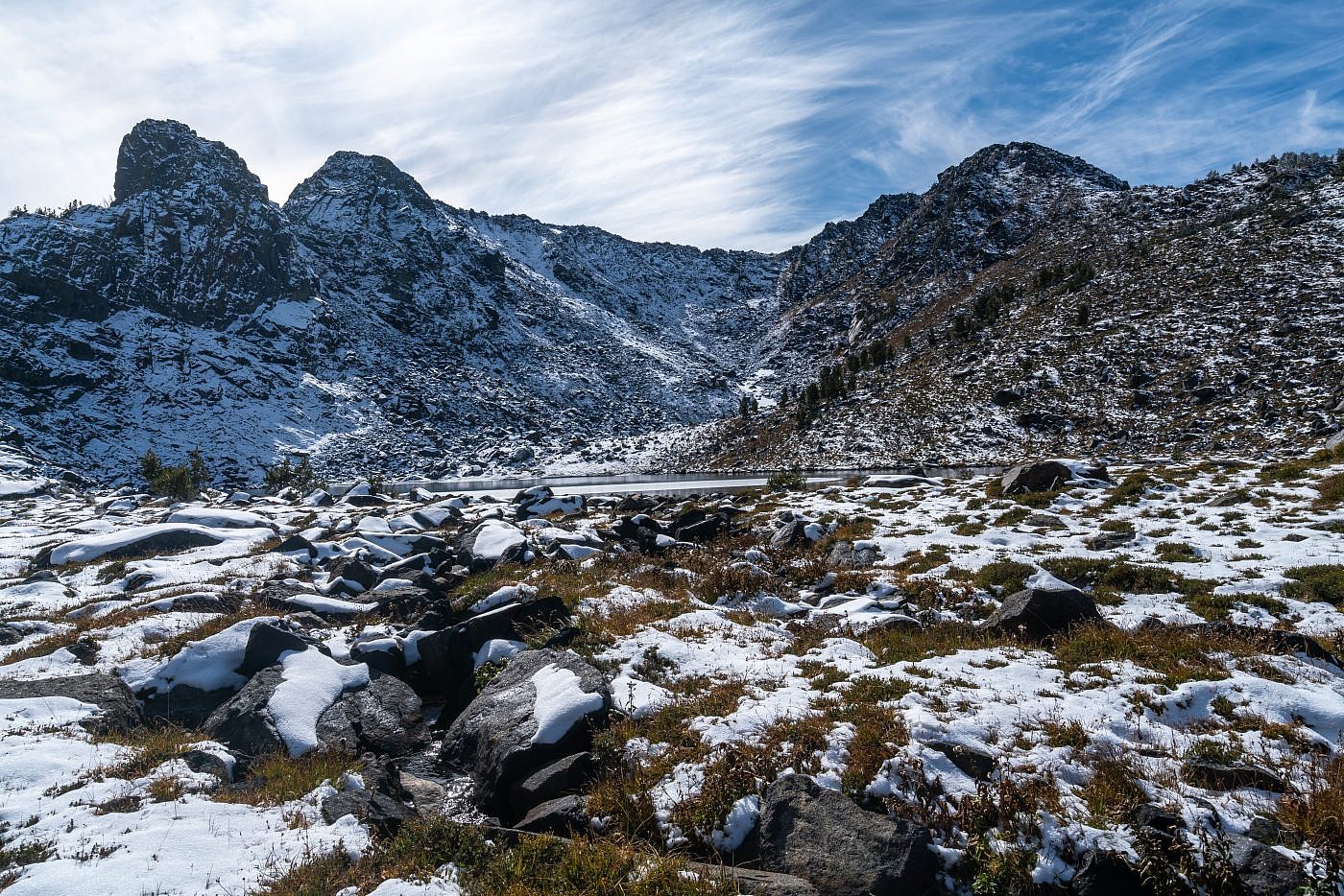
Working my way south along the rocky saddle. Gneiss Lake is being lit up beautifully by a small hole in the clouds. Leggat Mountain on the far right.
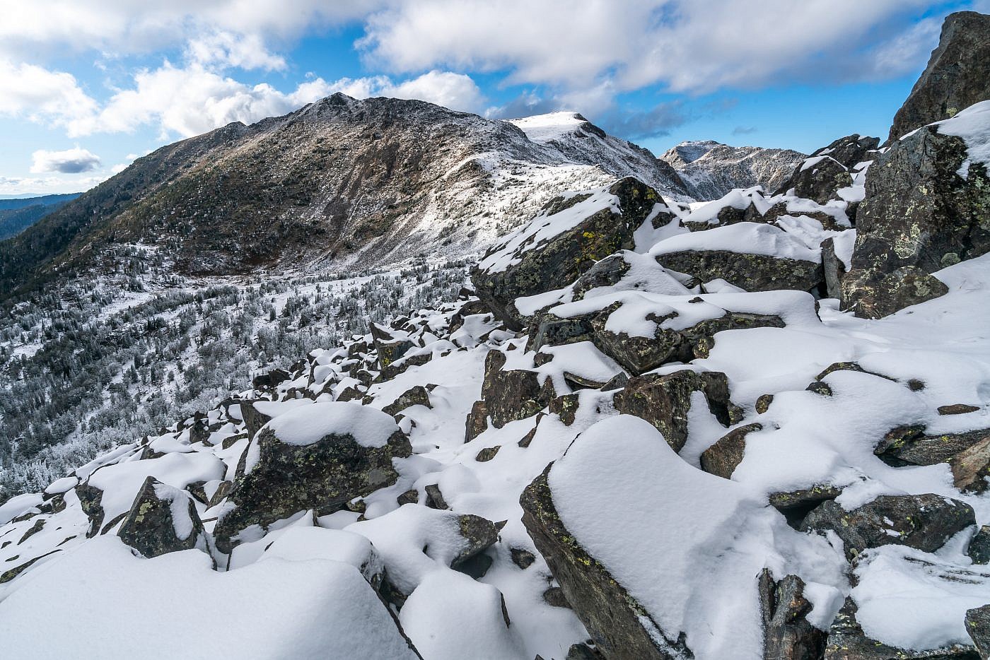
Looking back towards Thompason Peak while working my way south along the saddle. Around this point it got to be too rocky so I turned around. I decided it’d be easier to descend the saddle a bit into the drainage and then head south to avoid this rocky section.
Looking west along the Thompson Reservoir drainage.
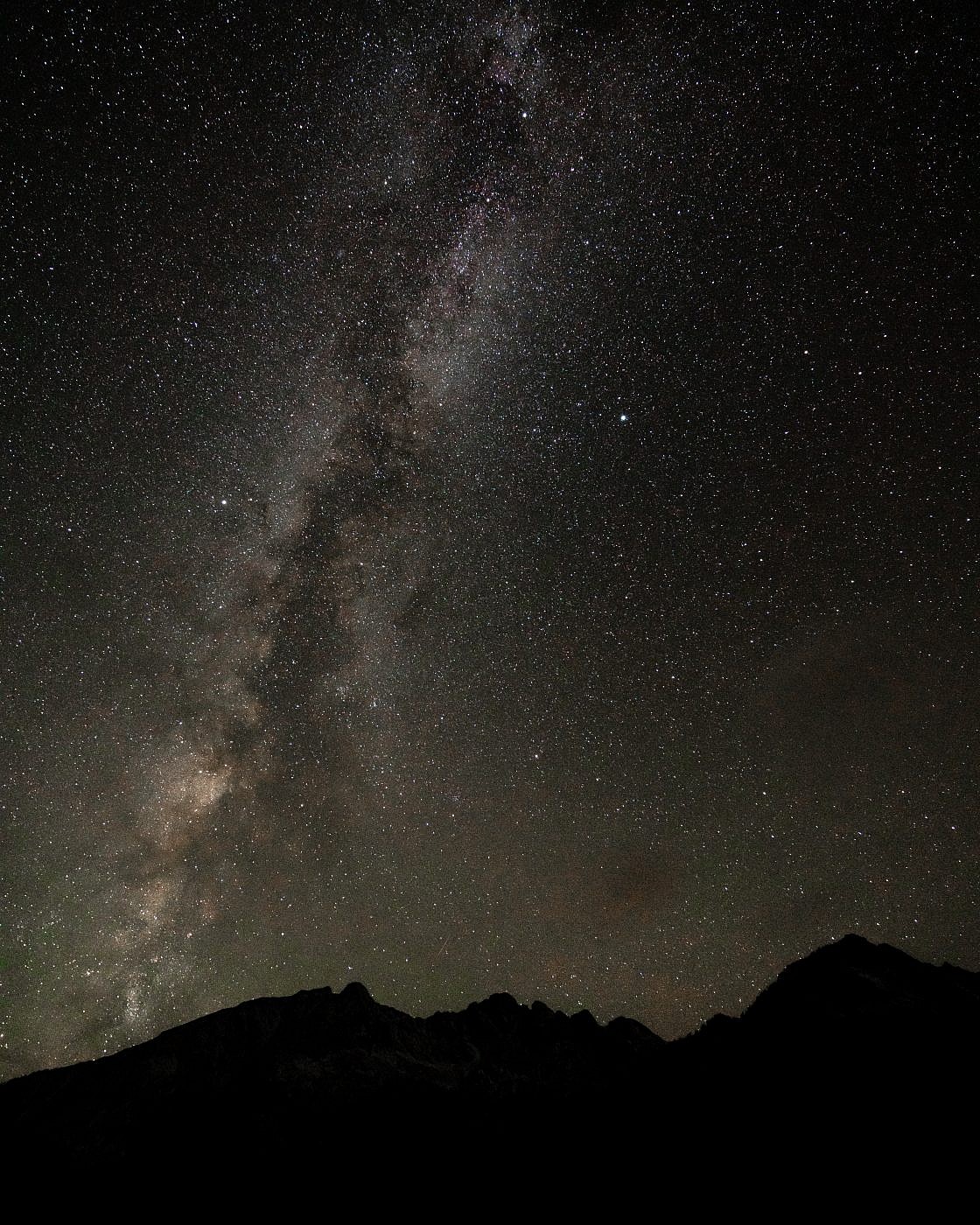
Back at camp. First time experimenting with astrophotography with the new A7R2.
On the Trail Part 2
The morning started out a bit rough for me. I just wasn’t quite ready for the cold yet so waking up to 20 degree temperatures for the first time made it exceedingly hard to get motivated. I ended up just wandering around for a while as I ate my breakfast waiting for the sun to rise above the ridge. Once I finally got motivated enough to hit the trail the sun was shining brightly overhead and those harrowing feelings quickly dissipated. On my way up to the saddle I noticed some tracks in the fresh snow that didn’t recall seeing the previous day. I can’t be positive but they looked like small bear tracks and I wondered if a bear had been tailing me as I made my way back to camp the previous night. This put me on high alert because I was literally the only human around for miles and didn’t want to encounter any bears regardless of their size.
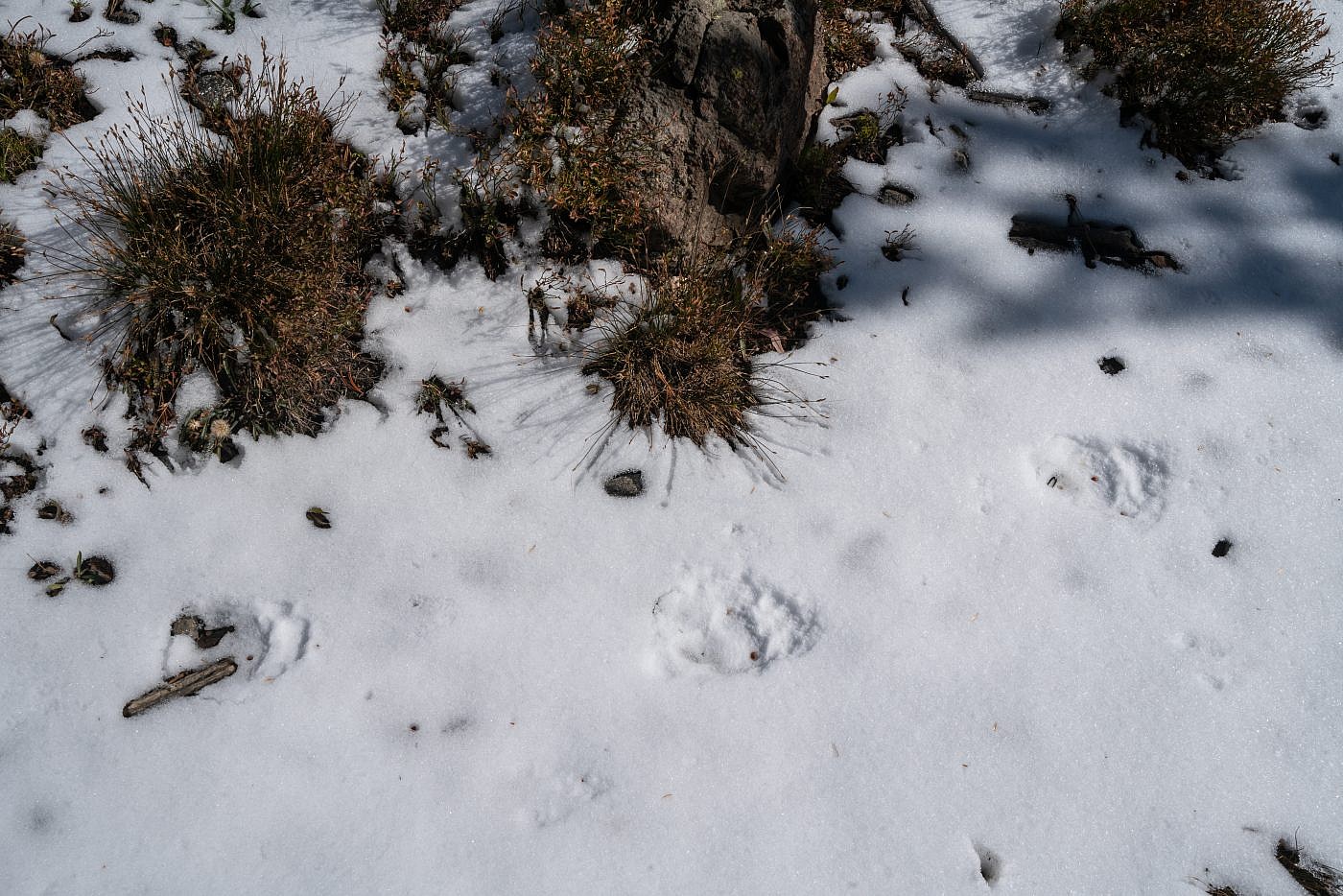
Possible bear tracks in the snow.
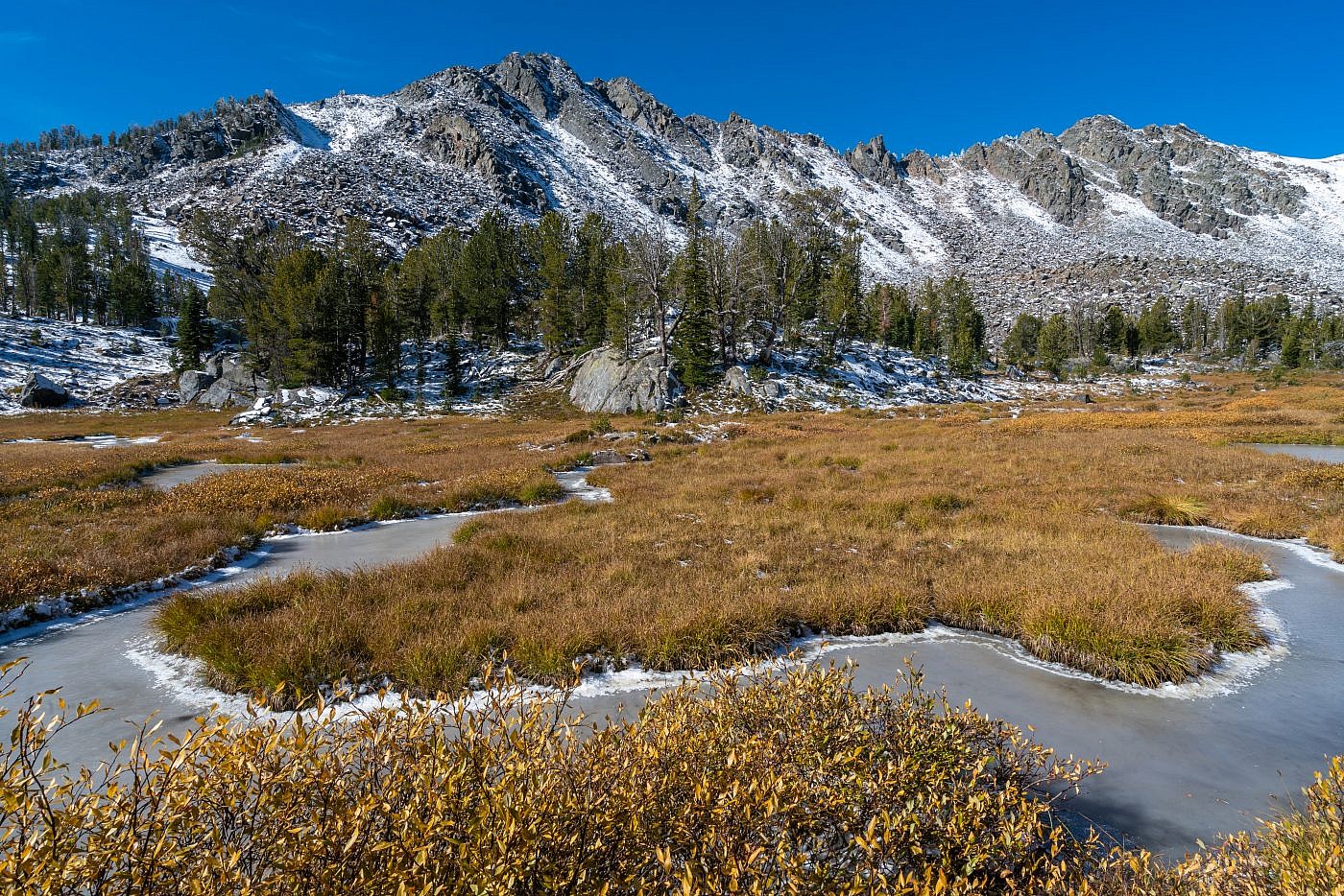
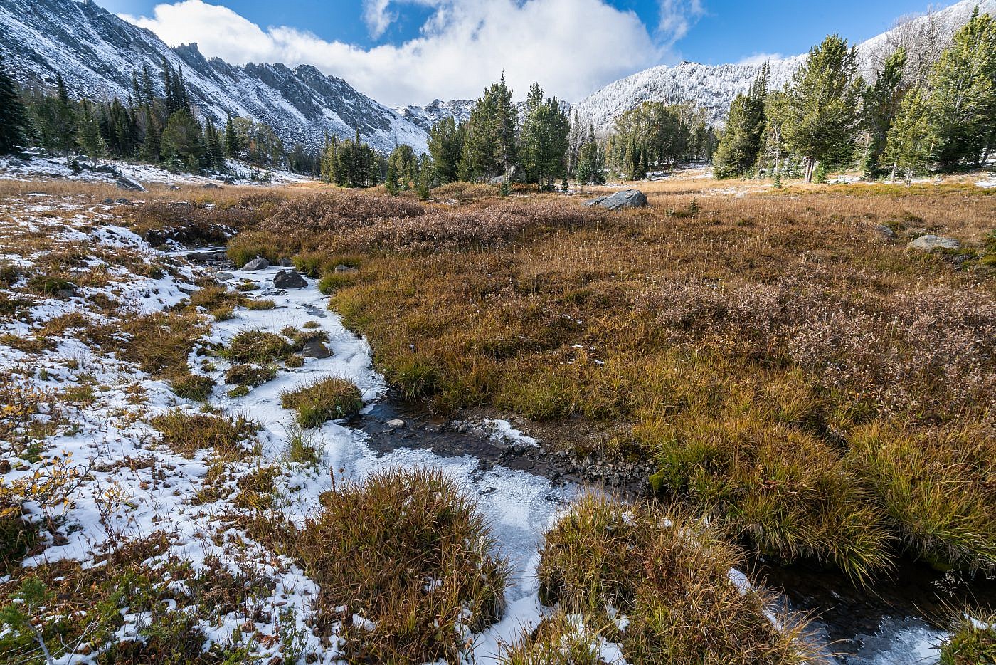
I took my time on the way up the saddle to take some photos of this frozen marsh.
The saddle.
Once at the saddle I had a snack and began planning my next move. I had decided the previous day to descend into the basin a little ways and then sidehill over to the lake rather than follow the crest of the saddle and this proved to be the right decision. The snow made it a little more difficult and there was a bit of talus scrambling but it was, for the most part, a pleasant journey. I also took some time to assess a possible route up Leggat Mountain. It looked like you could just ascend its northeast ridge all the way to the top but it was hard to say what kind of effect the snow would have and if the rockier terrain near the top was even passable.
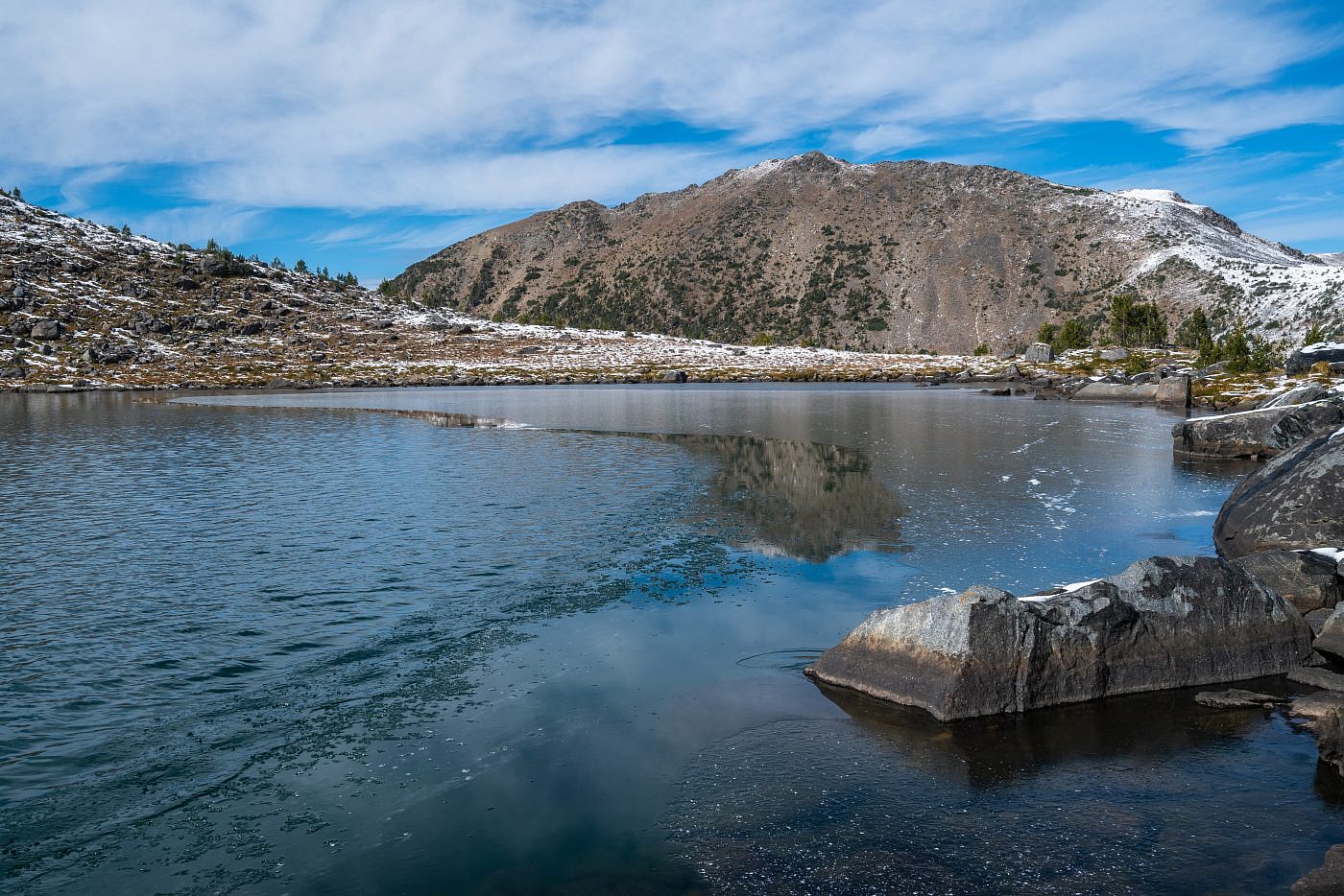
Thompson Peak as seen from the saddle. It’s a relatively simple scramble up its eastern ridge to the summit.
The ridge leading to Branham Peaks on the right and Bell Lake in the basin below. A trail leads to Bell Lake form the east side of the range.
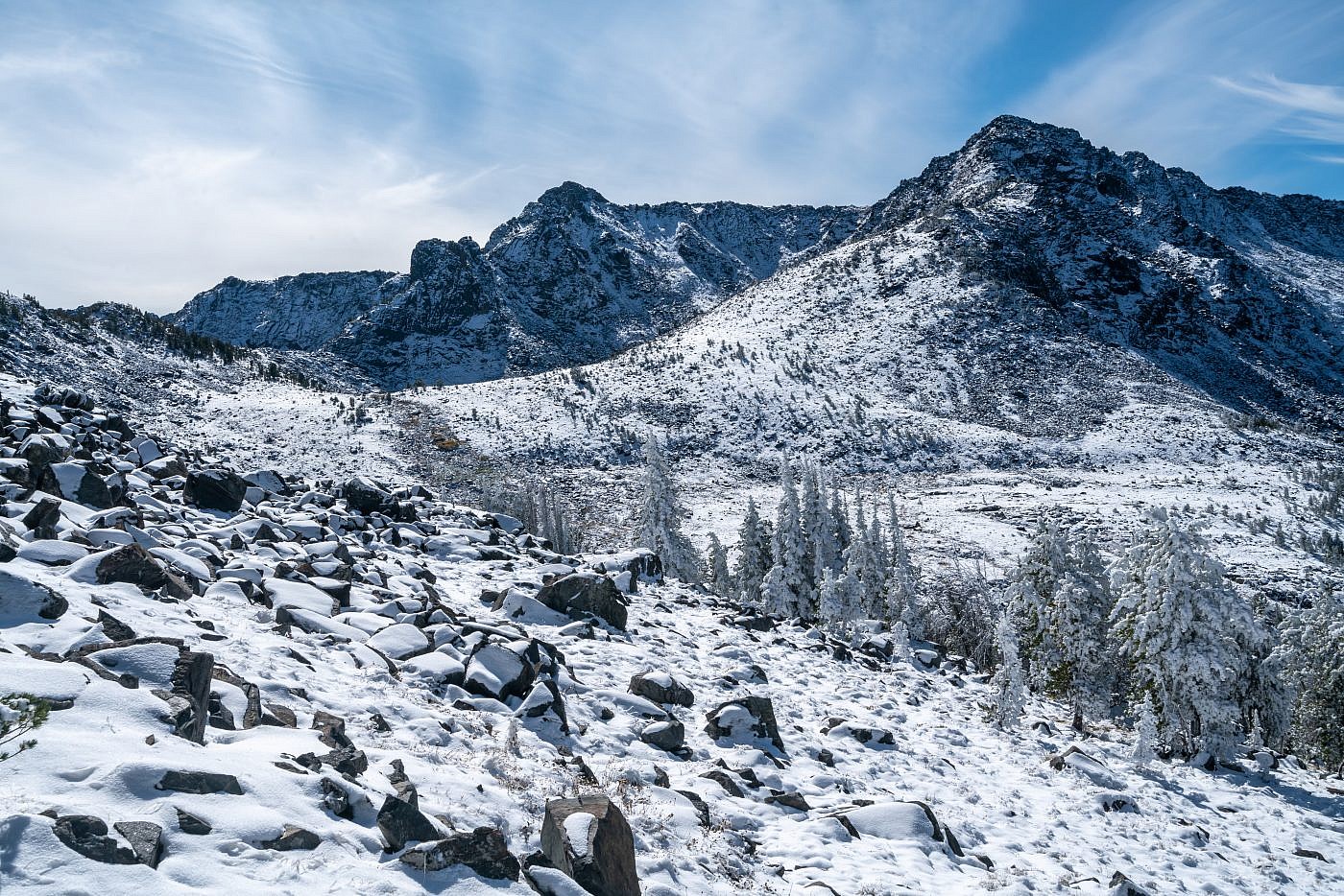
Working my way over to Gneiss Lake. It was a relatively simple hike through this terrain. From here it looked like you could follow the northeast ridge of Leggat all the way to its summit but I didn’t know what kind of challenge the snow would pose.
Gneiss Lake
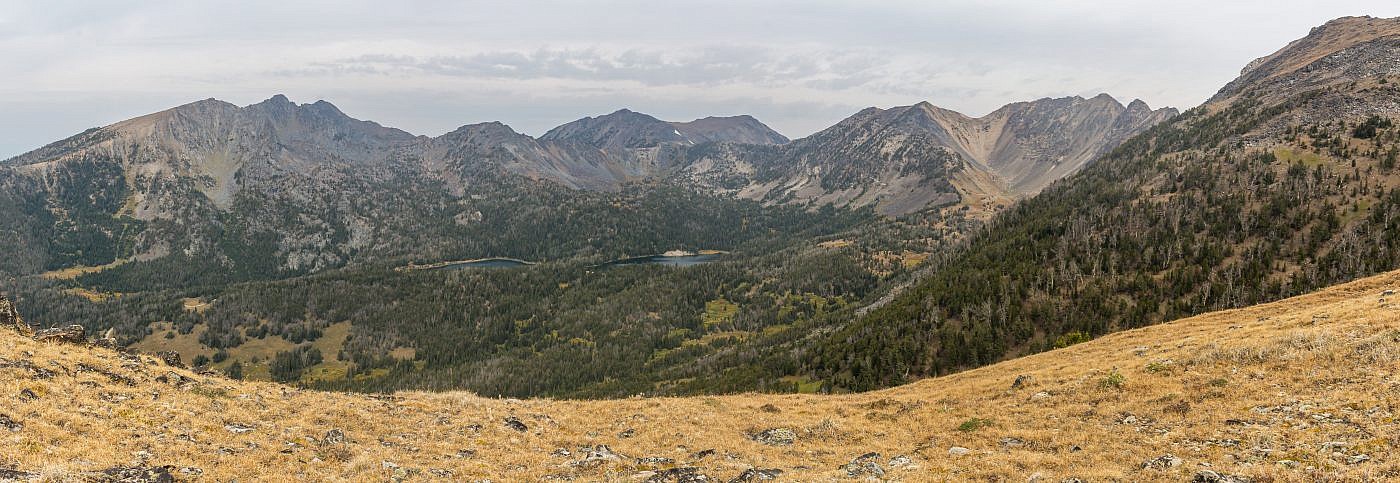
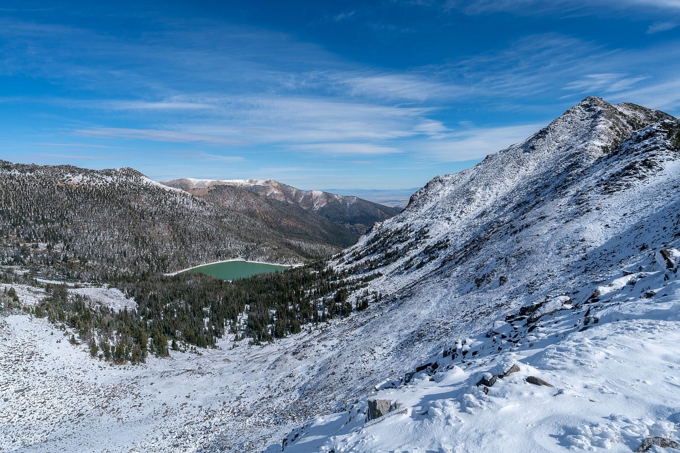
I made it to Gneiss Lake in early afternoon which was great timing-the sun was high in the sky lighting up this gorgeous alpine lake. I spent a decent amount amount of time wandering the shores and taking pictures and even made a slight detour up to the small saddle just east of the lake. This gave me an astonishing view of both the Gneiss Lake basin and the Branham Lakes basin.
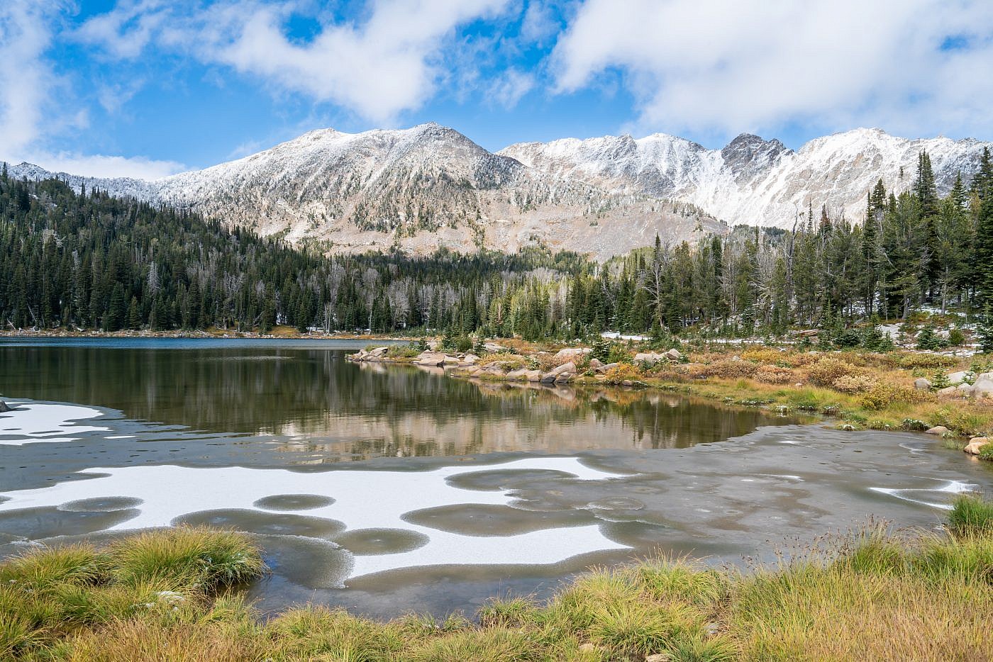
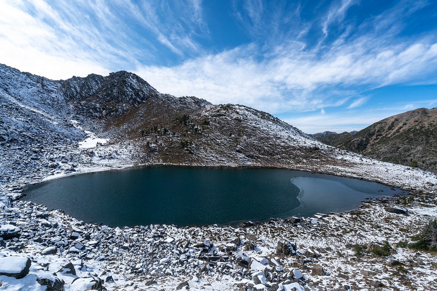
Gneiss Lake. Leggat Mountain on the right.
Gneiss Lake with Thompson Peak in the background.
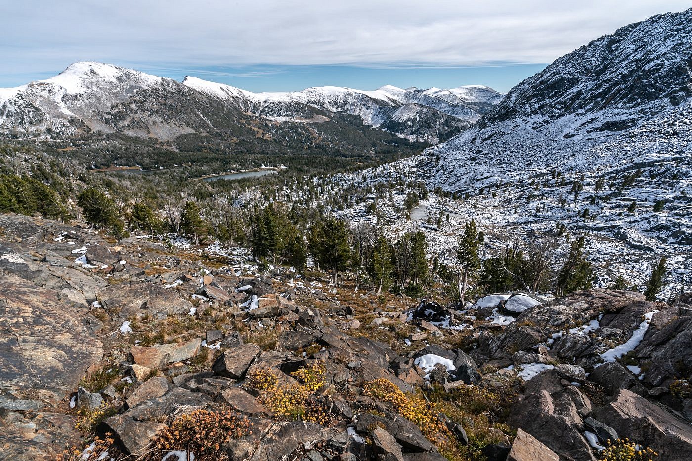
Looking over the Branham Lakes basin from the saddle east of Gneiss Lake.
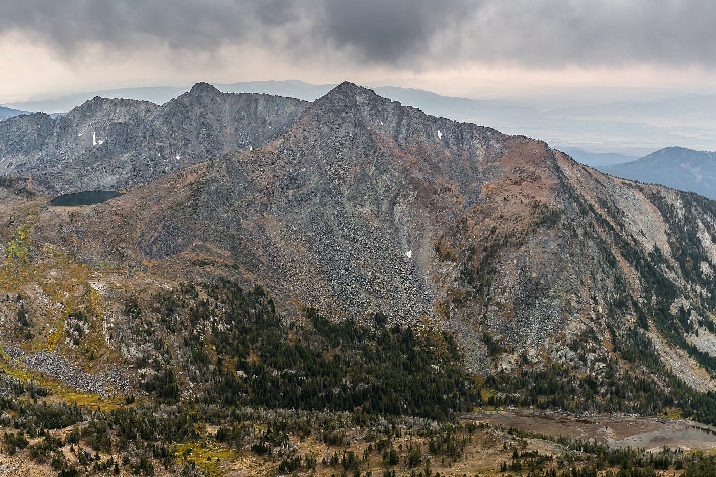
Gneiss Lake from the saddle just east of the lake. Leggat Mountain on the left. From this angle the path up Leggat looks obvious.
Leggat Mountain
Since it was only mid-afternoon I decided to make the attempt up Leggat Mountain. As expected the first part of the ascent was straightforward. It’s steep and rocky in spots but I never felt like I was in any danger. Just below the summit, though, things start to get hairy. It got too steep and too rocky to continue along the ridge so I chose to sidehill leftward towards the eastern face of the mountain searching for any sort of path through the rocks. I was able to avoid most of the rocks but the slopes were so steep that if you slipped and fell you’d probably tumble all the way down to your death. I was trying my best to keep my mind off of this potential disaster when suddenly the path presented itself to me. It was a narrow, but grassy channel which looked like it would lead straight through rocks and up to the summit. This turned out to be the case but ended up being probably the most dangerous part of the hike and only class 3 section. Although it wasn’t rocky it was so steep that I was practically just flopped against the side of the mountain crawling my way up. There were some branches and rocks here and there that I was able to use as handholds and after some strenuous, adrenaline-filled scrambling I emerged at the top.
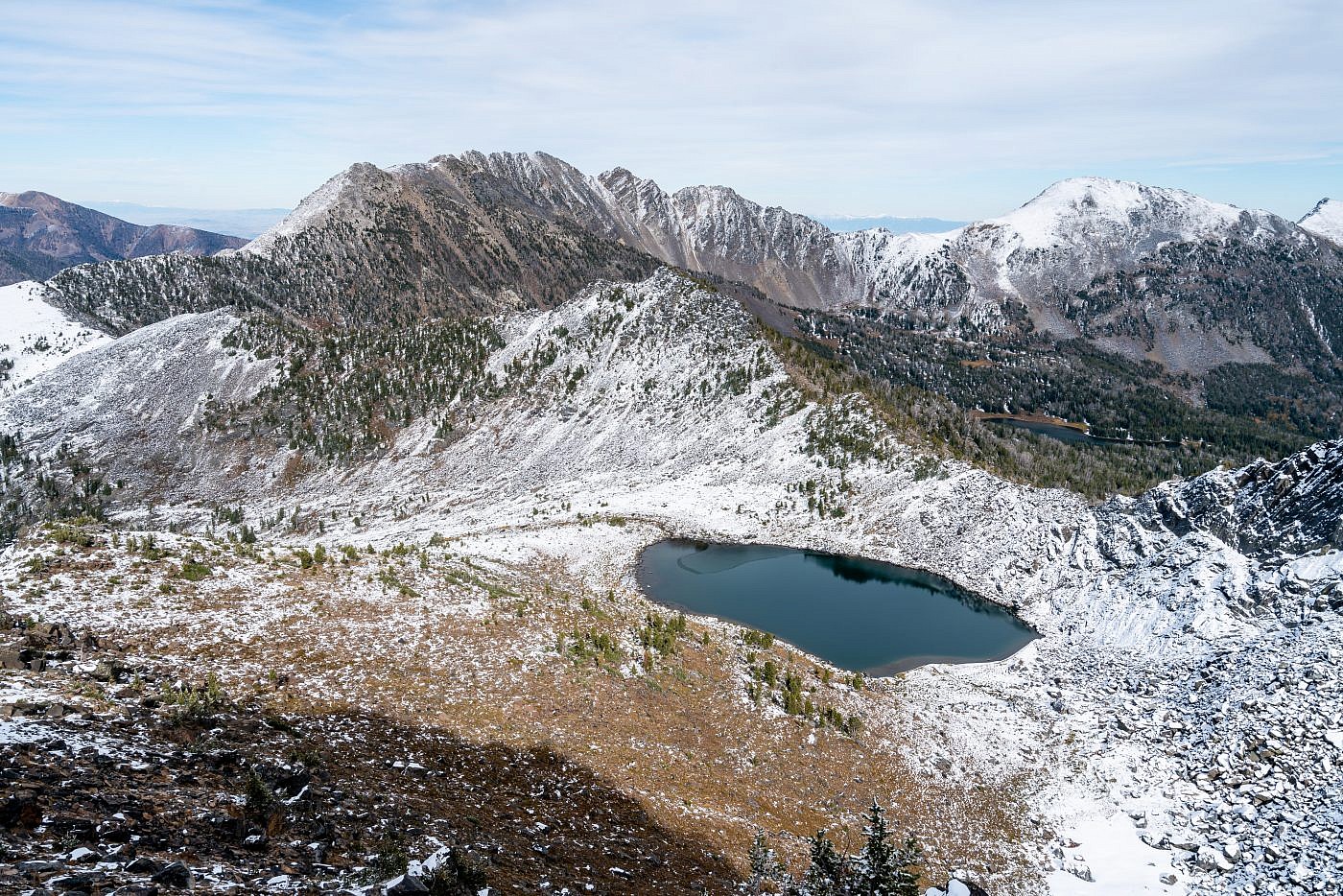
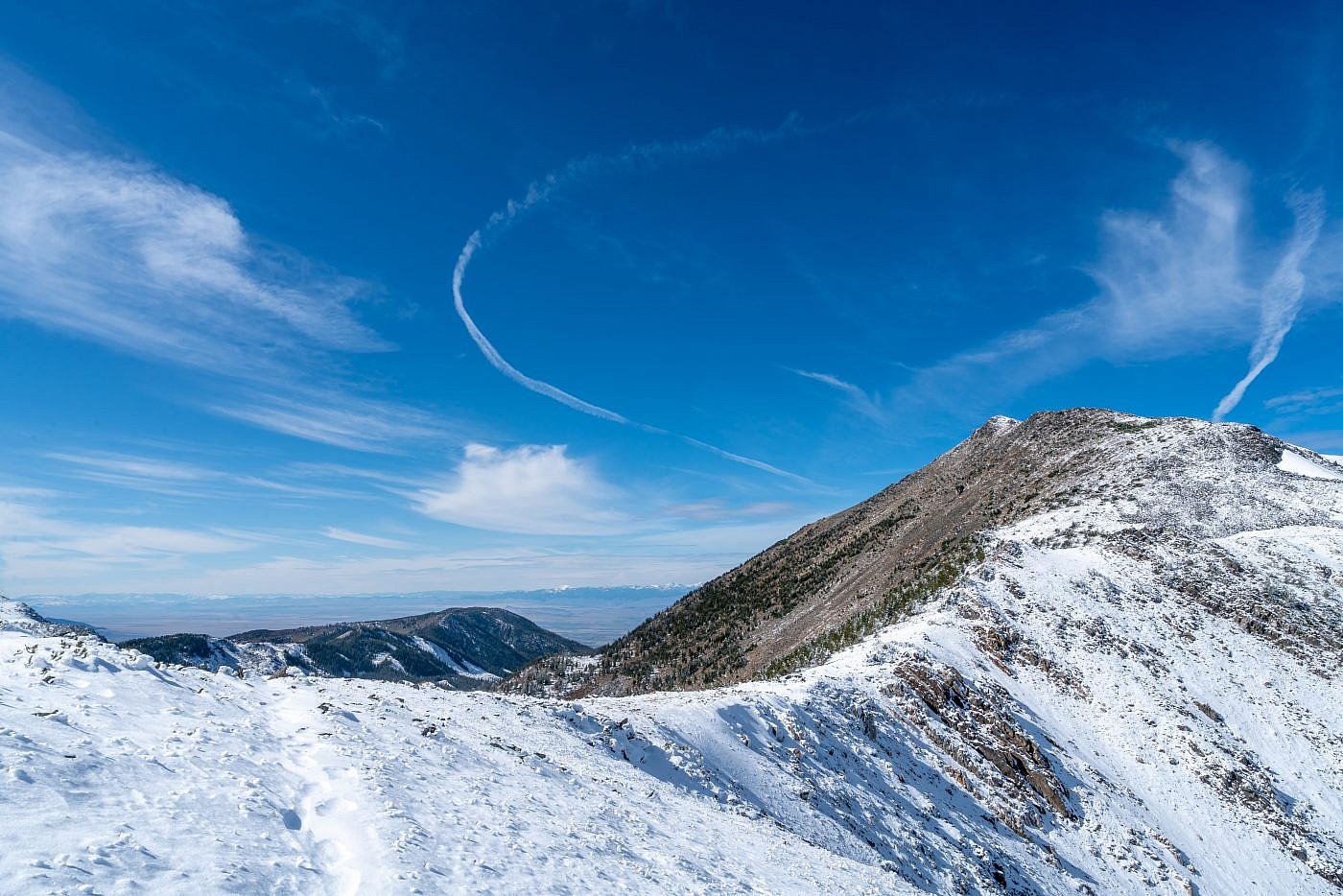
Working my way to the top of Leggat. From here you can see every almost every landmark I’ve described. I started at Upper Branham Lake in the far drainage on the right, hiked up to the saddle on the far left, continued off-trail through the drainage and then up to Gneiss Lake (front), made a slight detour up the saddle on the right, then came down and ascended the northeast ridge of Leggat.
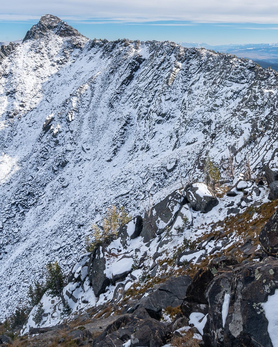
Leggats sister peak which is labeled as Leggat Mountain on some maps. It may be possible to follow the ridge over to it summit.
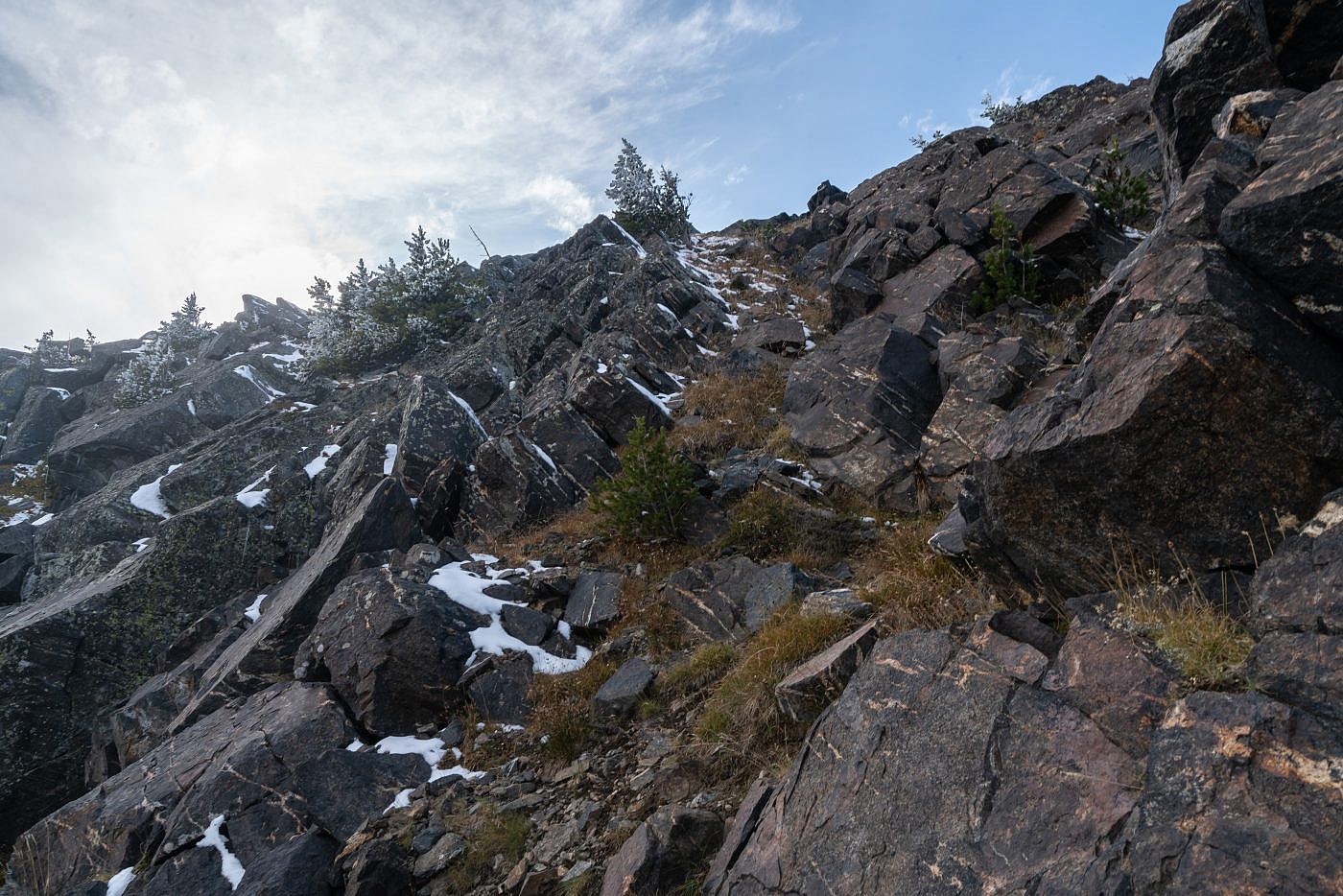
The steepest and most dangerous section of the hike was scrambling up the east face of Leggat. This is definitely class 3.
Looking west from the summit towards the Ruby Mountains. I summited their highpoint, Ruby Peak, earlier in the summer.
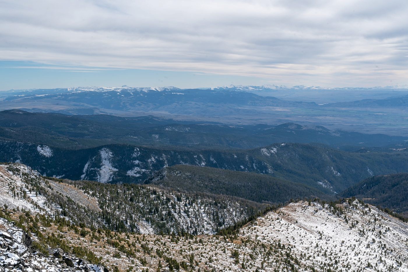
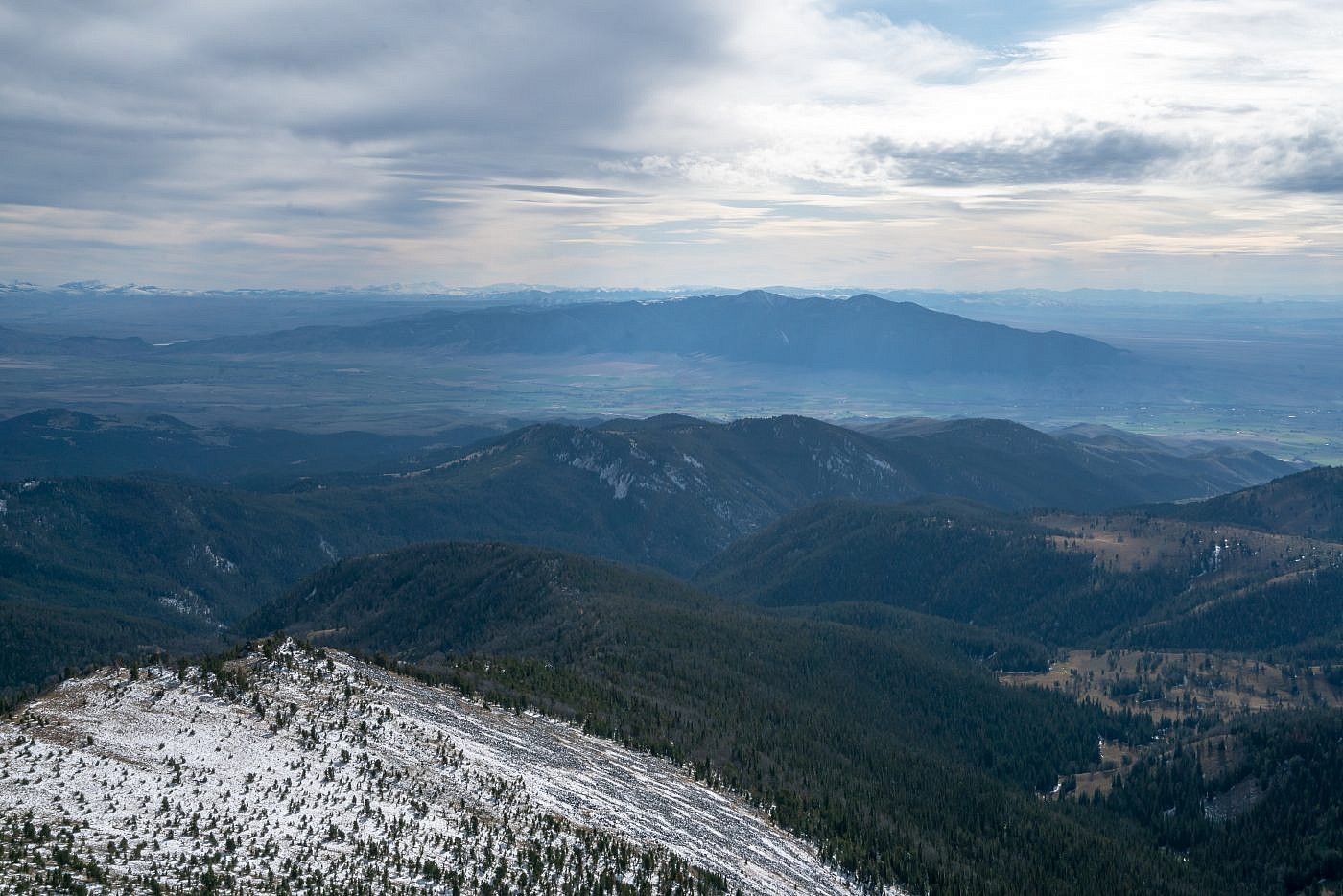
Looking south from the summit. Gravelly Range on the left. I believe you can just barely see the highpoint, Black Butte, which I bagged the previous year. Snowcrest Range in the distance on the right.
Final shot as I made my way back to camp.
