Castle Mountains
Elk Peak
Download KML
Distance
6.25 miles one way
Type
Day hike
Difficulty
Moderate
- Starting Elevation: 6800 ft.
- Ending Elevation: 8588 ft.
- Elevation Gain: 1788 ft.
 View all 11 photos
- Experience Date: Sep 22, 2019
- Hike Time: 5-7 hrs.
- Drive Time: 2 hr. 15 min.
- Road Condition: Well-maintained dirt road. 2 WD accessible. High-clearance recommended but not necessary.
- Parking: Parking alongside road.
- Fees: None.
- Campsite Availability: Camping alongside road near trailhead or on the flatter areas along the trail.
- Private Property: None posted.
- Trail Traffic: Many hunters in the area.
- Trail Condition: ATV road the entire way.
- Fire Restrictions: None.
- Stream Crossings: None.
- Water Sources: None.
- Snow: Fresh layer of snow.
- Winter Access: Unknown.
- Weather: Sunny. Cool. Windy.
- Bugs: None.
- Wildlife Sighted: None.
- Side Quests: Wapiti Peak.

Elk Peak (8,589′) is the highpoint of the Castle Mountains just east of White Sulphur Springs, MT. The Castles get there name because of the numerous castle-like rock spires poking through the trees; Elk Peak is just one of these spires. Because of the extensive road system in the Castles you can get to the summit from several angles but the shortest approach is from the east. There’s nothing tricky about the hike, you pretty much just follow the road as it climbs steadily to the summit. The road is in great shape so I recommend biking it if you’re relatively experienced. Wapiti Peak is a simple side quest but other than that there’s not too much else to do.
Elk Peak.
Background
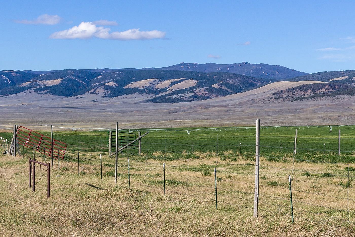
The Castle Mountains are a small, relatively unknown island range east of White Sulphur Springs, MT. Their name comes from the numerous castle-like rock spires that stick out sporadically throughout the otherwise forested mountain range. Like many of the gentler mountain ranges in the area roads pervade the Castles making them easily accessible from many angles. You won’t find many recreationists here but it is a very popular spot for hunters in the fall so I recommend a hunting vest if you’re visiting during that time of the year.
I first visited the Castles in December of 2018. At the time I was seeking out new mountain ranges to explore and since it was getting snowy I figured a gentler range like the Castles would be a more appropriate place to investigate. I had familiarized myself with the highpoint, Elk Peak (8,589′), and figured I might as well give it a shot. Typically you’d start from a trailhead to the east of the peak but I’d heard that the road was pretty well snowed in so I chose to approach from the north from a base camp at the Grasshopper Campground which is a great area to explore at if it’s your first time in the area. It’s a long hike from this angle and the snow concerned me a little but I figured I’d go as far as I could and at the very least I’d get a nice taste of the range. Sure enough I only made it only about halfway to the peak before the snow got too deep and I was forced to turn around but I was satisfied with my exploratory mission and remained excited to return.
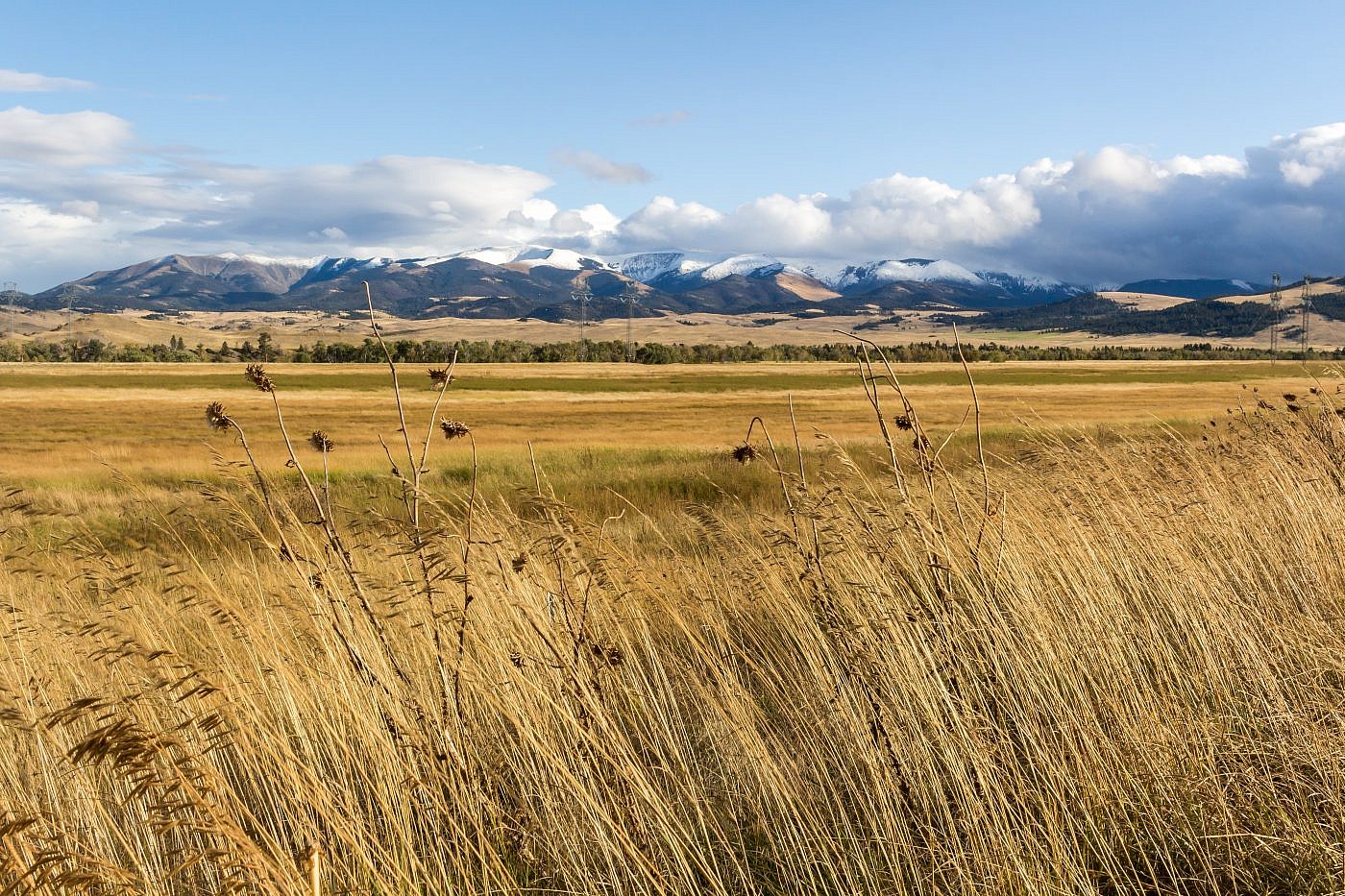
Looking north towards the Castles from the Shields River Valley. Elk Peak on the right.
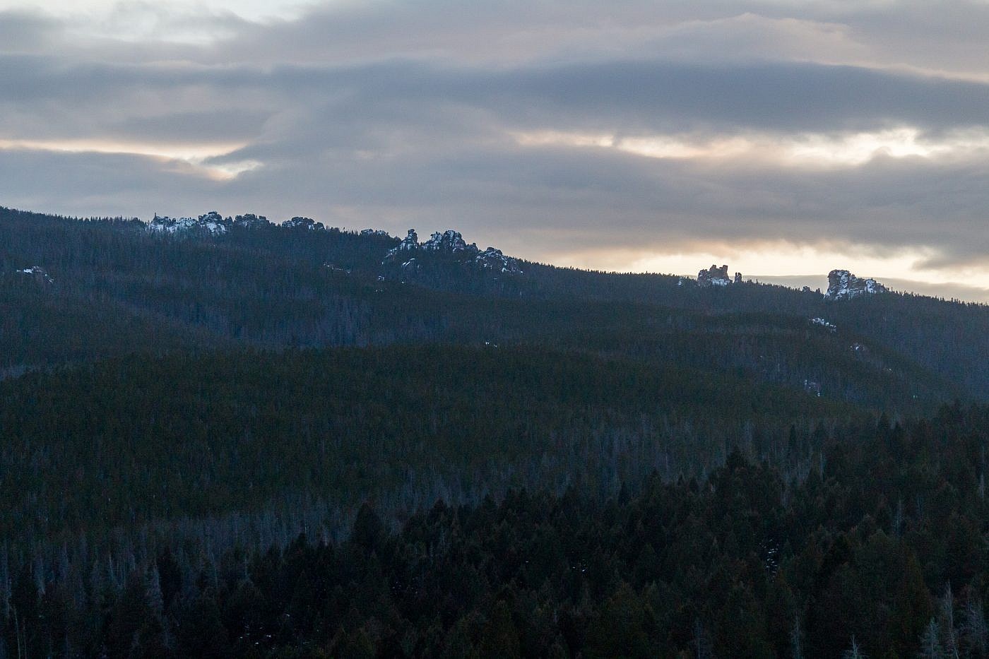
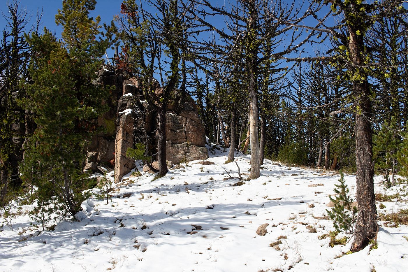
A shot of some of the castle-like rock spires spread throughout the range.
The Adventure Begins…
When I first set out on Saturday to embark on my adventure I wasn’t actually planning on summiting Elk Peak but Loco Mountain (9,242′), the highpoint of the northern Crazies. My plan was to stay at the Forest Lake Campground deep in the heart of the northern Crazies and then summit Loco the next day. My Beartooth Publishing map of the area showed trails leading almost straight to the summit so I figured it’d be a fairly straightforward hike. Unfortunately this plan was short lived as the dirt road leading into the Crazies from the north became so deeply rutted that my poor Outback couldn’t handle it. Luckily I had a backpack plan.
The northern Crazies as seen from Cottonwood Creek Road. I’m not sure if Loco Mountain is visible from this angle. Further down the road, where Forest Lake Road branches off, it became deeply rutted and forced me to turn around.
Conveniently, the access point for Elk Peak is very close to where I was at but getting there is a bit complicated so I will describe the route I took: From highway 294 exit north on NF-581 towards the town of Lennep, MT. Shortly after take a sharp left at a T and continue west on NF-581. Along the way you will pass through the ghost town of Castle Town. There’s not much to see from the road but I do recall seeing an sign with some historical information. Beyond Castle Town there’s an intersection with another road splitting to the left (Road J15994). Take this left and drive until where the road levels out on the crest of a ridge and intersects Road J8884. If your vehicle can handle it you can take a left and drive further up Road J8884 to the old Yellowstone Mine and park. I ended up taking a right instead and established my camp a little ways down the road where it reconnects to NF-581 with a wonderful view of the Shields River Valley to the south.
On the Trail
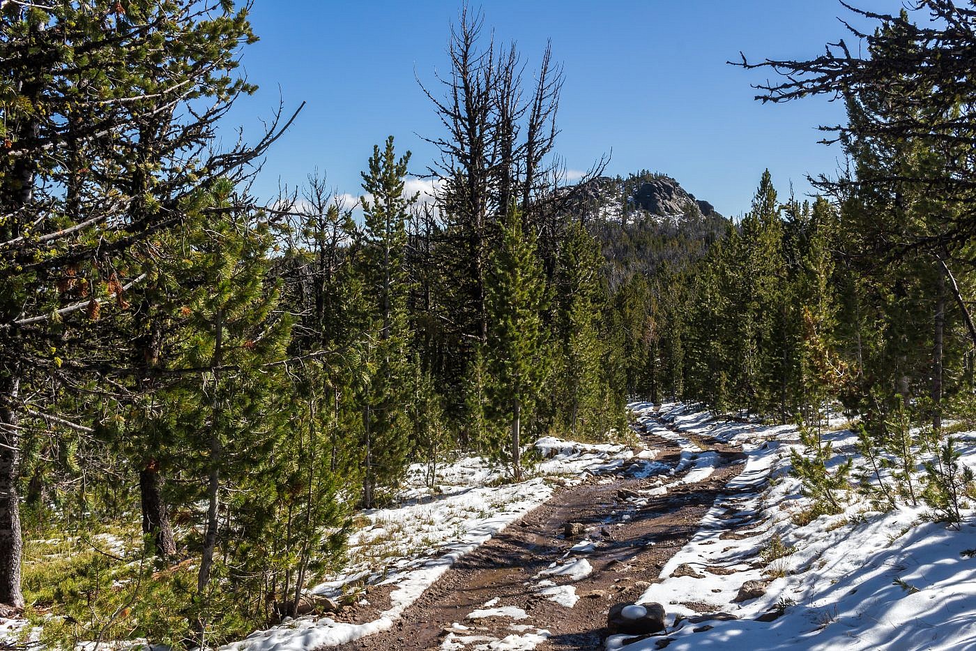
Since this entire hike is on ATV roads I decided I’d bike as much of it as I could. I started by following Road J8884 as it climbs steadily up and deeper into the mountains. A couple miles in there’s a clearing and the road transitions into Road J8886 heading due north. If you have a high clearance vehicle you can actually drive all the way to this point. Here you want to leave the road and follow a narrower ATV track (Road 718) to the southwest. At the time this clearing was full of hunters camping out so I made sure to wear my blaze orange hunting vest.
The rest of the hike will be spent on Road 718 as it climbs steadily and then levels off as you approach the high country. The bike ride was going smooth until this point where I began to encounter fresh snow that had fallen a couple days earlier. By now the day was getting warmer and the afternoon sun had turned much of the snow to slush making the bike ride more cumbersome but still manageable.
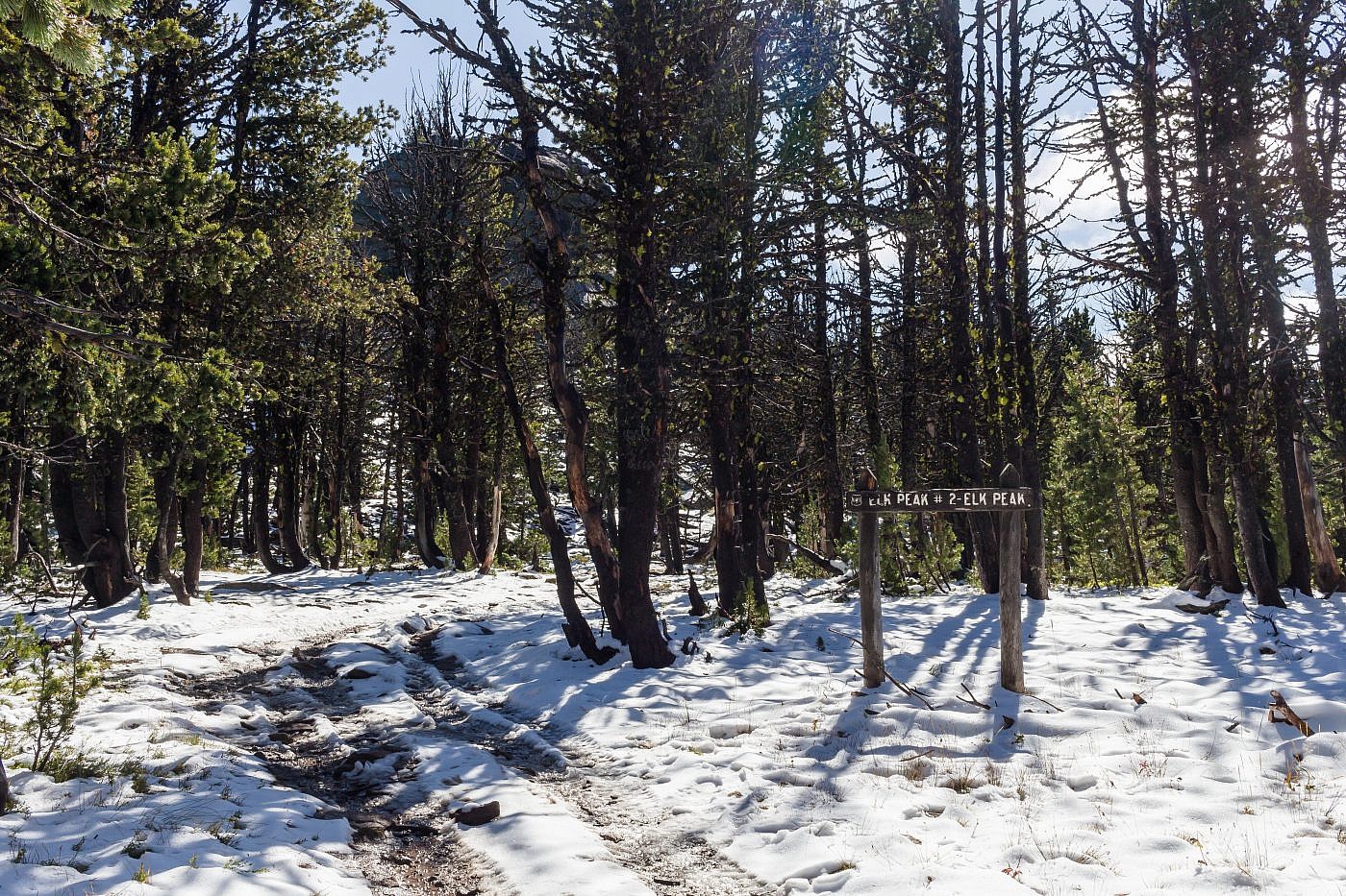
Just over a mile before the summit the road will start to turn south. Here you’ll see a sign for “Elk Peak #1-Wapiti”. This is Wapiti Peak which is no more than a small castle-like spire sticking out of the ground. You might as well climb to the top of it though and from this vantage point you get your first view of Elk Peak to the south.
Wapiti Peak.
Looking south from Wapiti Peak towards Elk Peak.
Elk Peak
After Wapiti Peak it’s a simple hike south to Elk Peak. There is a short but fun off-trail scramble right at the end to get to the summit Elk Peak which is basically just a large castle-like spire. I was able to ride my bike all the way to where you finally leave the trail but near the end the slush was started to get to me. I’d definitely like to return some time when the trails are completely dry.
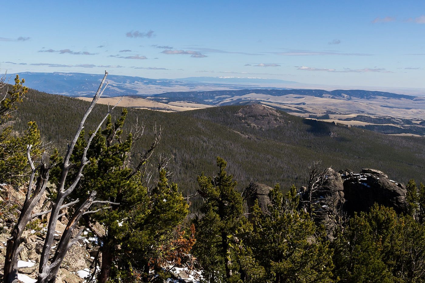
The final stretch of road between Elk Peak and Wapiti Peak.
The base of Elk Peak. From here’s it’s a simple and fun off-trail scramble up some boulders to the summit.
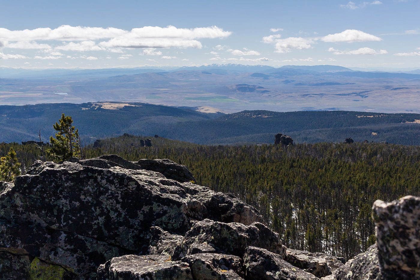
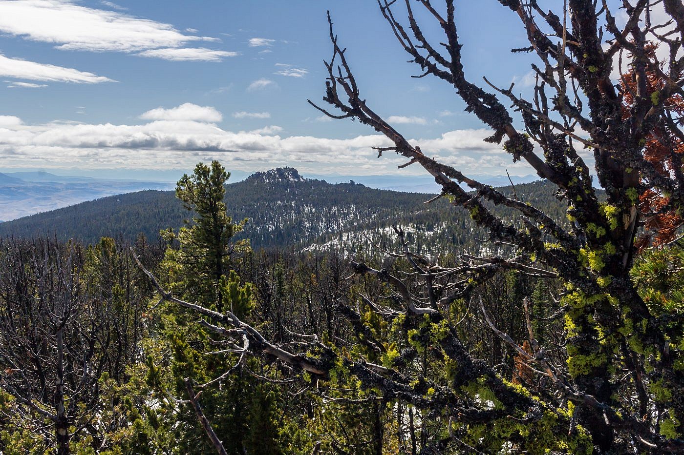
Looking southwest from the summit over the Shields River Valley. Bridgers in the distance. Notice all the “castles” poking out of the forest.
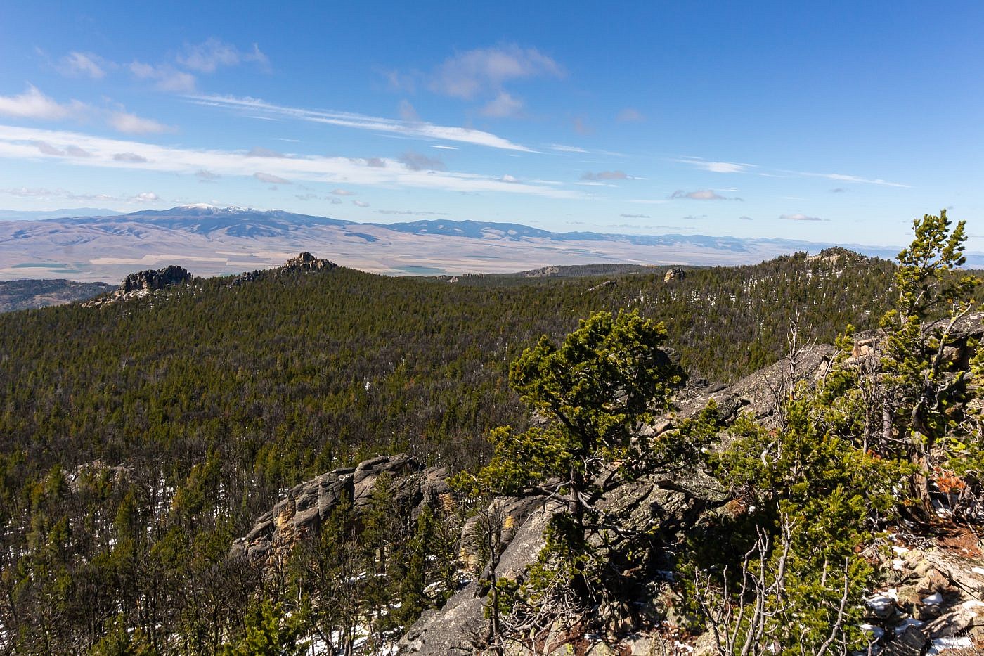
Looking northwest from the summit. Big Belts in the distance on the left and Wapiti Peak on the right.
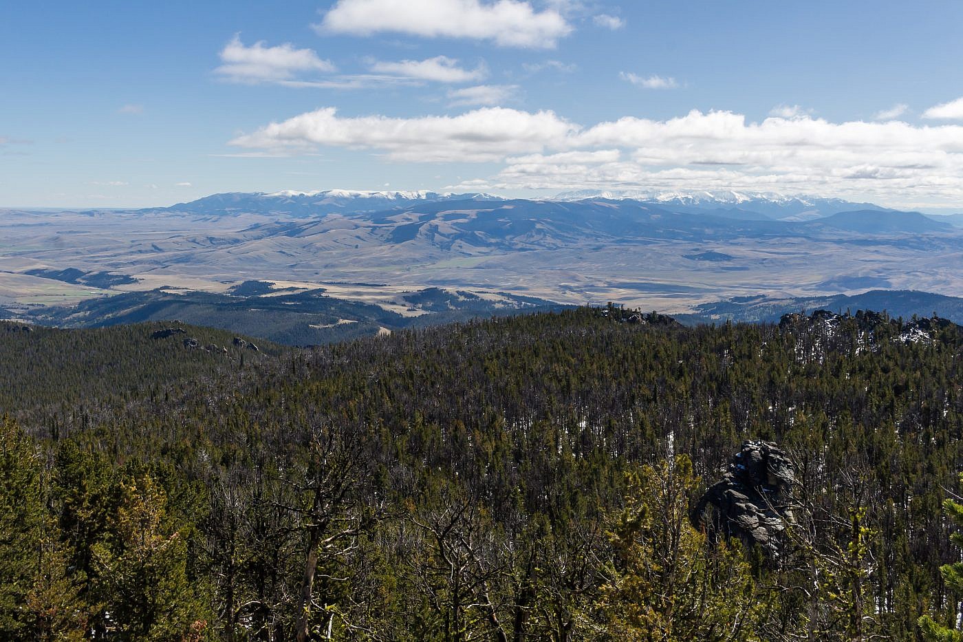
Looking southeast from the summit towards the Crazies.
Looking east from the summit towards the Big Snowy Mountains, a range I have yet to visit.
