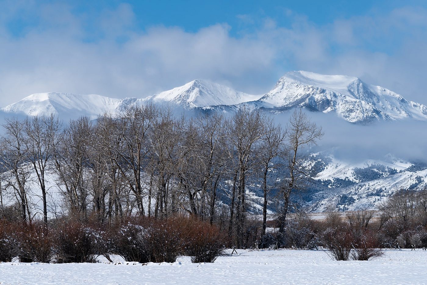
Tobacco Root Mountains
Hollowtop Mountain
Download KML
Distance
7.25 miles one way
Type
Backpack
Difficulty
Hard
- Starting Elevation: 6047 ft.
- Ending Elevation: 10604 ft.
- Elevation Gain: 4557 ft.
 View all 9 photos
- Experience Date: Sep 18, 2019
- Hike Time: 7-9 hrs.
- Drive Time: 1 hr.
- Road Condition: Well-maintained dirt road. 2 WD accessible. High-clearance not necessary.
- Parking: Plenty of parking.
- Fees: None.
- Campsite Availability: Plenty of camping around Hollowtop Lake.
- Private Property: None.
- Trail Traffic: Very light.
- Trail Condition: Trail to Hollowtop Lake followed by all off-trail travel to summit. Some sections of serious bushwhacking.
- Fire Restrictions: None.
- Stream Crossings: Minor stream crossings.
- Water Sources: North Willow Creek parallels the trail up to Hollowtop Lake. There are several other small lakes on the way up to the summit.
- Snow: None.
- Winter Access: Trailhead is probably accessible in winter.
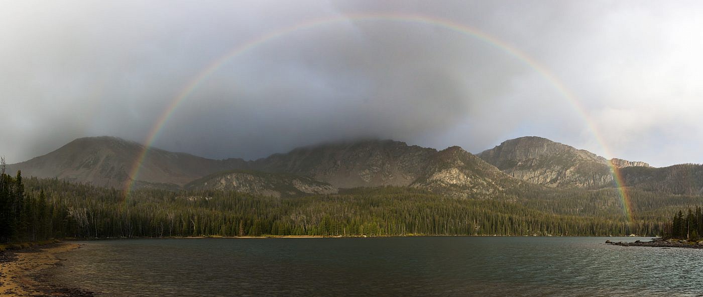
- Weather: Started out sunny and pleasant then became cloudy, cool, and windy.
- Bugs: None.
- Wildlife Sighted: None.
- Side Quests: Mount Jefferson. Horse Mountain. Potosi Peak.

Hollowtop Mountain (10,604′) is the highpoint of the Tobacco Root Mountains and can be seen on the horizon west of Bozeman, MT. It gets its name from the concave nature of its northeast face. There are several routes to the summit, all from different angles, but I recommend starting from the North Willow Creek trailheard near Pony, MT. This is the longest of the routes, and probably in some ways the most challenging, but it’s also the most scenic. The hike starts with a steady climb up to Hollowtop Lake which is a great destination of its own and makes for a great base camp if you want to break the trek into two days. This is followed by a nasty section of bushwhacking as you make your way to the saddle between Hollowtop Mountain and Mount Jefferson. Once at the saddle it’s a simple and steady climb up to the summit. Side quests include any of the peaks bordering the Hollowtop Lake basin including Mount Jefferson, Horse Mountain, and Potosi Peak.
Hollowtop Mountain.
Background
I first heard about Hollowtop Mountain (10,604′), the highpoint of the Tobbacco Roots, in 2016 while doing some volunteer trail work on South Fork Deep Creek in the Absarokas. Along the way several of the crew members exchanged stories about some of the mountains they’d climbed nearby and at some point Hollowtop became the topic of discussion. At the time my interest in peakbagging was still developing and I had little to contribute to the conversation but I didn’t hesitate to make a mental note of this supposedly classic hike of the Bozeman area. Afterward, I did some research on the peak and was able to to pinpoint its location on the horizon west of Bozeman. I also discovered that it got its name because of the concave nature of its northeastern face making its “top” look “hollow”.
Later that same summer my hiking partner, Arlo, and I would make an attempt on the beast via the Hollowtop Lake route but our mission was cut short because of dwindling light and unfavorable weather conditions. I was extremely bummed because I knew it would be a while before I’d have another shot at it and having to turn around after being so close felt like getting to the end of a book and finding the last page torn out; that sort of thing will drive you crazy!
Returning back to our campsite on Hollowtop Lake after our unsuccesful attempt of Hollowtop Mountain in 2016.
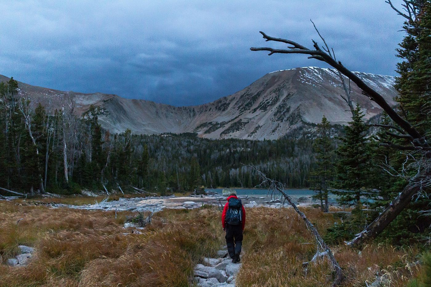
There are so my places to visit out here that reattempting Hollowtop never really took precedence in the years following our first attempt but once my main focus became mountain range highpoints it quickly jumped to the top of my list. So three weeks in to being a full-time peakbagger and four years after the fist attempt I finally decided it was time. This would be an extra special trip for me because I planned to spend the night at Hollowtop Lake which would make this my first solo backpacking trip ever.
There are all kinds of routes you can take to Hollowtop. The route I took starts near Pony, MT at the North Willow Creek trailhead. From here you follow North Willow Creek to Hollowtop Lake, bushwhack up to the saddle between Hollowtop and Mount Jefferson, and then onward to the summit. For a more get-in-and-get-out style approach you could start from the northeast near Mason Lake or the west off of South Boulder River road which is the route Cedron Jones’ outlines in his book “Peakbagging Montana”. Hollowtop Lake is a worthwhile destination on its own though so if you have the time I recommend camping at the lake. You could also get creative and form your own loops around some of the other peaks near the basin including Mount Jefferson, Horse Mountain, and Potosi Peak.
The Adventure Begins…
My spirits were high as I drove west out of Bozeman on a beautiful Wednesday morning in September. Not only would I be reattempting Hollowtop Mountain which had bested me four years earlier but I’d be embarking on my first solo backpacking trip ever. I was, admittedly, more nervous about camping alone in the wilderness than the actual summit attempt. I’m very comfortable hiking and camping alone but when the sun goes down and you’re deep within the bear-infested wilderness your mind can go to some dark places. I was mentally prepared for this challenge but still hoped there’d be some other campers in the vicinity to help alleviate some of my apprehension.
On the Trail
I was already familiar with the trail so knew the trek up to Hollowtop Lake would be a breeze. I wanted to get to the lake and scout out a camping spot as quickly as possible so I’d have ample time to summit the peak and possibly some of the other peaks in the area. About halfway in I ran into a pair of backpackers from Helena who were planning on spending several nights at the lake. We chatted for a bit and when I told about my plan to summit Hollowtop they almost shuddered in fear; I sensed they were somewhat new to the whole hiking thing. As we parted ways I felt relief knowing that there’d be at least one other group of campers up at the lake.
Hollowtop Lake. From left to right: Horse Mountain, Mount Jefferson, Hollowtop Mountain. Shot taken in 2016 on my first attempt.
It took me about 2 hours to get to the lake and after a bit of searching I settled on a nice camping spot on the top of a small hill. Now it was time for the true adventure. The biggest challenge, as I learned from my previous attempt, would be bushwhacking around the three lakes in the basin, Hollowtop, Deep, and Skytop, and up to the saddle between Hollowtop Mountain and Mount Jefferson. There’s no clearly defined path but my plan was to stay as close to the shores of the lakes as possible and try not to get mixed up in some of the nasty brush around them.
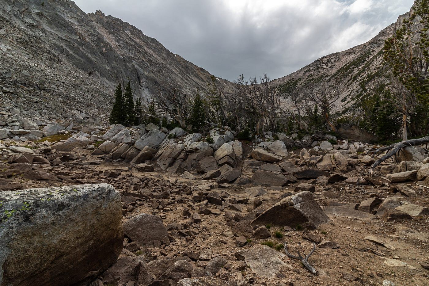
As I made it to the northern tip of Hollowtop Lake via a spur trail I was stopped dead in my tracks. In front of me was an unimaginable obstruction and must’ve been new since the last time I visited the area. Blocking my path was a large area of fallen down trees. I have no idea when this occurred or what caused it but my theory is that it was the result of a microburst which can result when air moves rapidly downward in a storm. When this downward whoosh of air hits the ground it can cause catastrophic damage. I was aware of a microburst that had occurred somewhere else in the Tobacco Roots so I figured it was entirely possible that another one had occurred here.
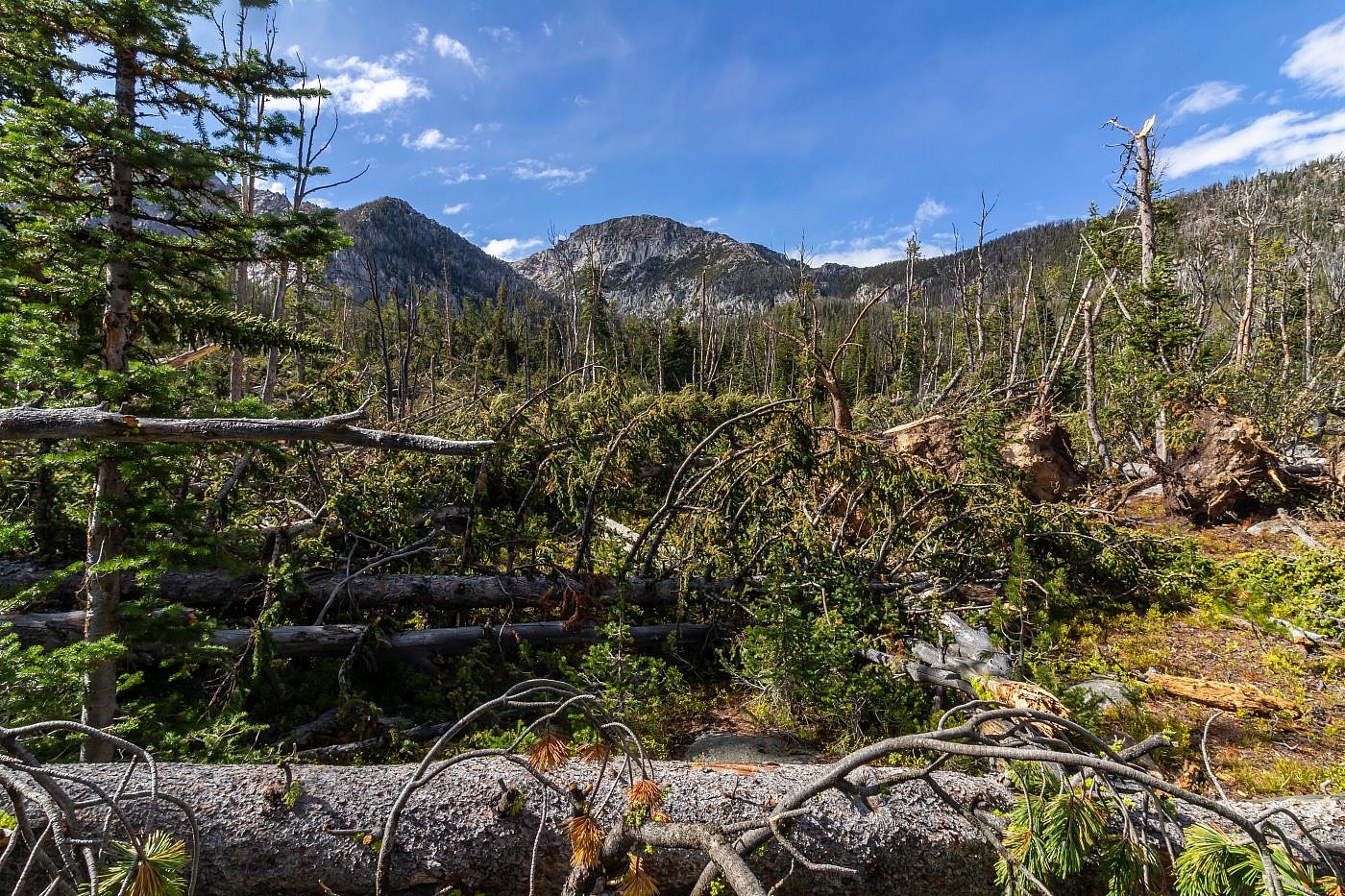
The giant obstruction near the north end of Hollowtop Lake. My theory is that this was caused by a microburst but I can’t be sure. To get through I headed right until I found a small gap in the trees and then clawed my way through.
I searched for a path through the destruction for quite some time. First I tried just going straight through but that proved futile. Next I went left and tried utilizing the shores of the lake to get around but that also ended in failure. In a final attempt to get through I started hiking to the right looking for an opening that I could squeeze through and finally I found the gap I was looking for. It still wasn’t easy though. The brush was thick, the terrain was uneven, and it was marshy in spots but eventually I clawed my way through and back into normal terrain.
I was relieved to be through that mess but there was still some nasty bushwhacking to endure. My initial plan had been thrown completely off course so I was just basing my new route on memory from the previous attempt. Eventually I made my way up to the crest of a small ridge which I began to follow northwest towards a tiny pond. From the pond the bushwhacking get significantly easier and after a bit of climbing I made it to the final basin below the saddle. This is as far as we had gotten during the first attempt.
By this point the sky had darkened quite a bit, the wind was howling, and the temperature had dropped making the saddle off in the distance feel ominous. This really started to mess with my mind because a similar thing had happened during my first attempt but now I was heading forward into it. All I could do was stick to the course and stay focused on the goal.
The ominous looking saddle the separates Hollowtop Mountain from Mount Jefferson.
As I traversed the basin towards the saddle I saw a small figure coming towards in the distance. Could it be? Another human? In fact it was. As they got closer I began flailing my arms trying to signal my whereabouts. I was craving just a moment of human contact to get my head on straight up in this frightful world that surrounded me. I was also a bit concerned about the steepness of the saddle and wanted to acquire intel about what I was getting into. We did finally meet and the individual reassured me that the saddle was not too bad. I figured he’d have more to say but he didn’t seem like he wanted to chat much so we parted ways and I continued anxiously onward.
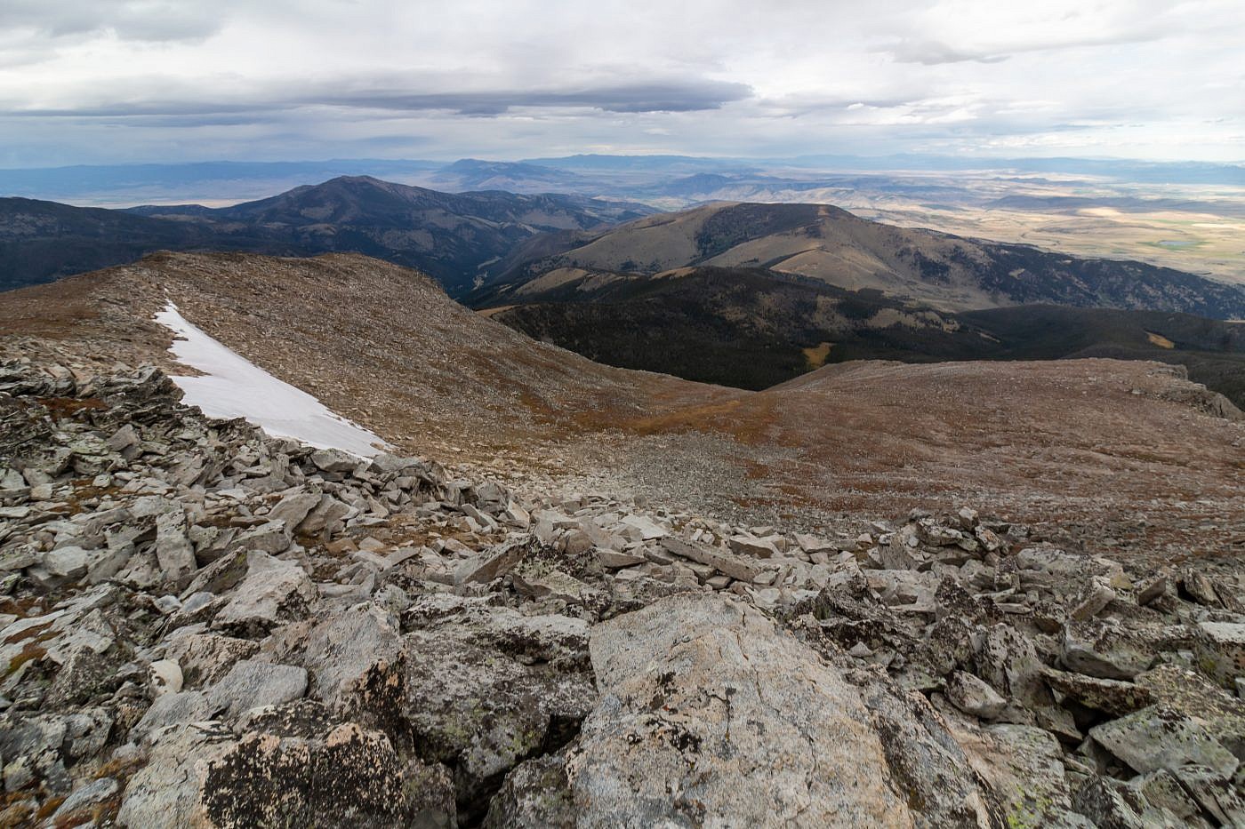
The saddle is steep and the ground is loose but I was able to make it up with relative ease and at the top I was almost paralyzed with emotion; it was both a beautiful and terrifying sight to behold. The wind was blowing so hard and the clouds made the scene look deadly, and I kept thinking about how doomed I would be if a storm broke out but I maintained my confidence and pushed forward up to the summit.

Looking west from the top of the saddle.
Hollowtop Mountain
It seemed like it took an eternity to make the final ascent to the top. All I wanted was to summit the thing and get back to the safety of my base camp and these thoughts caused some serious time dilation. I was grateful when I finally reached the top, conquering the beast that had left me feeling defeated years early. Despite this victory there was no way to relax on the summit because of the conditions so after taking a brief moment to sign my name in the summit register and taking a couple photos I raced down the mountain like a bat out of hell back to camp.
The “hollow top” of Hollowtop Mountain.
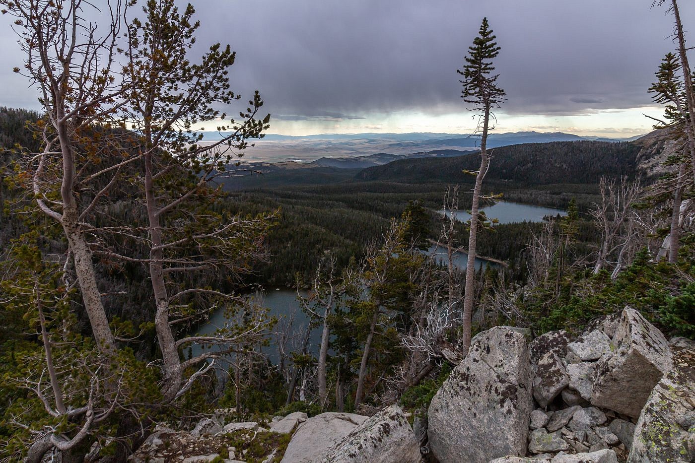
From left to right: Skytop Lake, Deep Lake, and Hollowtop Lake.
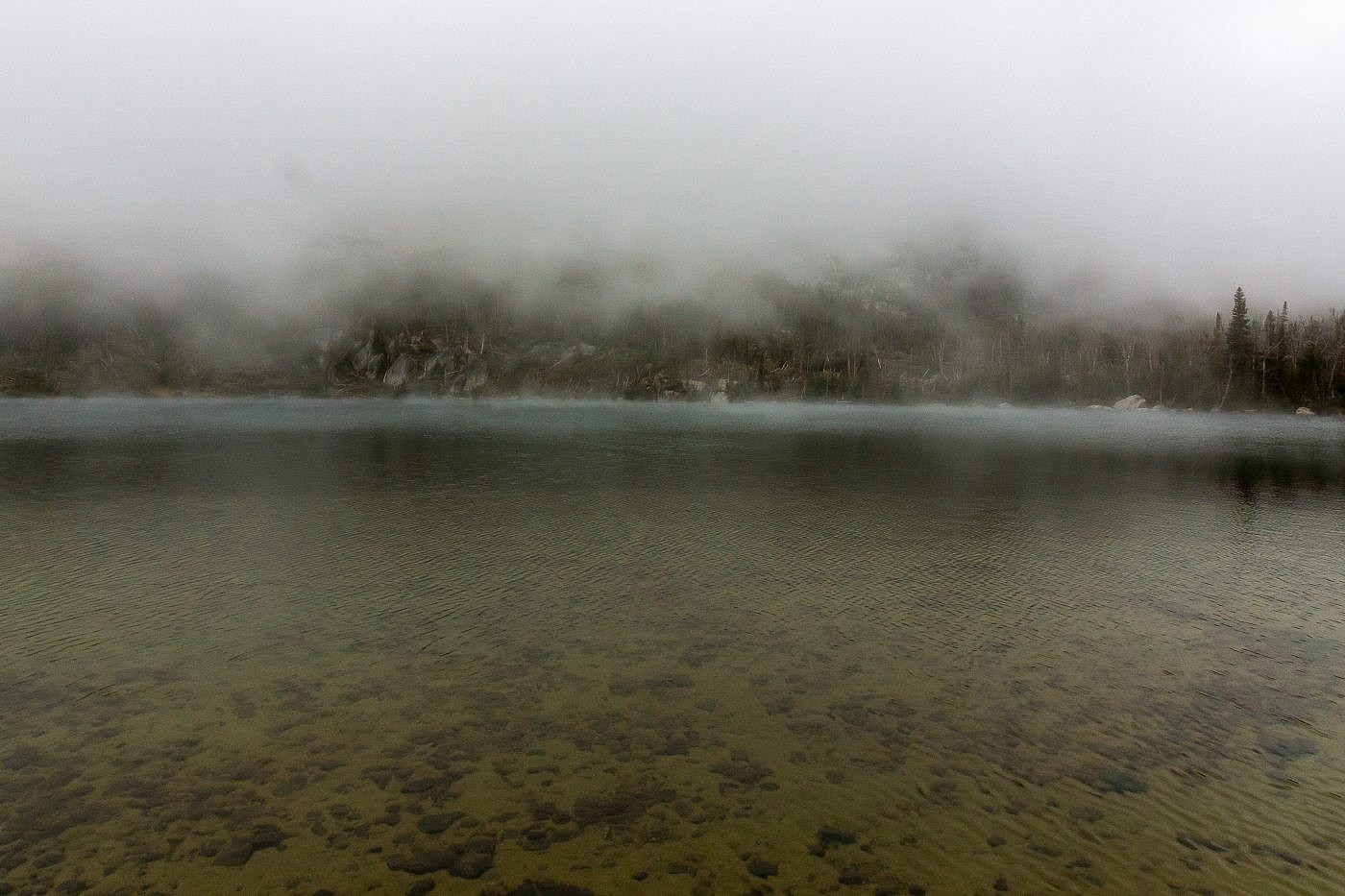
Early morning shot of Hollowtop Lake in the mists.
