Highland Mountains
Table Mountain
Download KML
Distance
5.5 miles one way
Type
Day hike
Difficulty
Hard
- Starting Elevation: 8000 ft.
- Ending Elevation: 10223 ft.
- Elevation Gain: 2223 ft.
 View all 20 photos
- Experience Date: Sep 7, 2019
- Hike Time: 6-7 hrs.
- Drive Time: 1 hr. 45 min.
- Road Condition: Well-maintained dirt road. 2 WD accessible. High-clearance not necessary. If you have a high-clearance vehicle you can continue another 2ish miles to where the road is gated.
- Parking: Plenty of parking at either parking location.
- Fees: None.
- Campsite Availability: Plenty of places to camp at either parking location.
- Private Property: None posted.
- Trail Traffic: Very light.
- Trail Condition: Road up to Highland Lookout. Solid trail up to Red Mountain. Trail fades in and out along the ridgewalk to Table Mountain.
- Fire Restrictions: None.
- Stream Crossings: None.
- Water Sources: None.
- Snow: None.
- Winter Access: Unknown.
- Weather: Cloudy. Windy. Cool.
- Bugs: None.
- Wildlife Sighted: None.
- Side Quests: Any of the side ridges or "arms" sprouting from Table Mountain.

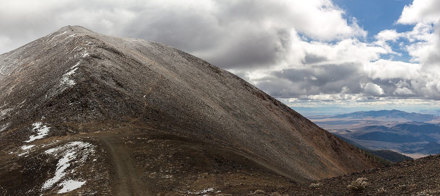
Table Mountain (10,223′) is the highpoint of the Highland Mountains just south of Butte, MT. This is easily within my top five hikes of the area, if not my overall favorite, because of the incredibly scenic ridgwalk and the fact you start at the fairly high elevation of 8,000′. A high clearance vehicle will get you even further up the mountain but the initial section through the woods is simple and still quite scenic. The hike starts with a steady climb along a road up to the Highland Lookout followed by an ascent of Red Mountain and then a ridgewalk all the way to the summit of Table Mountain. Although the net elevation gain is just over 2,000′ you’ll have to go up and over Monument Peak on the way to Table which makes this hike slightly more difficult than it appears. There’s no cover once you’re on the ridge so it’s a good idea to keep tabs on the weather in order to avoid any dangerous situations. There are several side ridges along the way any of which would make excellent side quests.
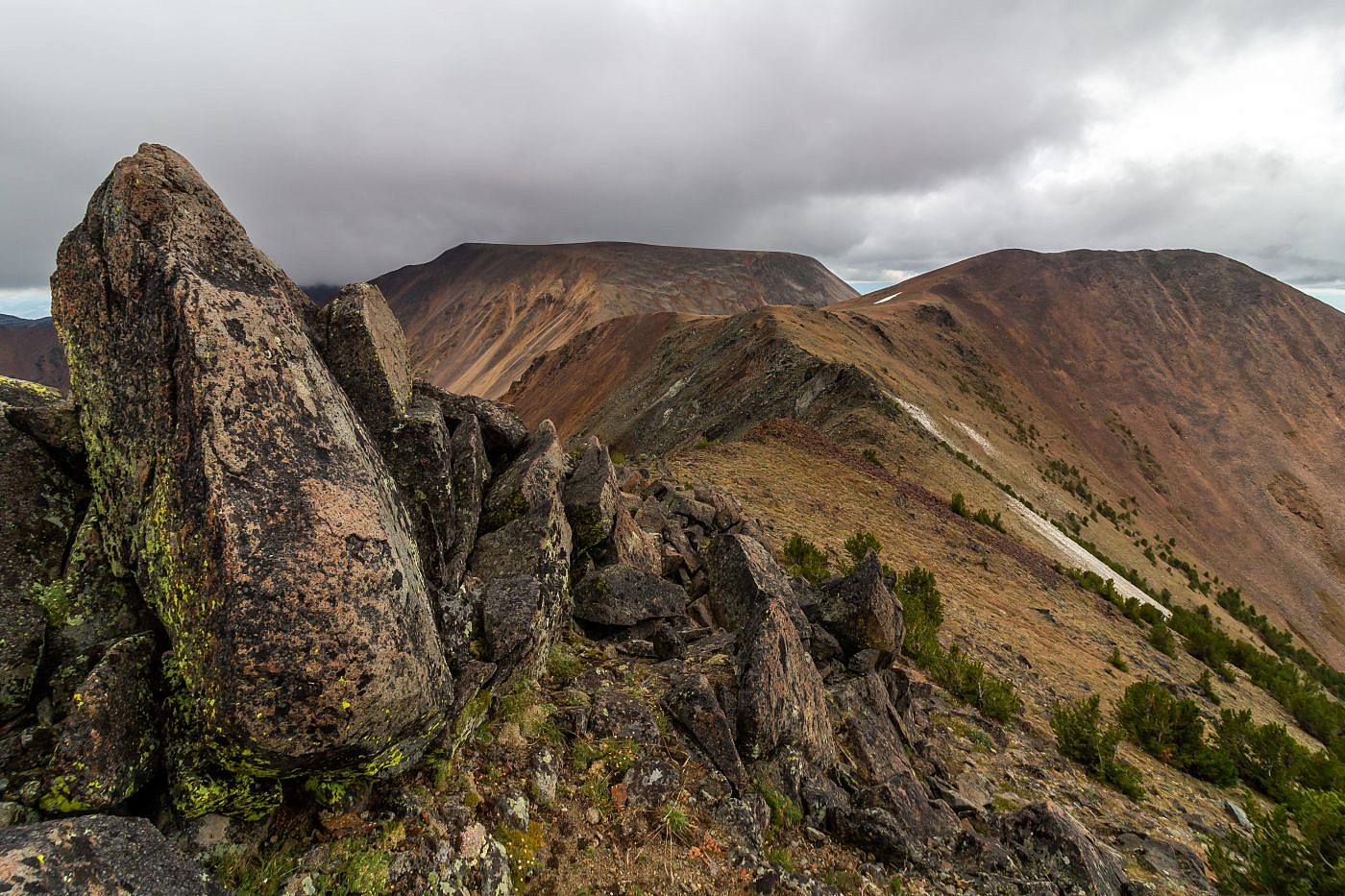
Table Mountain.
Background
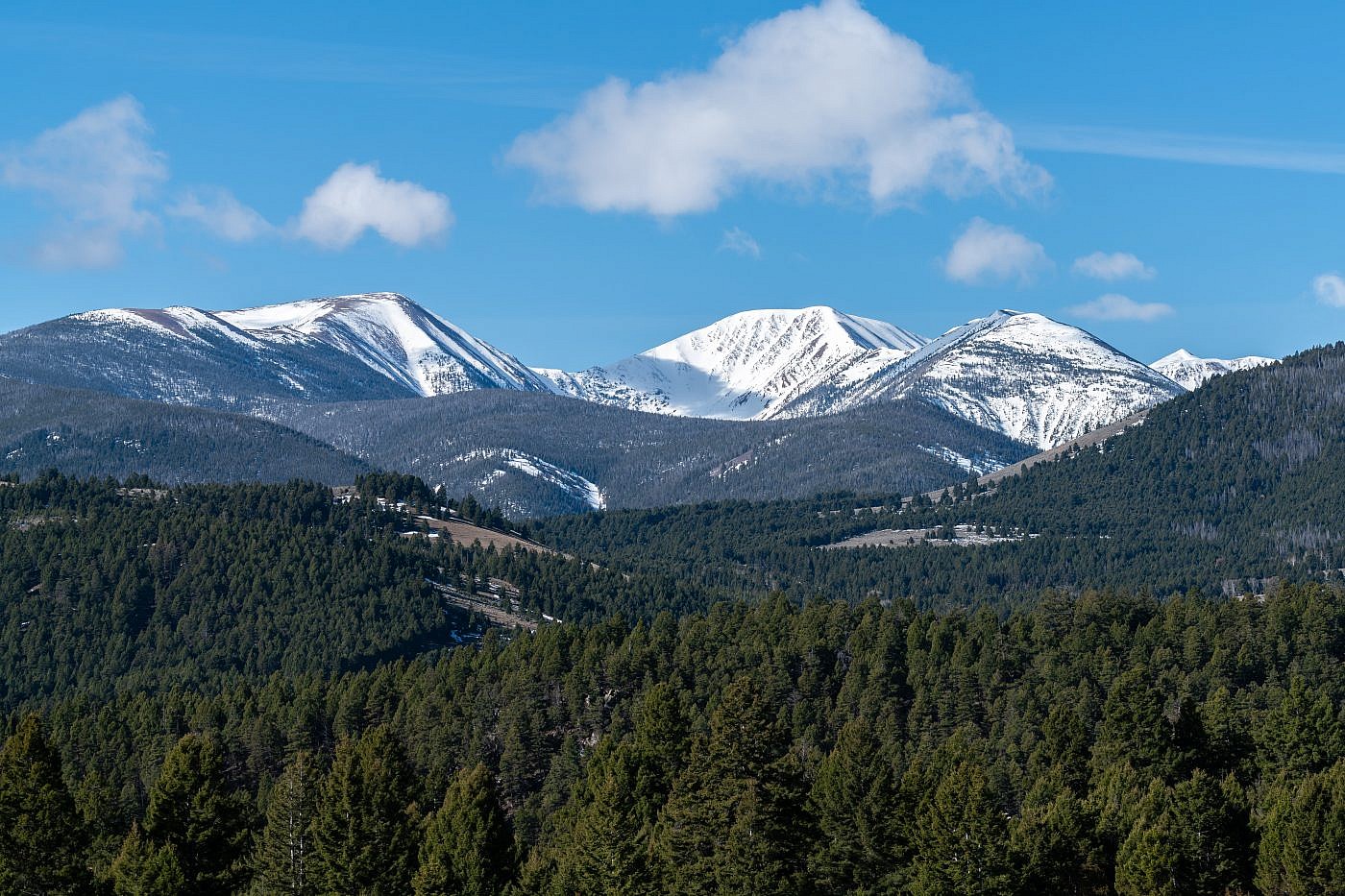
The Highland Mountains, south of Butte, MT, are a somewhat peculiar mountain range. Unlike many mountain ranges which tend to run in a particular direction, the Highlands are almost circular with a small region of high-elevations peaks in the core surrounded by foothills descending radially outward to the valleys below. Table Mountain (10,223′), the range highpoint, is the crown jewel of this range and its name really is reminiscent of it shape. The first time I saw it from the summit of Red Mountain, another peak of the Highlands, I imagined one of those stars from Super Mario 64 floating on its summit waiting to be collected. I also think the mountain kind of looks like a giant octopus-like monster with long tentacle arms stretching outward waiting to scoop up its victims.
There are two main routes to the summit that I know of. The most popular starts from the north with an ascent of Red Mountain, passing the Highland Lookout along the way, followed by a long ridgewalk around a giant cirque all the way to the summit of Table Mountain. This route is incredibly scenic and allows you to hike most of the worthwhile points of the range in a single day. Cedron Jones’ route in “Peakbagging Montana” is more of a get-in-and-get-out style of approach that goes straight to the summit from the south side of the mountain. I highly recommend the first approach if it’s your first time in the area.
Highland Mountains.
The Adventure Begins…
The adventure began on a cool, cloudy Saturday morning in September. I had been up to Red Mountain the previous year so I knew how epic the hike was going to be and really wanted to share the experience with someone but my hiking partner, Arlo, felt the weather was too questionable and wasn’t willing to take the risk. I, on the other hand, was. There weren’t any storms in any of the forecasts I regularly check and I knew if the clouds near Butte looked anything like the clouds near Bozeman there was going to be some incredible photo opportunities that don’t come around too often.
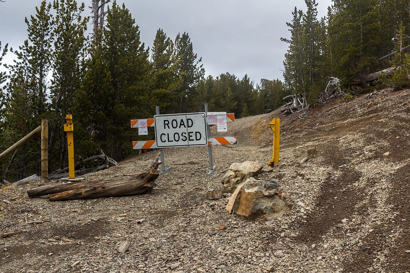
Getting to the trailhead is a little complicated. Starting from Highway 2 south of Butte exit at FS road #84 aka Roosevelt Drive. Continue along Roosevelt Drive until it curves north. At this point continue straight and onto Highland Road. Follow this road for a ways until you see a picnic area on the right and a sign for Highland Lookout. From here turn left onto FS road #8520. On a clear day you can see Red Mountain and the lookout straight ahead. Continue along this road for about a mile and take a left on FS road #688 at a four-way intersection. Follow this road for another mile or so and take a right onto the more primitive FS road #8514. As soon as this road enters the forest it starts to become rougher. This is the point where I parked but if you have a high clearance vehicle you can drive an additional two miles to where the road is gated.
On the Trail
If you’re a relatively experience mountain biker I highly recommend biking up to Highland Lookout. That’s what I did and it was well worth it, especially for the bike ride down. The first section is a steady uphill grade and is topped off will a series if snake-like switchbacks that run up the north ridge of Red Mountain just before the lookout. The greatest part about this hike is there isn’t a single boring section along it; even this first section is exhilarating.
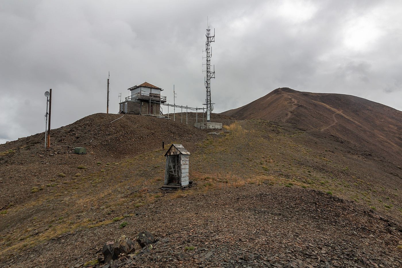
Highland Lookout with Red Mountain in the background.
After taking some time to explore the lookout and take in the views I locked up my bike and began the quick trek up Red Mountain. Once you leave the lookout you’re abandoning all cover from the elements for the remainder of the hike so if the weather’s looking ominous this is as far as you want to go.
The first time I did Red Mountain the conditions were similar. It was cold, windy, and there was a whirlwind of clouds dancing about the mountains. It was a little later in the season, though, and there was a light dusting of snow on the ground. I recall taking cover behind the lookout debating whether or not to make a shot at Red Mountain; I was more worried about a surprise blizzard than a thunderstorm that time. I waited patiently for an opening in the clouds and when I saw my opportunity I went for it. This time, the weather didn’t look all that threatening but the drama created by the clouds and lighting made the mountains appear frightening. I was both nervous and excited as I ascended Ol’ Red and would be for the remainder of the hike.
View of Red Mountain near Highland Lookout from my first visit.
The Ridge
At the summit of Red Mountain you’re treated to a grand vista of the entire Highland Range. Despite being a tiny mountain range the peaks look incredibly fierce. Red Mountain alone makes for a short-and-sweet hike but the ridgewalk over to Table is, in my opinion, one of the best hikes around. There is a trail in some spots but the destination is obvious so routefinding shouldn’t be an issue.
A small, sub-alpine lake named Emerald Lake sits at the center of the large cirque that you hike around. Apparently this lake is on private property so there’s no way to legally access it. It looks like a great little backpacking destination and I wonder if the owner would be willing to let people on their property. I talked to one individual who claimed that he use to hike there while in the Boy Scouts many years ago and still seemed to think you could get there. Maybe one day I’ll do some more digging and see if it’s in any way possible to get to this elusive lake.
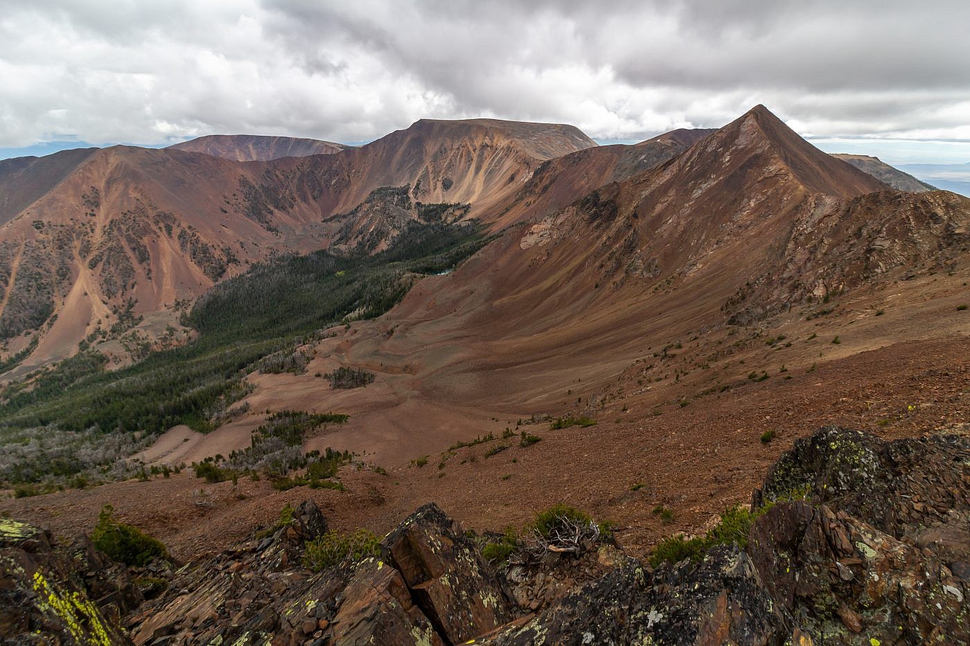
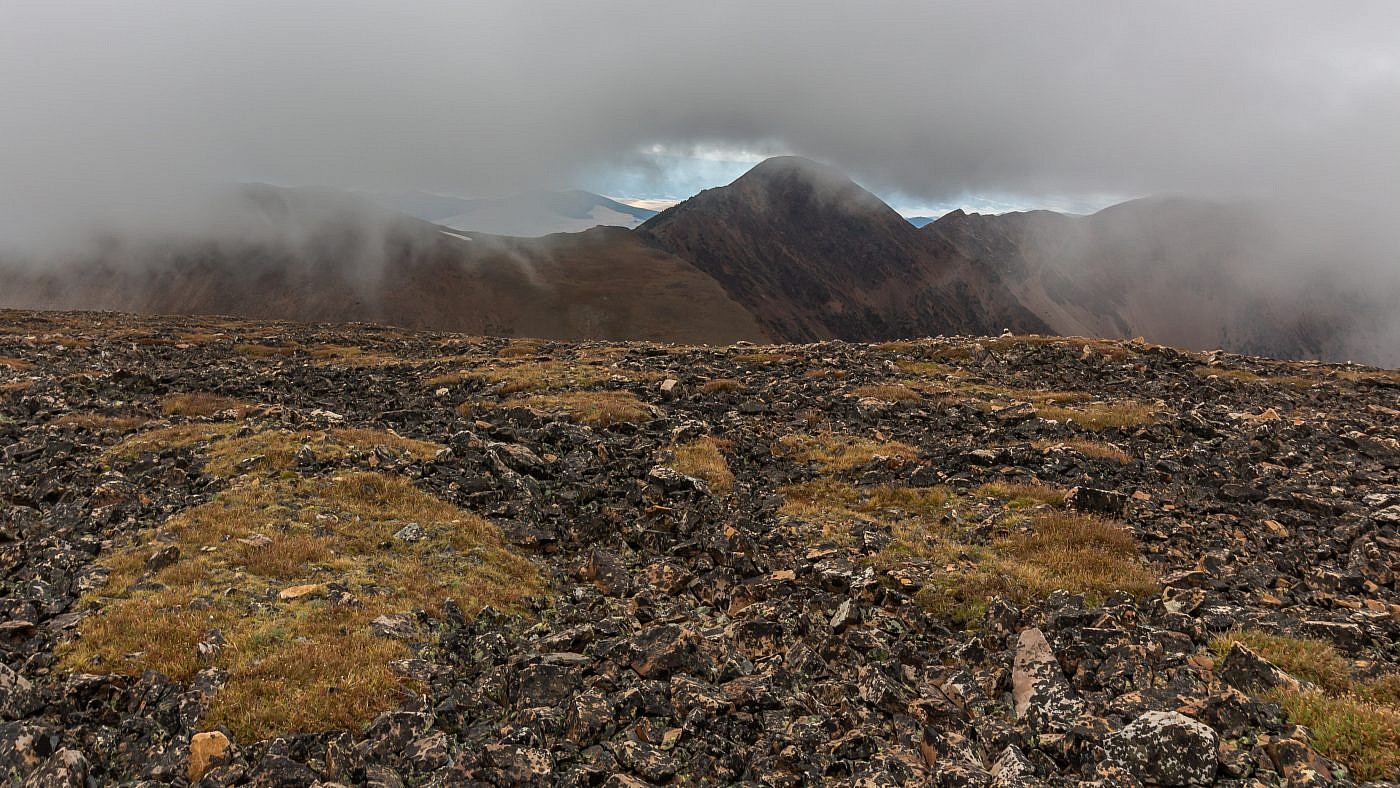
View of the Highlands from near the summit of Red Mountain. Table Mountain in the center and Monument Peak on the right.
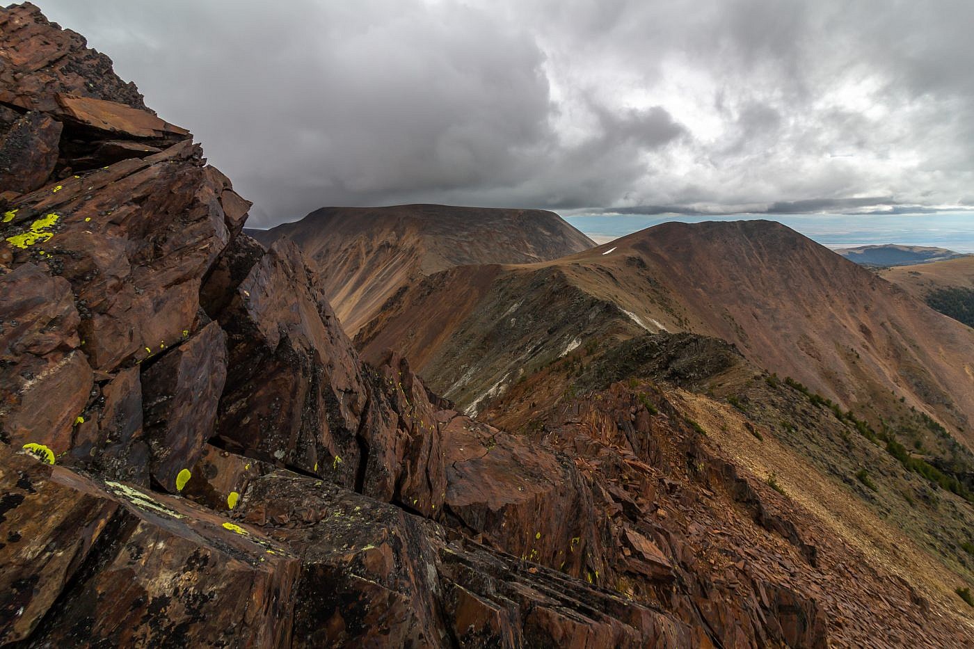
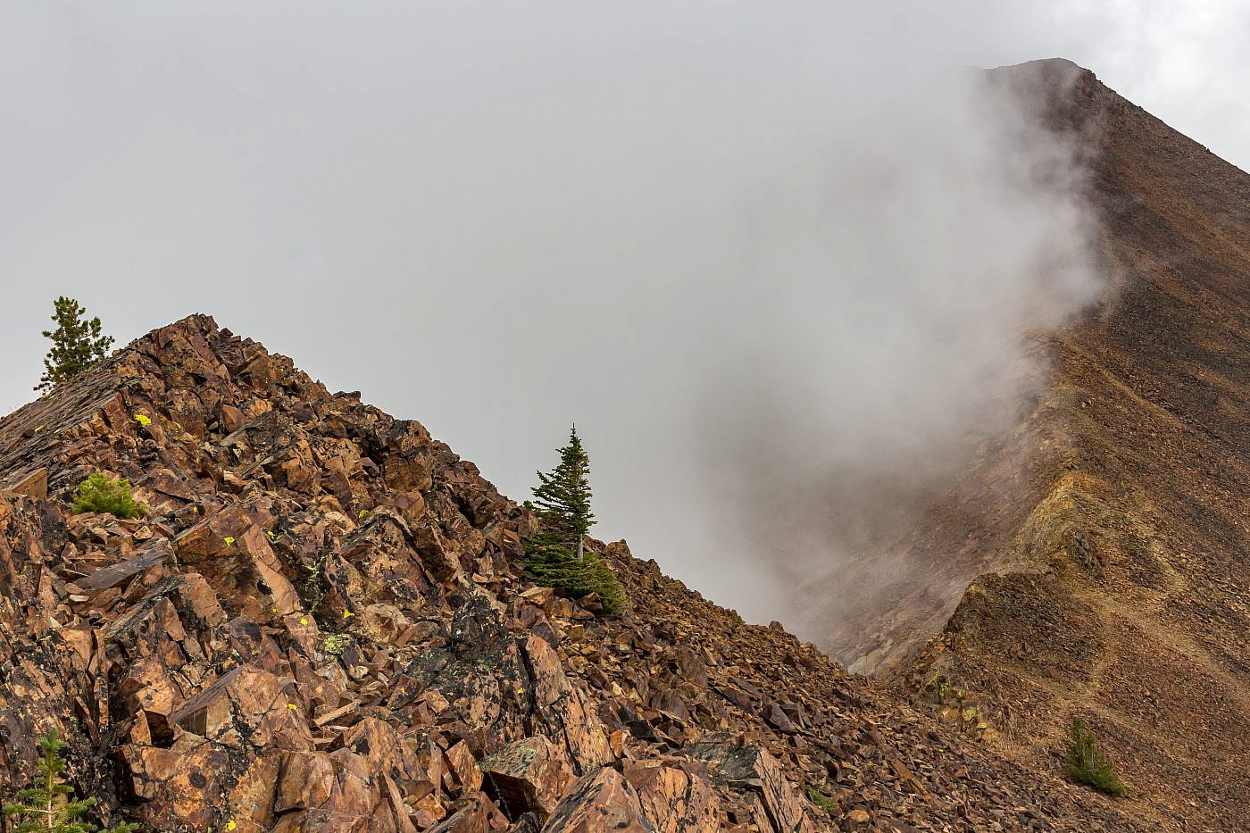
Even though Table is a mere 150′ taller in elevation than Red you will, inevitably, need to hike up and over Monument Peak twice which adds another 1,000′ or so of elevation. The slopes of Monument Peak are covered in nasty, dinner-plate talus so stick to the trail as much as possible. The opposite side is a bit steeper and there’s even a small section of class 3 scrambling.
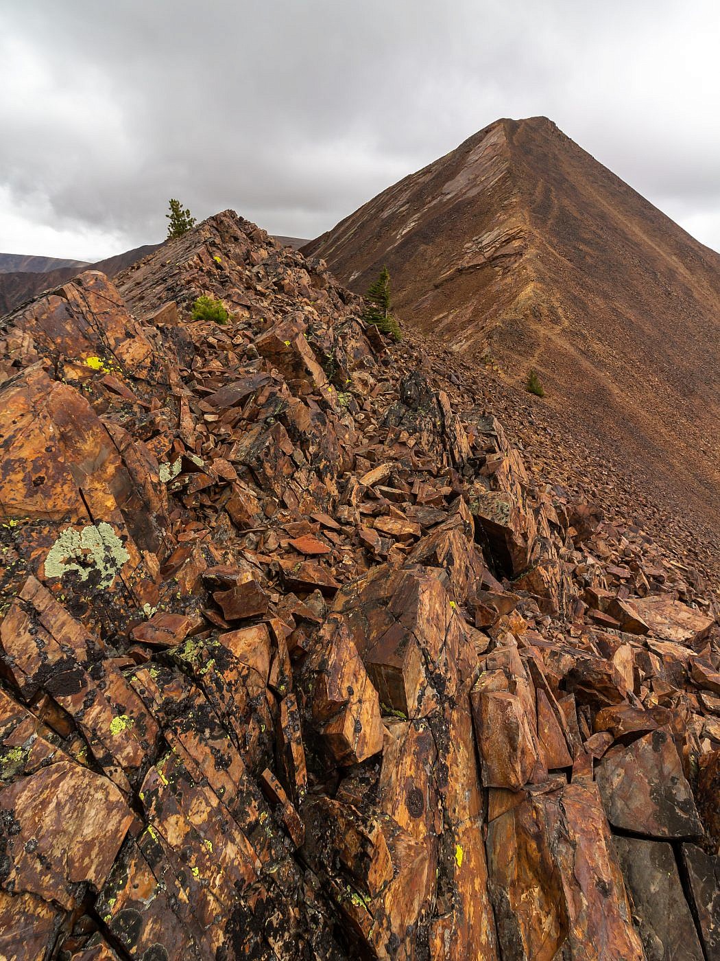
Approaching Monument Peak.
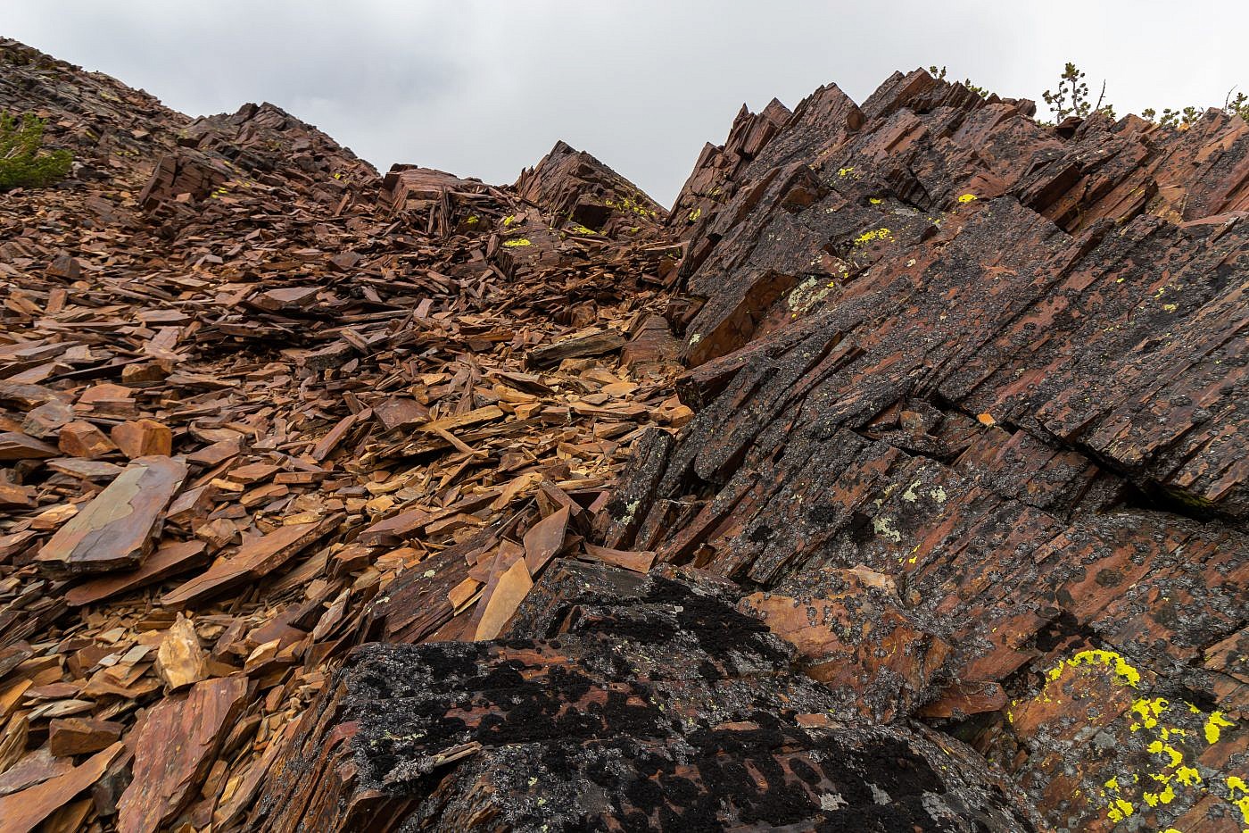
Descending the south ridge of Monument Peak. The trail mostly disappears here and there a bit of simple class 3 scrambling over the dinner-plate talus that covers the mountain.
Descending Monument Peak. The flat peak on the right could be done as a side quest.
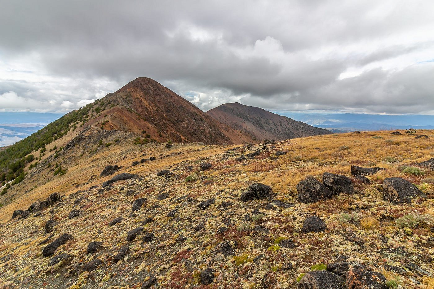
Looking back along the ridge towards Monument Peak and Red Mountain.
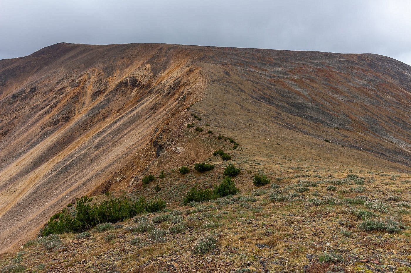
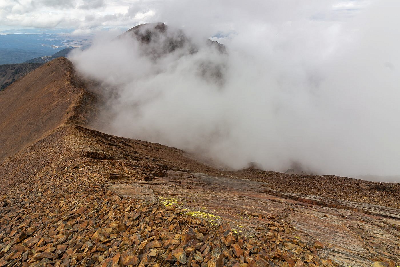
The final climb up to Table Mountain. Even though the summit appears close there’s still another 1/2 mile and 600′ of elevation to go.
Table Mountain
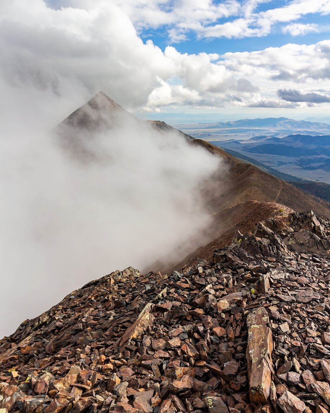
As I made the final, seemingly endless climb up Table Mountain I grew more and more nervous. Clouds were rolling in fast, obscuring the summit and I was experiencing a combination of emotions. I felt both euphoric because of the dramatic scenery was but increasingly anxious about the uncertainty of the weather. I was alone, miles away from any sort of cover, and by the time I made it to the top clouds had completely engulfed the summit which created a very disorienting situation. I wanted to spend more time exploring the summit but felt pressure to get off the mountain and back to safety.
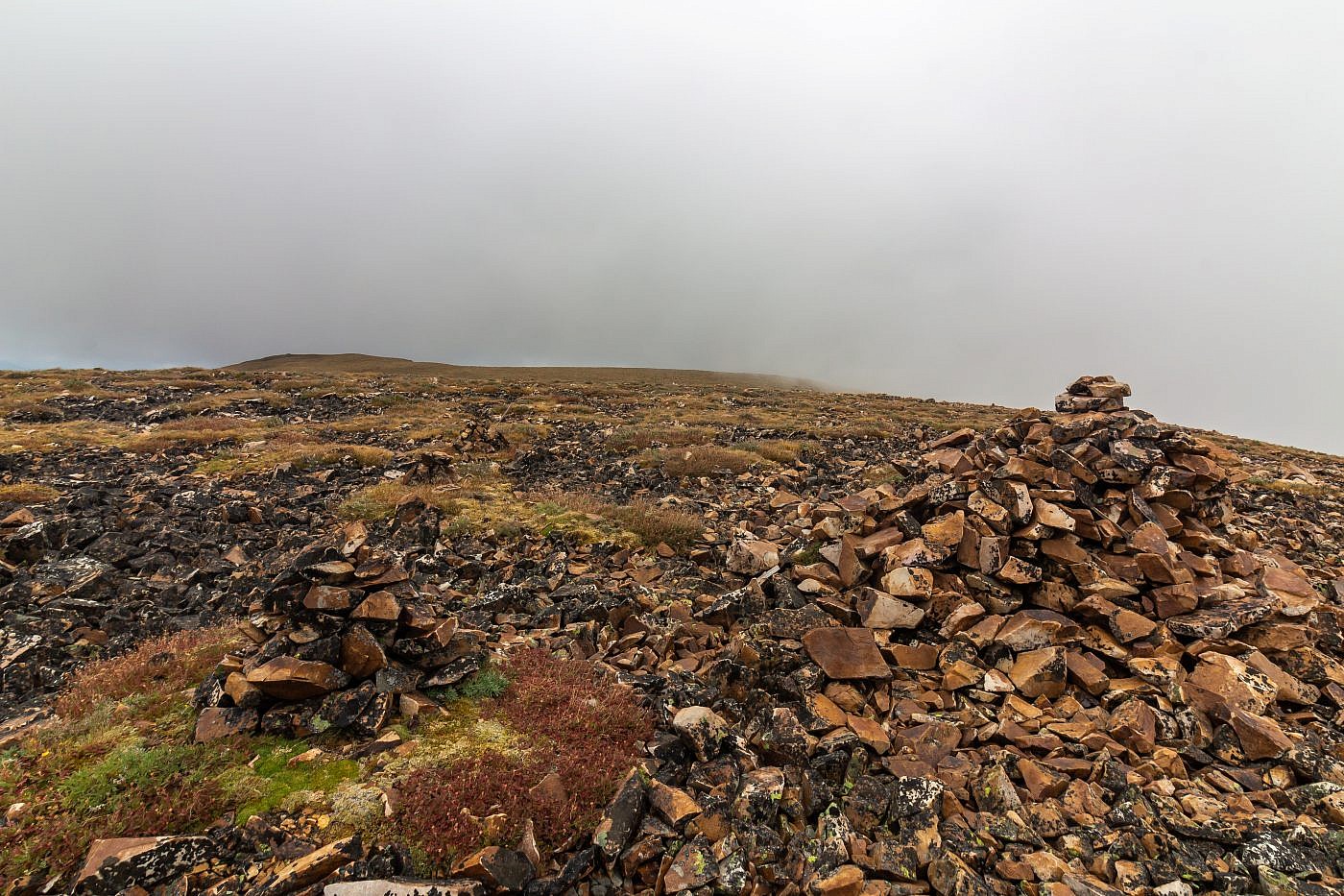
Looking east from the summit. Clouds were moving in quick and almost completely engulfed the summit. There are two “arms” sprouting off of Table Mountain which on a better day would make great side quests. One leads east to East Peak and the other heads northeast which can be seen from the summit of Red Mountain.
Looking towards Monument Peak from the summit. This is one of my favorite shots from the entire trip.
The Return
As I hustled my way down Table Mountain and towards Monument Peak clouds begin rolling in quicker and pooling up in the cirque below. I now started to realize that the ridge was acting as a barricade preventing itself from being entirely engulfed. This seemed uncharacteristic of a storm system which made me feel a little more relaxed. While ascending Monument Peak the sun finally made its first appearance illuminating this gorgeous, misty mountain scene.
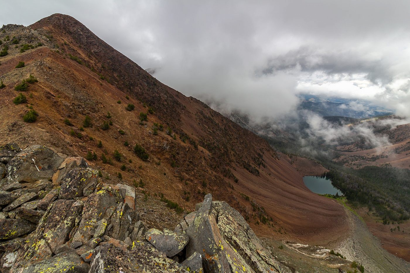
Monument Peak towering over Emerald Lake. The lake is supposedly on private land and therefore inaccessible.
Looking towards Red Mountain from the slopes of Monument Peak.
Monument Peak.
Looking towards Monument Peak from the summit of Red Mountain.
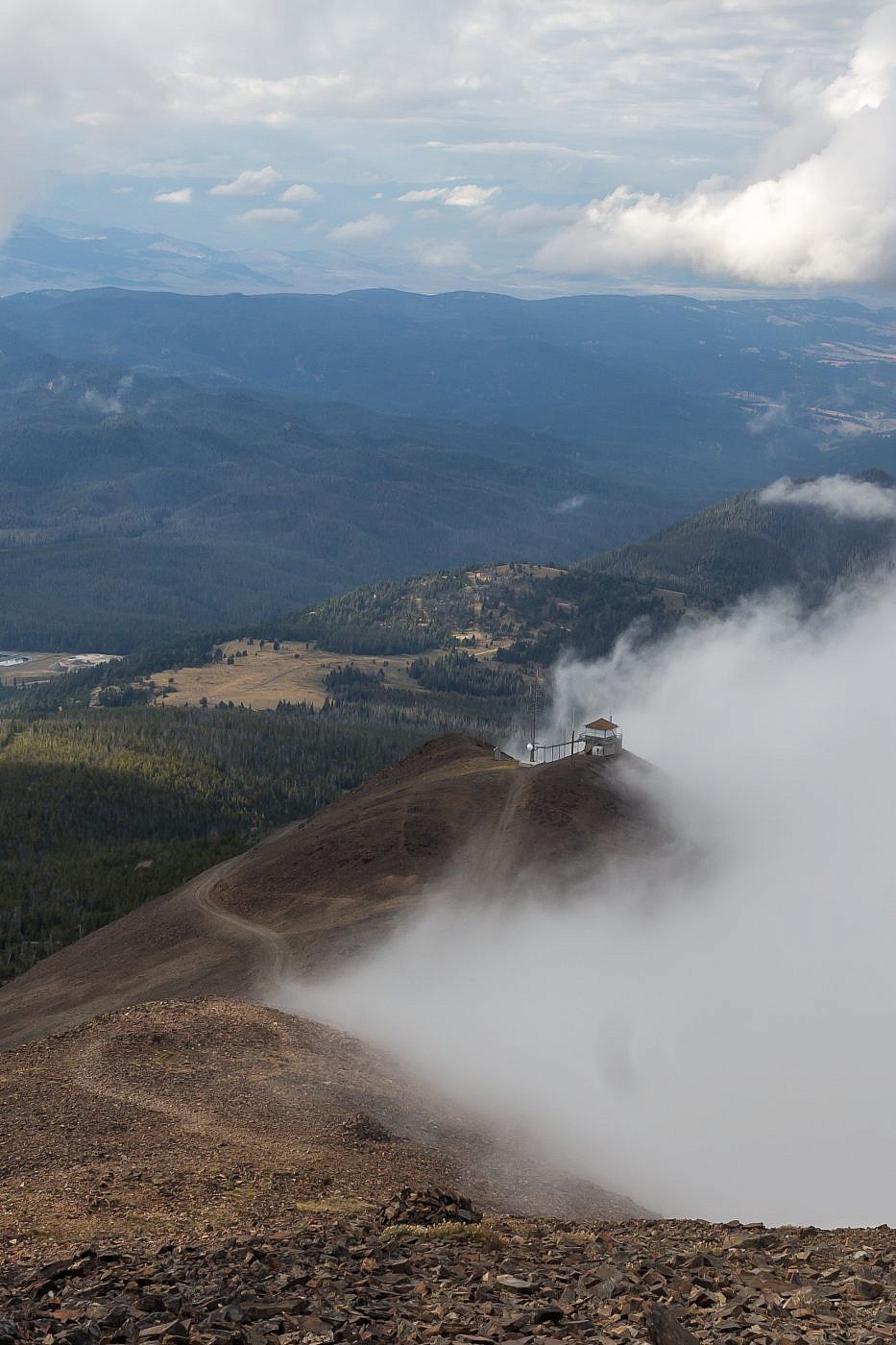
View of Highland Lookout while descending Red Mountain.
Back to Safety
I was quite relieved when I finally made it back to the safety of the lookout. After taking a moment to collect myself I hopped on my bike and raced down the snake-like switchbacks like a knight charging into battle. Back at the car I decided to make camp near my parking spot on a beautiful little perch overlooking the Humbug Spires Wilderness Study Area on the west side of the Highlands.
I did much reflecting as I settled in for the night. My journey to Table Mountain was possibly the single most beautiful and thrilling mountain experience of my life despite being on edge for most of the adventure. I do, however, hope to one day return to conquer the beast again under more relaxing conditions.
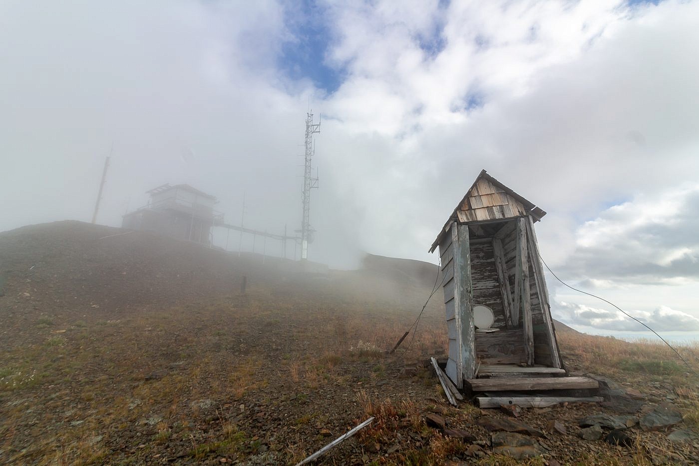
Highland Lookout had taken on a completely new look by the time I made it back.
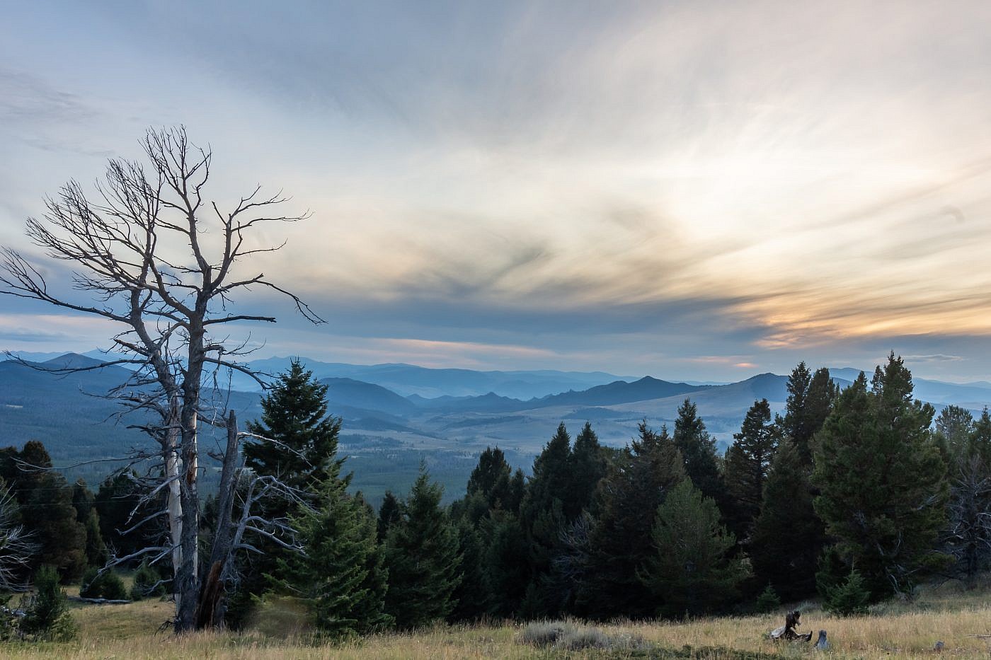
View from my campsite overlooking the Humbug Spires Wilderness Study Area.
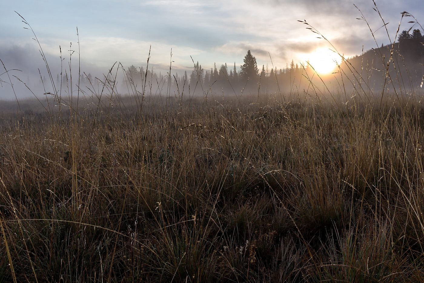
Early morning sunrise shot from near my campsite.
