Anaconda Range
West Goat Peak
Download KML
Distance
7.25 miles one way
Type
Day hike
Difficulty
Hard
- Starting Elevation: 6400 ft.
- Ending Elevation: 10793 ft.
- Elevation Gain: 4393 ft.
 View all 17 photos
- Experience Date: Sep 5, 2019
- Hike Time: 8-10 hrs.
- Drive Time: 2 hrs. 45 min.
- Road Condition: Well-maintained dirt road. 2 WD accessible. High-clearance not necessary.
- Parking: Small grassy area plus parking along the road.
- Fees: None.
- Campsite Availability: Camping at trailhead. There are some flatter sections along the trail that you could camp on. Could also camp near saddle where you leave the official trail or in the Lost Lakes basin.
- Private Property: None posted.
- Trail Traffic: None.
- Trail Condition: Mostly good. There's a marshy area where the trail disappears and several other areas where the trail becomes faint. All off-trail once you reach the saddle although spur trails can be found.
- Fire Restrictions: No fires within 1/4 mile of Lost Lakes.
- Stream Crossings: One minor stream crossing after you leave the trail.
- Water Sources: Middle Fork Fishtrap Creek parallels the trail but isn't easily accessible most of the time. Lost Lakes.
- Snow: Some small snow fields near the top.
- Winter Access: Unknown.
- Weather: Partly sunny. Warm. 70's.
- Bugs: Some mysterious flying insects just at the summit.
- Wildlife Sighted: None.
- Side Quests: East Goat Peak.

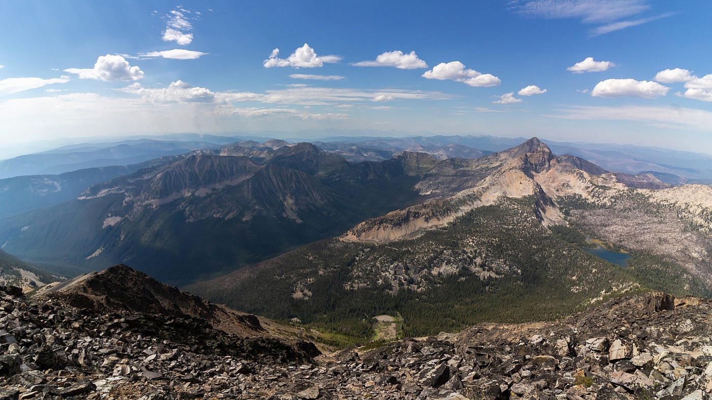
West Goat Peak (10,793′) is the highpoint of the Anaconda Range (or “Pintlers”) just north of the Big Hole Valley in southwest Montana. It’s a challenging hike that climbs almost 4,500′ of elevation over about seven miles. Luckily the elevation gain is spread out nicely throughout the hike but the trail can be hard to follow at times and is quite tedious for the first five miles which are spent in the trees. The Lost Lakes basin makes it all worth it in the end and it’s a relatively simple scramble from there to the summit. West Goat’s neighbor, East Goat Peak (10,390′), could be easily incorporated into the hike if you’re hungry for more. Getting to the trailhead is a little complicated but the roads are in decent shape and there’s some area to camp near the trailhead.
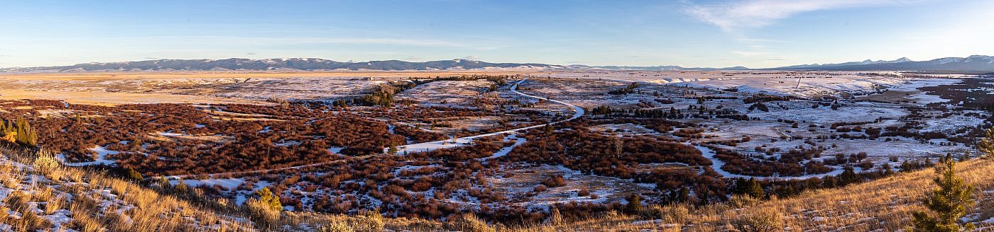
West Goat Peak and the Lost Lakes Basin.
Background
I remember very distinctly the first time I gazed upon the Anaconda Range (also known as the “Pintlers”). I had been in Idaho to view the solar eclipse of 2017 and on our return journey we passed through the Big Hole Valley along Highway 43. I recall glancing to the north and seeing this wondrous mountain range with humongous peaks towering over a beautiful valley and I began to contemplate the unknown that lay within. Then it dawned on me. Why should I restrict myself to exploring just the mountain ranges close to Bozeman? Seriously, why? There’re so many out there, each one with its own personality. Each one with its own novel experience to be had. In that moment I began piecing together a plan to embark on a journey to explore as many mountain ranges as I could and I believe it’s this moment in time that planted a seed which ultimately lead me to do what I do today.
I didn’t finally get a chance to explore the Anacondas, which roughly trace the continental divide, until June 2019 and its then that I discovered West Goat Peak (10,793′), the range highpoint. You can’t miss this one. It clearly dominates every other peak in the area and although it’s not the most rugged looking I could just feel that it’d take some serious effort to get to its summit. This would turn out to be the case when I came back later that same year to conquer the beast.
The inspirational view I got of the Anacondas from Highway 43 near Wisdom, MT. West Goat Peak is the obvious highpoint.
By the time summer was in full swing I was really starting to question what I was doing with my life. I found myself to be increasingly unsatisfied with my job and dreamt of a life on the road, free of the shackles of society. Money is somewhat essential for life, though, so I decided to compromise. Rather than quit my job entirely I dropped to two shifts per week in order to free up enough time to feed my addiction while also making just enough money to survive on. In other words, I became a full-time peakbagger and worked on the weekends. This became my reality at the start of September 2019 and West Goat Peak was my first victim.
West Goat Peak is probably one of the more challenging highpoints of Montana. Not because it’s super steep, not because it’s technically challenging, and not because the trailhead is hard to get to. This one is just plain tedious. But the views from the top are incredibly rewarding and the Lost Lakes basin alone makes this one worth doing. The most popular route follows Trail #2129 which parallels Middle Fork Fishtrap Creek to a saddle about 5 miles in. Then you leave the trail, bushwhack up to the Lost Lakes basin, and continue onward to the summit.
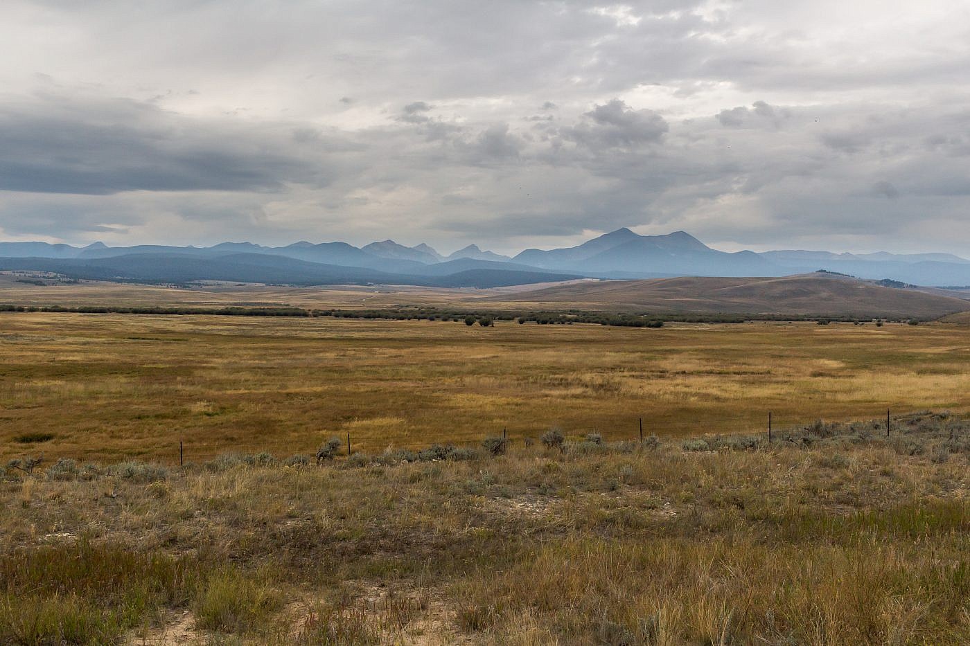
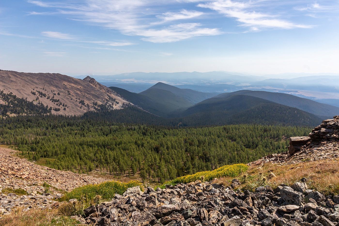
The Big Hole Valley
The Big Hole Valley is glorious. I simply love this place. It’s one of the most remote places within reasonable distance from Bozeman and it’s flanked by three beautiful mountain ranges, the Beaverheads to the southwest, the Anacondas to the north, and the Pioneers to the east. Cellphone reception is very limited in the valley so you’ll definitely be off the radar recreating here. The quaint town of Wisdom is one of the few settlements in the area. Services are limited here but there is a gas station, a grocery store, and a handful of restaurants and bars. Maybe my favorite part of Wisdom is the American Legion Memorial Park which allows free camping although donations are appreciated. There’s everything you’d expect at a campground but the real draw is a small hut which is free to access and serves as a wi-fi hotspot. The facility is not maintained in the winter months.
The Big Hole isn’t just known for its beauty and exceptional fly fishing but also for its rich history. The Big Hole River, a tributary of the Jefferson, was originally named the Wisdom River by Lewis and Clark as they passed by while searching for a continuous waterway through the rockies (i.e. the “Northwest Passage”) and although they didn’t pass through the Big Hole Valley together Clark passed through on his return journey. Maybe the most well-known historical landmark in the valley is the Big Hole National Battlefield located just 10 miles west of Wisdom. It’s here, on August 9th and 10th of 1877, that a battle took place between a band of Nez Perce and the U.S. Army during the Nez Perce War which started when several bands of Nez Perce refused to relocate to the reservation set aside by the U.S. government. For several months the U.S. army chased the various bands of Nez Perce as they attempted to retreat to Canada. The conflict came to an end when Chief Joseph surrendered just 40 miles from the Canadian border.
Panorama of the Big Hole Valley from a perch near the Big Hole Battlefield. Pioneer Range in the distance on the left and Beaverheads in the distance on the right.
The Adventure Begins…
I left Bozeman on a Wednesday evening with the plan to camp as close to the trailhead as possible. I debated whether or not to camp at the trailhead itself but by the time I got to the Big Hole Valley the sun was starting to go down so I settled on the Fishtrap Creek Fishing Access right along the Big Hole River. I’ve stayed at this campground a handful of times and have not once seen a single soul there.
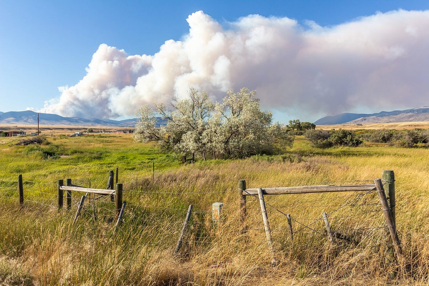
On the way to the campground I made a short pit stop by Whitehall, MT to photograph this plume of smoke coming from a forest fire in the Boulder Mountains.
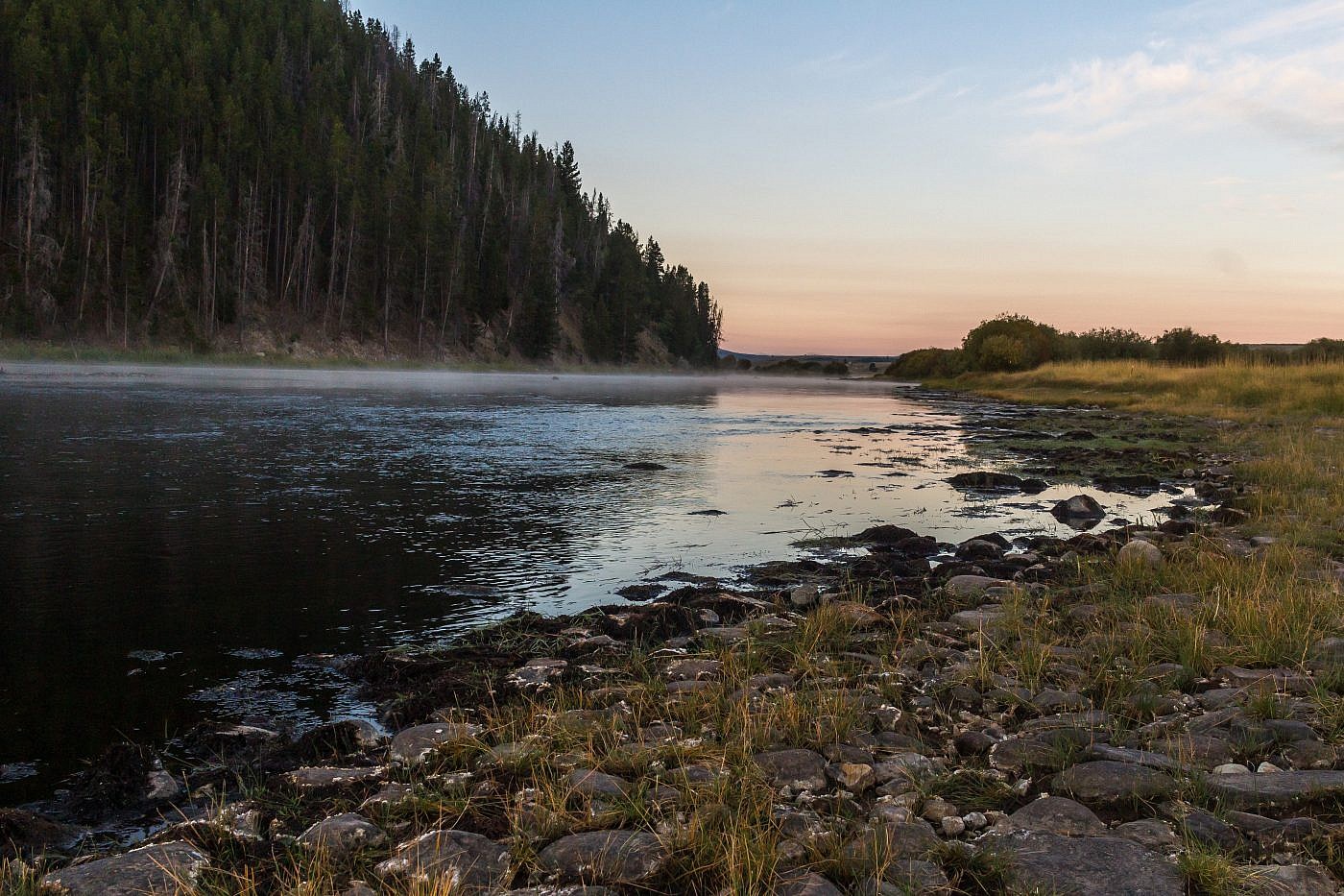
Early morning photograph of the Big Hole River from the Fishtrap Creek fishing access.
Although the roads to the trailhead are well-maintained, finding the trailhead itself is a bit tricky. From Highway 43 turn west onto a dirt road (Calvert Creek Road) leading to Fishtrap and Mudd Creeks. Follow this road for about 5.4 miles until an intersection with FS road #1279. Take a sharp right at the junction and continue another 4 miles or so to the trailhead on the left. This trailhead is poorly marked and easy to miss. There’re no signs, just a faint trail leading west into the forest and a small grassy area on the other side of the road for parking. Just before reaching the trailhead you’ll drive over a large culvert on the side of the road. This is a good indicator that you’re almost there. You could easily camp anywhere along this road if you want to stay near the trailhead.
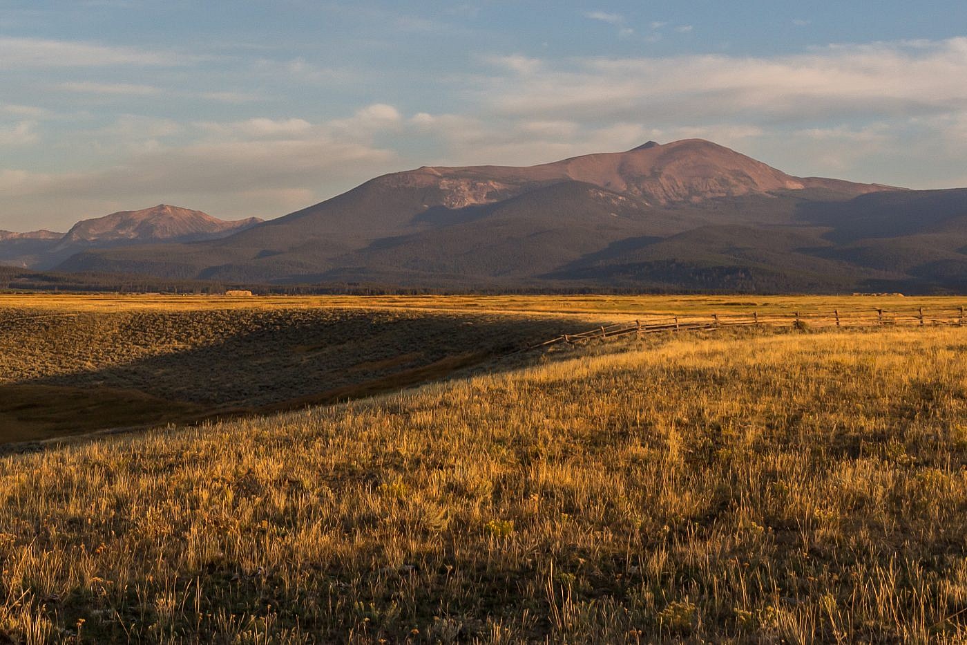
Approaching the trailhead. West Goat is just barely peaking out behind East Goat on the right.
On The Trail
As I often do I started out on my mountain bike. Bikes are not allowed in wilderness areas but the boundary for the Anaconda-Pintler Wilderness is about 2.5 miles in and I figured by then it’d be too inconvenient to bike anyway. The trail parallels Middle Fork Fishtrap Creek most of the way although the creek itself is not easily accessible. After a mile or so of flattish travel you’ll enter an open meadow where the trail all but disappears. Head straight through the meadow to where the trail picks up again and starts to head steeply up a broad ridge. There is a spur trail leading east out of the meadow that I originally mistook for the actual trail which cost me some time. I also had to ditch my bike at this point because the trail was too steep.
At this point you just want to keep hiking. You’re mainly stuck in the forest so there’s not much for views. Further on you’ll encounter some boggy sections which can be tricky to navigate. The trail mostly disappears during theses sections so I recommend following the blazes and using your best judgment. I had a bit of trouble keeping track of the trail and wandered off in the wrong direction several times.
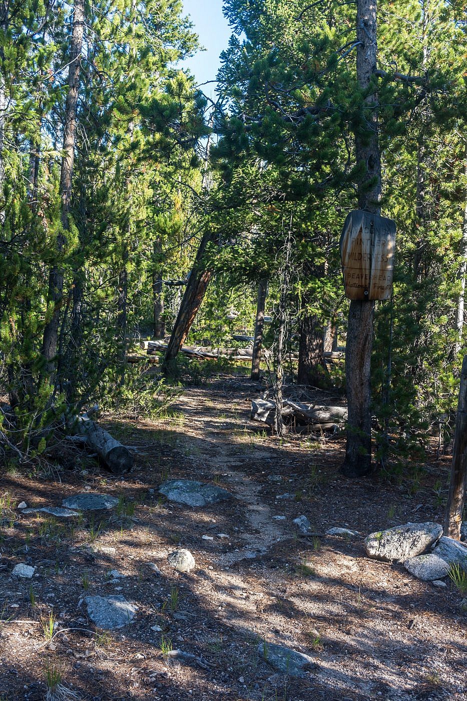
Entering the Anaconda-Pintler Wilderness. Much of the first 5ish miles of the hike are through a homogeneous forest.
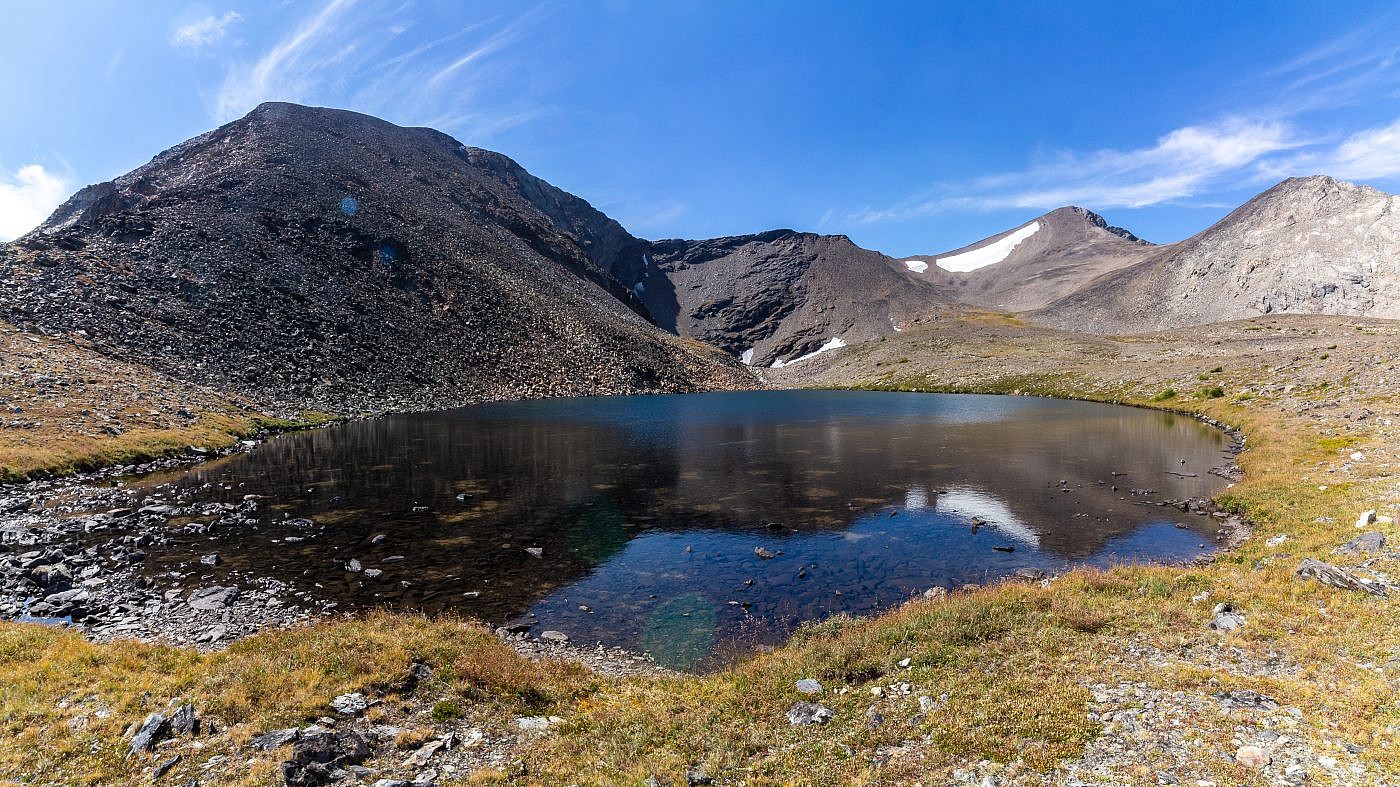
Once the boggy sections are behind you the trail continues climbing steadily towards a saddle which is the highpoint of the official trail about 5 miles in. At this saddle Trail #2129 (the one you’re on) turns into Trail #2128, descends the other side of the saddle, and follows East Fork Fishtrap Creek back to the road you came in on. At the point where the two trails meet you want to leave the main trail and continue along the obvious spur trail to the left leading towards the Lost Lakes Basin. At this point its personal preference as to the exact path you want to take. I followed the spur trail as far as I could until it ran into East Fork Fishtrap Creek and then turned sharply west towards the basin. After a short, but steep climb up some talus you’ll be at the basin.
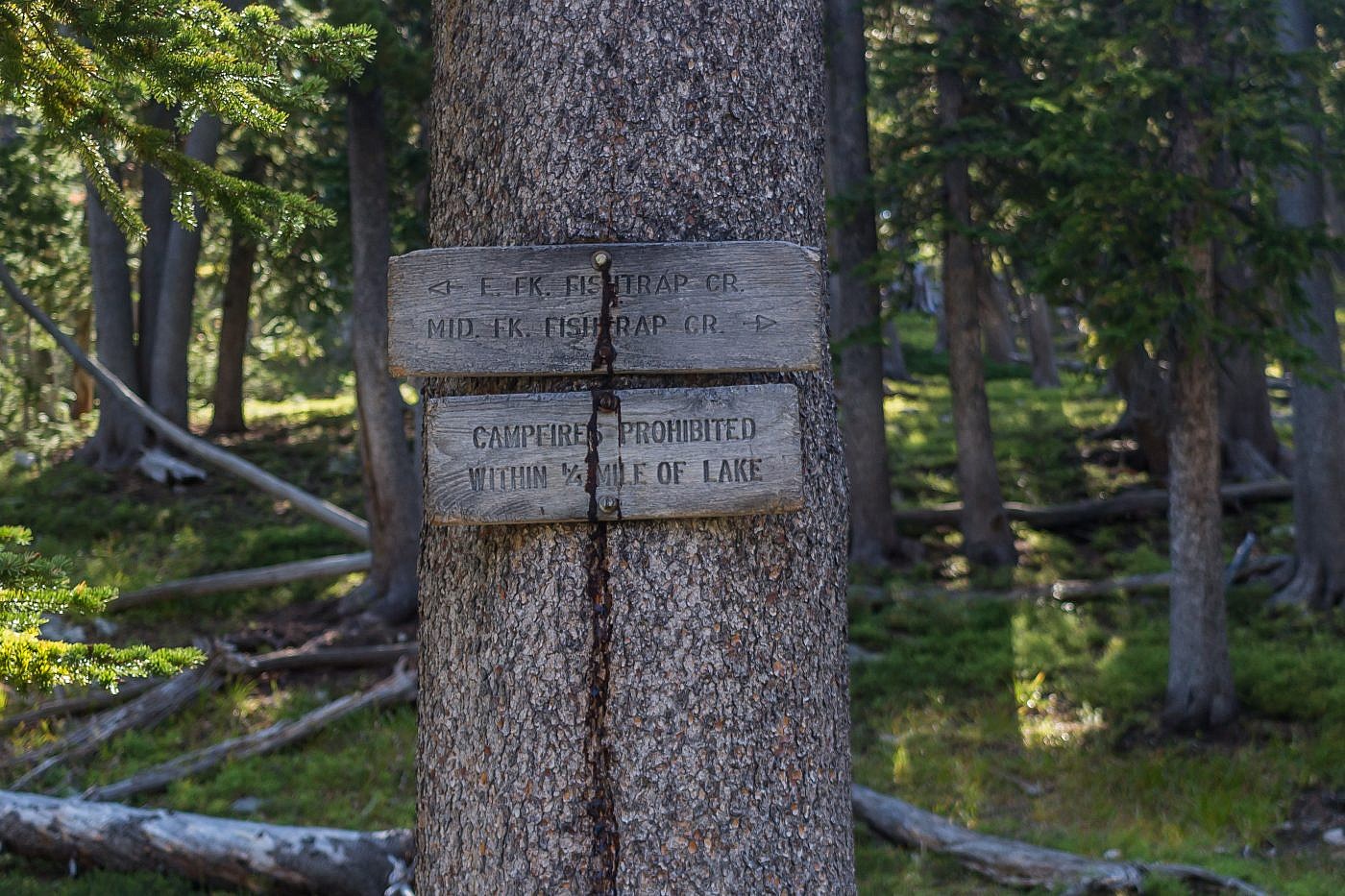
A sign at the saddle where Trail #2129 meets Trail #2128. At this point you want to head towards the Lost Lakes basin. I followed the obvious spur trail leading that direction as far as I could and then headed west along East Fork Fishtrap Creek up to the basin.
Looking back towards the saddle (right) from the edge of the Lost Lakes Basin. Trail #2129 comes in from the right and Trail #2128 follows East Fork Fishtrap Creek down the drainage in the center.
Once at the basin you’ll get your first view of West Goat. There are several obvious paths to the summit. You could either head towards the saddle to the left of the peak or the saddle to the right which is the route I took. If you’re feeling extra adventurous I believe you could head up the ridge to the left, summit East Goat Peak, then loop around to West Goat and back down. I, for some reason, had it in my mind that there were some class 3 sections along the ascent so I was a little nervous going in since I was alone. Luckily it ended up being a simple, although steep, class 2 scramble all the way to the top.
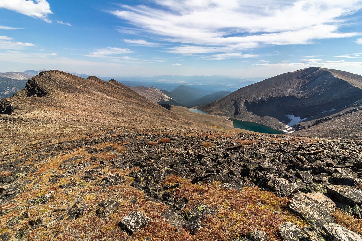
First view of West Goat Peak from the Lost Lakes basin. Here I shot for the saddle to the right of the peak and followed the ridge up to the summit.
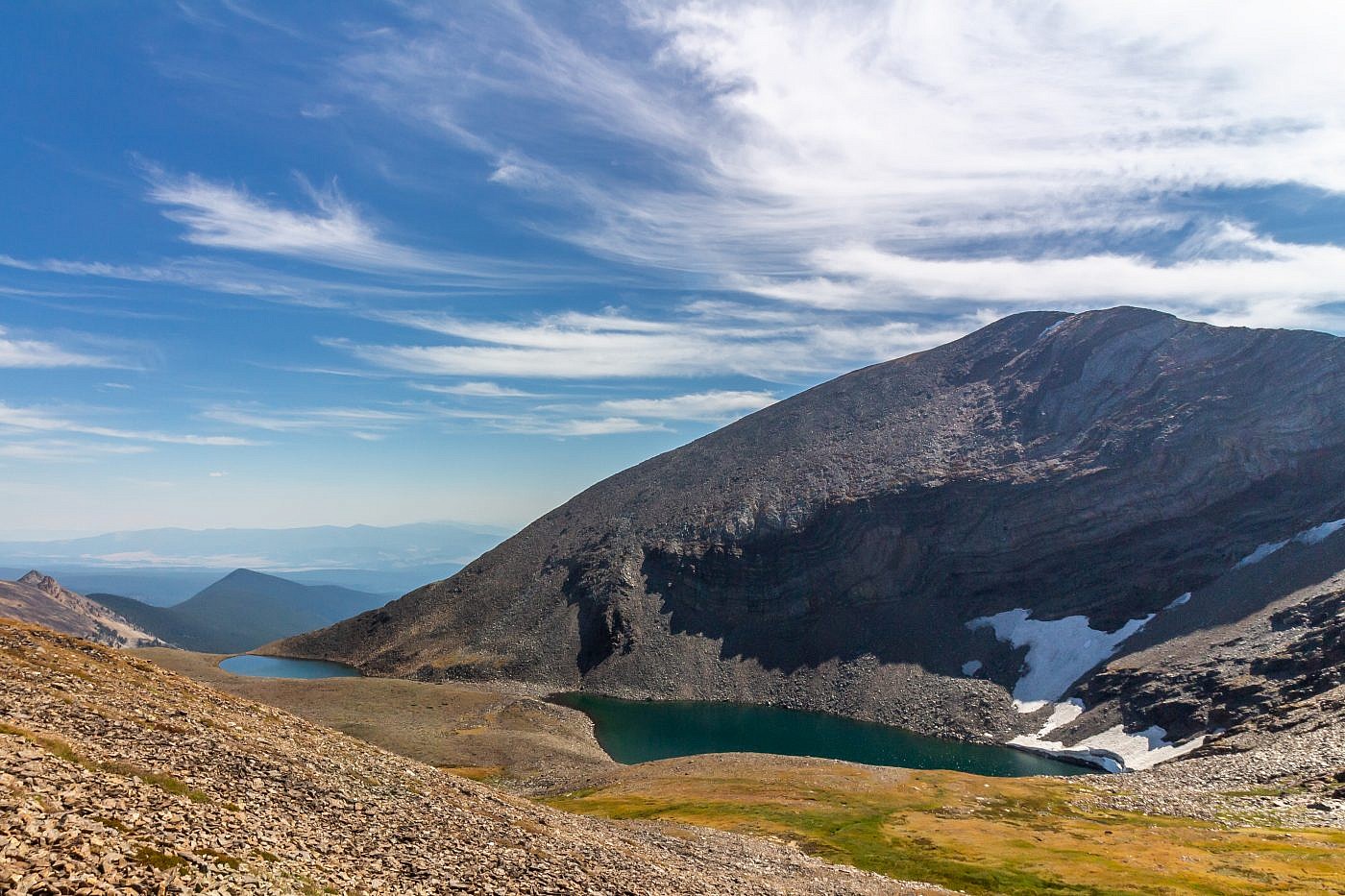
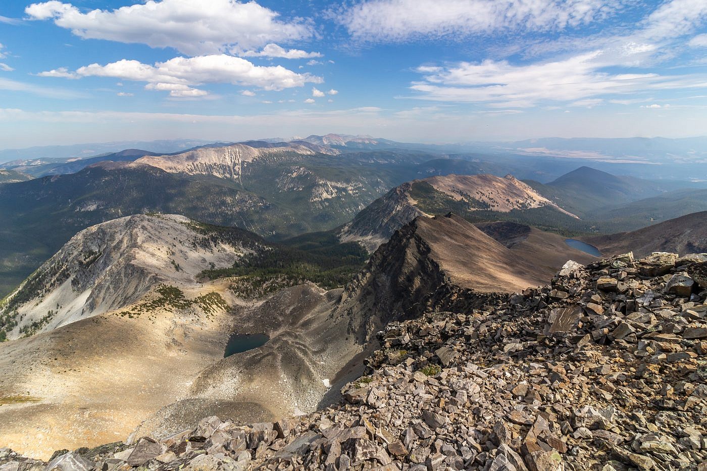
Looking back over the Lost Lakes basin. East Goat Peak towers overhead.
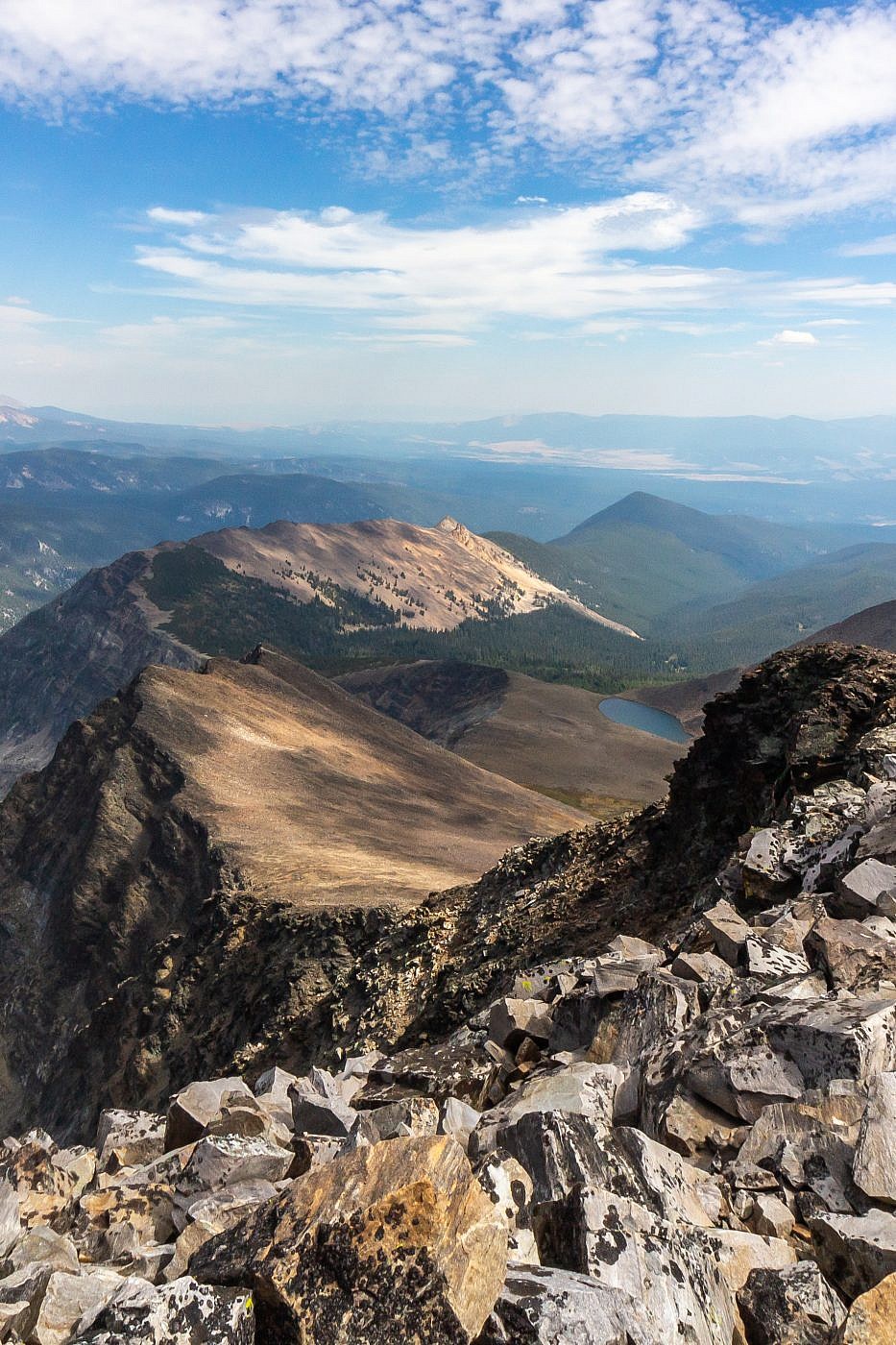
Looking east from the summit. Warren Peak (10,463′) and Warren Lake on the right.
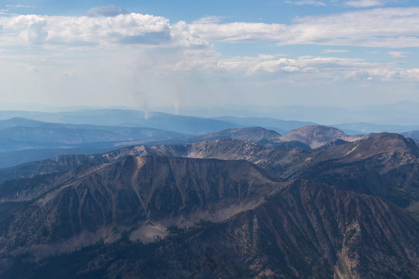
Closeup shot of what appears to be some small forest fires burning in the distance.
Looking north from the summit.

The Lost Lakes basin. East Goat on the right. It looks like you could easily descend down the ridge to the right, up East Goat, and back down to the basin (or do this in reverse).
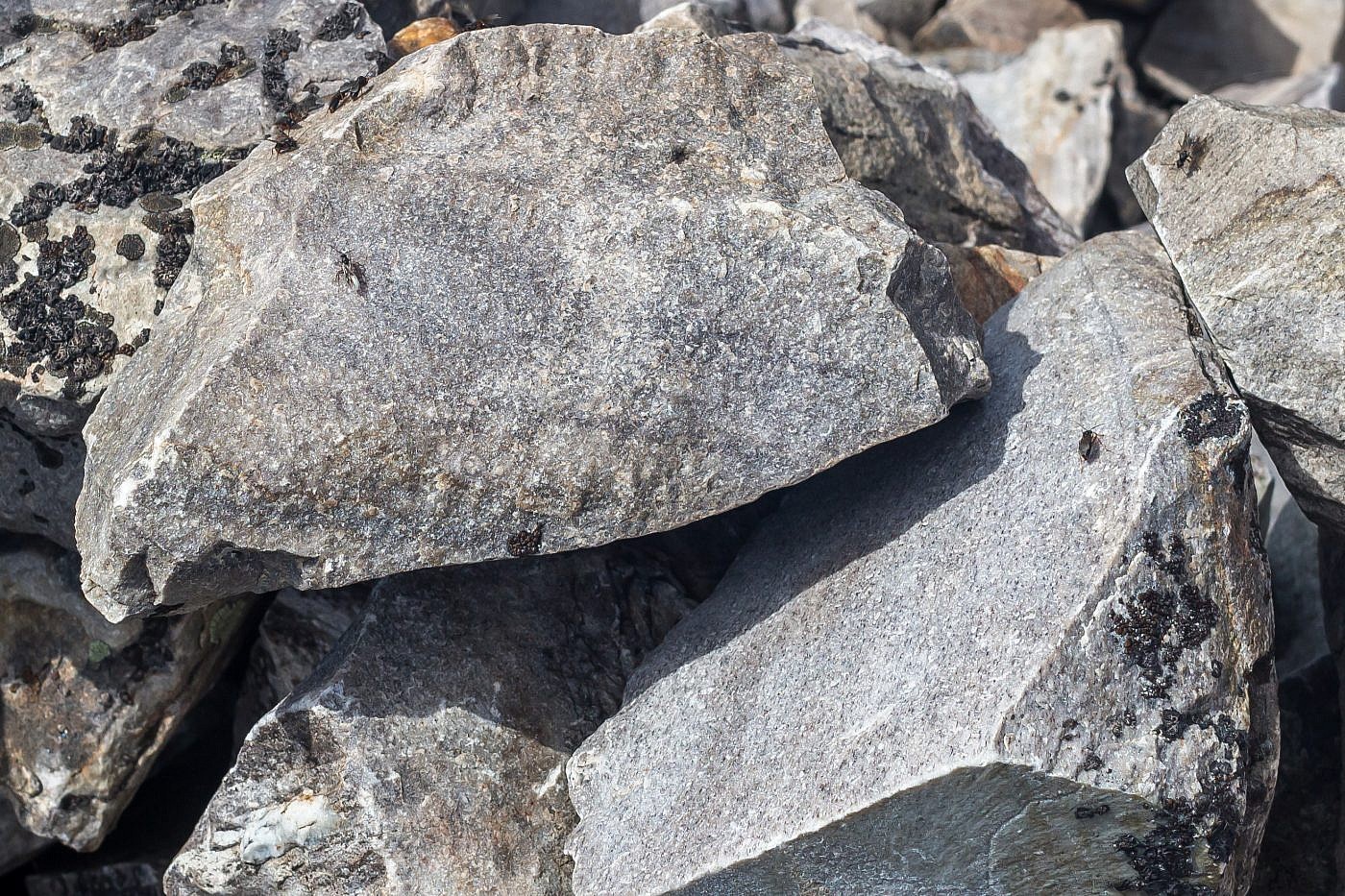
Some strange bugs were swarming the summit. I didn’t encounter them anywhere else along the hike. Not sure why they were hanging out there but they kept me from being able to relax at the top.
The Return
For me, the return became excruciating. I’m not really sure what happened. I was feeling pretty good until the last several miles at which point I started to break down mentally and physically. I started to feel sick and every step I took became a struggle. All I could think about was making it back but the trail just seemed to go on for an eternity winding through seemingly endless miles of forest.
Upon making it back to the trailhead I crashed in my car and just passed out for a good 45 min. To top things off, after finally mustering up enough energy to pack up my car I discovered, much to my horror, that my hiking poles had somehow fallen out of my bike bag at some point during the last mile. I hiked up the trail just a little ways to see if they were close but had no luck and decided I’d have to return in the morning to search (luckily I was able to find them the next day). I finished off the night with a quick bite at the Antlers Saloon in Wisdom and spent the night at the American Legion Memorial Park where I enjoyed a long, comfortable, and well-deserved sleep.
