Crazy Mountains
Glacier Lake and Conical Peak
Download KML
Distance
9 miles one way
Type
Backpack
Difficulty
Extreme
- Starting Elevation: 6450 ft.
- Ending Elevation: 8550 ft.
- Maximum Elevation: 10700 ft.
- Elevation Gain: 2100 ft.
 View all 48 photos
- Experience Date: Jul 23, 2016
- Hike Time: 8-9 hrs one way.
- Drive Time: 1 hr. 45 min.
- Road Condition: Long, bumpy dirt road. 2 WD accessible.
- Parking: Large parking lot that was about 3/4 full.
- Campsite Availability: Some flat spots along trail after first junction. Plenty of camping at Twin Lakes. Poor camping around Glacier Lake but good spots about 1/4 mile beyond in meadows.
- Trail Traffic: Moderate.
- Trail Condition: Mostly well maintained. Lots of deadfall between first intersection and Twin Lakes but fairly easy to navigate around. Turnoff near Upper Twin Lake is not well marked-don't follow spur trail that parallels lake.
- Fire Restrictions: No fires within 1/4 mile of Twin Lakes.
- Water Sources: Plenty along the way.
- Snow: Still some larger patches in the basins and on peaks.
- Winter Access: Probably not. Area is popular for backcountry skiing though.
- Weather: 80's. Sunny to partly cloudy.
- Bugs: Few flies and mosquitos.
- Side Quests: Oasis Lakes. Twin Lakes.

Glacier Lake can technically be accessed from many of the trailheads in the Crazies but the Big Timber Creek Trail is the most popular approach. The lake lies at 8700’ for a net elevation gain of 2200’ over 7.6 miles but a 10,000’ saddle must be crossed to get there which substantially increases the difficulty of the hike. The trail climbs gradually towards Twin Lakes, a great, albeit popular camping spot, and increases in steepness as you switchback up the saddle followed by a sharp decent down to the lake. The Eagle Park trailhead on the northeast side of the Crazies may provide an easier approach since you don’t have to cross the saddle. Those thirsting for more adventure might consider bagging Conical Peak along the way. It’s a class 3 scramble that covers and additional ~1/4 mile over 700′ of elevation.
Glacier Lake.
Background
After a full season of hiking in 2015 I was blown away by the near infinite amount of hiking options in the Bozeman area but of all the places the Crazy Mountains had impressed me the most. Yet July was almost over and we had yet to visit them. This was not by choice, of course. Several months earlier my hiking companion, Arlo, had gone on a solo expedition to Twin and Oasis Lakes via the Big Timber drainage to acquire intel on the snow situation and the verdict was upsetting; there would be no backpacking the Crazies for a while.
So several months passed and we finally had our opportunity. Arlo suggested a trip to Glacier Lake, located smack-dab in the heart of the Crazies, and of course I had to concur. Naturally I pulled out my Beartooth Publishing map to assess the trail and, almost immediately, my mouth began to water; the trail would lead us within arms reach of the 10,700′ Conical Peak. It looked like a straight forward scramble to its summit from the 10,000′ saddle that we’d have to climb over anyway so I thought to myself, we might as well finish the job. Maps never tell the whole story though so I quickly consulted the Hiking Bozeman Forum (HBF) for some extra details. One member claimed that “it’s not bad at all from the saddle” and “might be one of the easiest scrambles in the whole range”. This sealed it; I’d do anything within my power to bag my first real peak in the Crazies.
Glacier Lake can technically be accessed from many of the trailheads in the Crazies but the Big Timber Creek Trail is the most popular approach. The lake lies at 8700’ for a net elevation gain of 2200’ over 7.6 miles but a 10,000’ saddle must be crossed to get there which substantially increases the difficulty of the hike. The trail climbs gradually towards Twin Lakes, a great, albeit popular camping spot, and increases in steepness as you switchback up the saddle followed by a sharp decent down to the lake. The Eagle Park trailhead on the northeast side of the Crazies may provide an easier approach since you don’t have to cross the saddle. Those thirsting for more adventure might consider bagging Conical Peak along the way. It’s a class 3 scramble that covers and additional ~1/4 mile over 700′ of elevation.
Getting Started
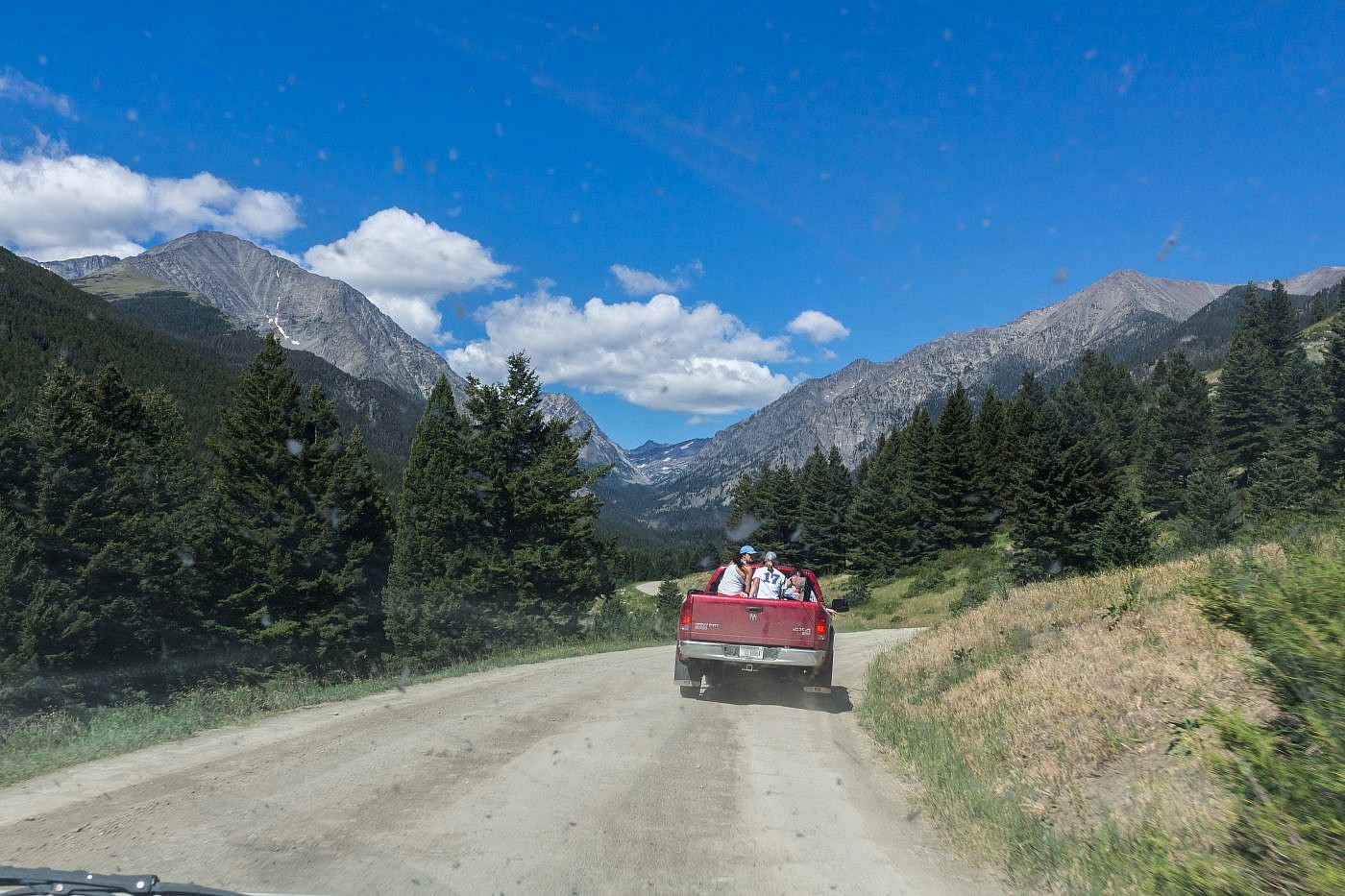
Big Timber Canyon Road has got to be one of the most tedious drives in the area. The mountains seem so close yet it takes an excruciating 45 minutes to get there from Highway 191. Luckily the road’s in decent shape and the scenery is excellent which makes the drive a bit more tolerable. You’re also treated to a nice view of Crazy Peak (11,200′), the tallest peak in the range.
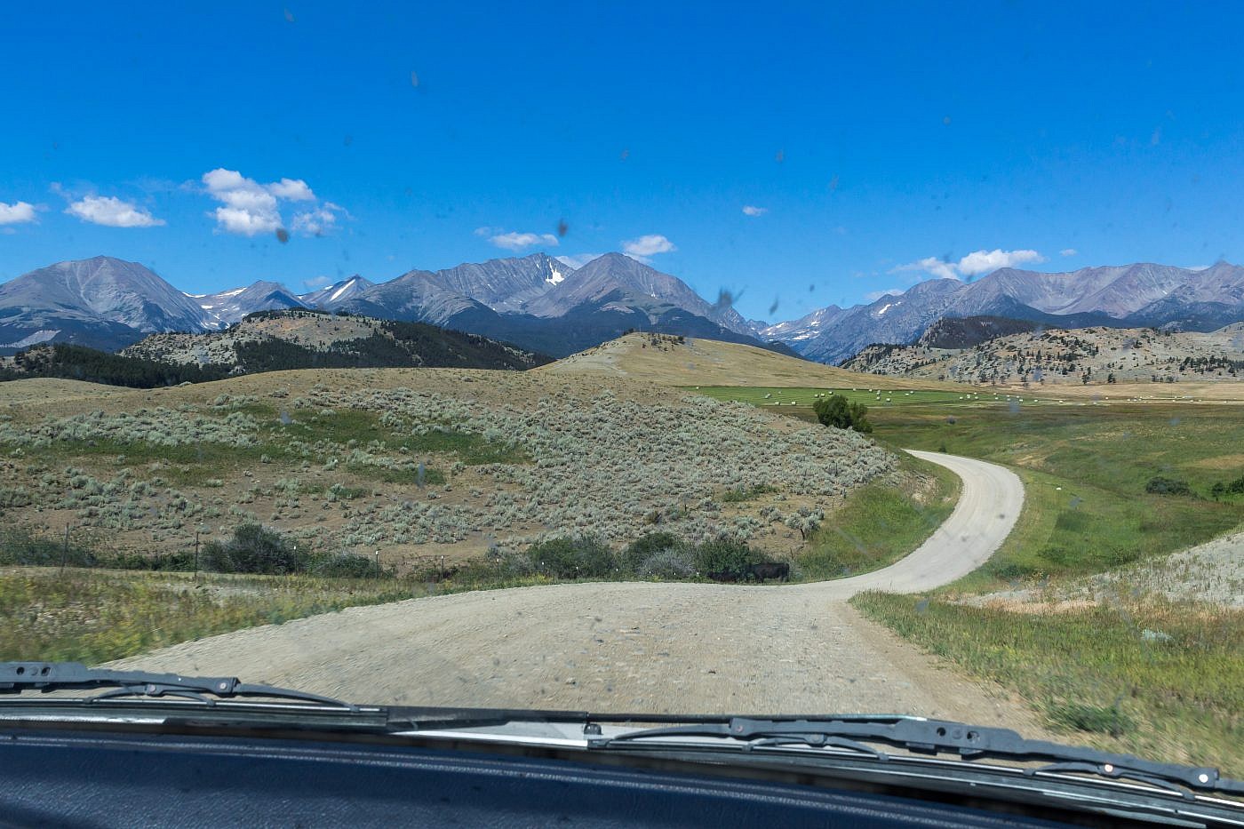
Approaching the Crazies from Big Timber Canyon Road. The road takes fooooooooorever.
Crazy Peak (11,200′). The traverse between the false summit (right) and the actual summit (left) makes it a challenging climb but it can supposedly be done without ropes.
The Adventure Begins…
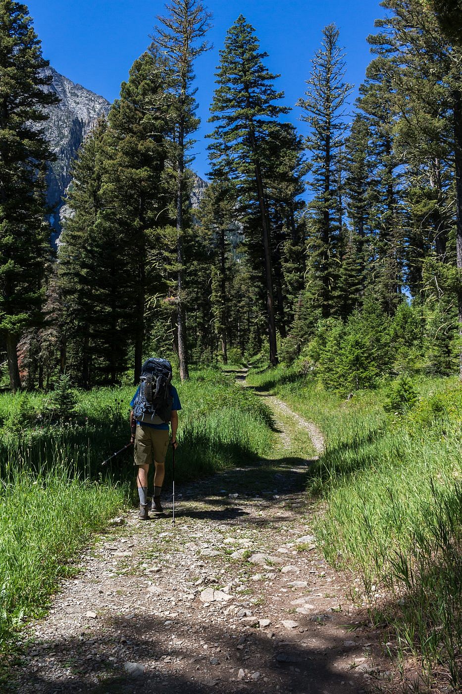
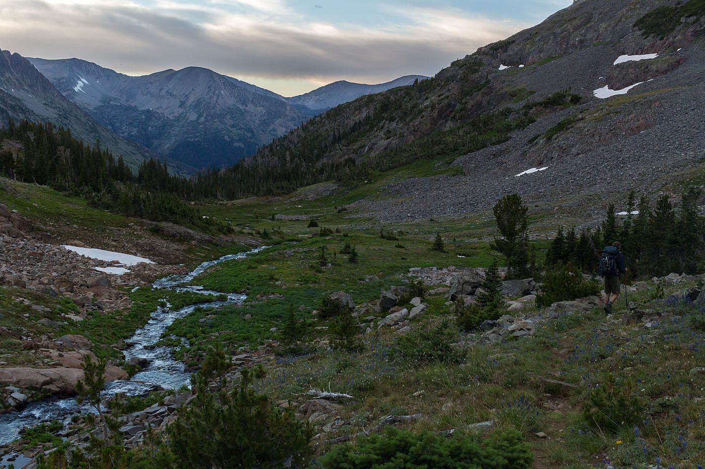
Relieved to finally be at the trailhead we quickly geared up and were off. Having already backpacked to Granite Lake the previous year this first section of trail was familiar but for some reason seemed a bit steeper and rockier than I remember. Regardless, we made it to the first intersection (~2.8 miles) in about an hour which was pretty good time. A nice campsite lies along Big Timber Creek just a short distance beyond the first intersection. See my write-up on Granite Lake for more information on this stretch.
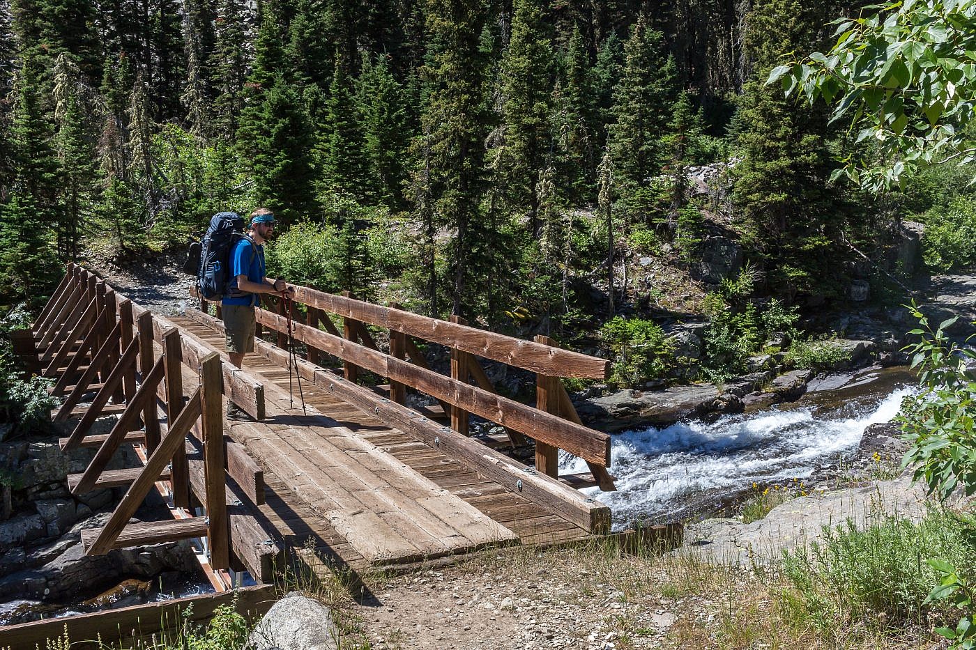
One of several creek crossing during the first stretch.
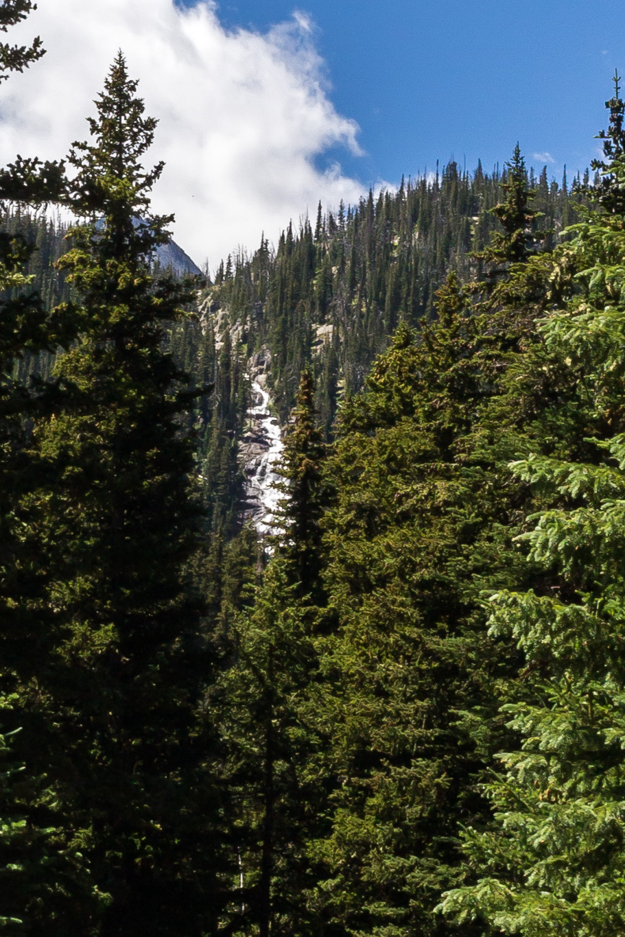
Possibly Thunder Falls?
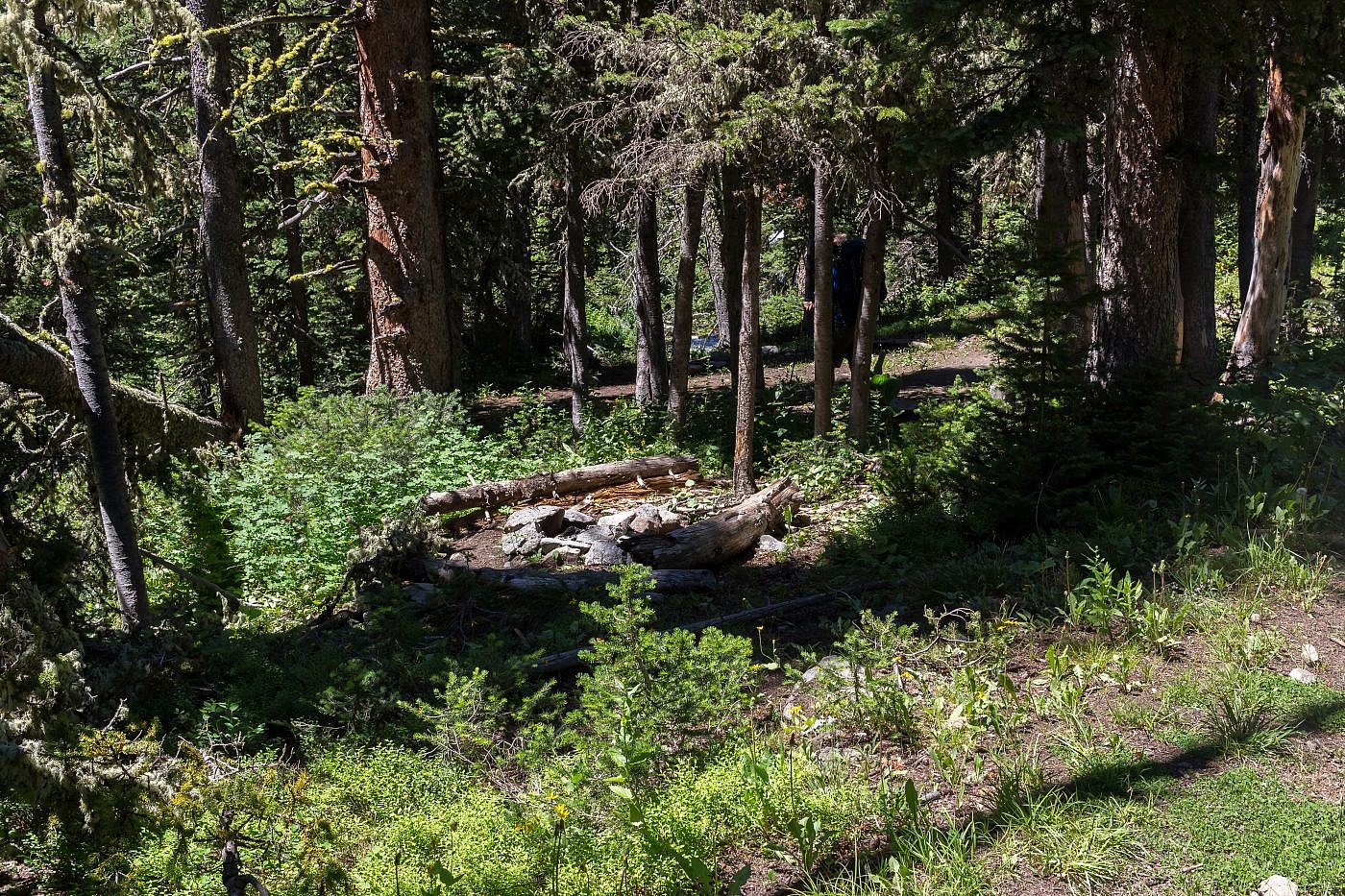
Campsite just beyond the first intersection.
Twin Lakes
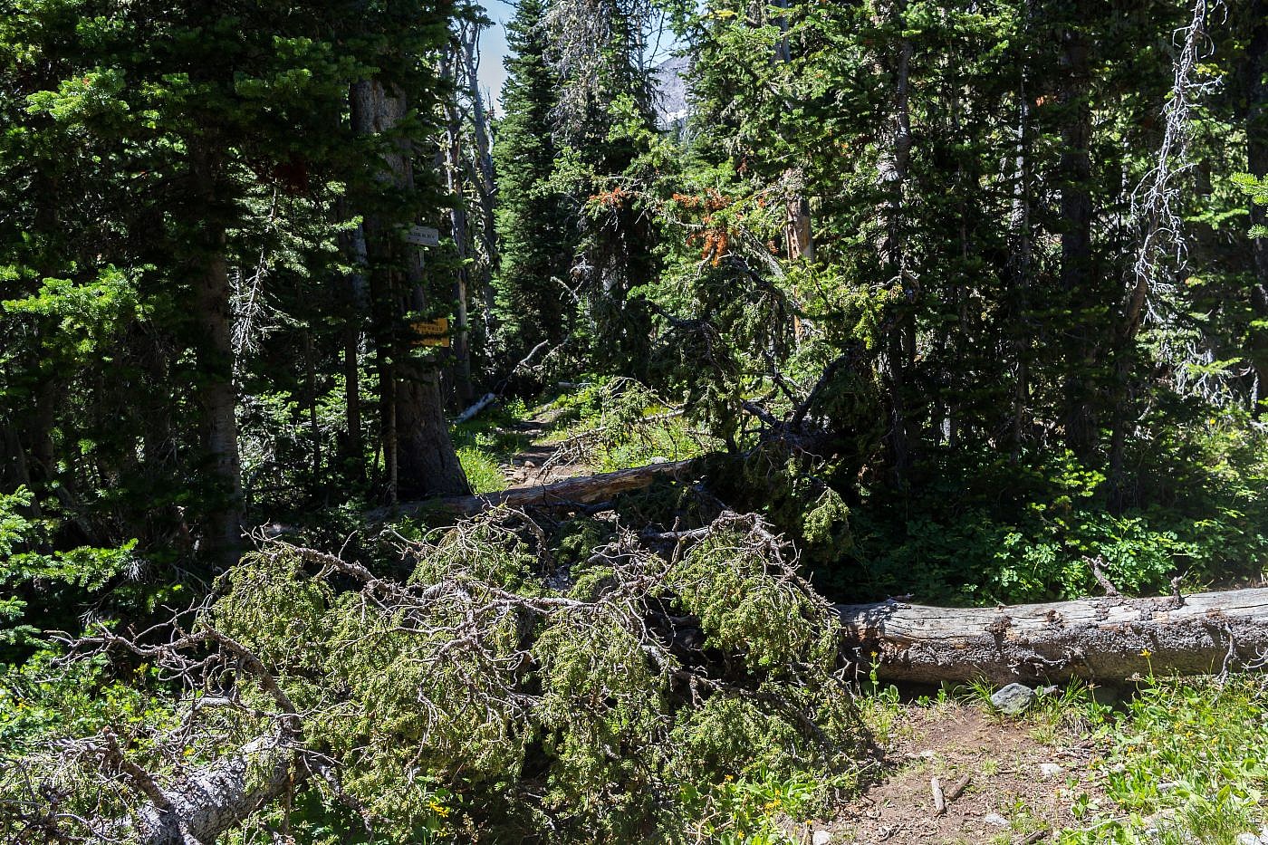
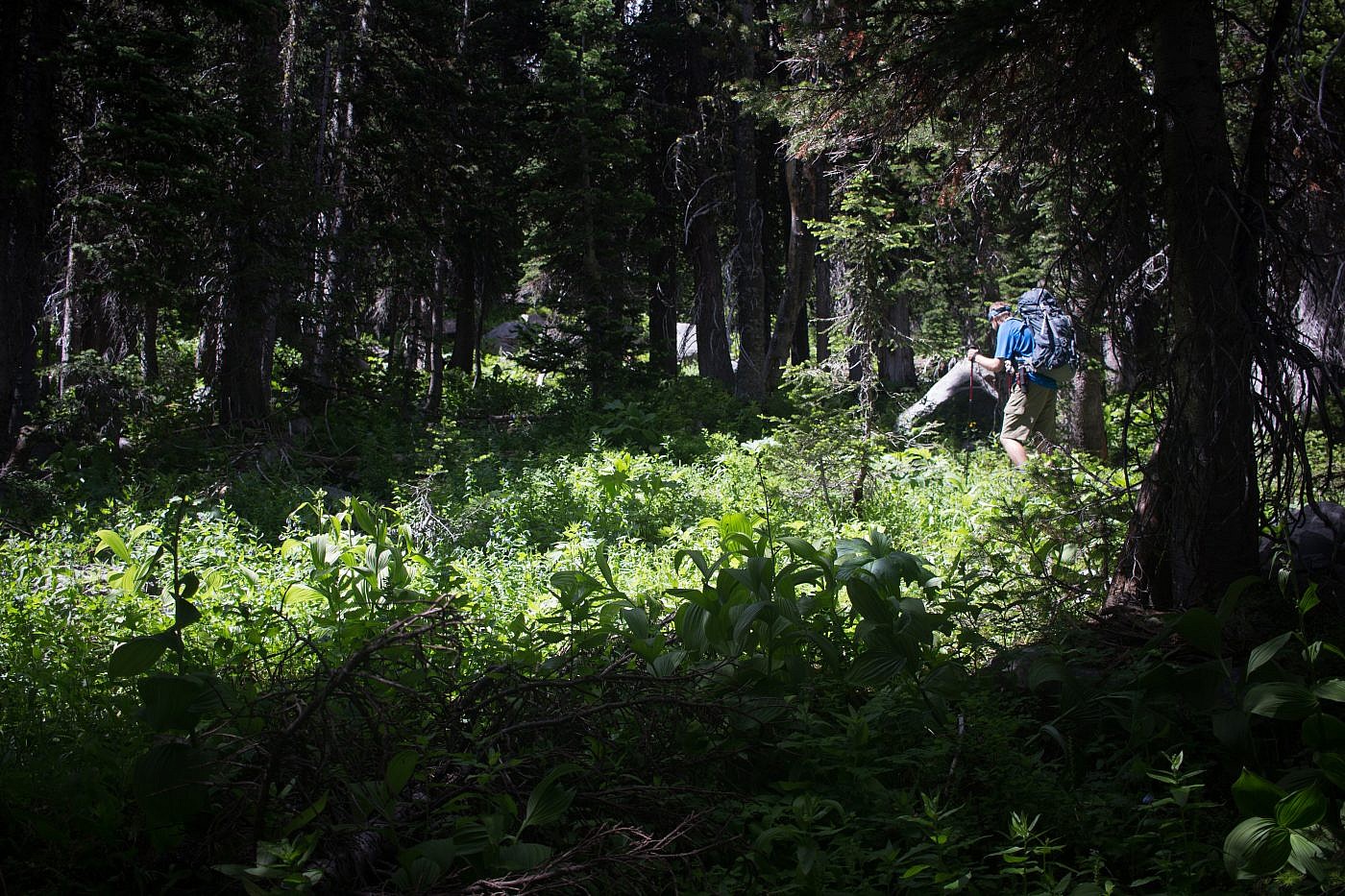
We took a short break at the campsite and began the simple 1.4 mile trek up to Twin Lakes. For whatever reason this section of trail receives little maintenance as demonstrated by the absurd amount of deadfall we encountered. It’s nothing like the obstacle course at Elephant Head Mountain though and there are plenty of spur trails that make it easy to meander around.
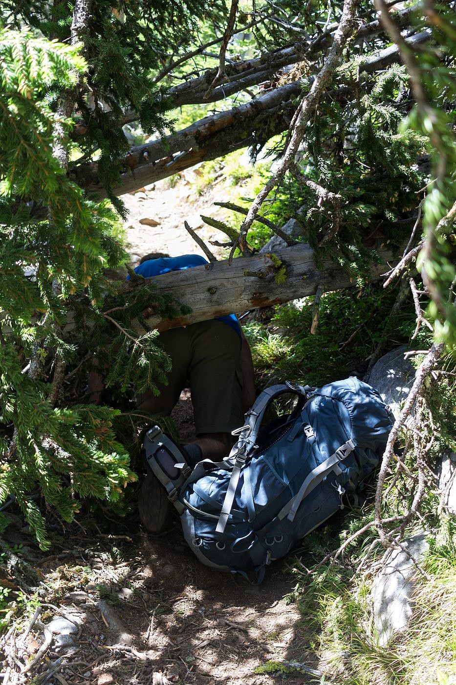
Arlo tunneling under a fallen tree. There’s actually a spur trail that leads around the tree but we were too airheaded to see it on the way up. I blame Arlo for all our troubles though since he’s always in the lead.
After about a mile the shores of Lower Twin Lake appear to the left. We wandered down to the lake to check it out and there appears to be plenty of flat spots for camping. Remember, no fires within 1/4 mile of Twin Lakes so please be respectful.
Oasis Lakes can be accessed by scrambling up the slopes to the north. Although I haven’t done it myself, my hiking companion, Arlo, snowshoed up there earlier in the year and claims there’re some astonishing views to be had.
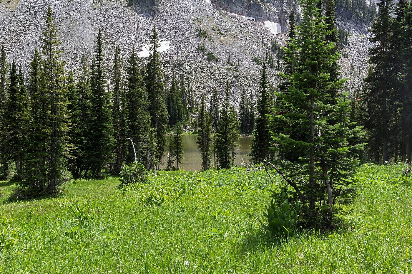
Lower Twin Lake. There appears to be some reasonable campsites in the area.
The slopes leading to Oasis Lakes.
After an additional 0.4 miles or so we made it to the tip of Upper Twin Lake. The views are just spectacular and there’re plenty of flat spots to set up a tent.
Upper Twin Lake. There’re plenty of areas to camp.
From here the trail continues along the shore for a short ways before abruptly veering up the slopes to the northwest. Make sure you stick to the right! Arlo and I mistook a spur trail (which follows the shore) for the actual trail and we, once again, found ourselves in the ever too familiar bushwhack-our-way-out-of-this-mess scenario (again, Arlo is to blame).
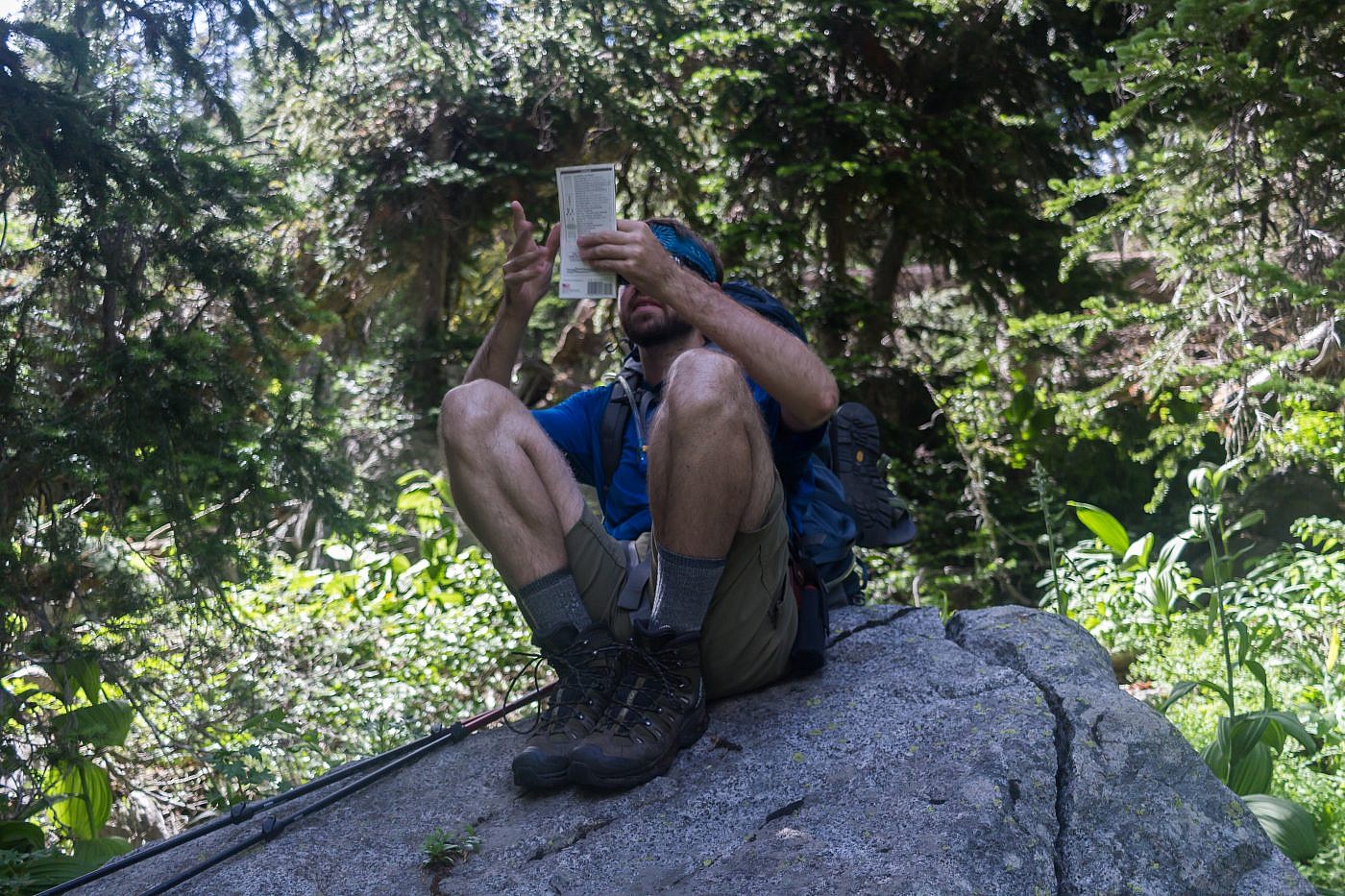
Taking a quick look at the map during our fiasco.
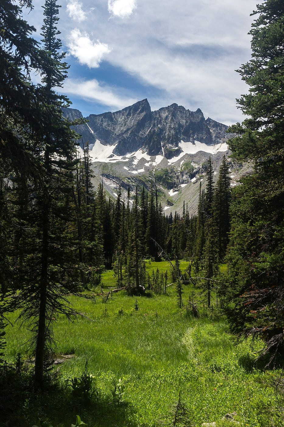
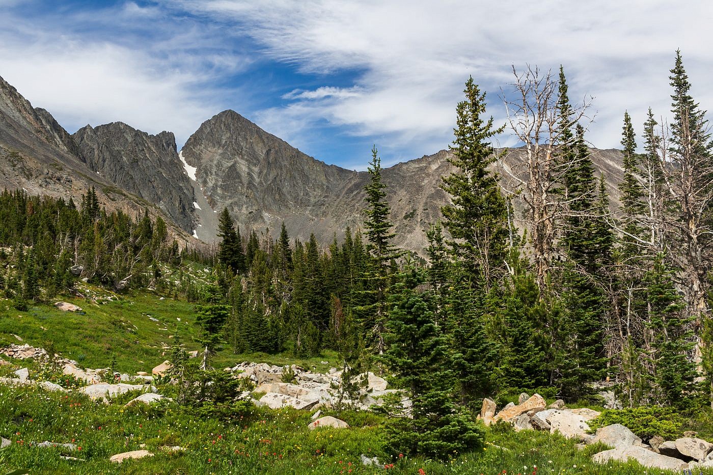
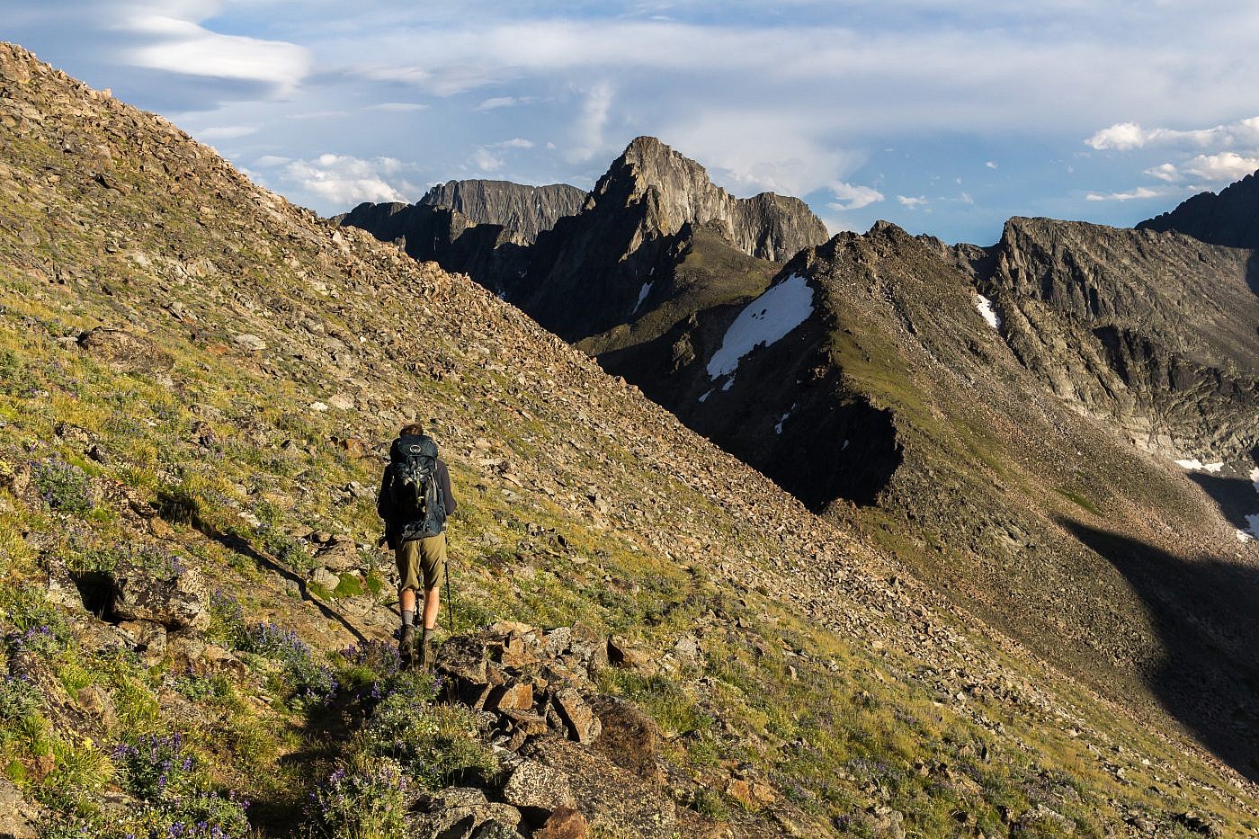
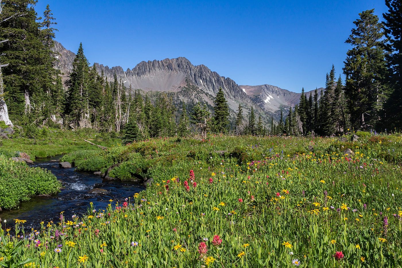
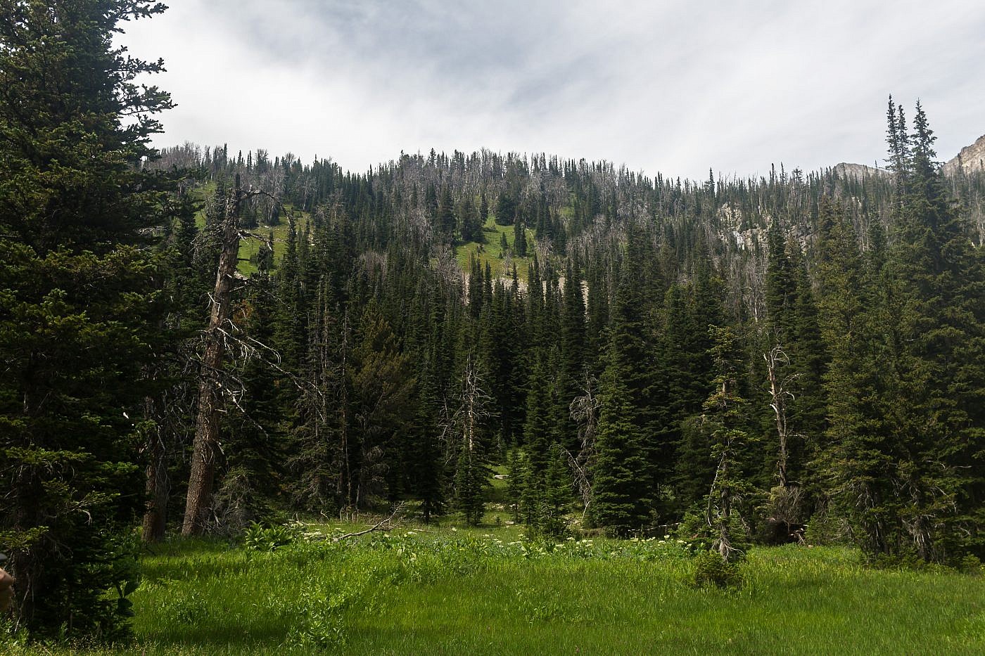
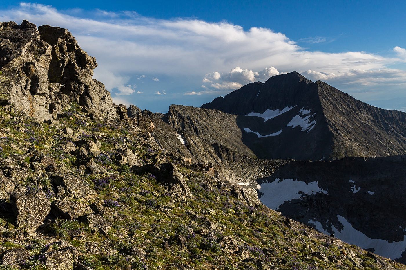
After about 30 minutes of slogging, stumbling, and scrambling we were finally reunited with our trail. From here the trail switchbacks up towards the saddle and leads through meadow after meadow filled with beautiful wildflowers. Slowly the trees are replaced with small shrubs and grasses until finally you’re above the treeline where the landscape really begins to pop. The first views of Conical Peak to the northwest open up as well.
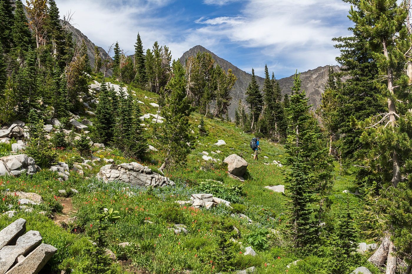
Finally back on the trail. A cool unnamed peak in the background. Call it “Unnamed Peak”?
Another unnamed peak to the south.
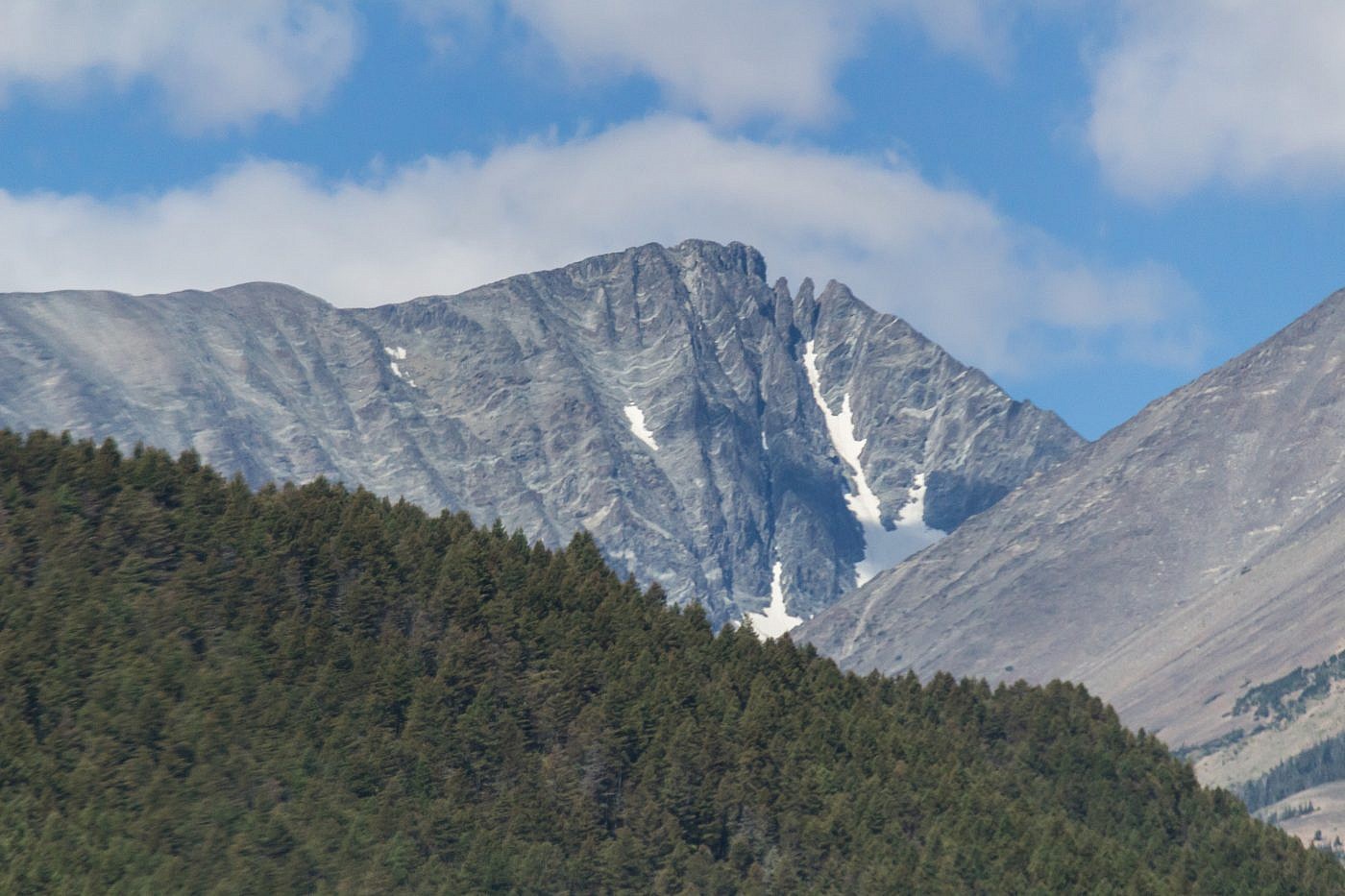
One of the first views of Conical Peak (10,748′). Still tons of climbing to go.
Saddle Up!
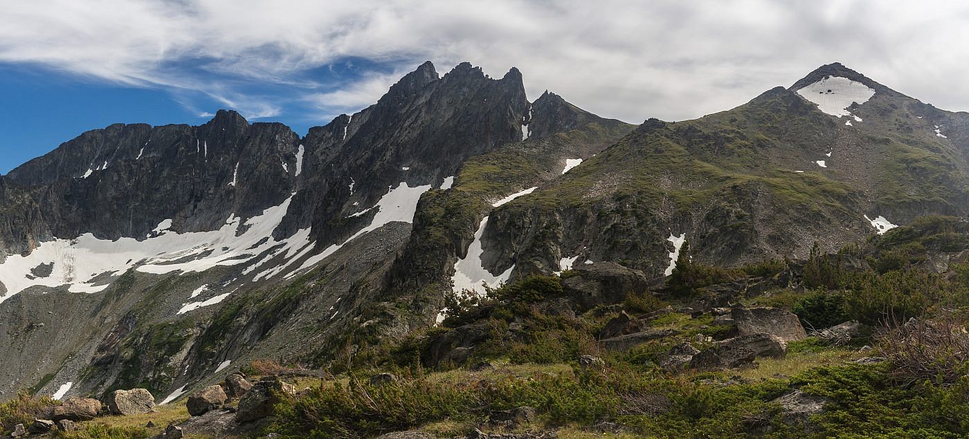
The trail continues onward along an endless series of switchbacks up towards the saddle. It feels like the climb is never going to end but the scenery is so out of this world that I’d have probably been okay with that.
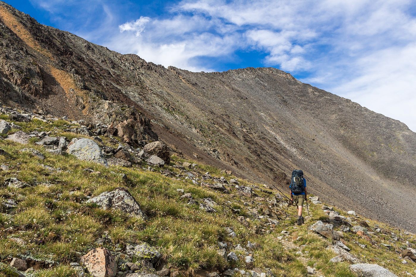
Working our way up the saddle.
Almost to the saddle.
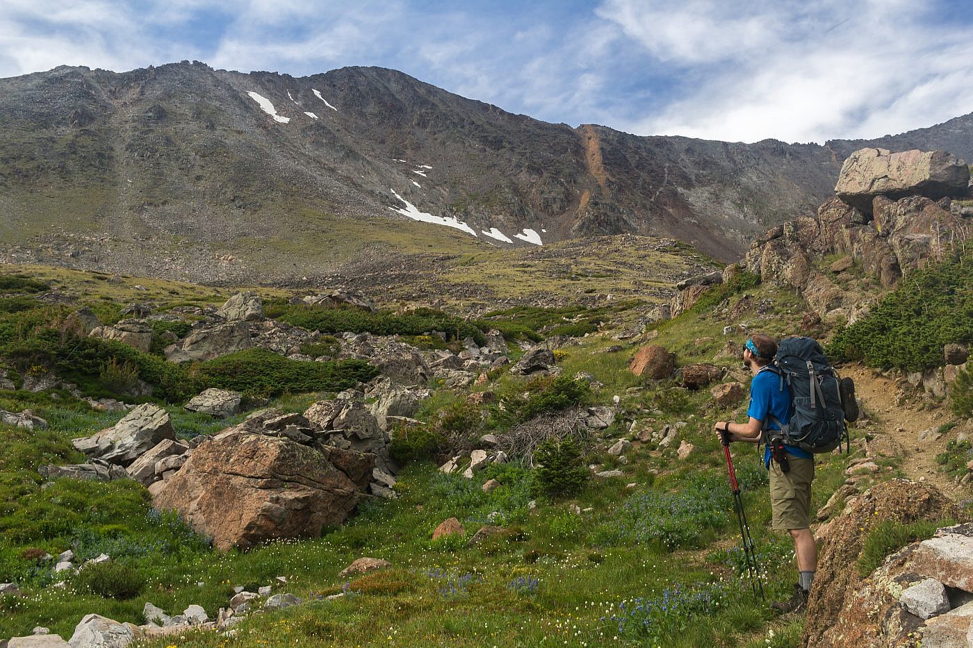
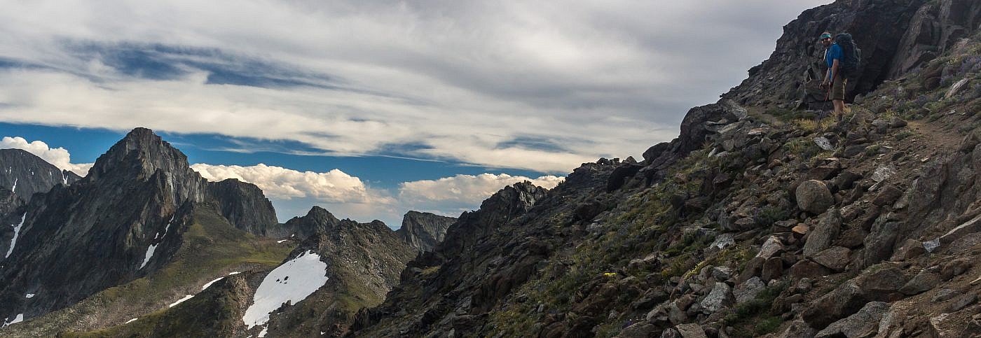
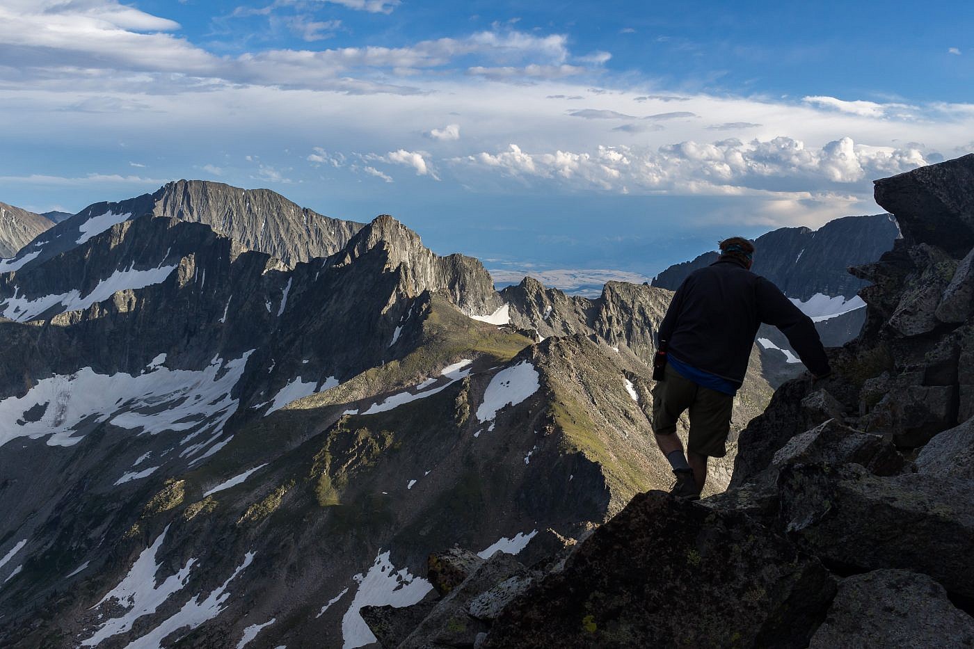
Once at the saddle we immediately threw down our packs and took a moment to catch our breath. We hadn’t decided yet if we were going to attempt this colossal beast of a mountain right now, which was another 1/4 mile and 700 ft. of elevation, or wait until the next day and hit it on the way back. After some deliberation it was decided, we would go for it now. Adrenaline levels were already running high from the climb up to the saddle alone and I felt a sudden surge of energy despite having already climbed over 3000′ feet with a 40 lb. pack. This was the moment I’d been waiting for all day; the climax of the trip was near and I was overwhelmed with excitement.
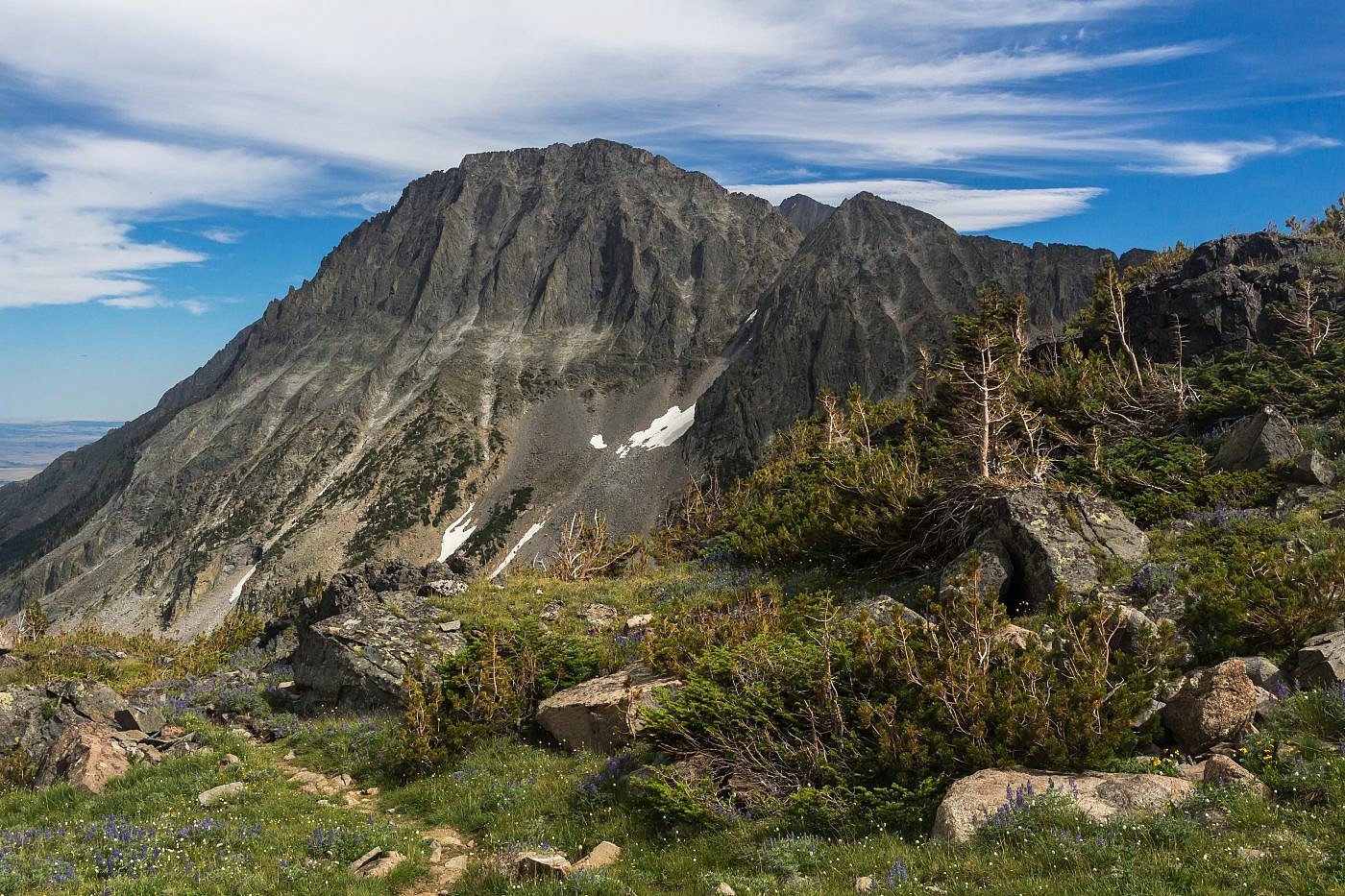
The path up Conical Peak from the saddle. It looks pretty easy from this angle.
Conical Peak
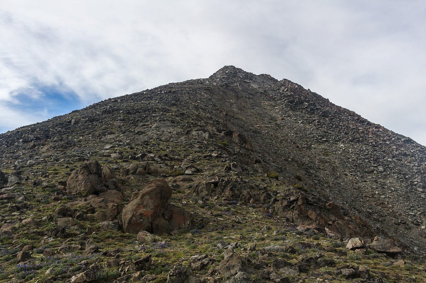
The climb starts out as a simple class 2 scramble, as we were expecting. But the quality of the rock quickly deteriorates, becoming loose and jagged (or “rotten” as one HBF member puts it), the higher up you get. It’s definitely a hairy class 3 scramble which was surprising at the time since this was supposedly one of the “easiest scrambles in the whole range”. There are definitely some spots where a slight mishap could result in death but I never felt like ropes were necessary (it’s a good idea to always have 3 anchor points though).
It turns out some serious scrambling is required to ascend this thing.
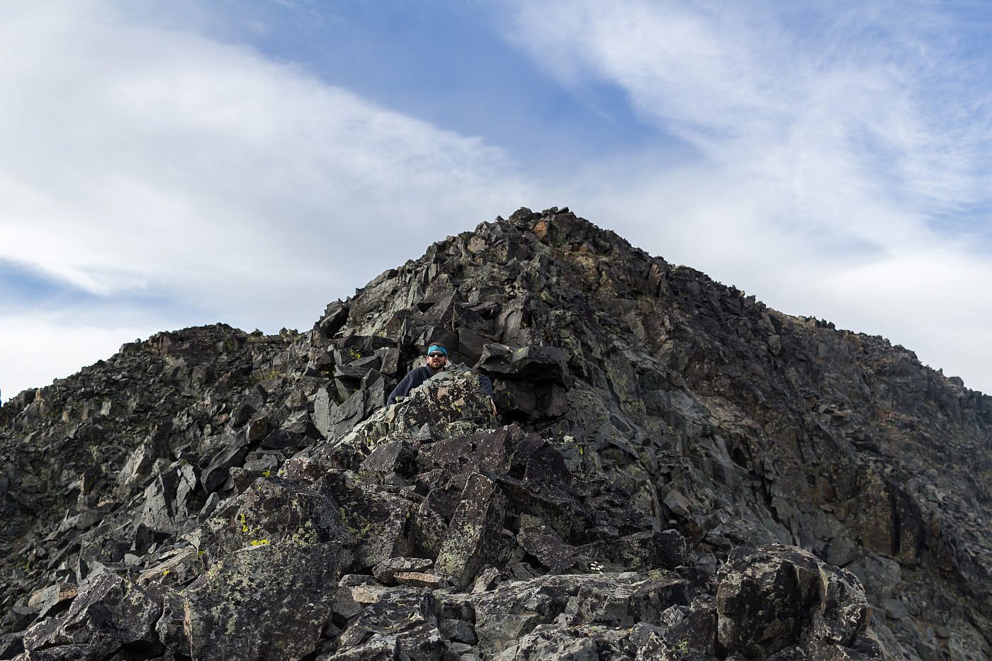
Many times we were fooled into thinking the summit was close.
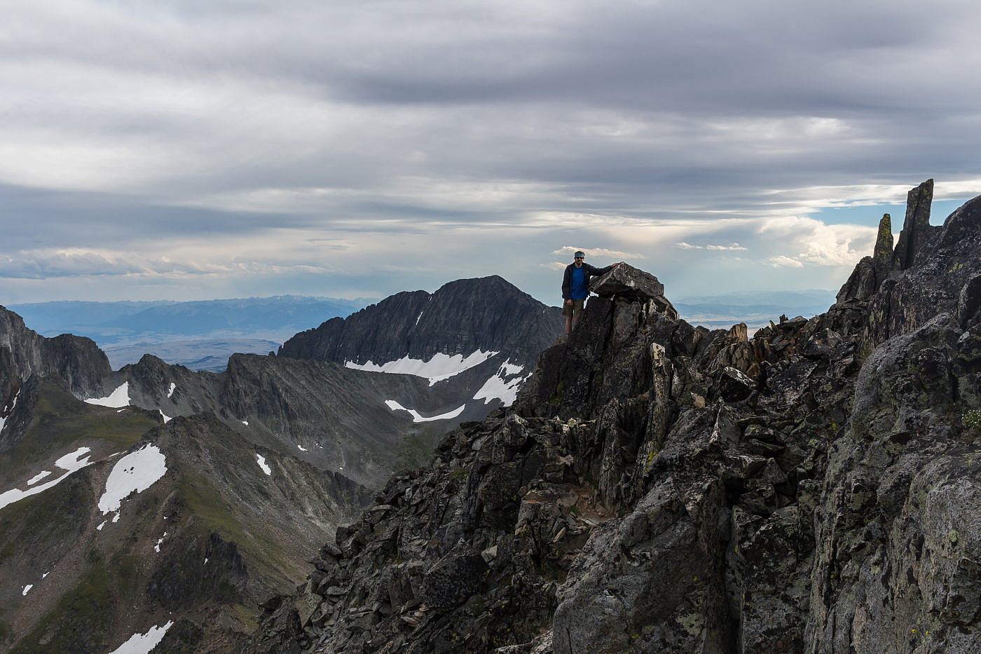
After a good 45 minutes or so of careful route-finding and meticulous maneuvering we were finally at the top. The views are just breathtaking; basically the entire range is visible. The wind was surprisingly calm so we took some time to identify all the major peaks and admire the beauty of the scene before descending back to the saddle..
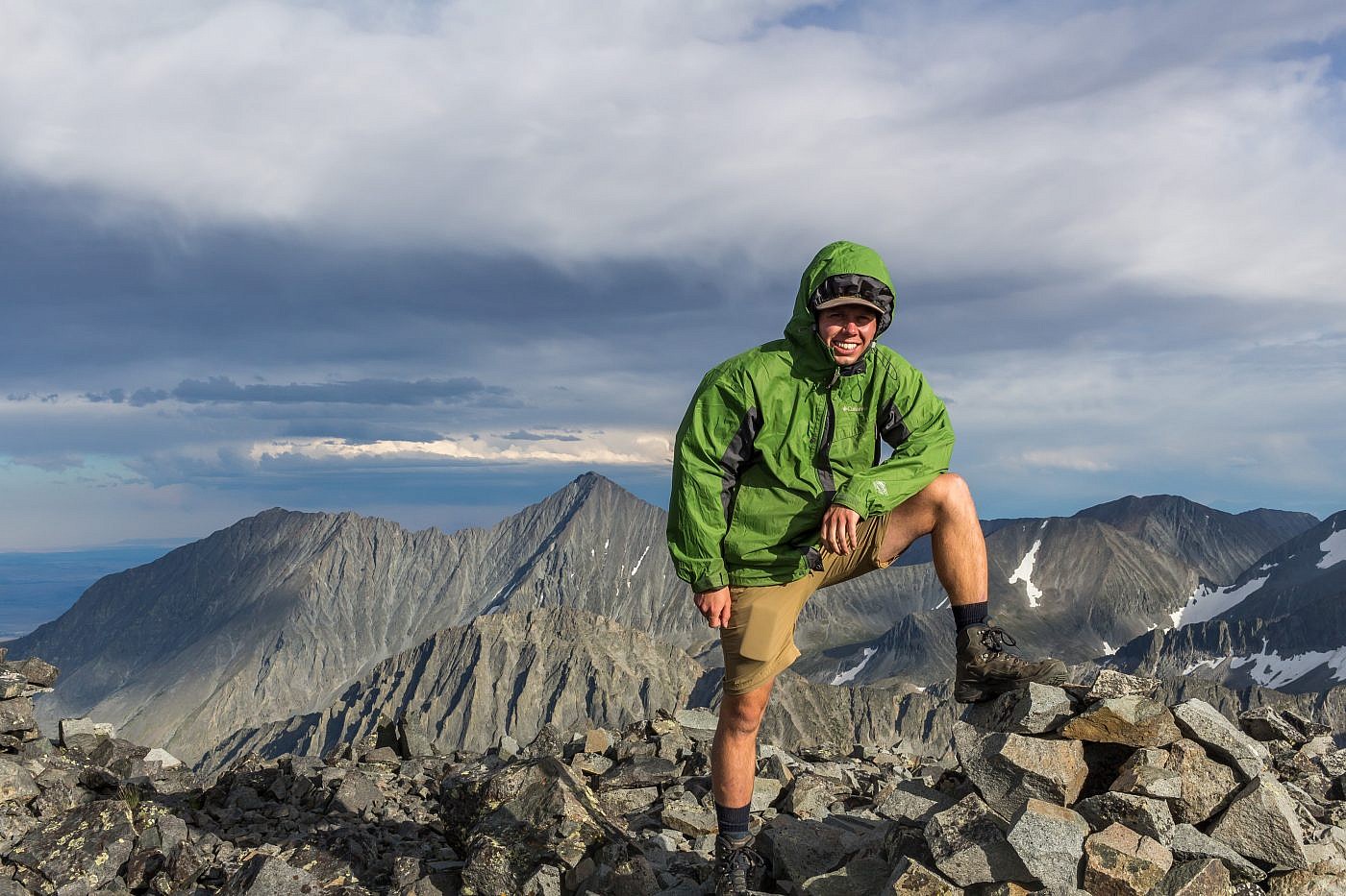
Victory!
Looking northeast from the summit. Cave Lake lies behind the ridge on the left.
Looking north from the summit. Sunlight Peak on the far left. Conical can also be climbed from Cave Lake via this ridge.
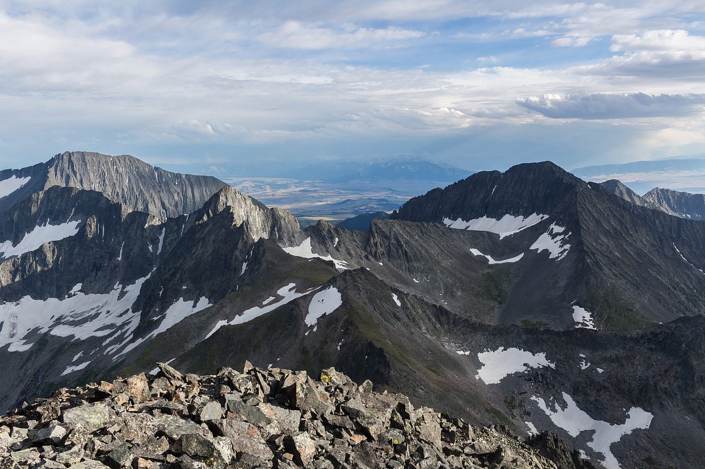
Looking south from the summit. Iddings Peak (10,936′) on the left and Wilsall Peak (10,571′) on the right. Absarokas in the background.
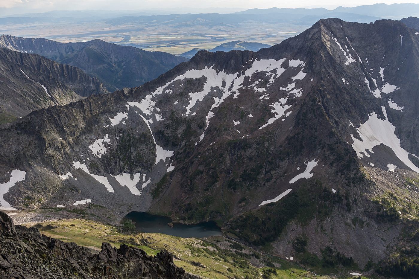
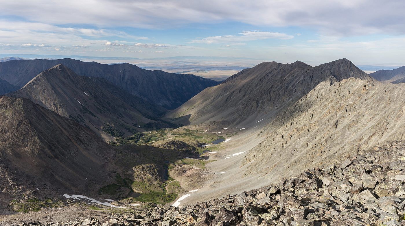
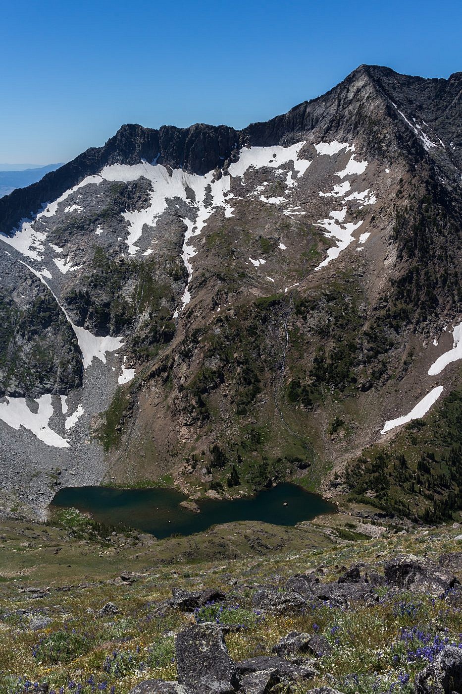
View of Glacier Lake from the summit. Bridgers in the background.
Looking down the Big Timber drainage. Crazy Peak on the right, Big Timber Peak just to the left, and Granite Peak in front. This is basically the eastern edge of the Rocky Mountains.
Heading back down.
Back at the saddle. Wilsall Peak in the background.
By the time we made it back to the saddle my legs felt like jello and I just wanted to collapse under the weight of my strained body, but nature was calling and the sooner we made it down the sooner we’d be able to relax.
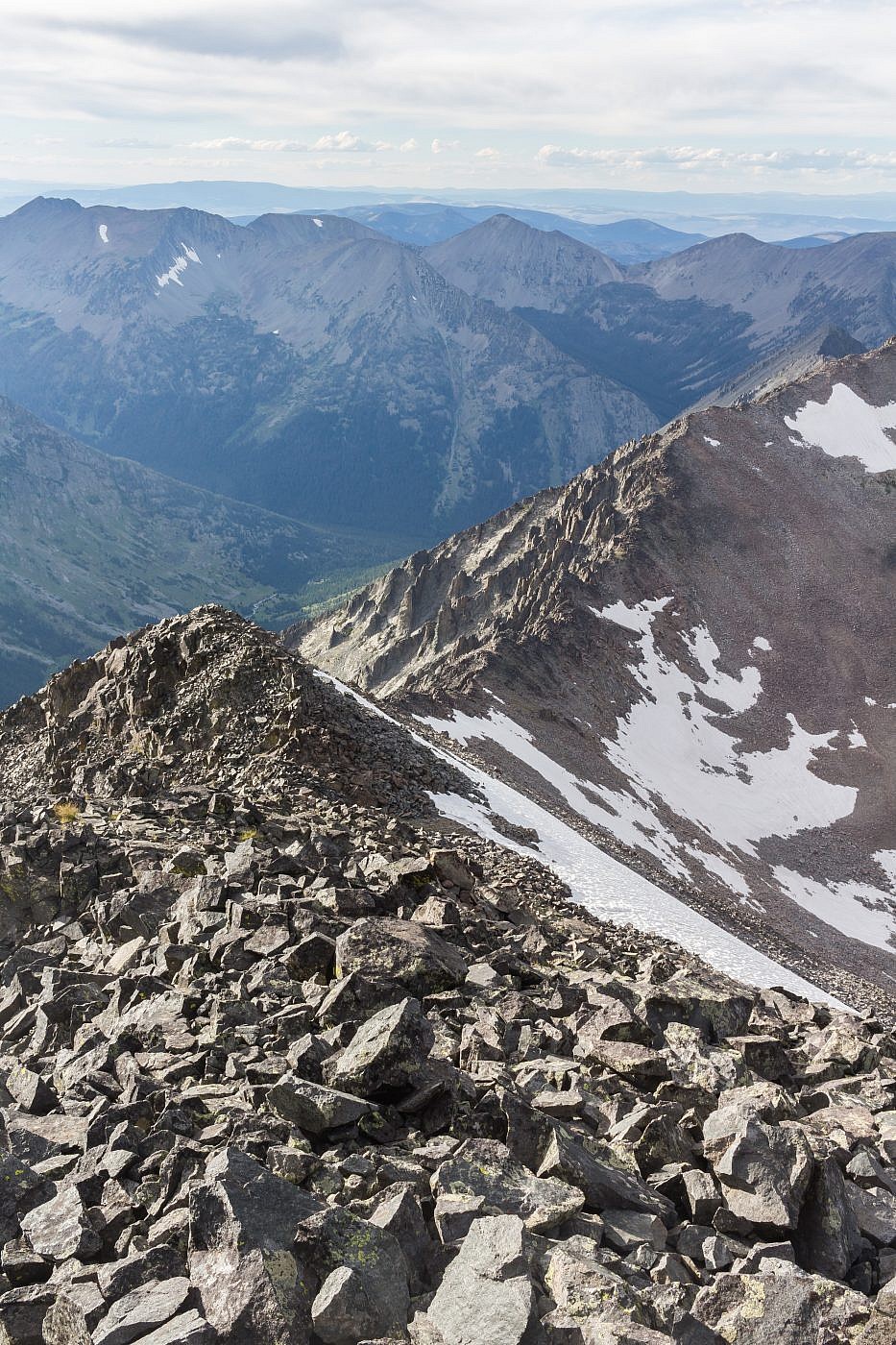
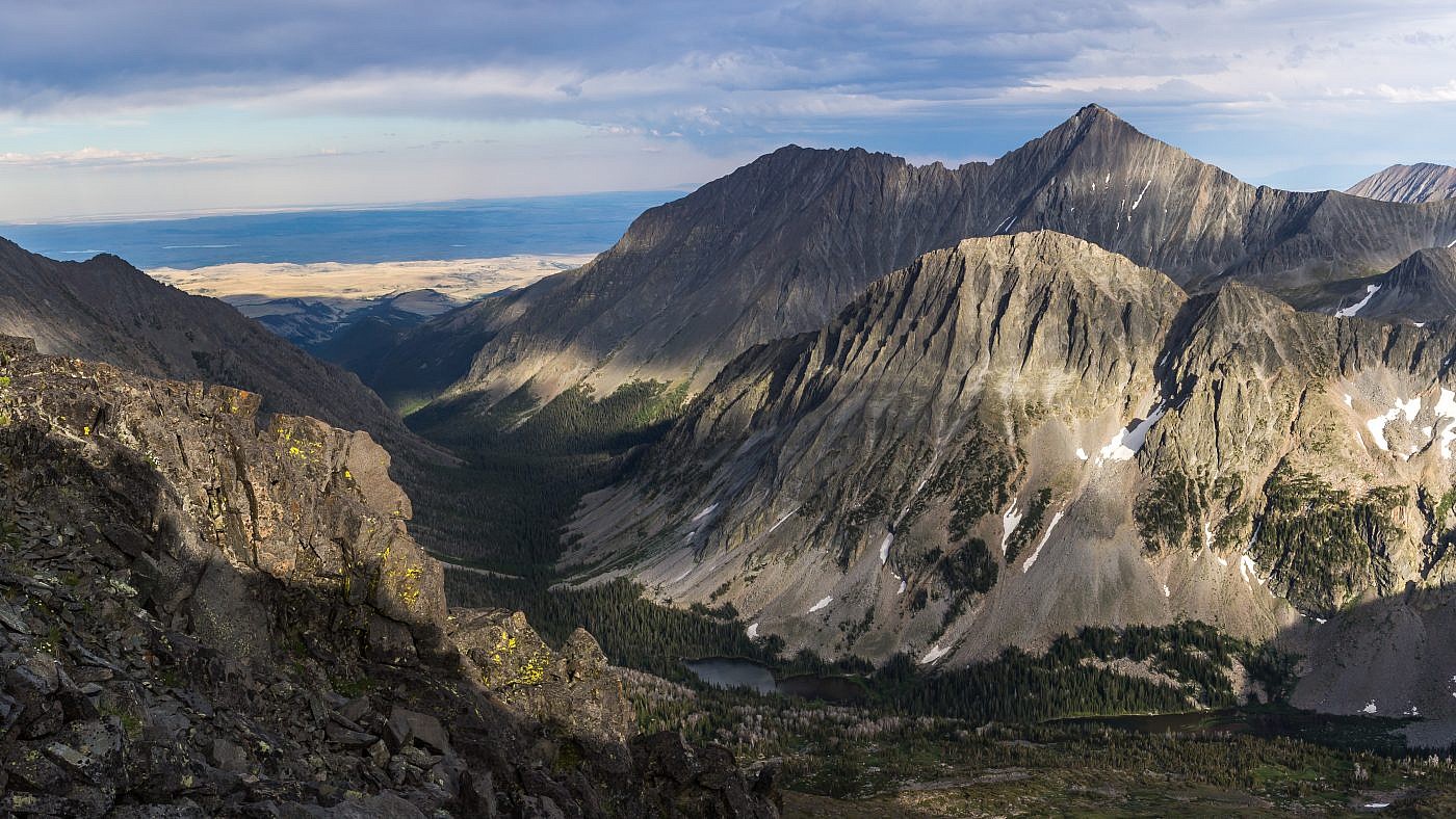
Another endless series of switchbacks leads 1000′ down to Glacier Lake which is another mile or so ahead. The worst part is that the trail is visible below you and I felt the constant need to check our progress which made the final stretch last an eternity.
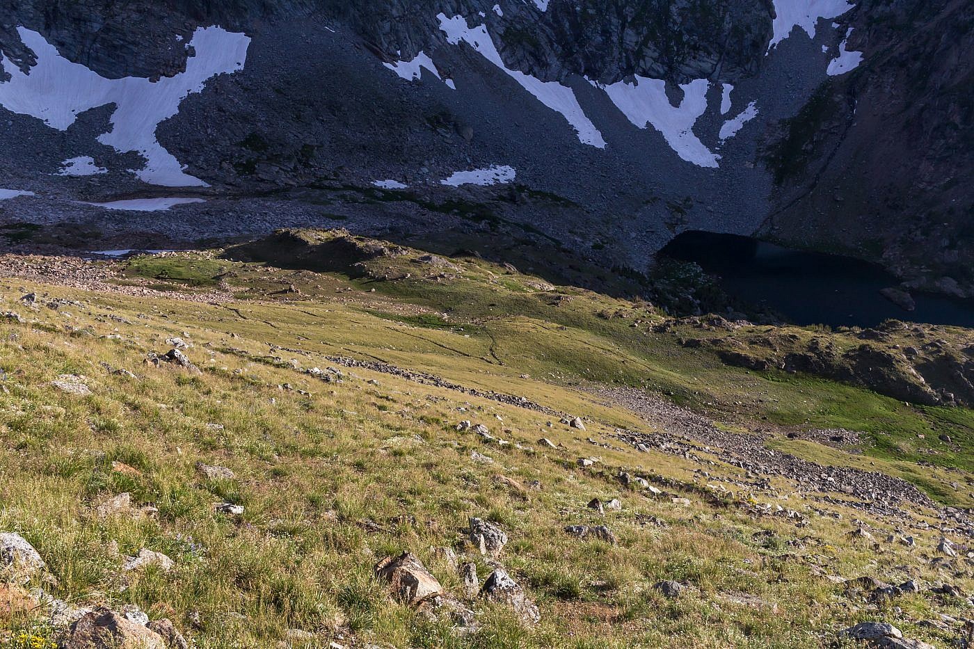
More switchbacks from hell lead down to Glacier Lake.
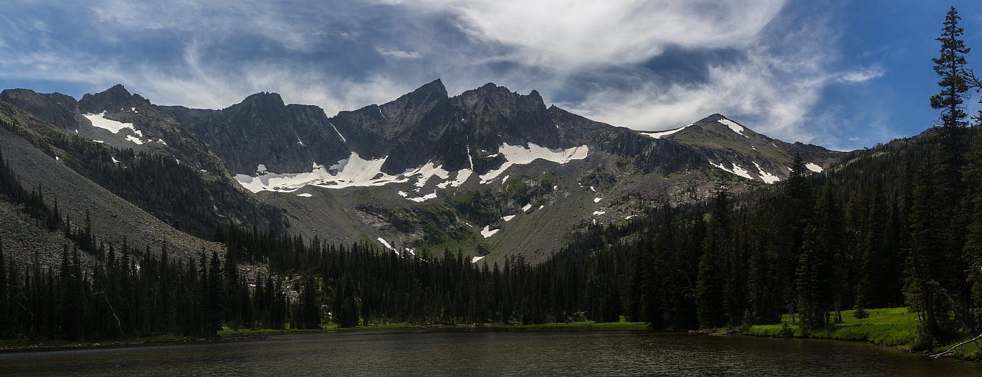
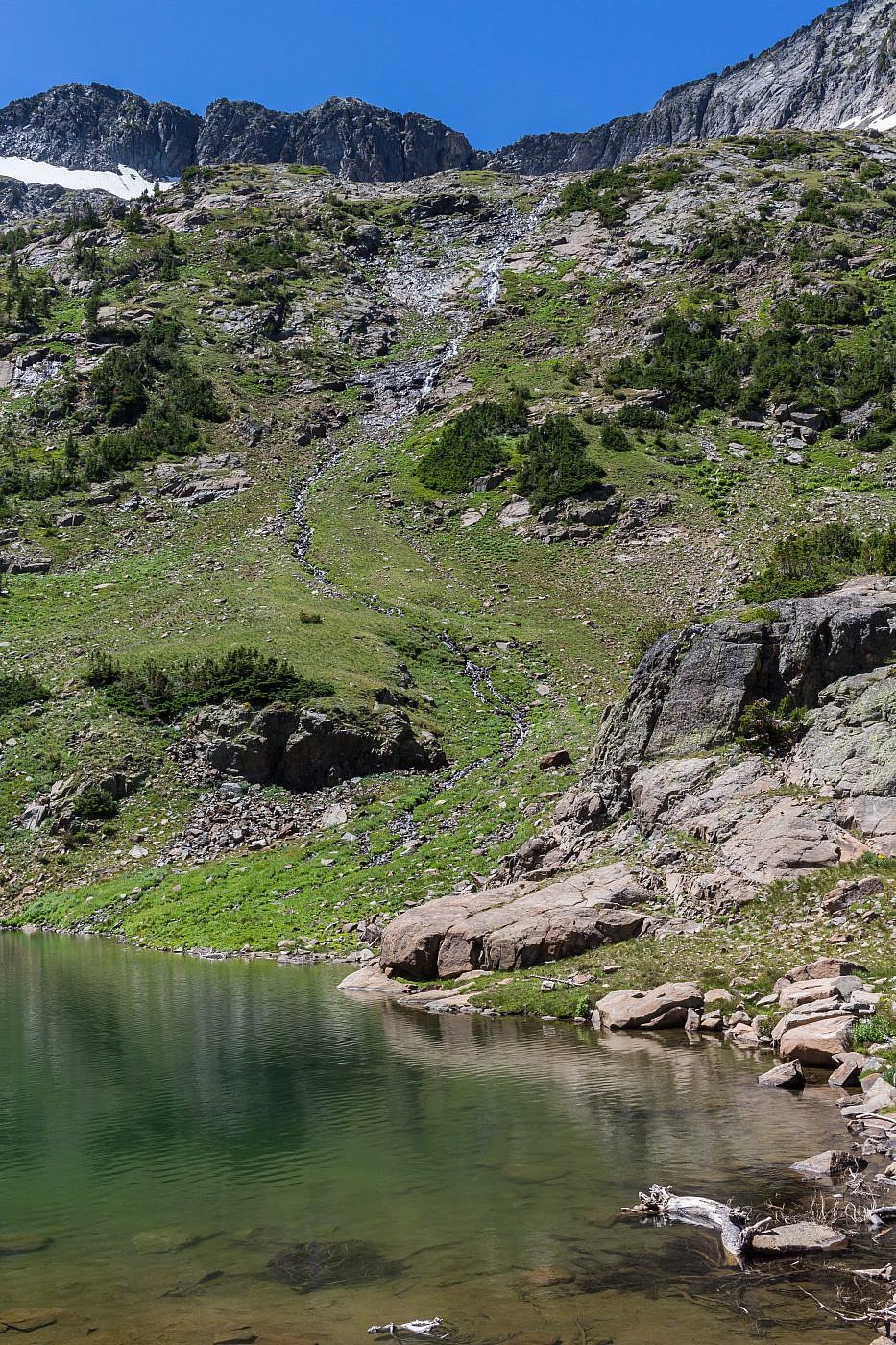
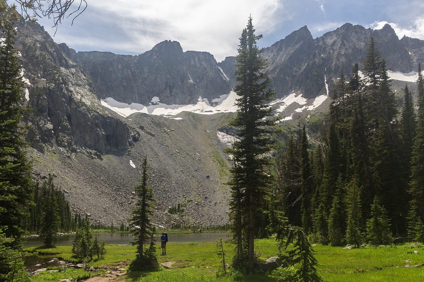
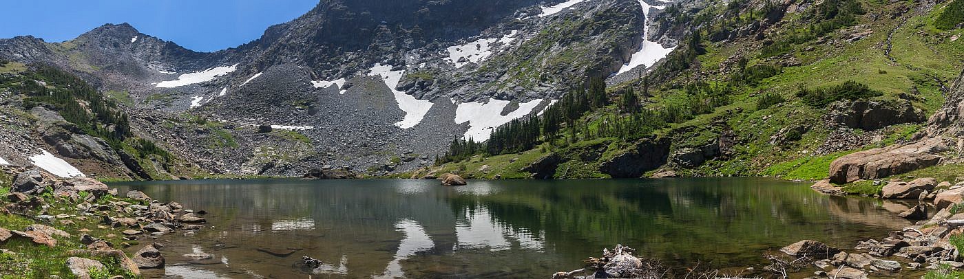
Glacier Lake
After another hour or so we were finally at the shores of Glacier Lake. It’s a gorgeous alpine lake with crystal clear water fed by the many permanent snow fields that surround it. Beautiful waterfalls cascade down the gnarly mountain slopes and you get the feeling that you’ve been totally disconnected from the civilized world. Unfortunately we were both so exhausted that neither one of us could really take much time to appreciate the splendor of the lake and the observation that there were no viable camping options in the vicinity was a let down. So we kept to the trail hoping to finding better luck in the meadows below the lake.
Finally at Glacier Lake. Not too many camping options though.

Heading down into the meadows below Glacier Lake.
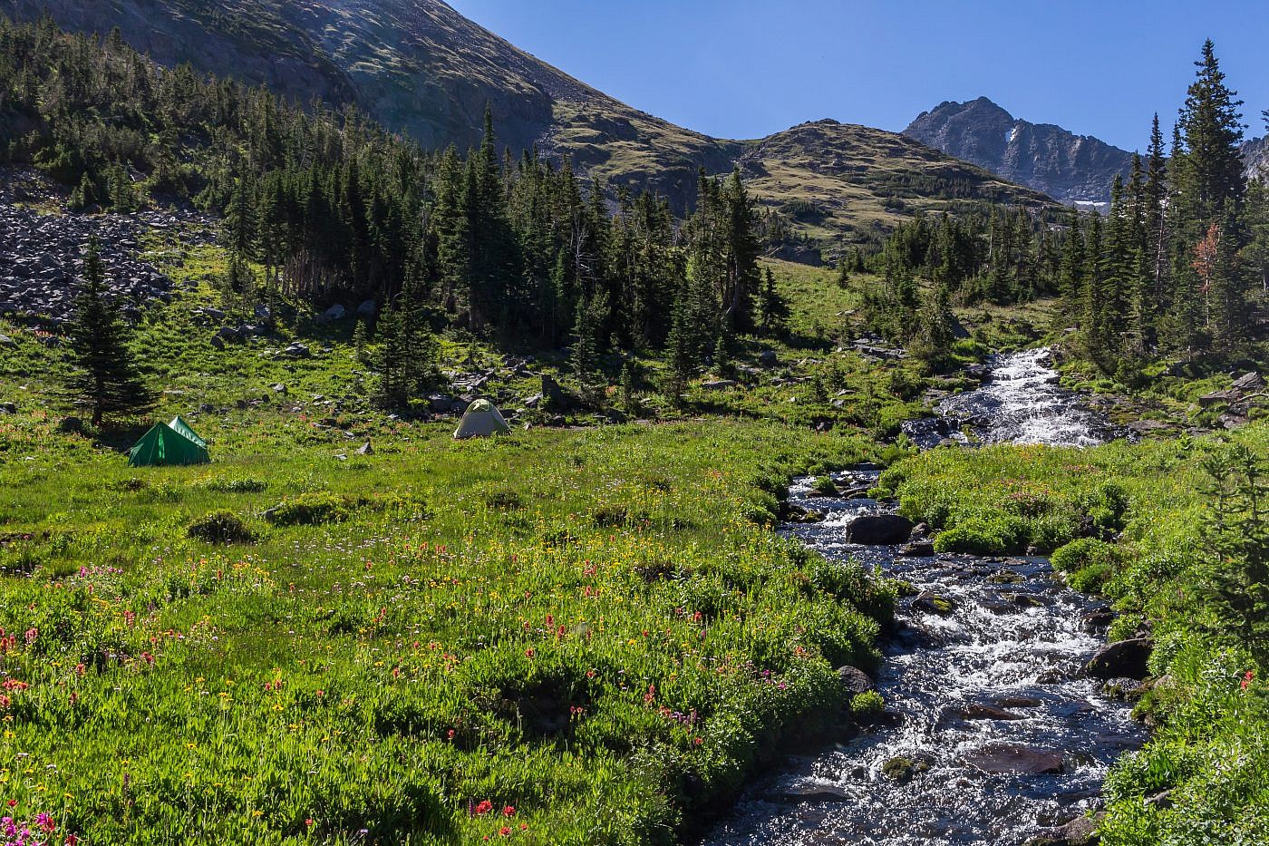
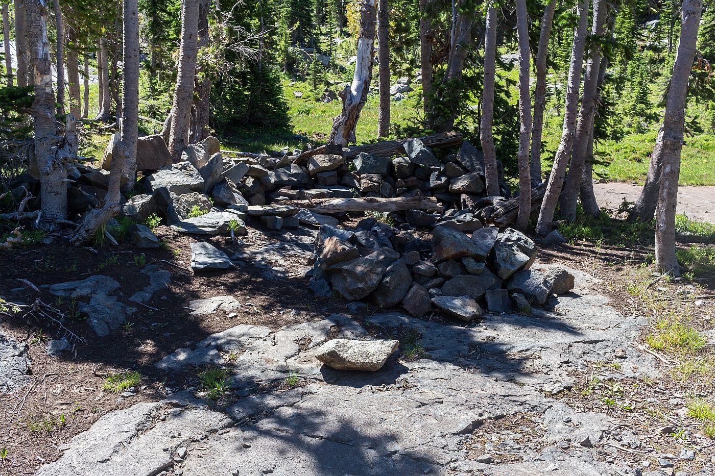
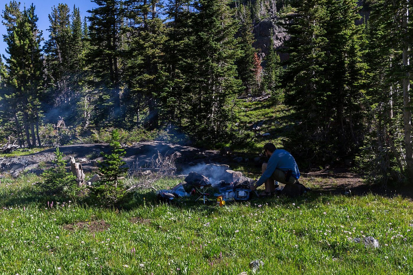
After another 1/2 mile or so the terrain flattens which made for a perfect camping spot. There’re even a couple of established fire rings in the area and there was no one around so we had the freedom to choose the most ideal spot. Once settled in we quickly got a fire going, stuffed our faces, and settled in for the night.
In 9 hours we had covered 9 miles and 4000′ of elevation, the most intense backpacking trip I’ve been on to date. I felt a tremendous sense of accomplishment and contentment as I laid down in the comfort of my own tent and reflected on the events of the day while drifting off into a deep sleep.
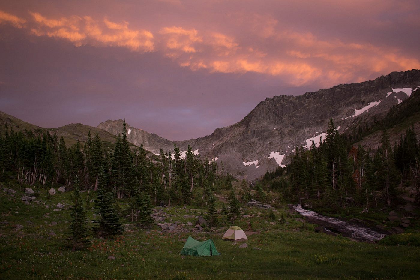
An epic camping spot was eventually found. A beautiful sunset brought a wonderful close to the day.
Our campsite.
The Return
We were in no rush to get back in the morning so we both slept in and even took the time for a post-breakfast nap which sadly got cut short when a pair of hikers, who’d spent the night at Moose Lake, passed by our site. Around 11:00 AM we finally able to muster enough energy to gear up and hit the trail.
Glacier Lake on the way out.
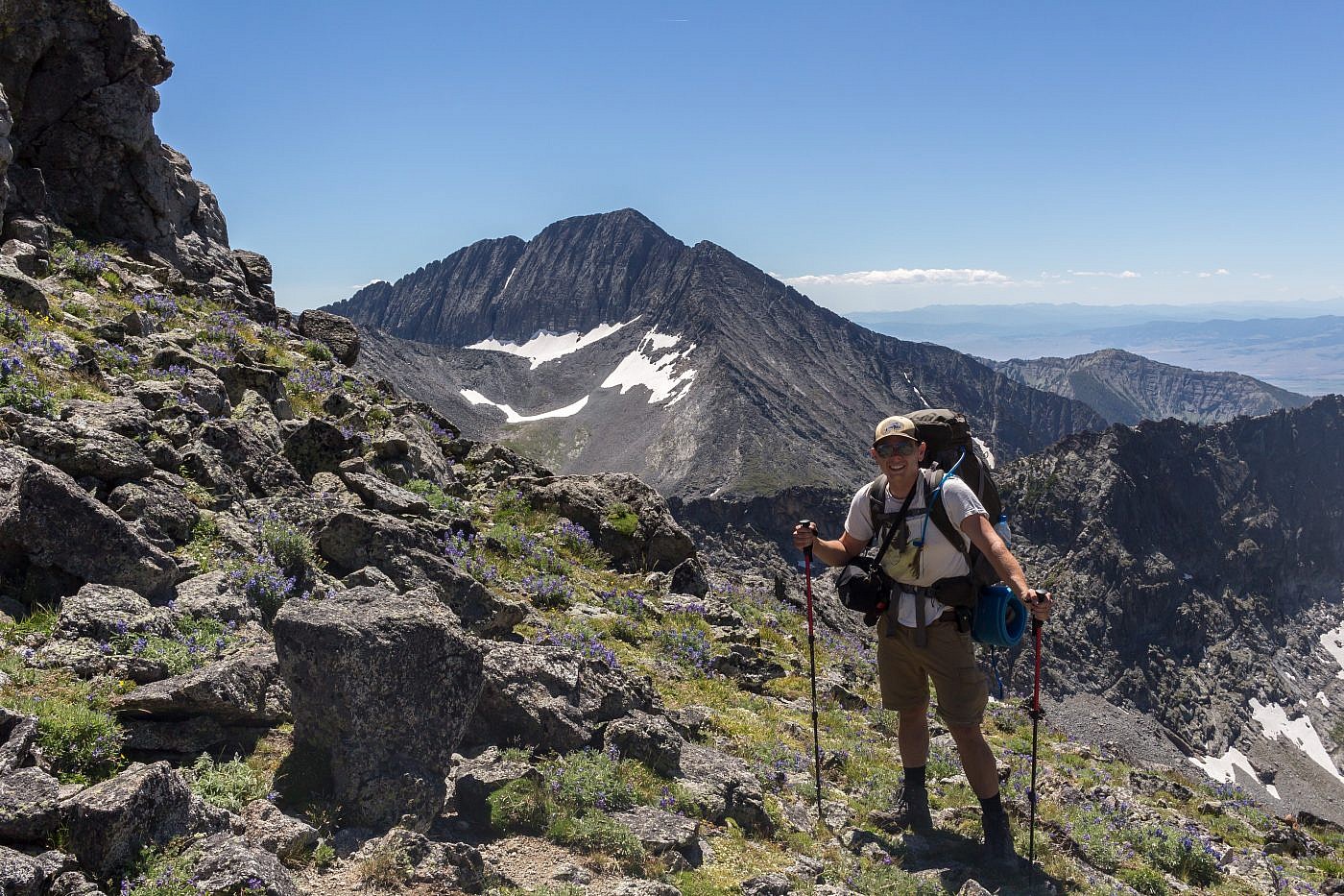
Me atop the saddle. Wilsall Peak in the background.
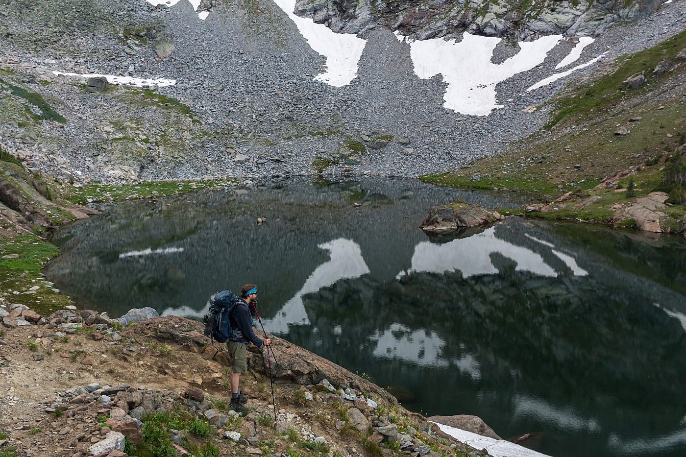
View of Glacier Lake from the saddle.
On the way back we took a couple quick pit stops at Glacier and Upper Twin Lakes so I could collect water samples for Adventure Scientist’s Global Microplastics Initiative. They will analyze these samples to gain a better understanding of how microplastics are being spread throughout the world and the dangers they pose to the environment. They’re always looking for more volunteers so if you’re interested you can find more information here.
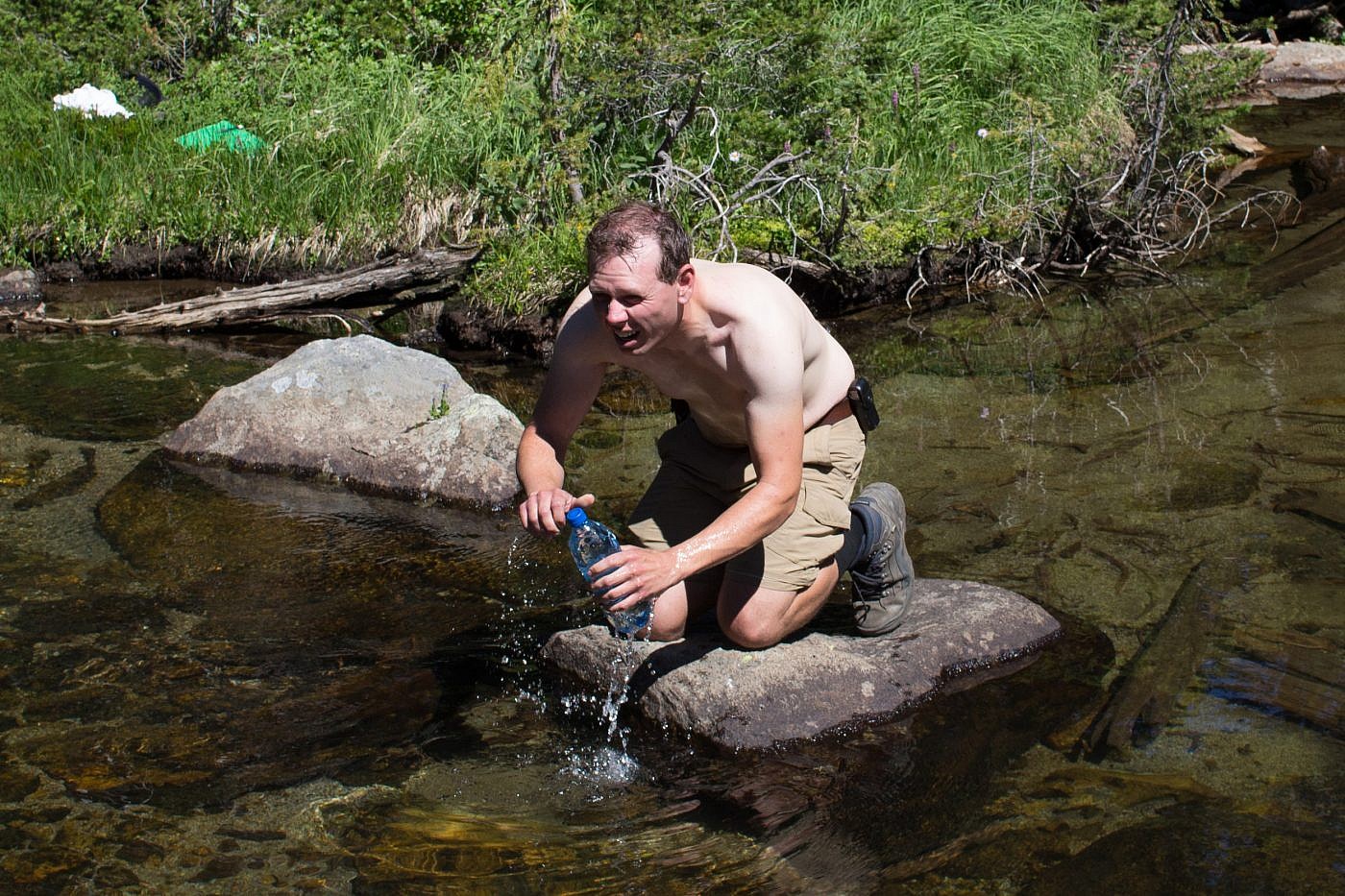
Me collecting a water sample from Upper Twin Lake for Adventure Scientist’s Global Microplastics Initiative.
The Crazies never cease the amaze and this hike contains all the ingredients necessary for a true adventure; it tops the charts. There’re pristine alpine lakes, inspirational views, and a mountain with a serious attitude. There’s no question though, this one’s tough even if you choose not to bag Conical along the way and it’s the first of my adventures to earn an “extreme” rating.
Life achieves its summit when it does to the uttermost that which it was equipped to do.
-Jack London, White Fang
