Absaroka Range
Livingston Peak
Download KML
Distance
4 miles one way
Type
Day hike
Difficulty
Moderate
- Starting Elevation: 6150 ft.
- Ending Elevation: 9300 ft.
- Elevation Gain: 3150 ft.
 View all 24 photos
- Experience Date: Jun 28, 2015
- Hike Time: 6-7 hrs
- Drive Time: 1 hr.
- Road Condition: Dirt road. Road gets pretty rocky near the end but could still be accessed by a 2WD vehicle with decent clearance.
- Parking: Averaged-sized lot. Empty
- Fees: None
- Campsite Availability: Plenty of flat areas along the trail.
- Private Property: None
- Trail Traffic: Very light.
- Trail Condition: Well defined and maintained.
- Fire Restrictions: None posted.
- Stream Crossings: None.
- Water Sources: Some creek access.
- Snow: Little to none.
- Winter Access: Unknown
- Weather: Very sunny and hazy with little cloud cover. Hot. Mid 90’s.
- Bugs: Many horseflies.
- Wildlife Sighted: Female moose and calf.
- Side Quests: Razorback ridge north of saddle. East Baldy Basin.

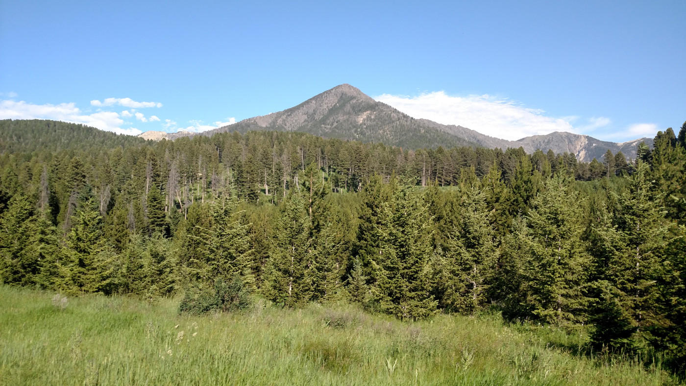
Livingston Peak towers at 9300′ to the southeast of Livingston and is kind of like Baldy’s sister peak, being similar in size, shape, and terrain. The trail roughly follows Lost Creek through West Baldy Basin and covers 3000′ of vertical over just 4 miles. 2000′ of that elevation is covered in the last mile so you can expect flat followed by some serious climbing. It can also be accessed from the east via East Baldy Basin but I’ve not taken this approach and cannot comment on the state of the trail. It’s a fun hike that can be done relatively quickly for experienced hikers and probably melts out much earlier than the other peaks of the Absarokas. The views from the top are stellar and give you a feel for the vastness of the Absaroka-Beartooth Wilderness.
Livingston Peak.
Background
After many months summer was officially here and peak bagging season was underway. But along with it came an unrelenting sun and scorching temperatures. A brutal heat wave had recently smothered Bozeman, adversely affecting our hiking plans. But as we’d prove time and time again the weather would not be a hindrance and Livingston Peak of the Absarokas, a gentler peak of the range, was the perfect candidate given the conditions.
Livingston Peak (9300′), towering to the southeast of Livingston, is kind of like Baldy’s sister peak, being similar in size, shape, and terrain. It covers 3000′ of vertical over just 4 miles, comparable to Baldy, so we knew there was going to be some serious climbing involved. It can be accessed from the west via West Baldy Basin or the east via East Baldy Basin; both routes are about the same distance.
Getting Started
The heat wave was in full force as we departed Bozeman on I-90 towards Livingston. There was no cloud cover and the temperature was already approaching 90 degrees. But for now the AC was cranked and the prospect of bagging a new peak was enough to keep morale high.
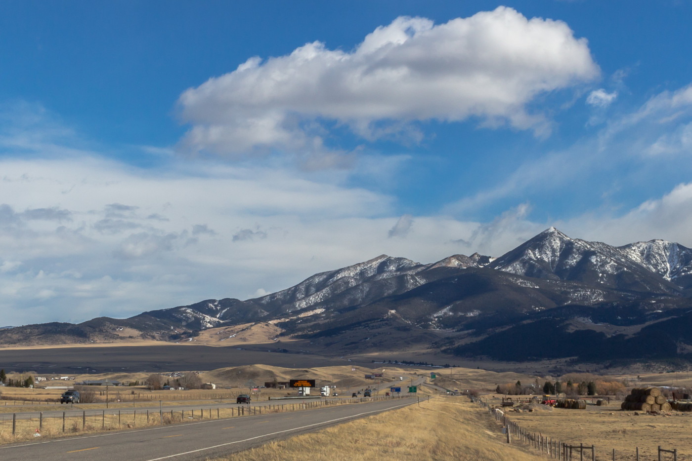
The first views of the peak open up about halfway to Livingston. From this angle it appears as a prominent, triangular hump; much less intimidating than the other gnarled peaks of the Absarokas but still a worthy opponent. A series of dirt roads lead from Livingston to the trailhead, gradually worsening in condition until the final stretch which is rocky and requires a high clearance vehicle. The parking lot is fairly spacious but we were once again the only ones there.
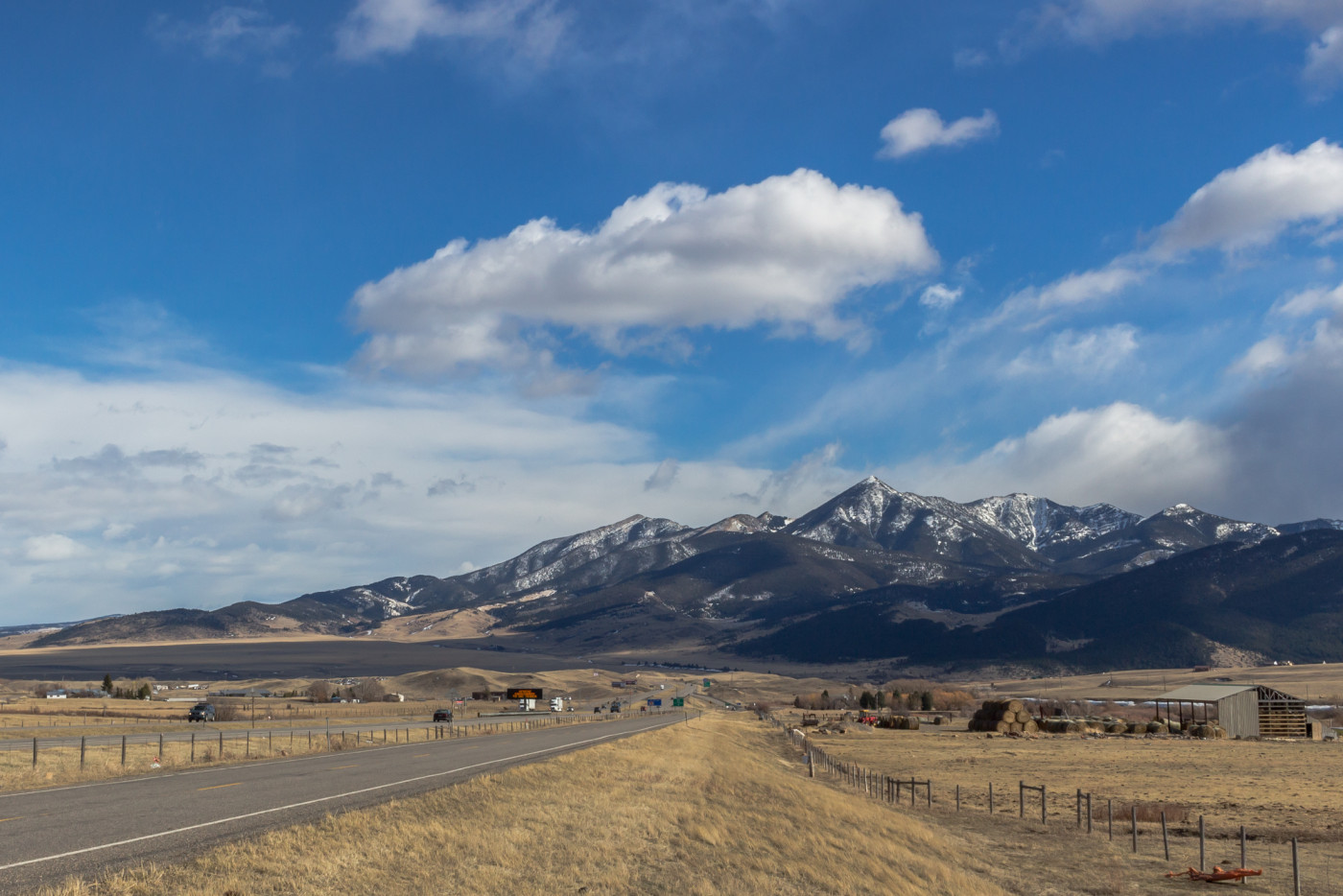
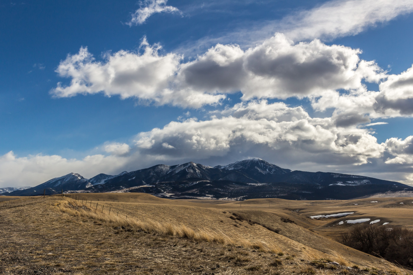
View of Livingston Peak from I-90. Taken February 2016.
The Adventure Begins…
As is typical with most hikes the trail starts out flat and boring, infested with view-obscuring trees. But on this occasion the trees were a sanctuary from the sun so I welcomed them with open arms.
We weren’t on the trail long before I noticed a soft buzzing sound in the vicinity. The sound got stronger and suddenly I felt a sharp pain near my shoulder. Quickly I swatted at my shoulder and watched in horror as a big black (squashed) horsefly fell lifeless to the ground. Great, not only did we have to deal with the heat but now there was a swarm of hungry horseflies ready to turn my body into lunch. This is something I would’ve expected back in Wisconsin, but I thought Montana was a safe haven from these vicious pests.
Just under a mile in the trail intersects a dirt road. Continue across the dirt road until back on the trail. A few paces beyond the road is another trail intersection. To the left is West Baldy Basin which continues along the ridge towards the peak. To the right the trail leads down to Lost Creek which can easily be mistaken for the right trail.
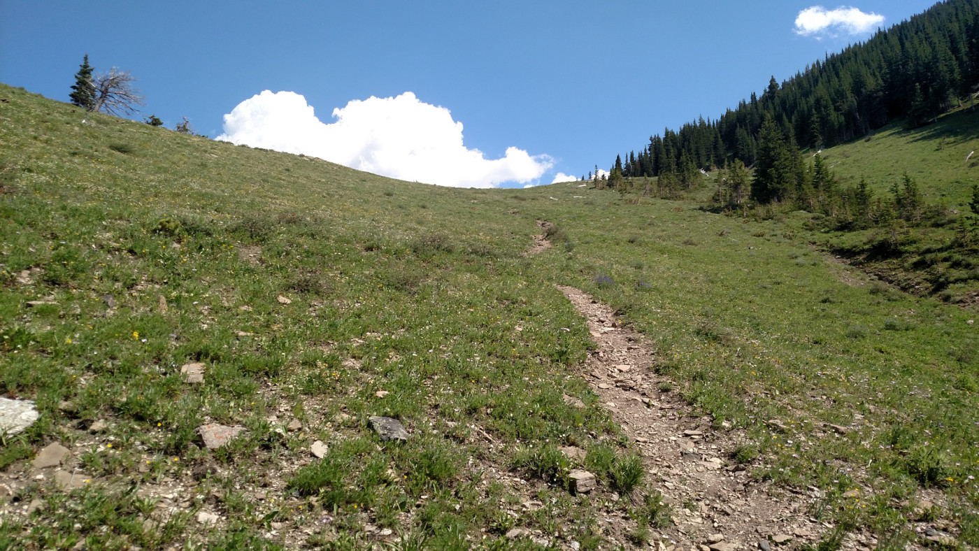
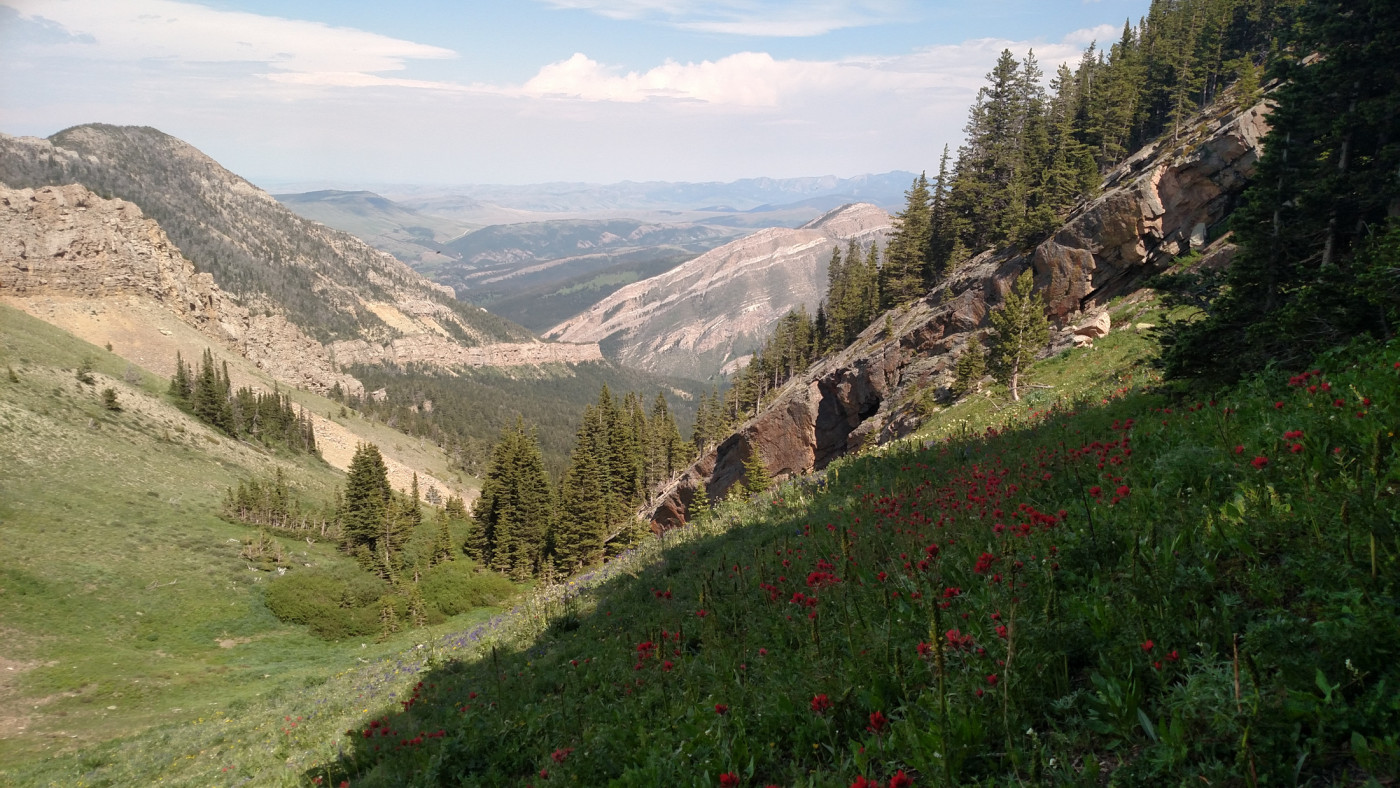
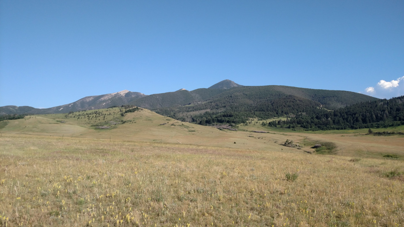
Views of Livingston Peak open up as you steadily climb the side of the ridge into West Baldy Basin. By now I was drenched in sweat and found it difficult concentrate on the scenery while battling the endless waves of horseflies. The only effective means of combating them, since neither one of us had bug spray, was to keep moving and that’s exactly what we did.
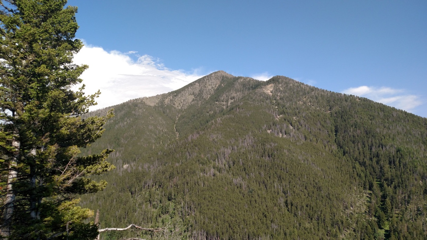
One of the first views of Livingston Peak from the trail.
Eventually the trail meets up with Lost Creek and we decided it was time for a short breather. The flies wouldn’t let us pause for long though so we quickly slathered ourselves with cold creek water and pressed onward towards the saddle below Livingston Peak.
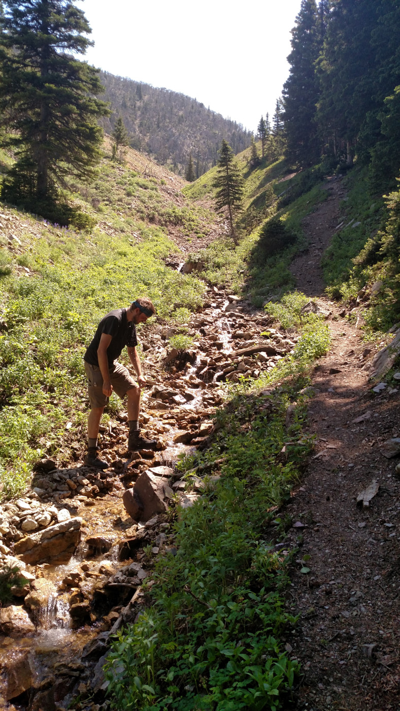
Taking a moment to cool off.
Approaching the saddle.
Saddle Up
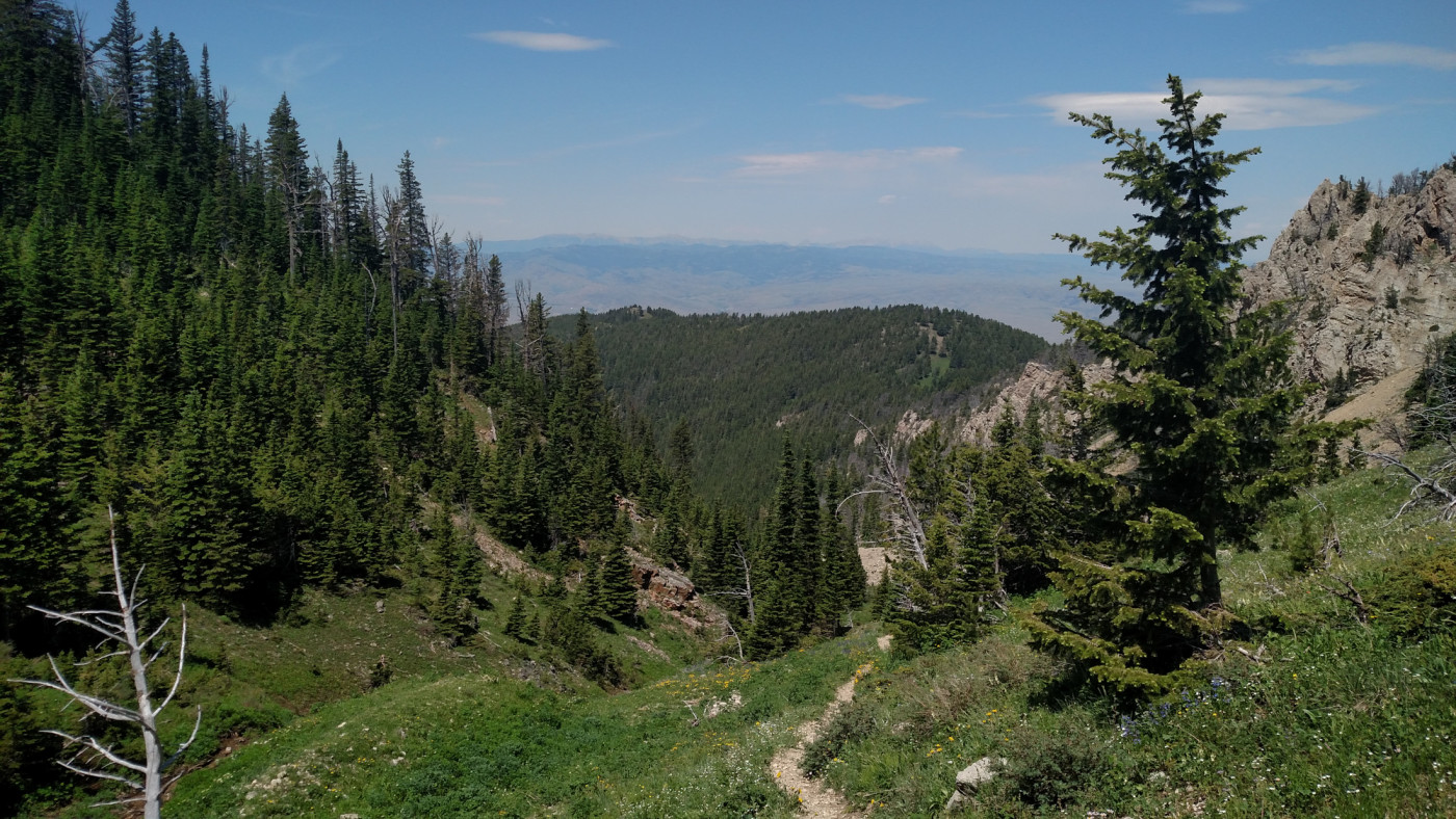
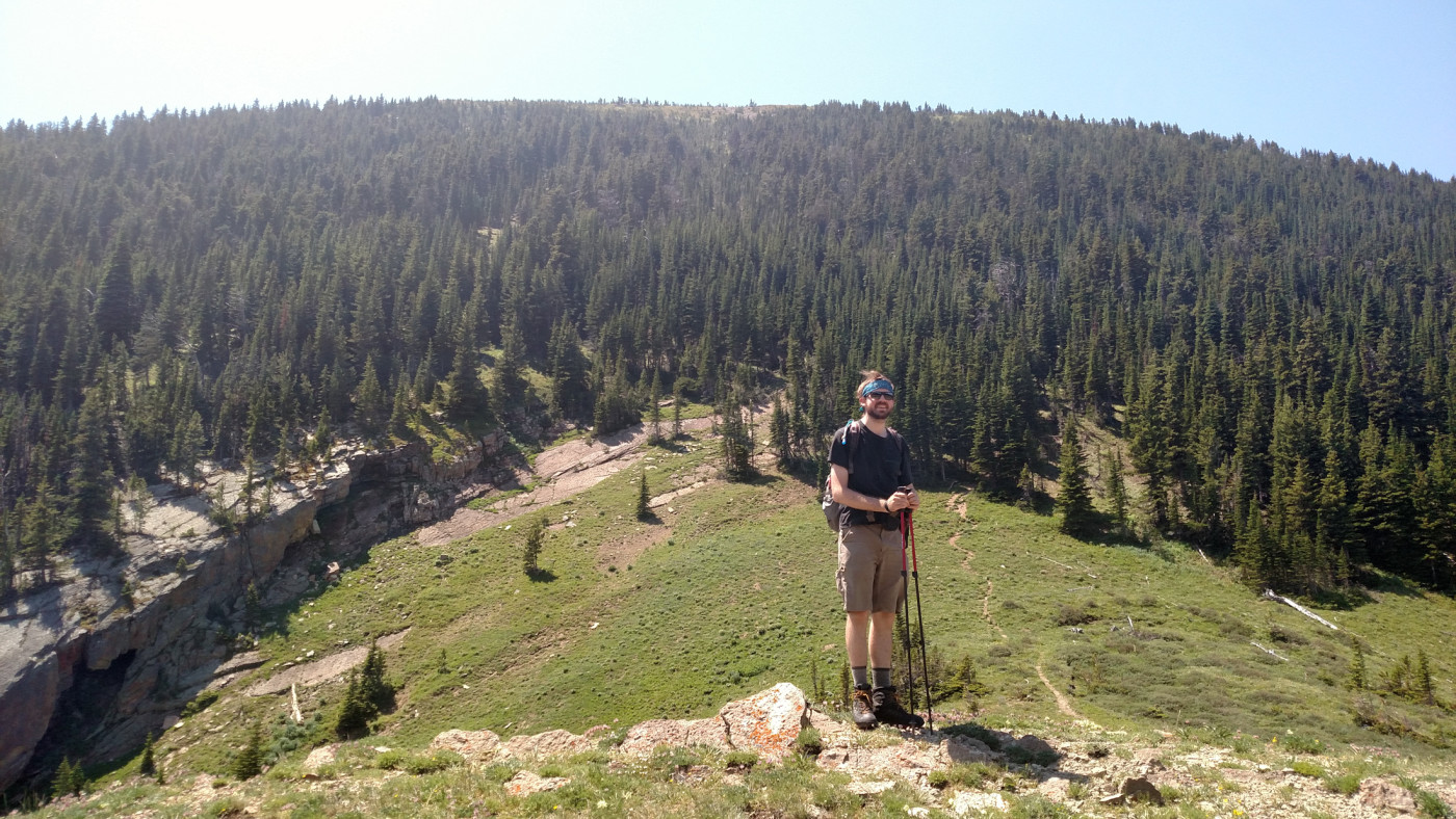
From the saddle the official trail continues east toward East Baldy Basin. To the south is a well-established, unofficial trail leading straight up to the summit of Livingston Peak. There’s great views to the east of the saddle and a giant razorback-like ridge to the north that looked fun to explore.
Looking east towards East Baldy Basin from the saddle.
Looking north towards the razorback ridge from the saddle.
On a typical day, the saddle would be a great place to hang out. But this day was anything but typical. While searching for a lunch spot we debated the lesser of two evils. The top of the saddle, although lacking shade, was windy enough to keep the horseflies at bay. On the other hand, a shady area would provide temporary relief from the sun but would be like ringing the dinner bell for the horseflies. Neither option was ideal but we chose the saddle. The wind wasn’t nearly as good of a natural fly repellent as we’d hoped for so we quickly scarfed down lunch and hit the trail.
The climb up to the summit is one of the more strenuous ascents I’ve made. It covers a mind-boggling 2000′ of elevation in just one mile. And you can forget about switchbacks, this thing goes straight up. Near the top the trail sort of just dissolves into the landscape; it was every man for himself at that point.
Looking up towards the summit from the saddle. Long ways to go yet.
The Summit
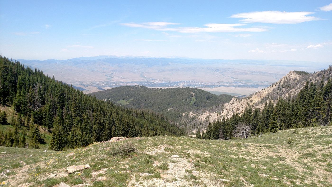
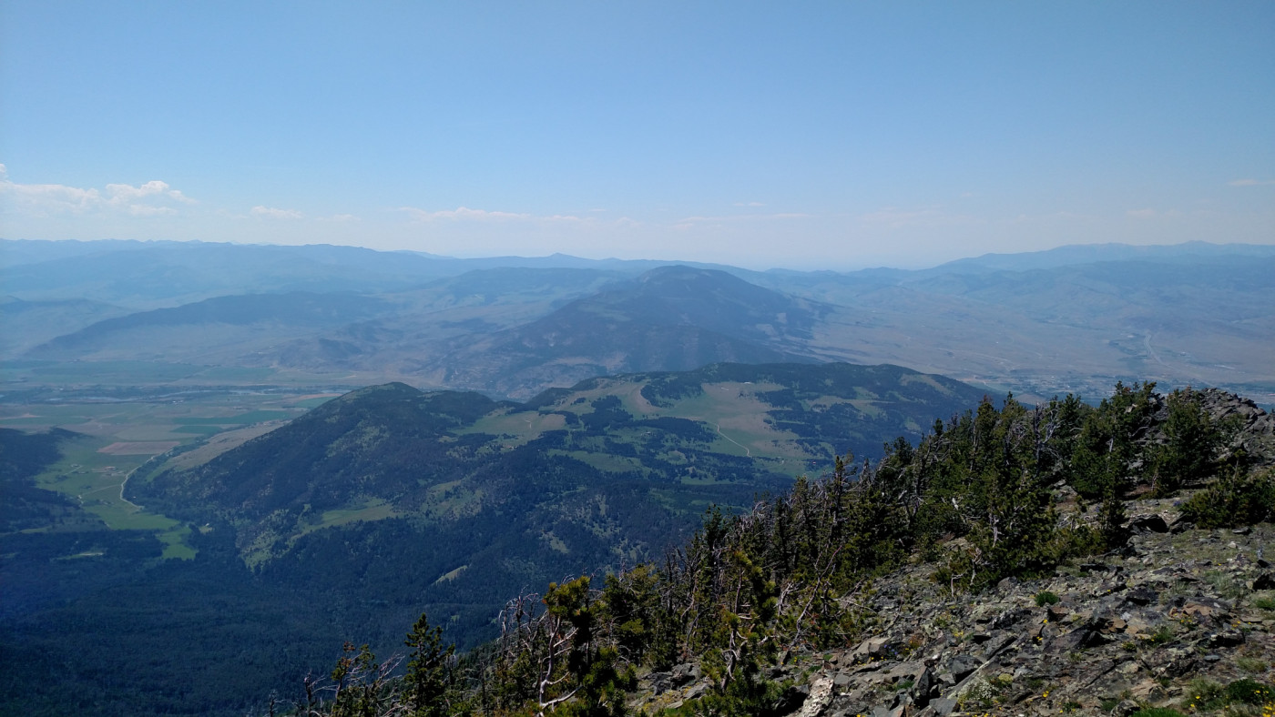
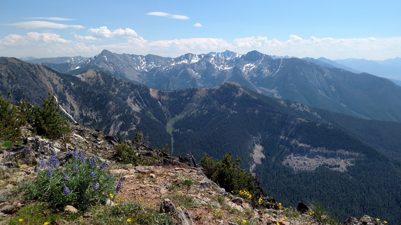
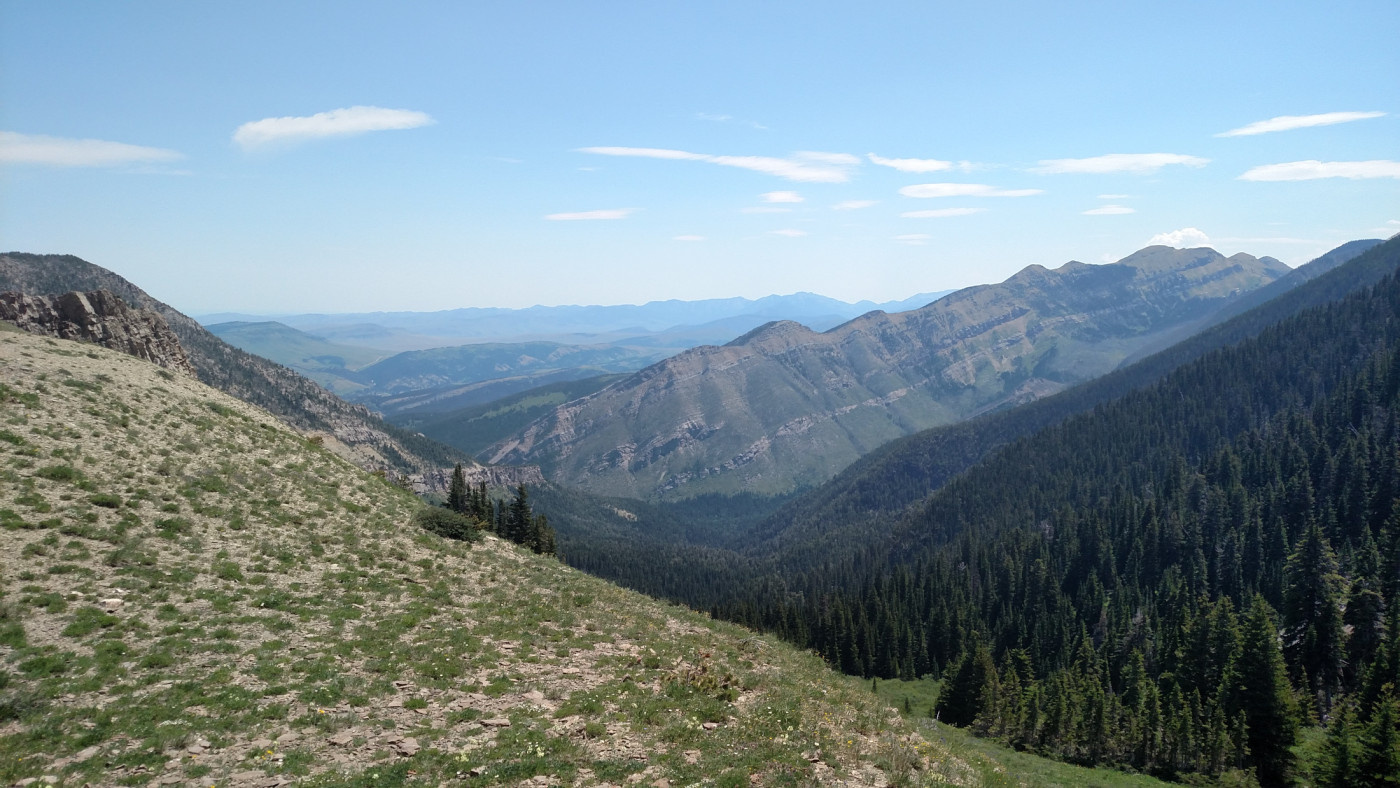
A cairn with a sign clearly mark the summit of Livingston Peak. If not for a slight bit of haze the views would’ve been pristine. The Absoraka-Beartooth Wilderness can be seen extending for many miles to the southeast. Paradise Valley is visible in its entirety, stretching all the way to the distant Yellowstone Plateau. There’s great views of the Gallatins, the Bridgers, and Bozeman Pass as well. Smoke, probably from a small forest fire, had swarmed the northern lands blocking out views of the Crazy Mountains.
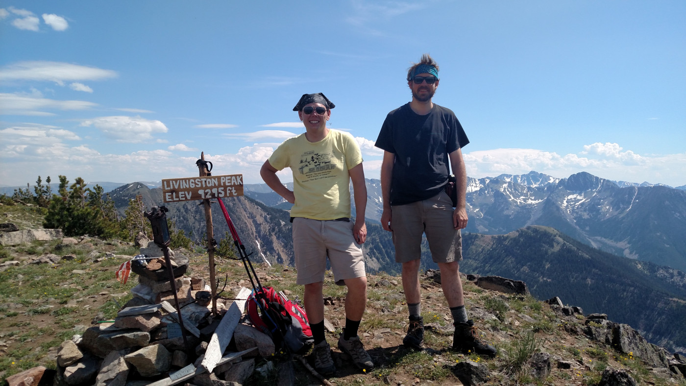
The summit. The vast Absaroka-Beartooth Wilderness in the background.
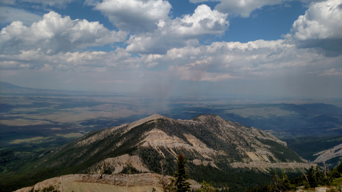
Smoke could be seen to the North.
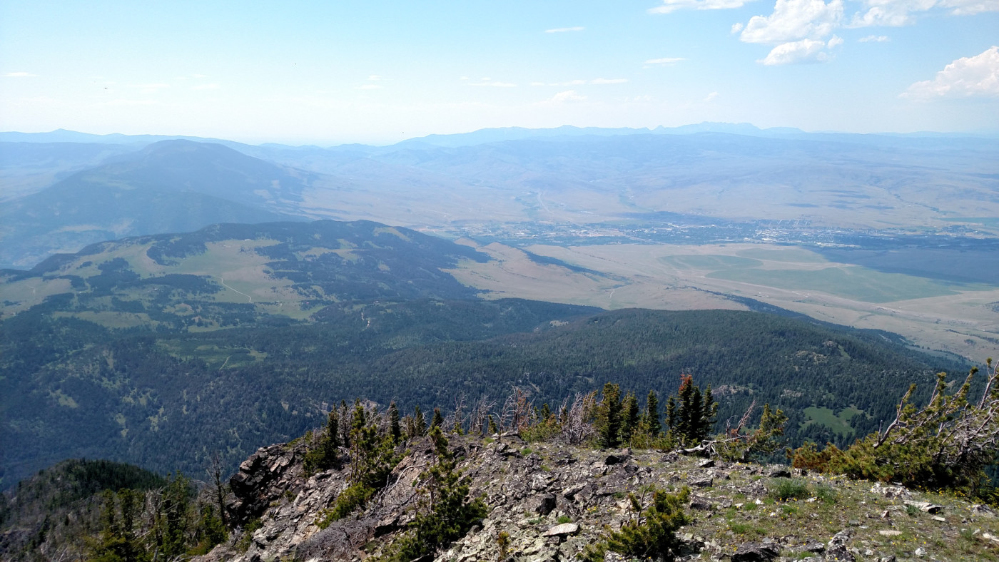
Looking west from the summit towards Livingston. Bozeman Pass can be seen in the distance.
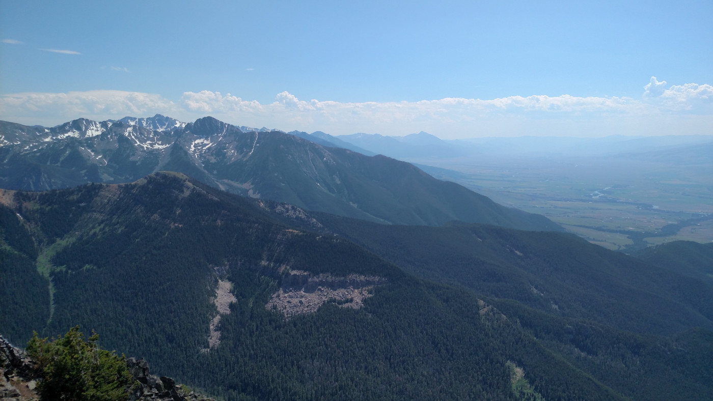
The Absarokas meet Paradise Valley.
The summit, it turns out, is not nearly as pointy as it appears from the east or west. It’s actually long and narrow and if viewed from the north or south it would appear broad and flat. We wandered around the top for bit and took a rest on the western end of the peak. The horseflies weren’t as troublesome on the summit but there was absolutely no way to hide from the sun so after a quick snack we prepared for the descent. Descending the steep section will wreck havoc on the knees. There’s just no way around it so take it slow and be careful. I strongly advise using a walking stick or trekking poles to aid with this section.
Livingston Peak (on the right) appears much broader from the North. Photo taken February 2016.
The Return
After the saddle the remaining journey was a cakewalk. The flies were still bad but the sun, now lower in the horizon, was bearable. In no time we were back at the car and ready to leave.
East Baldy Basin.
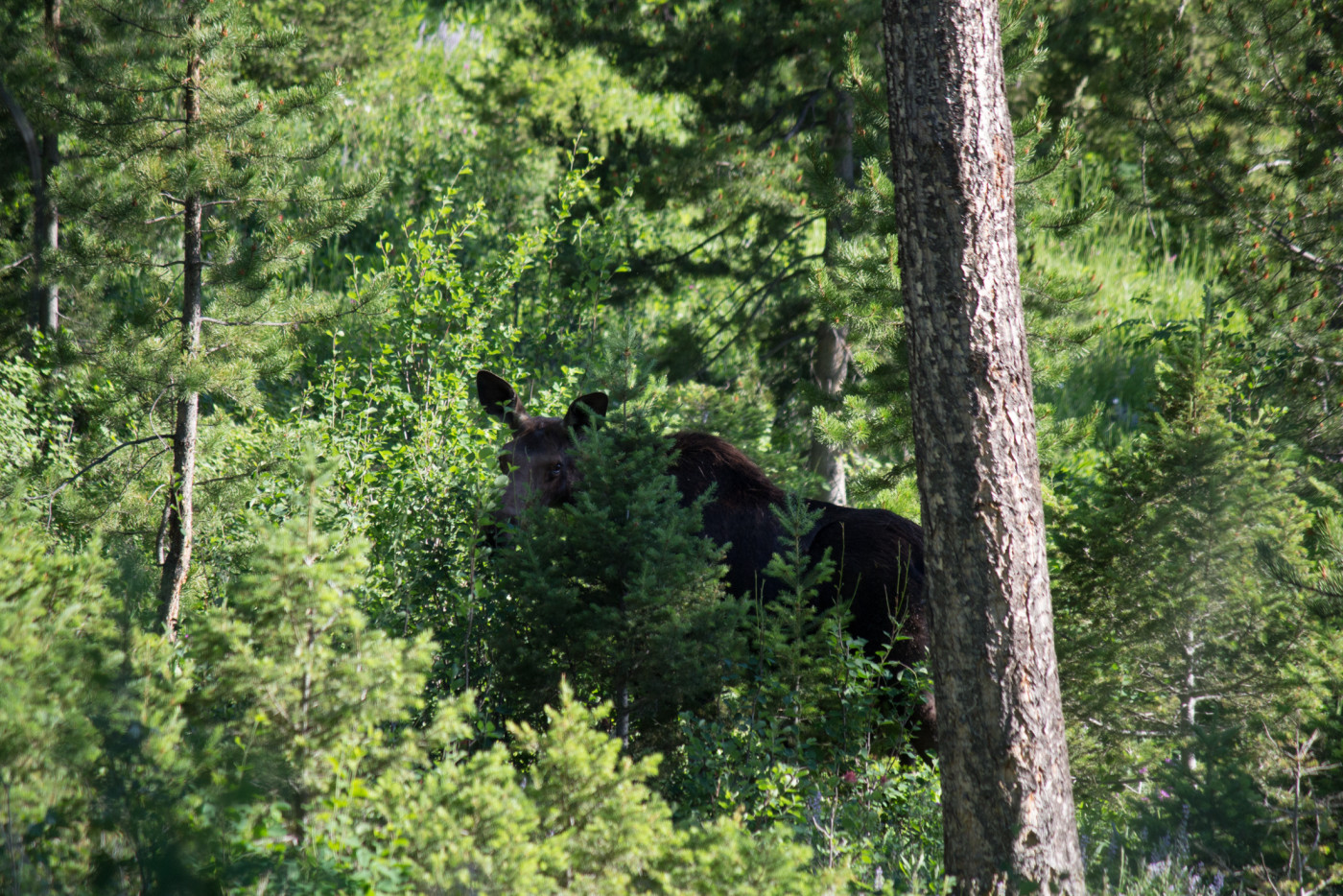
We only got about 100 feet down the dirt road when I realized I had forgotten to pee at the trailhead. Not wanting to hold it all the way to Livingston I parked the car for a moment to relieve myself. As I began I looked up and saw a strange figure deep within the brush. It was brown with an elongated head and had a baby at its side; an intriguing creature which seemed to be a cross between a horse, a deer, and an elk. The only possibility was moose, but I’d never seen one and knew that a sighting was somewhat rare, especially with a calf. I consulted Arlo and he agreed it had to be moose. In a heartbeat I grabbed my camera, threw on the zoom lens, and started snapping pictures of this magnificent beast. We must’ve watched them for at least 15 minutes as they roamed gracefully through the woods eating leaves, completely indifferent to our presence, until eventually disappearing further into the brush. I was totally psyched to see my first moose; such a triumphant end to another wonderful day in the mountains.
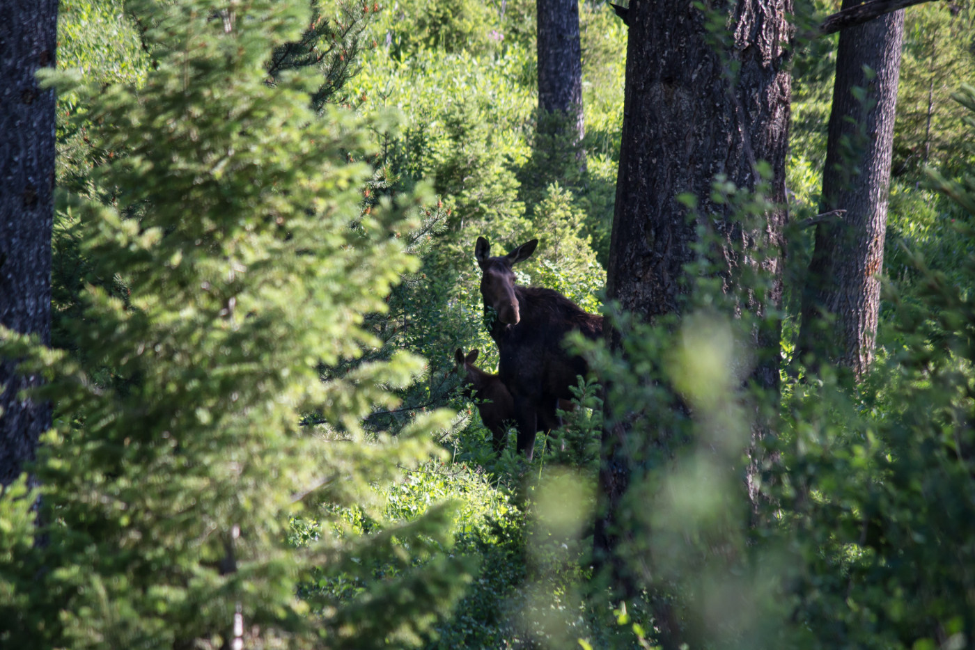
The moose and its calf.
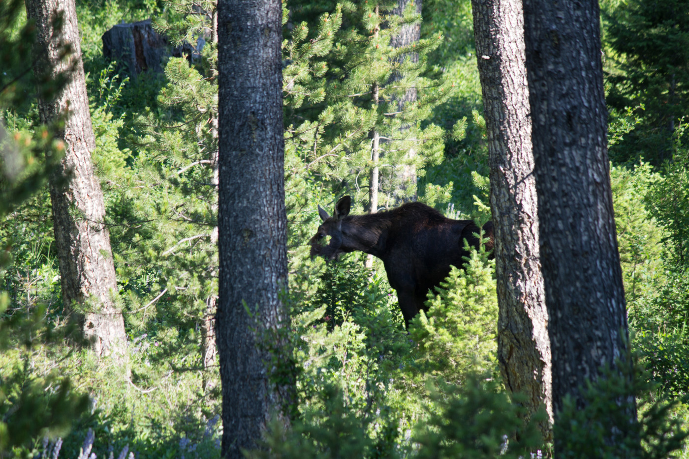
Munchin’ on leaves.
Another view of Livingston Peak on the way out.
