Crazy Mountains
Sunlight Ridge to Tabletop
Download KML
Distance
6.5 miles one way
Type
Day hike
Difficulty
Hard
- Starting Elevation: 6350 ft.
- Ending Elevation: 9800 ft.
- Elevation Gain: 3450 ft.
 View all 38 photos
- Experience Date: Jun 7, 2015
- Hike Time: 6-8 hrs.
- Drive Time: 2 hrs.
- Road Condition: Dirt road. 2WD accessible.
- Parking: Averaged-sized lot. Empty
- Fees: None
- Campsite Availability: Camping at Sunlight Lake. Plenty of flat spots along trail.
- Private Property: None posted.
- Trail Traffic: Very, very light.
- Trail Condition: Well maintained. Trail becomes unclear as you scale the ridge but direction is obvious. Must climb scree to get to the Tabletop.
- Fire Restrictions: None.
- Stream Crossings: No bridge at Sunlight Creek. Must wade or carefully cross a log. Probably becomes easy to cross later in season.
- Water Sources: Sunlight Creek until about 3 miles in.
- Snow: Peaks still snow-capped and lakes at the base of Sunlight Peak were frozen. Patches of snow along the ridge.
- Winter Access: Unknown.
- Weather: Partly cloudy. 70's. Very comfortable.
- Bugs: None
- Wildlife Sighted: None
- Side Quests: The Tabletop. Sunlight Peak. Sunlight Lake.

The northwest end of the Crazies offers some of the most fantastic hiking around and the Sunlight Ridge Trail is possibly the most exhilarating hike I’ve been on. The trail, which is very well maintained, leads you through a flat, heavily forested area before ascending Sunlight Ridge, passing through a number gorgeous sub-alpine meadows along the way. The last segment of trail is completely exposed, hugging the side of the ridge and leading to the saddle that separates Sunlight Peak and Tabletop Mountain (unofficial name). Sunlight Peak does not appear to be climbable without ropes but you can easily scramble up the Tabletop for an excellent view of the razor-sharp ridges and glacially carved U-shaped valleys which, in my opinion, define the Crazies. Camping is also available at Sunlight Lake if it’s late enough in the year.
Sunlight Ridge.
Background
Springtime in the mountains was finally here. The endless months of battling cold were over and snow was now an enhancement rather than an impediment. Daytime temperatures were warm and pleasant while nighttime temperatures were cool and refreshing and with the summer solstice approaching our adventures would not be constrained by the amount of daylight. This short window in June was prime hiking season so why not celebrate with a first trip to the Crazy Mountains?
For some time now my hiking companion, Arlo, had expressed interest in these “Crazy Mountains”. He told stories of how an old family friend used to venture there in the old days, exploring their secrets. But after almost four years living in Bozeman neither one of us had even (knowingly) laid eyes on the them. So when Arlo proposed a trip to the Crazies I agreed in a heartbeat.
After close examination of the map it was decided that the Sunlight Ridge Trail, leading to Sunlight Lake, in the northeast end of the range would be a suitable dayhike. It’s one of only a handful of access points to the Crazies and looked like it had plenty of adventurous opportunities to offer. The trail roughly follows the Sunlight Creek drainage and leads up Sunlight Ridge to a saddle between Sunlight Peak and a 9800′ flat-topped unnamed mountain which I shall refer to as Tabletop Mountain or just the “Tabletop”.
Getting Started
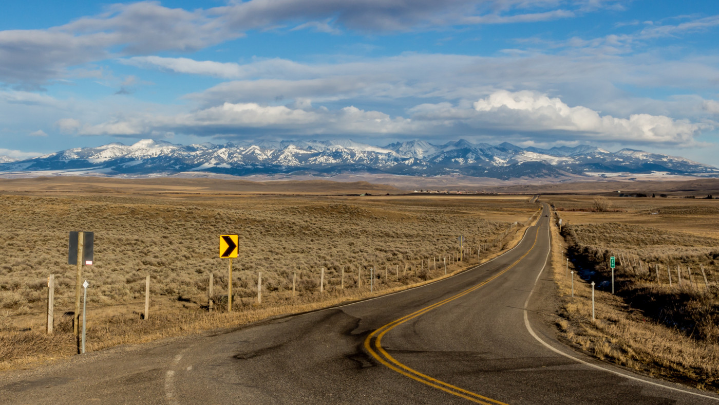
As we exited Bridger Canyon our first glimpse of the Crazies came into view. A massive plane lay between us and our new mountain playground to the east. Sunlight gleamed off the snow-capped peaks which stretch for about 20 miles north to south.
First view of the Crazies. Photo taken in February 2016.
A straight forward drive on the Shields River Road leads from Wilsall all the way to the trailhead. It starts out paved but transitions to 2WD accessible dirt road, cutting east between the north and south sectors of the Crazies.
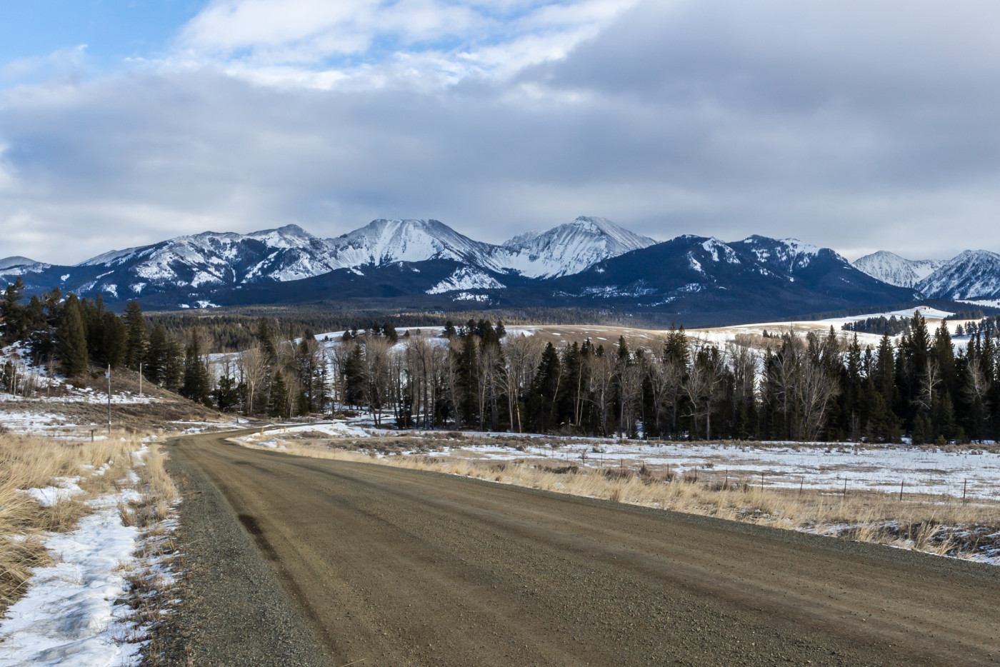
First good view of the Tabletop (center left) and Sunlight Peak (center right) along the dirt road. Photo taken in February 2016.
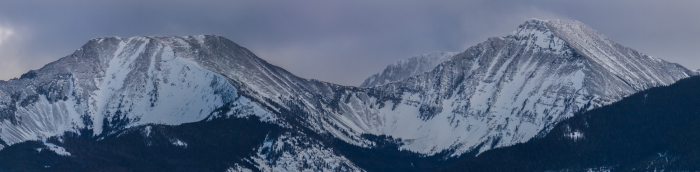
Close up of the Tabletop (left) and Sunlight Peak (Right).
Once at the trailhead we were shocked to see only one other car in the parking lot. Why weren’t more people taking advantage of this incredible weather? Not that it bothers me, one reason I go into the mountains in the first place is to escape civilization, but it’s a shame to see such an epic trail go unnoticed.
The Adventure Begins…
My memory of the first part of trail is vague at best. It winds uneventfully through a flat, forested section with the occasional view of Sunlight Peak. Right away we passed the only other hikers on the trail, a pair of elderly ladies finishing up their morning stroll through the woods. We now had the entire trail to ourselves, a key ingredient for a true backcountry experience.
We now had the entire trail to ourselves, a key ingredient for a true backcountry experience.
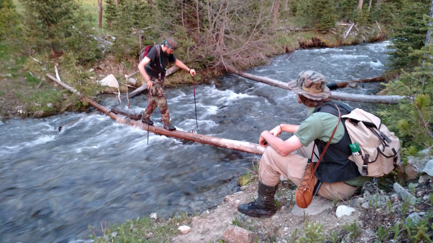
Just over three miles in the trail meets Sunlight Creek. A hack job bridge, comprised of a single, skinny log appeared to be the only means of getting across. Spring meltwater pummeled the log making it slick and unstable. To make matters worse, it had snapped in one spot creating a sort of mini-waterfall that we’d have to hop over. We could easily wade across but no one wanted to get their feet wet so we quickly scoured the area for other options. Another log bridge was found a little ways upstream but turned out to be more daunting then the first option so we turned back and searched for sticks to aid in our crossing. I presume that later in the year, once much of snow is melted out, the creek becomes much easier to cross.
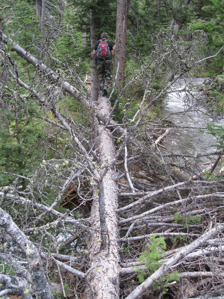
The “more daunting” option. A massive drop on the other side prevented us from crossing. Photo courtesy of Aaron Christian.
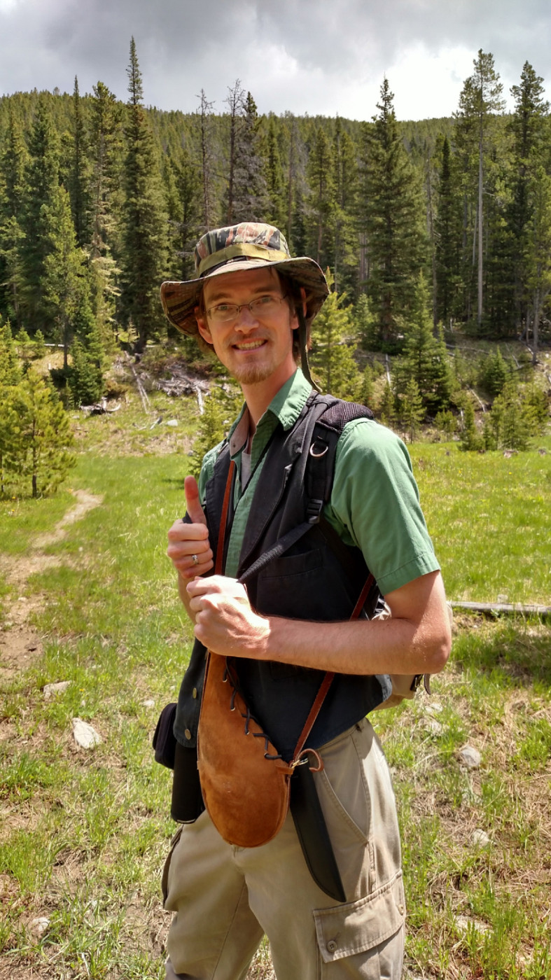
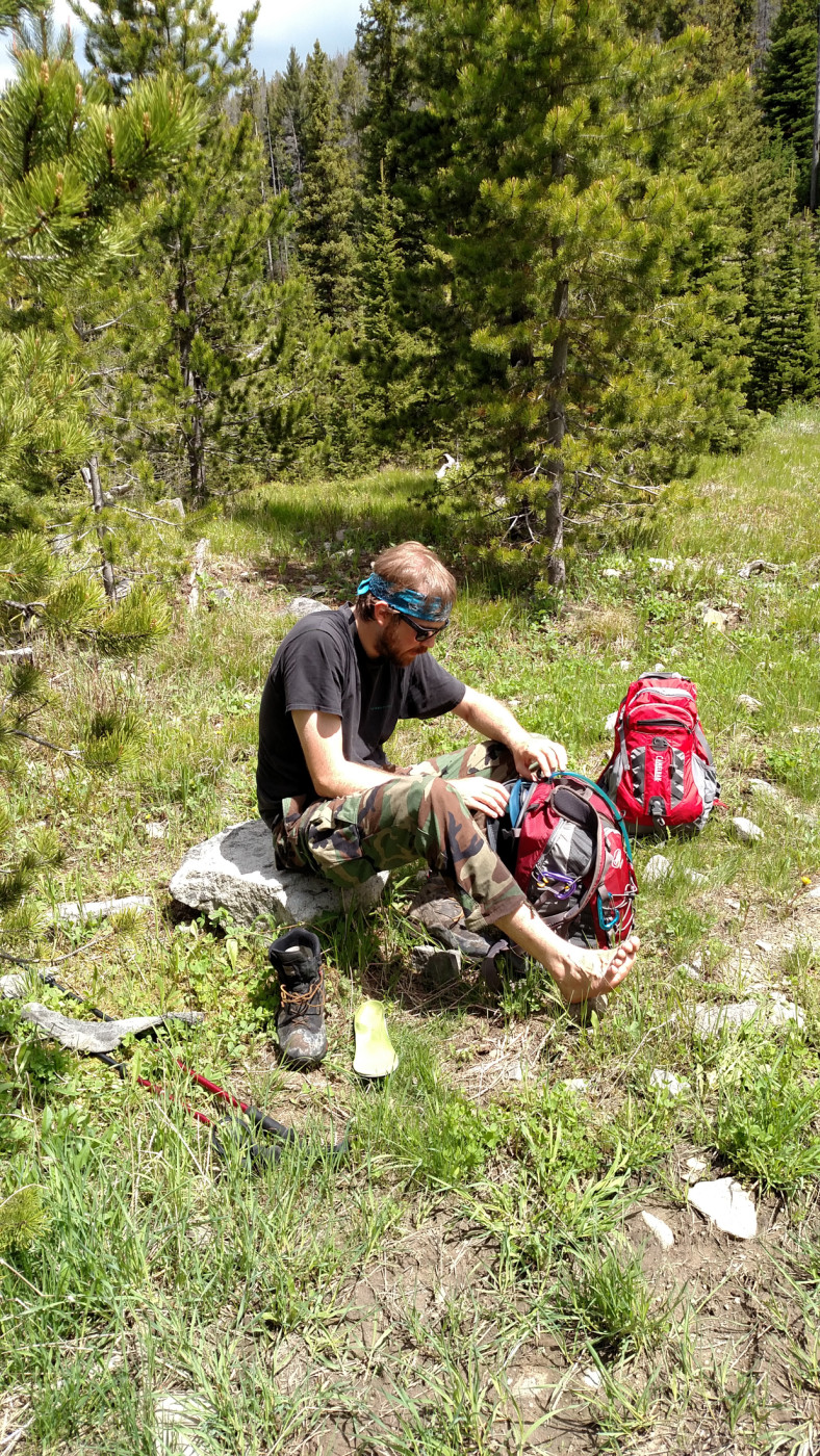
Christian was the first to cross and, after a suspenseful moment, managed to make it without any trouble. Then it was my turn. I had two sticks to use for balance but even with those I felt vulnerable. Carefully, I inched my way towards the other side, pausing at the water gap to contemplate my next move. We’d thrown rocks down to create additional footing but I quickly realized they were too slick to rely on so I held my breath, stepped forward across the gap and launched myself over to safety. Arlo wasn’t so fortunate. He teetered a bit while crossing the gap and had to plunge one foot into the chilly water to retain his balance. Relieved to be across, we took the opportunity to regroup and have a snack while Arlo drained the water from his boot.
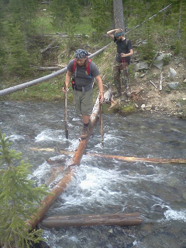
Me crossing the log bridge.
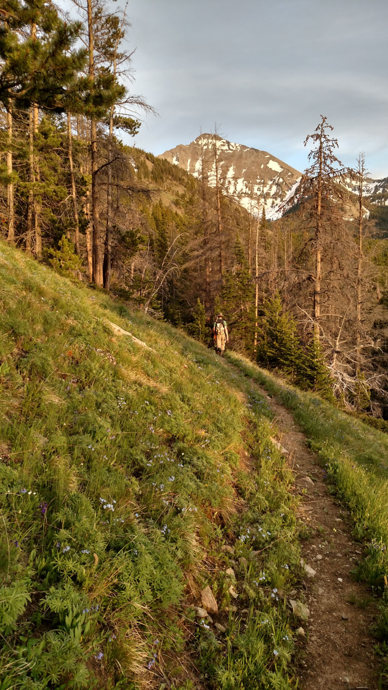
After our short break we bid the creek good riddance and began the more interesting stretch of the hike. The trail continues to parallel the creek for a short ways but then abruptly veers away, heading up the side of Sunlight Ridge. The scenery changes drastically as you’re led up the ridge through numerous sub-alpine meadows flourishing with spring growth. An unnecessary amount of cairns mark the beginning and end of every meadow making it impossible to get lost.
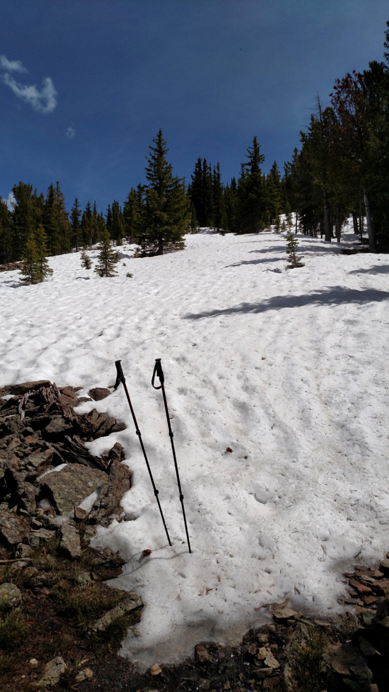
There was still some snow along the ridge but it was easy to avoid.
The scenery changes drastically once again at the start of the alpine tundra. A few lingering trees manage to survive in this scree field and the trail occasionally vanishes in the mess of loose rock but as long as you continue up the ridge it’s easy to stay on track. Eventually the trail becomes clear again and continues completely exposed along the side of the ridge towards the Sunlight Peak saddle. The ridge drops rapidly towards the valley below so be sure to watch your step.
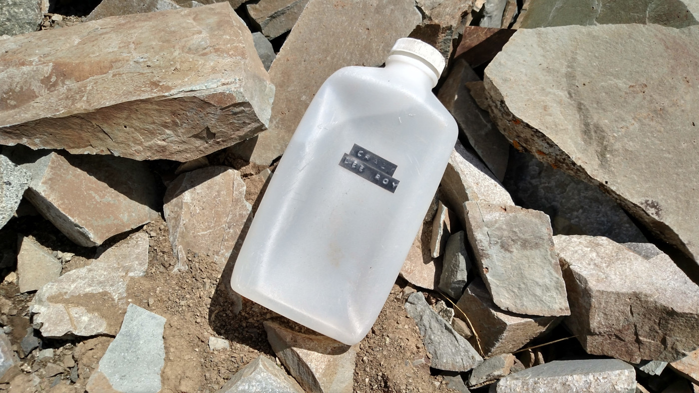
Not sure who “Crazy” Lee Roy is but he forgot his water bottle on the trail. I can only speculate about his fate.
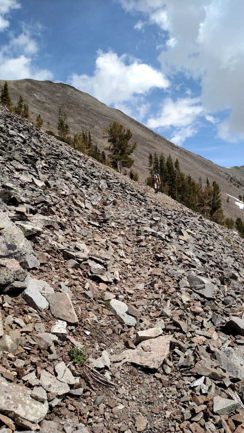
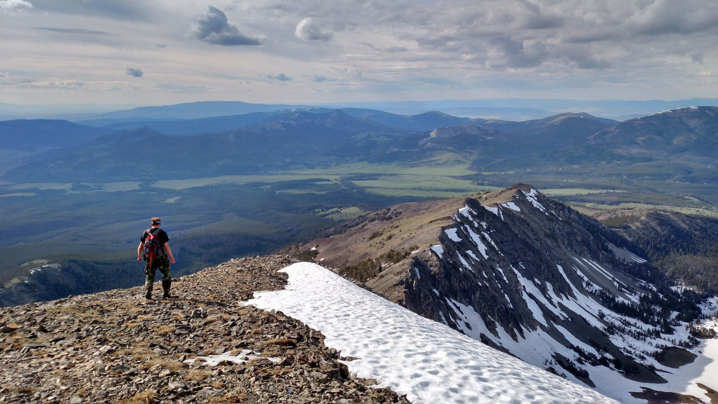
The exposed ridge just before the saddle.
The saddle.
Saddle Up!
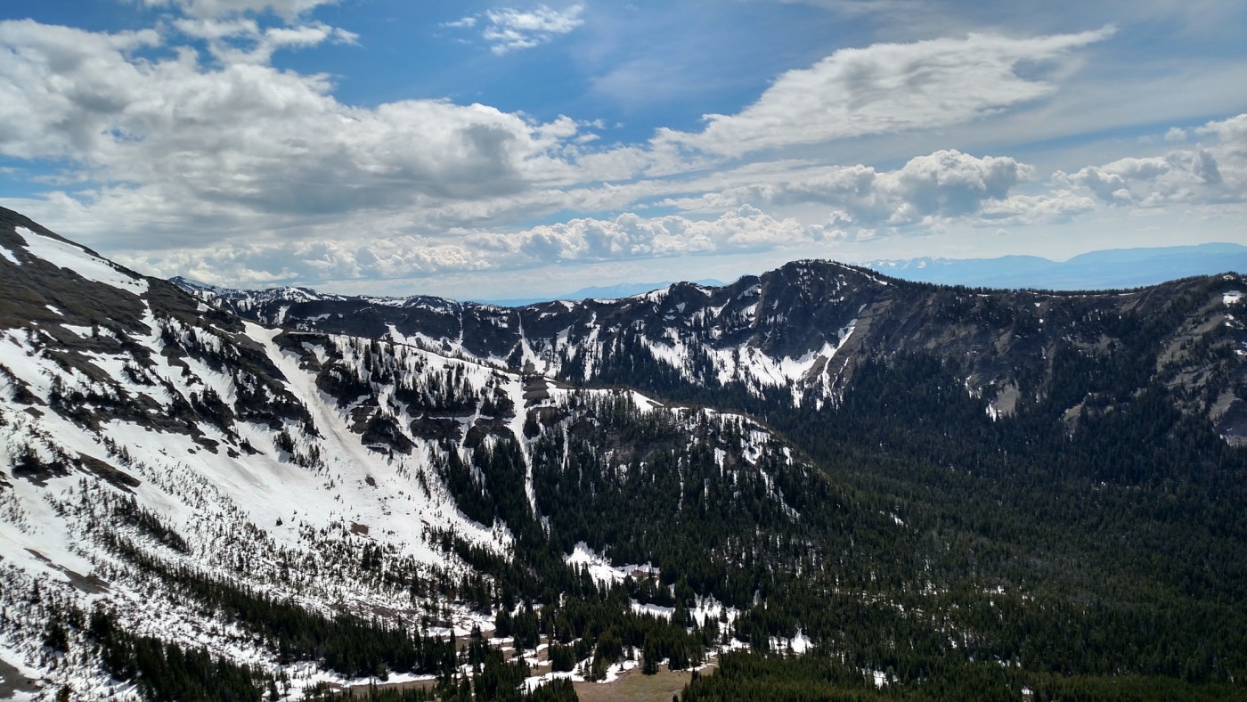
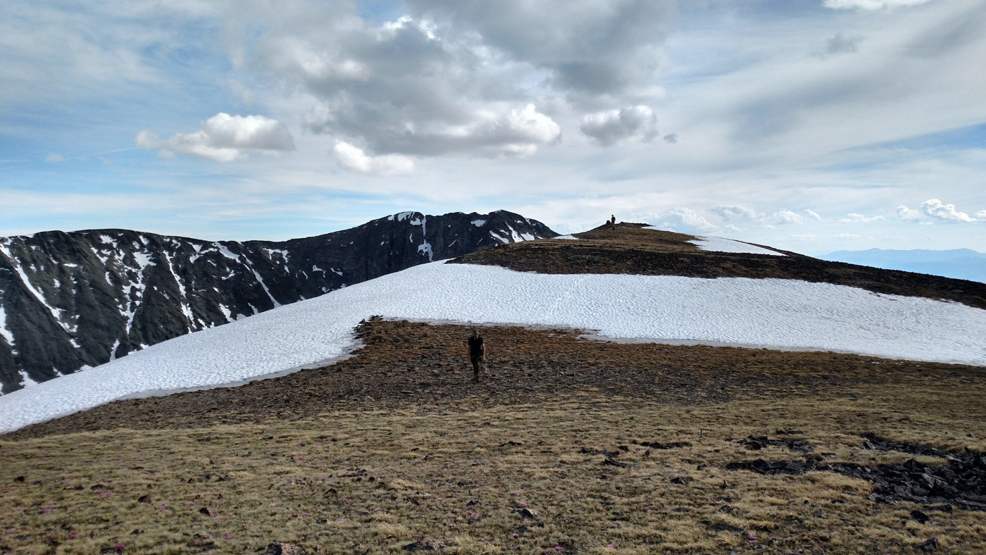
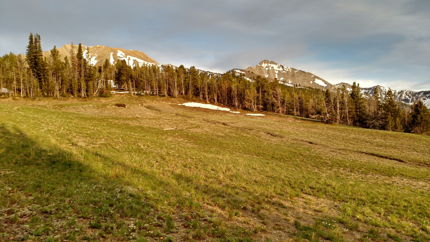
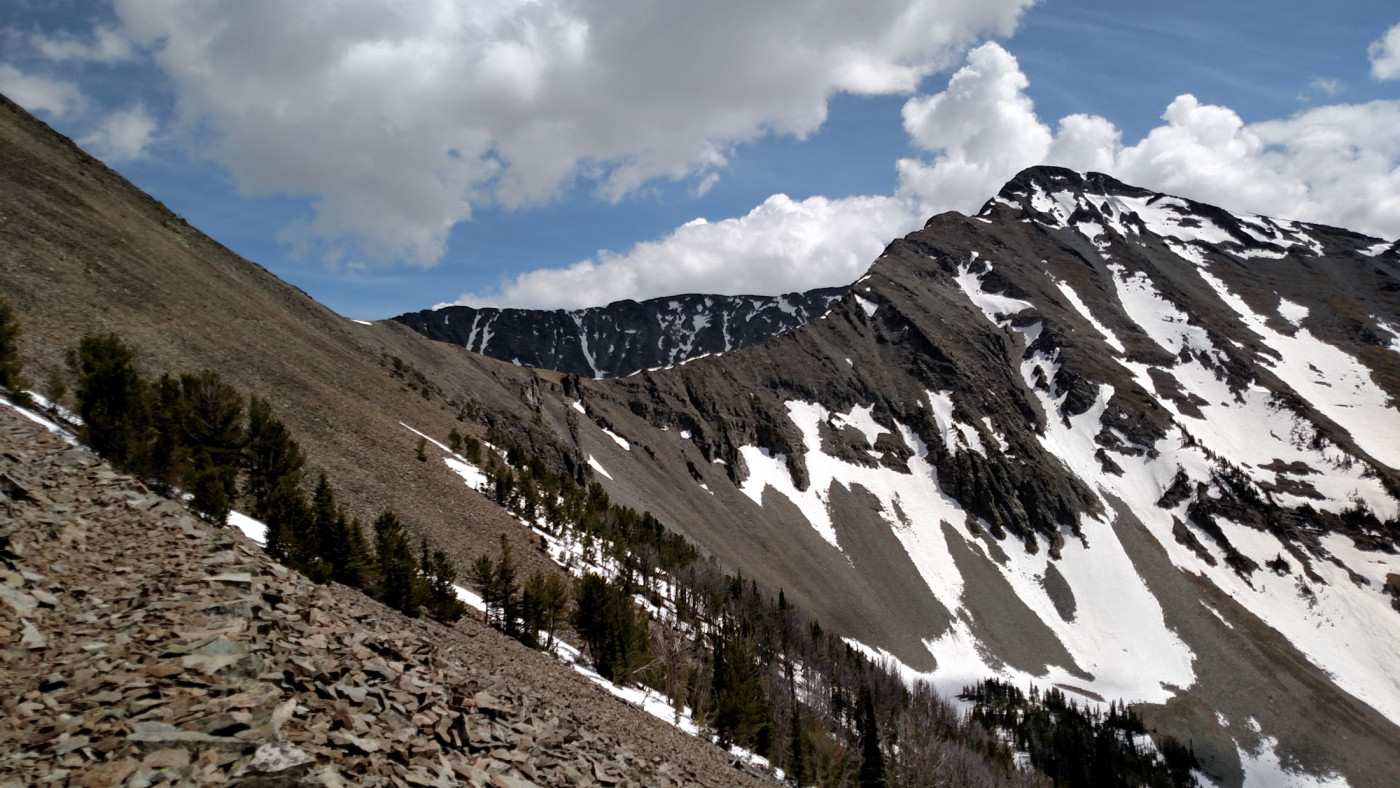
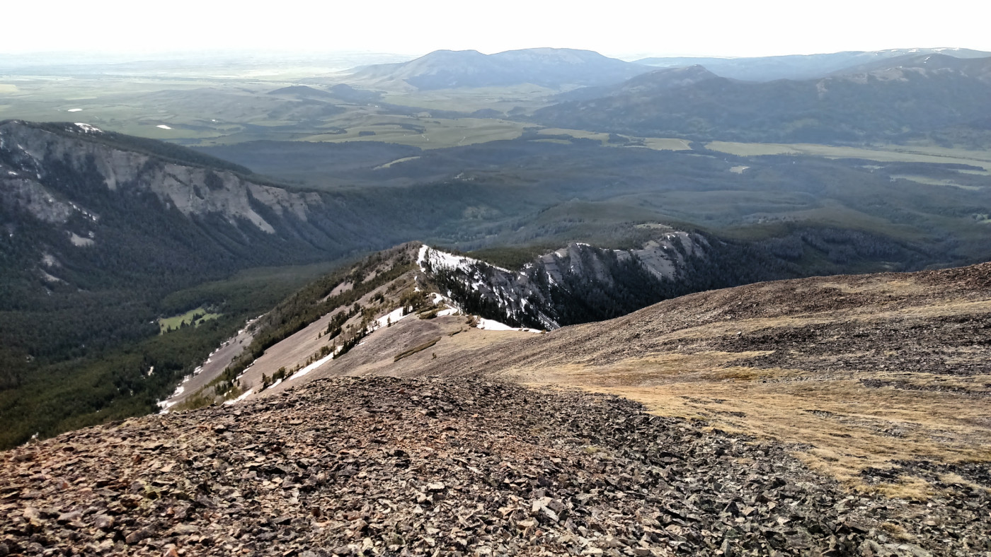
I was overcome with awe as we finally set foot on the saddle. The scene was like something out of a fairy tale; a true hikers paradise. The saddle is almost perfectly flat at the top and carpeted with a healthy layer of grass. At the edge of the saddle is a dugout with a lounge made out of rocks that is shielded from the wind by a nearby cairn. A knife-edge ridge leads from the saddle up to the false-summit of Sunlight Peak to the south and a steep slope of scree leads to the summit of the Tabletop just to the north. To the east the trail descends into a large valley containing Sunlight Lake which was still covered in snow but would be an excellent place to camp if it were a little later in the season. The Sunlight Lake Trail leads from the lake deeper into the Crazies eventually intersecting with the Sweet Grass Creek Trail.
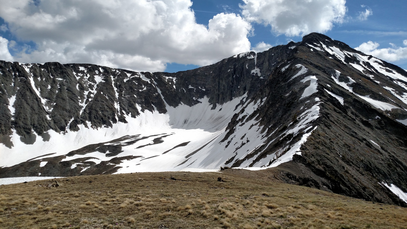
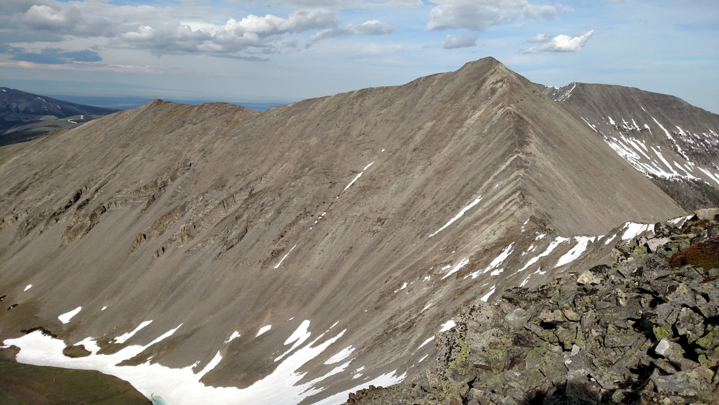
Sunlight Peak. The point on the right is actually a false summit. The true summit is just to the left.
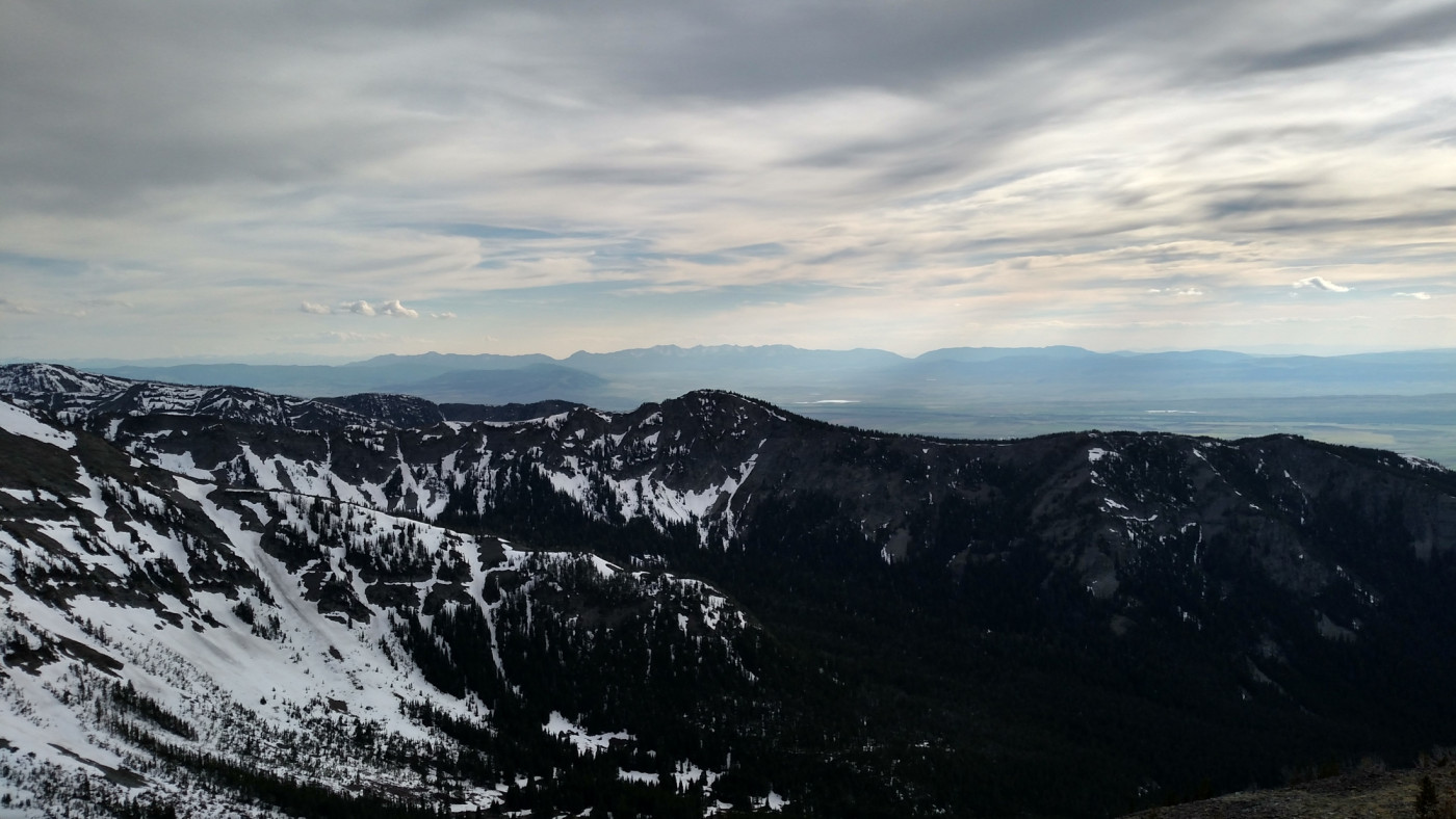
Looking east from the saddle. The Sunlight Lake Trail follows the valley.
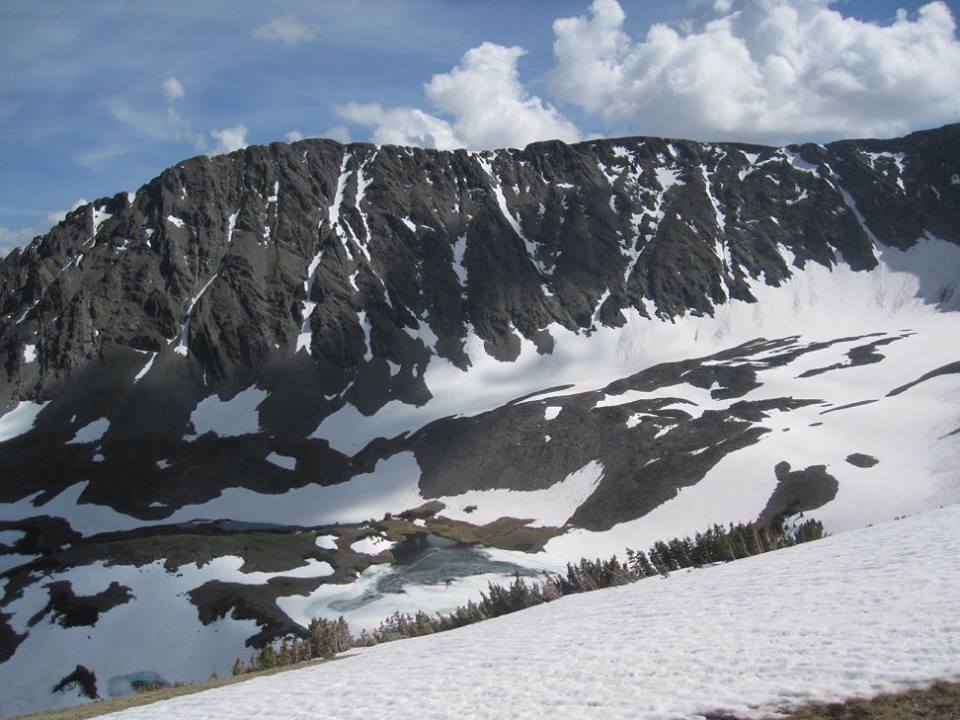
Sunlight Lake still frozen and covered in snow.
The top of the saddle.
Before making our next move we took some time to rest at the saddle. I sprawled out on the cushy grass allowing the wind to glide over my body while I munched down lunch. After some alone time we migrated over to the dugout to relax and discuss where to go from here. It was clear now that it would be suicide to try to scale Sunlight Peak without technical climbing skills. The other options were to descend to the lake or ascend the Tabletop. More interested in the killer views that awaited we chose the latter.
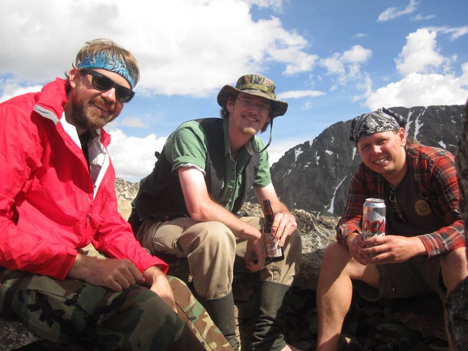
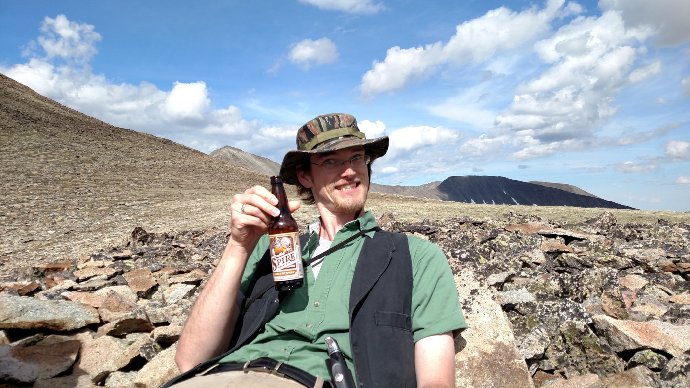
Relaxing at the dugout drinking a refreshing 24 oz. Coors Light.
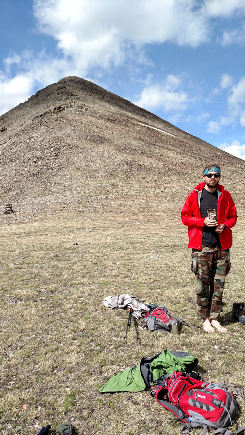
The route up to the Tabletop.
The Tabletop
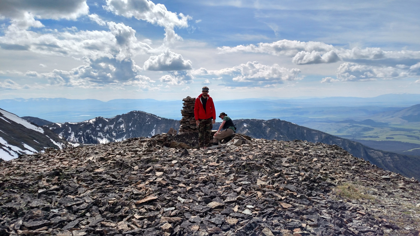
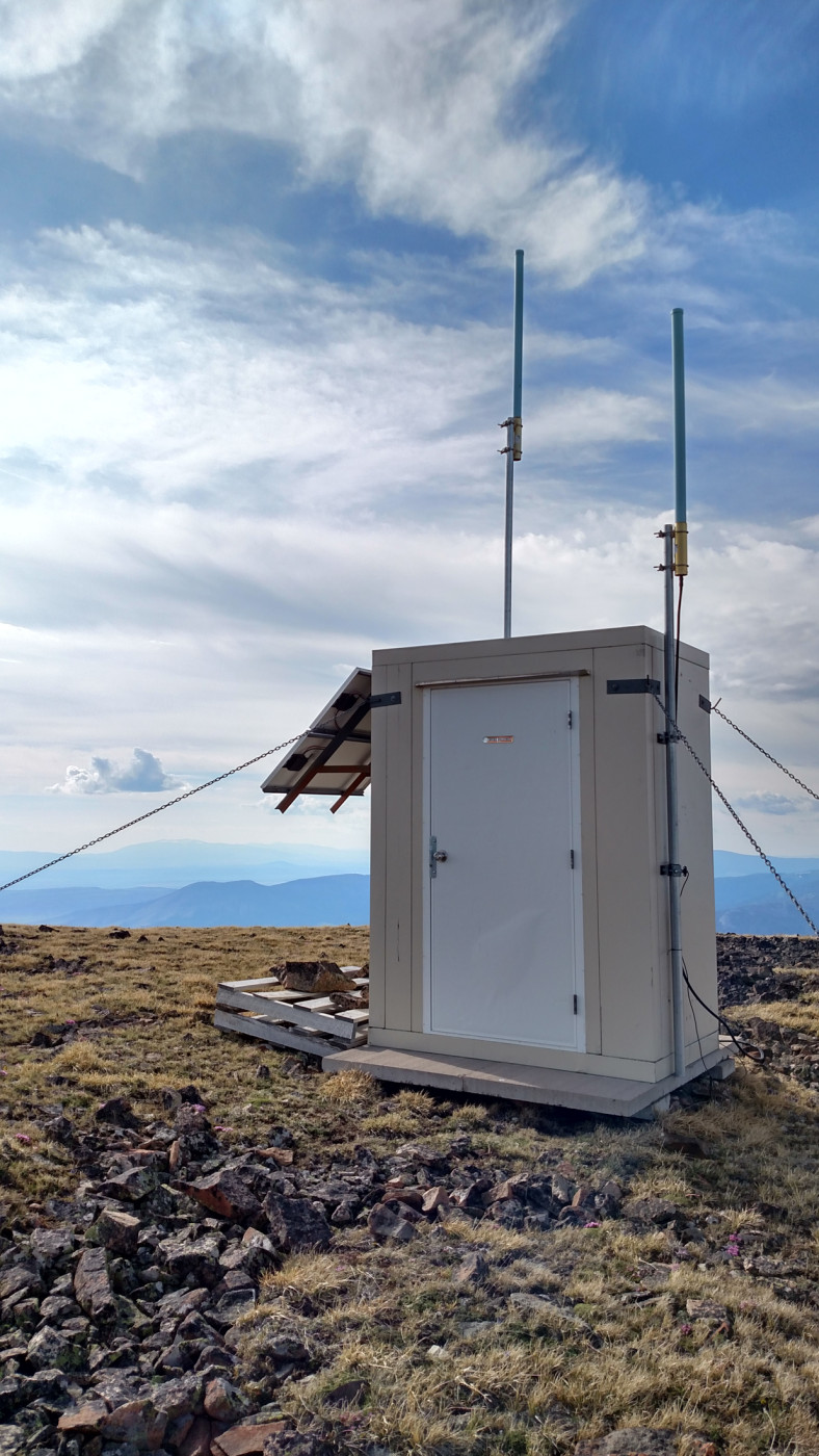
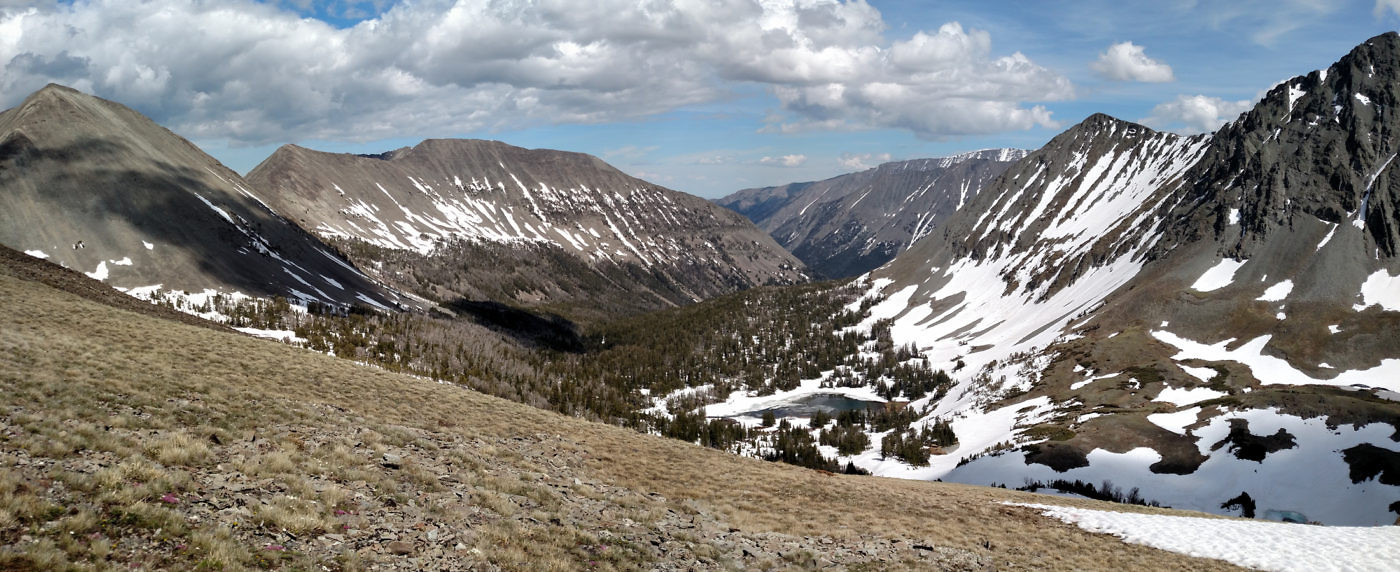
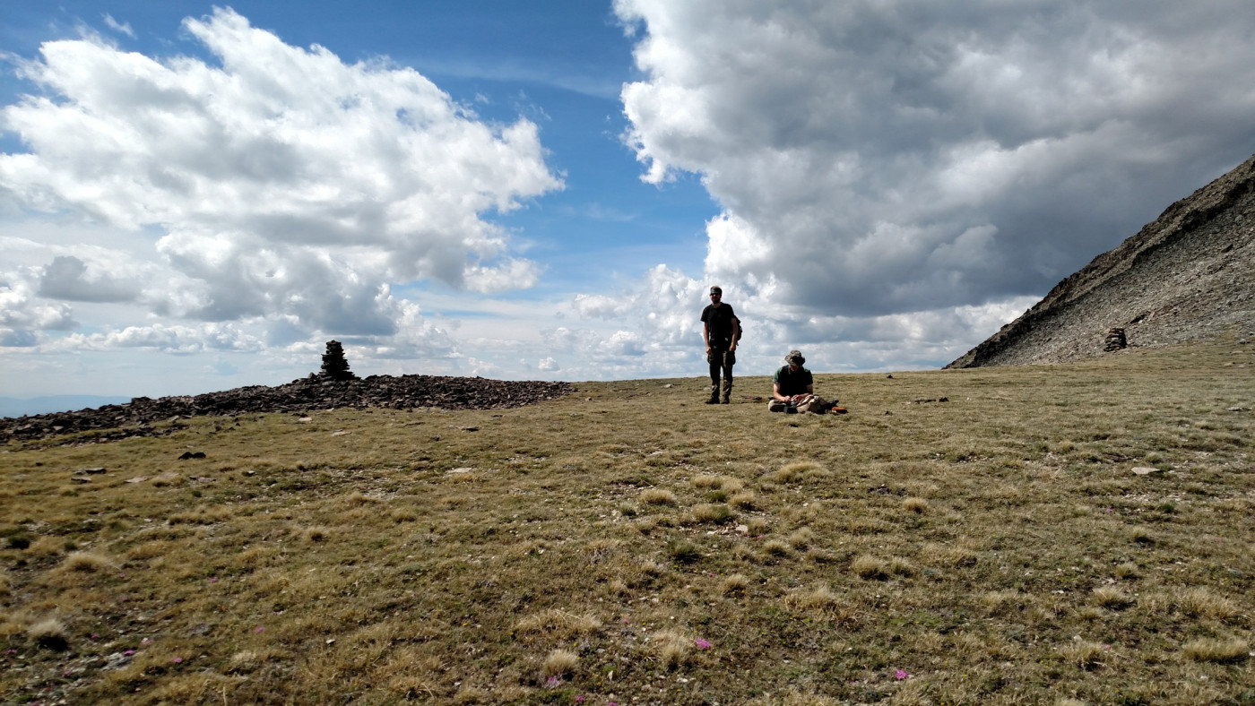
Climbing the Tabletop was not so easy. There’s no trail and the combination of steepness and loose scree was lethal, forcing us to scramble, sometimes on all fours, all the way up. But with a bit of perseverance we made it to the top and it was well worth the effort. We slowly roamed over to the opposite end of the Tabletop, which is flat and about a half-mile in length, passing some sort of research station along the way, and taking in views of the surrounding mountains. A large U-shaped valley sits below to the north and we spent a good amount of time lobbing boulders over the edge. It would be incredible to camp up there sometime and gaze up into the stars above.
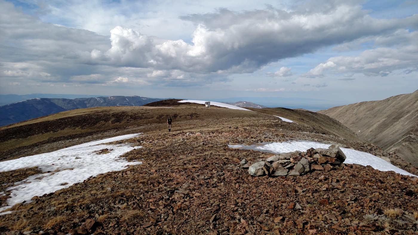
The top of the table.
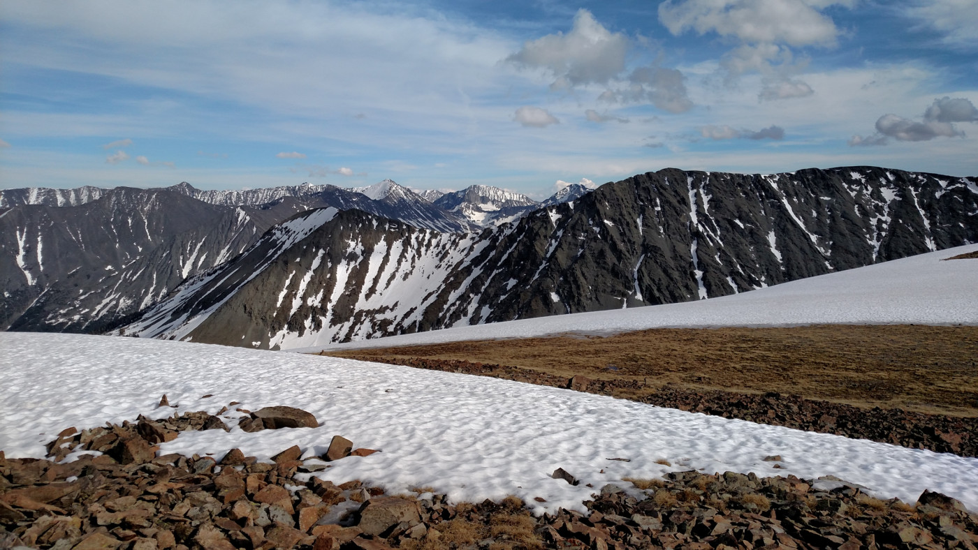
Excellent views of the full Crazy Mountain Range.
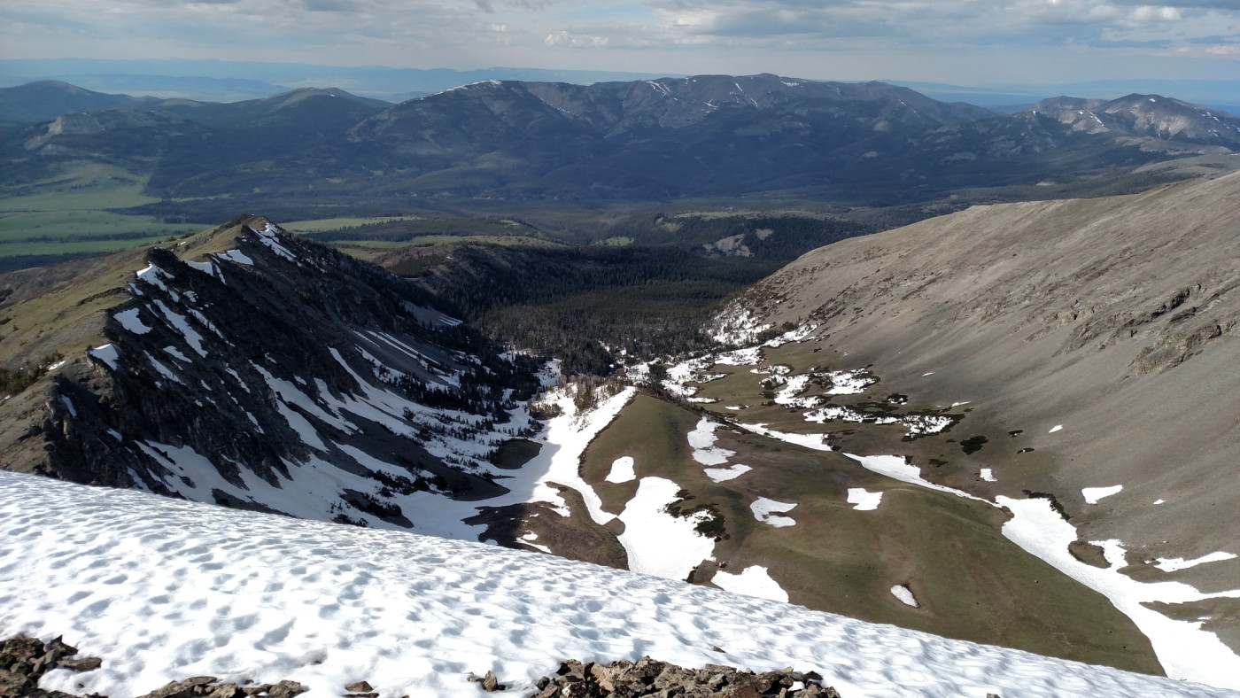
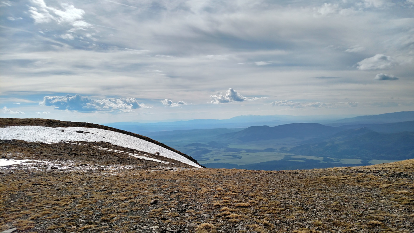
The glacial valley to the north of the Tabletop.
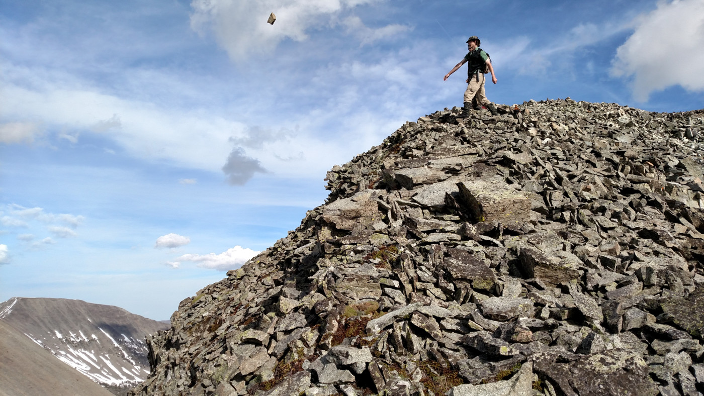
Christian lobbing a rock over the edge.
The Return
I would’ve loved to have spent more time on the Tabletop but only a couple hours of daylight remained and we still had a great deal of distance to cover. Rather then going back the way we came we chose to descend straight down Sunlight Ridge to the west, knowing that it would eventually hitch up with the trail and save us some time. It proved to be a smart choice and once on the trail we began the long trek through the radiant landscape. By the time we made it back to the twig bridge it was getting pretty dark but we all made it safely across and finished off the hike in the red ambiance of the setting sun.
Our route down the Tabletop.
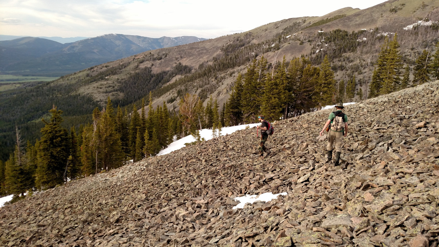
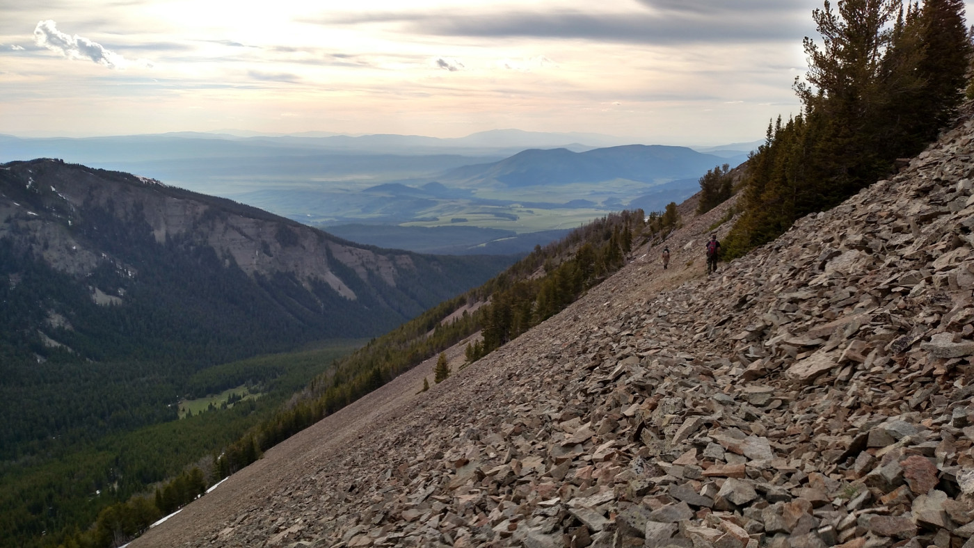
Scrambling down the scree slopes. The trail becomes very faint at this point but it’s obvious where to go.
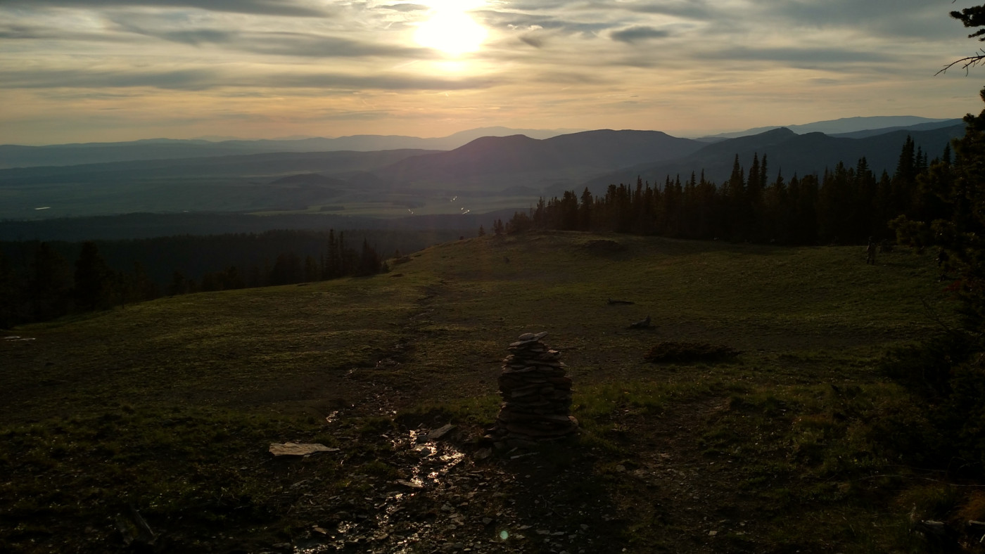
One of the many cairn-marked meadows.
The Tabletop and Sunlight Peak lit up golden.
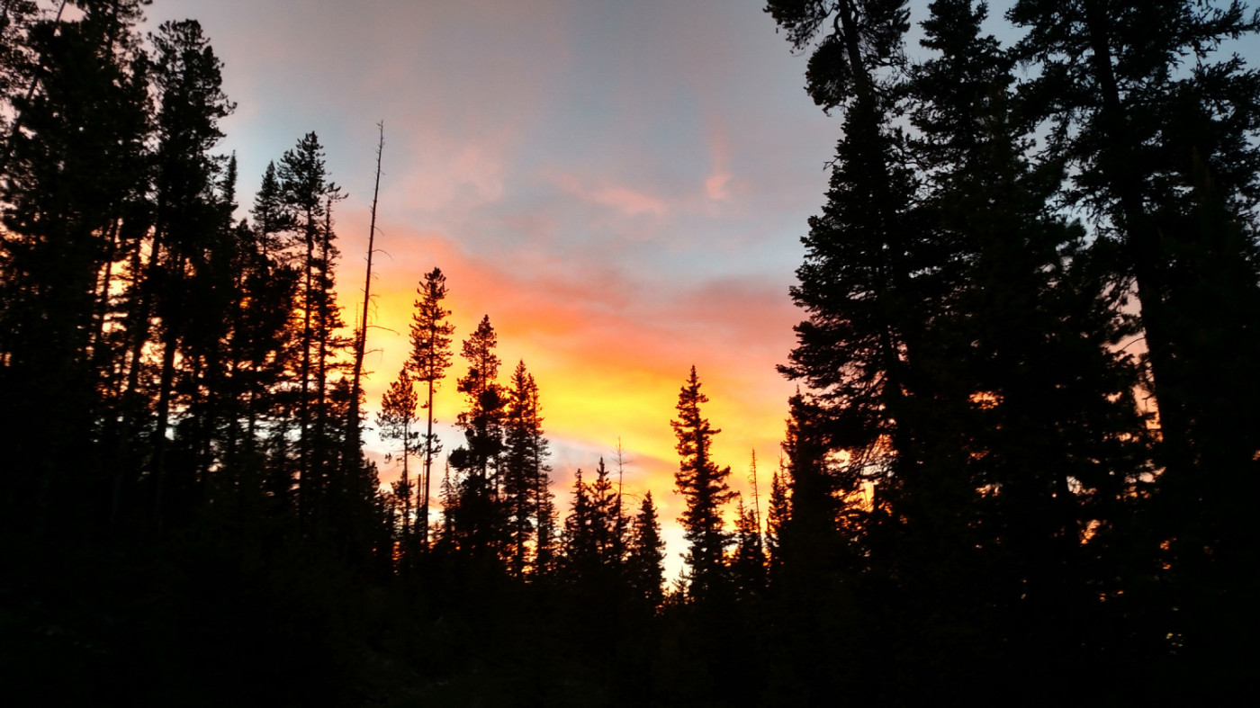
A beautiful sunset to finish off the adventure.
It’s a dangerous business going out your door. You step onto the road, and if you don’t keep your feet, there’s no knowing where you might be swept off to.
-Bilbo Baggins
